|
Iles-de-la-Madeleine
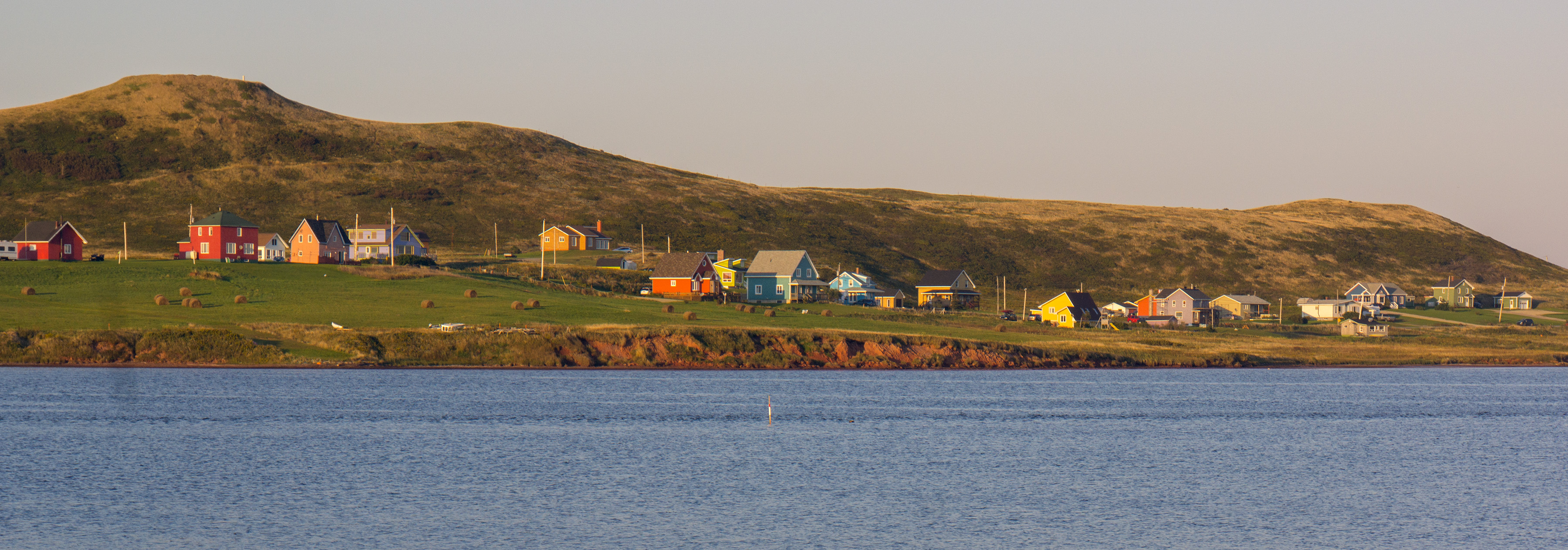
The Magdalen Islands (french: Îles de la Madeleine ) are a small archipelago in the Gulf of Saint Lawrence with a land area of . While part of the Province of Quebec, the islands are in fact closer to the Maritime provinces and Newfoundland than to the Gaspé Peninsula on the Quebec mainland. The islands are considered a part of the Mi'kma'ki, of the Mi'kmaw Nation, who call the islands Menagoesenog. Administratively, the islands are part of the Gaspésie–Îles-de-la-Madeleine region in the Canadian province of Quebec. The islands form the territory equivalent to a regional county municipality (TE) and the census division (CD) of Les Îles-de-la-Madeleine. Their geographical code is 01. The islands are also coextensive with the urban agglomeration of Les Îles-de-la-Madeleine, which is divided into two municipalities: Les Îles-de-la-Madeleine ( 2011 census pop. 12,291), the central municipality, and Grosse-Île (pop. 490). Their mayors are Gaétan Richard and Rose ... [...More Info...] [...Related Items...] OR: [Wikipedia] [Google] [Baidu] |
Urban Agglomeration Of Les Îles-de-la-Madeleine
The Urban agglomeration of Les Îles-de-la-Madeleine is an urban agglomeration in Quebec that consists of: *the municipality of Les Îles-de-la-Madeleine *the municipality of Grosse-Île History As part of the 2000–2006 municipal reorganization in Quebec The 2000–2006 municipal reorganization in Quebec resulted in large-scale amalgamation of smaller municipalities in Quebec into larger cities. It was undertaken by one administration, and modified and partially undone by its successor. The firs ..., the City of Les Îles-de-la-Madeleine was created on January 1, 2002 by the merger of the village municipality of Cap-aux-Meules and the municipalities of Fatima, Grande-Entrée, Grosse-Île, Havre-aux-Maisons, L'Étang-du-Nord, L'Île-du-Havre-Aubert. In a 2004 referendum both Cap-aux-Meules and Grosse-Île voted to de-merge, but in the end only Grosse-Île de-merged and became an independent municipality again on January 1, 2006. However, the legislation governing the ... [...More Info...] [...Related Items...] OR: [Wikipedia] [Google] [Baidu] |
Gaspésie–Îles-de-la-Madeleine
Gaspésie–Îles-de-la-Madeleine () is an administrative region of Quebec consisting of the Gaspé Peninsula (''Gaspésie'') and the Magdalen Islands, Îles-de-la-Madeleine. It lies in the Gulf of Saint Lawrence at the eastern extreme of southern Quebec. The predominant economic activities are fishing, forestry and tourism. Region The administrative region of Gaspésie–Îles-de-la-Madeleine was created on December 22, 1987. It brings together two geographical units: the Gaspé peninsula (20,102.69 km2) and the Magdalen Islands archipelago (205.4 km2). The population was 90,311 at the time of the 2016 Canadian Census, 2016 census. The region's interior, 80% of which is covered by coniferous forests, is among the most rugged terrain in the province. Rich soils cover the land along the coast and within the region's river valleys. Important mineral deposits are also found in this region. Forty-two local municipalities are located in the Gaspésie–Îles-de-la-Mad ... [...More Info...] [...Related Items...] OR: [Wikipedia] [Google] [Baidu] |
Gulf Of Saint Lawrence
, image = Baie de la Tour.jpg , alt = , caption = Gulf of St. Lawrence from Anticosti National Park, Quebec , image_bathymetry = Golfe Saint-Laurent Depths fr.svg , alt_bathymetry = Bathymetry of the Gulf of St. Lawrence , caption_bathymetry = Bathymetry of the Gulf of St. Lawrence , location = , group = , coordinates = , type = Gulf , etymology = , part_of = , inflow = , rivers = , outflow = , oceans = , catchment = , basin_countries = CanadaSaint Pierre and Miquelon (France) , agency = , designation = , date-built = , engineer = , date-flooded = , length = , width = , area = , depth = , max-depth = , volume = , residence_time = , salinity ... [...More Info...] [...Related Items...] OR: [Wikipedia] [Google] [Baidu] |
Jacques Cartier
Jacques Cartier ( , also , , ; br, Jakez Karter; 31 December 14911 September 1557) was a French-Breton maritime explorer for France. Jacques Cartier was the first European to describe and map the Gulf of Saint Lawrence and the shores of the Saint Lawrence River, which he named "The Country of Canadas" after the Iroquoian names for the two big settlements he saw at Stadacona (Quebec City) and at Hochelaga (Montreal Island).. Early life Jacques Cartier was born in 1491 in Saint-Malo, the port on the north-east coast of Brittany. Cartier, who was a respectable mariner, improved his social status in 1520 by marrying Mary Catherine des Granches, member of a leading aristocratic family. His good name in Saint-Malo is recognized by its frequent appearance in baptismal registers as godfather or witness. First voyage (1534) In 1534, two years after the Duchy of Brittany was formally united with France in the Edict of Union, Cartier was introduced to King Francis I by Jean Le V ... [...More Info...] [...Related Items...] OR: [Wikipedia] [Google] [Baidu] |
Flag Of Acadia
The flag of Acadia is a symbolic flag representing the Acadian community of Canada. It was adopted on 15 August 1884, at the Second Acadian National Convention held in Miscouche, Prince Edward Island, by nearly 5,000 Acadian delegates from across the Maritimes. It was designed by Father Marcel-Francois Richard, a priest from Saint-Louis-de-Kent, New Brunswick. The Musée Acadien at the Université de Moncton has the original flag presented by Father William to the 1884 Convention. It was sewn by Marie Babineau. According to Perry Biddiscombe: The Tricolour represents the Motherland of the Acadians. The yellow star, the Stella Maris, is the symbol of Mary, Acadian national symbol and patron of the mariners. It is set on the blue stripe, because blue is the colour of Mary. The yellow colour of the star represents the Papacy. Design Father Richard selected the French flag as the basis of the Acadian one to underline the adherence of the Acadians to the French civilizatio ... [...More Info...] [...Related Items...] OR: [Wikipedia] [Google] [Baidu] |
Jacques Cartier 1851-1852
Ancient and noble French family names, Jacques, Jacq, or James are believed to originate from the Middle Ages in the historic northwest Brittany region in France, and have since spread around the world over the centuries. To date, there are over one hundred identified noble families related to the surname by the Nobility & Gentry of Great Britain & Ireland. Origins The origin of this surname ultimately originates from the Latin, Jacobus which belongs to an unknown progenitor. Jacobus comes from the Hebrew name, Yaakov, which translates as "one who follows" or "to follow after". Ancient history A French knight returning from the Crusades in the Holy Lands probably adopted the surname from "Saint Jacques" (or "James the Greater"). James the Greater was one of Jesus' Twelve Apostles, and is believed to be the first martyred apostle. Being endowed with this surname was an honor at the time and it is likely that the Church allowed it because of acts during the Crusades. Indeed, ... [...More Info...] [...Related Items...] OR: [Wikipedia] [Google] [Baidu] |
Rock Salt
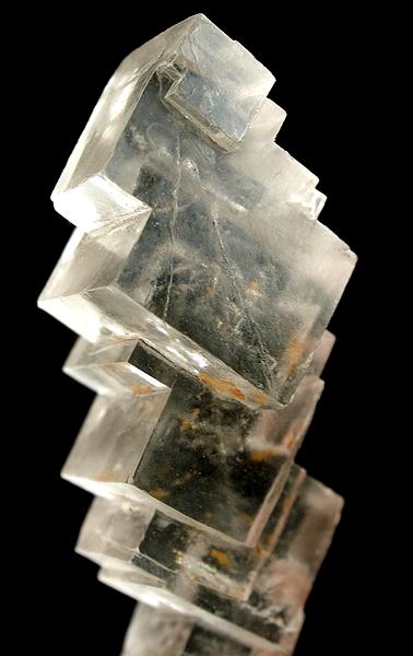
Halite (), commonly known as rock salt, is a type of salt, the mineral (natural) form of sodium chloride ( Na Cl). Halite forms isometric crystals. The mineral is typically colorless or white, but may also be light blue, dark blue, purple, pink, red, orange, yellow or gray depending on inclusion of other materials, impurities, and structural or isotopic abnormalities in the crystals. It commonly occurs with other evaporite deposit minerals such as several of the sulfates, halides, and borates. The name ''halite'' is derived from the Ancient Greek word for "salt", ἅλς (''háls''). Occurrence Halite dominantly occurs within sedimentary rocks where it has formed from the evaporation of seawater or salty lake water. Vast beds of sedimentary evaporite minerals, including halite, can result from the drying up of enclosed lakes and restricted seas. Such salt beds may be hundreds of meters thick and underlie broad areas. Halite occurs at the surface today in playas in region ... [...More Info...] [...Related Items...] OR: [Wikipedia] [Google] [Baidu] |
Fossil Fuels
A fossil fuel is a hydrocarbon-containing material formed naturally in the Earth's crust from the remains of dead plants and animals that is extracted and burned as a fuel. The main fossil fuels are coal, oil, and natural gas. Fossil fuels may be burned to provide heat for use directly (such as for cooking or heating), to power engines (such as internal combustion engines in motor vehicles), or to generate electricity. Some fossil fuels are refined into derivatives such as kerosene, gasoline and propane before burning. The origin of fossil fuels is the anaerobic decomposition of buried dead organisms, containing organic molecules created by photosynthesis. The conversion from these materials to high-carbon fossil fuels typically require a geological process of millions of years. In 2019, 84% of primary energy consumption in the world and 64% of its electricity was from fossil fuels. The large-scale burning of fossil fuels causes serious environmental damage. Over 80% of ... [...More Info...] [...Related Items...] OR: [Wikipedia] [Google] [Baidu] |
Permian
The Permian ( ) is a geologic period and stratigraphic system which spans 47 million years from the end of the Carboniferous Period million years ago (Mya), to the beginning of the Triassic Period 251.9 Mya. It is the last period of the Paleozoic Era; the following Triassic Period belongs to the Mesozoic Era. The concept of the Permian was introduced in 1841 by geologist Sir Roderick Murchison, who named it after the region of Perm in Russia. The Permian witnessed the diversification of the two groups of amniotes, the synapsids and the sauropsids ( reptiles). The world at the time was dominated by the supercontinent Pangaea, which had formed due to the collision of Euramerica and Gondwana during the Carboniferous. Pangaea was surrounded by the superocean Panthalassa. The Carboniferous rainforest collapse left behind vast regions of desert within the continental interior. Amniotes, which could better cope with these drier conditions, rose to dominance in place of their am ... [...More Info...] [...Related Items...] OR: [Wikipedia] [Google] [Baidu] |
Geologic Uplift
Orogeny is a mountain building process. An orogeny is an event that takes place at a convergent plate margin when plate motion compresses the margin. An ''orogenic belt'' or ''orogen'' develops as the compressed plate crumples and is uplifted to form one or more mountain ranges. This involves a series of geological processes collectively called orogenesis. These include both structural deformation of existing continental crust and the creation of new continental crust through volcanism. Magma rising in the orogen carries less dense material upwards while leaving more dense material behind, resulting in compositional differentiation of Earth's lithosphere ( crust and uppermost mantle). A synorogenic process or event is one that occurs during an orogeny. The word "orogeny" () comes from Ancient Greek (, , + , , ). Although it was used before him, the term was employed by the American geologist G. K. Gilbert in 1890 to describe the process of mountain-building as distinguished f ... [...More Info...] [...Related Items...] OR: [Wikipedia] [Google] [Baidu] |
Salt Dome
A salt dome is a type of structural dome formed when salt (or other evaporite minerals) intrudes into overlying rocks in a process known as diapirism. Salt domes can have unique surface and subsurface structures, and they can be discovered using techniques such as seismic reflection. They are important in petroleum geology as they can function as petroleum traps. Formation Stratigraphically, salt basins developed periodically from the Proterozoic to the Neogene. The formation of a salt dome begins with the deposition of salt in a restricted basin. In these basins, the outflow of water exceeds inflow. More concretely, the basin loses water through evaporation, resulting in the precipitation and deposition of salt. While the rate of sedimentation of salt is significantly larger than the rate of sedimentation of clastics, it is recognized that a single evaporation event is rarely enough to produce the vast quantities of salt needed to form a layer thick enough for the formation ... [...More Info...] [...Related Items...] OR: [Wikipedia] [Google] [Baidu] |


.jpg)


.jpg)