|
Ikertooq Fjord
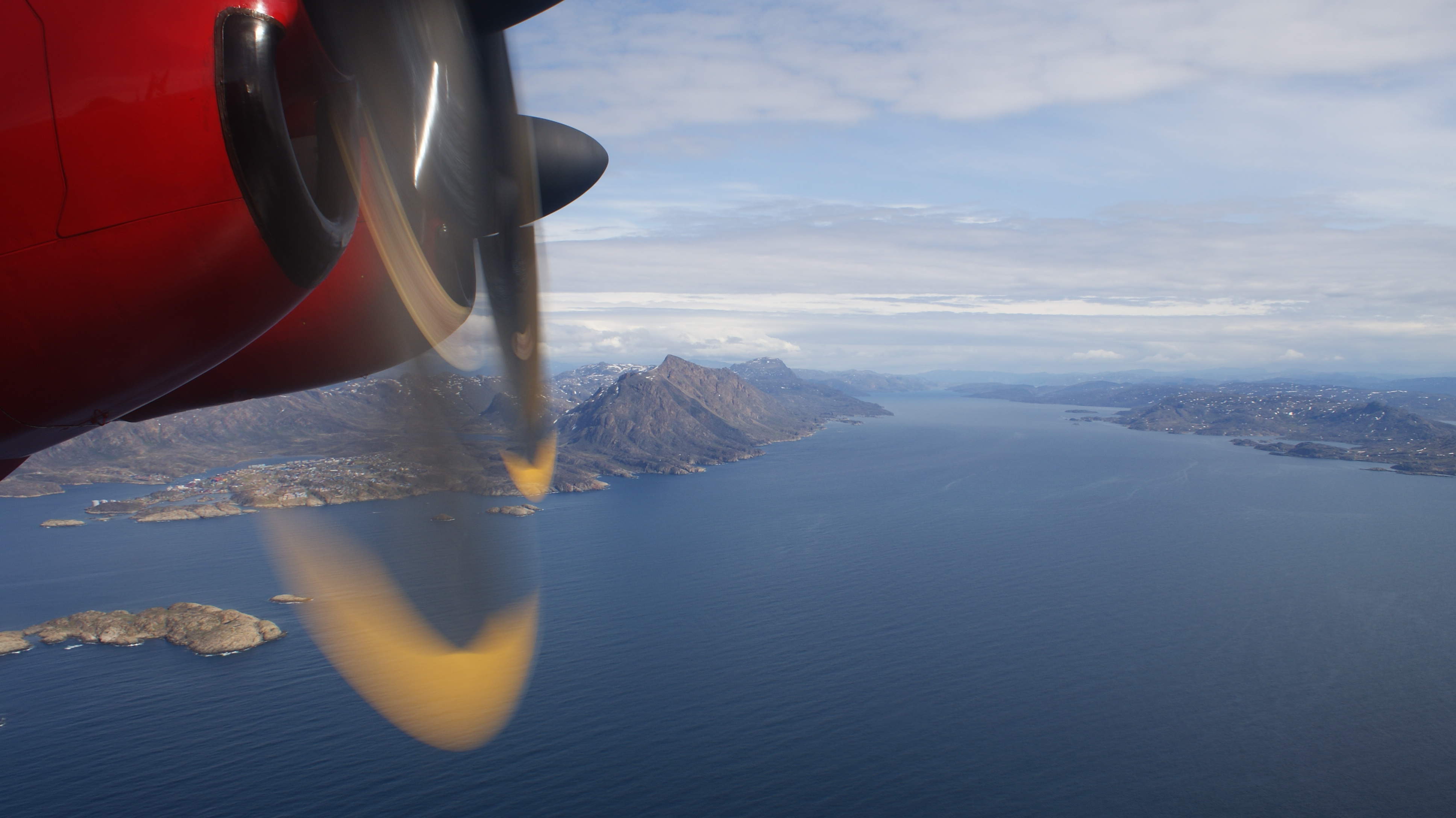
Ikertooq Fjord (old spelling: ''Ikertôq'') is a long fjord in the Qeqqata municipality in western Greenland. The fjord empties into Davis Strait south of Sisimiut. Geography The upper part of the fjord, a confluence of three tributary inlets at approximately is called ''Suluppaavarsiorfik'' (old spelling: ''Sulugpâvarsiorfik''). The tributary bays, from south to north, are: ''Avalleq'', ''Akulleq'' (the innermost, main arm at approximately ), and ''Maligiaq''. Itinneq, an outflow river from the large, latitudinal Tasersuaq lake, empties into the northern inlet. The fjord initially flows westward, to then turn west-south-west between the mainland peninsula in the south, and Sarfannguit Island in the north, widening considerably at its mouth at approximately , where it empties into Davis Strait. The fjord is unusual in that it connects through a very narrow waterway to the head of the narrower Amerloq Fjord near the village of Sarfannguit. The northern inlet at the fjord h ... [...More Info...] [...Related Items...] OR: [Wikipedia] [Google] [Baidu] |
Greenland
Greenland ( kl, Kalaallit Nunaat, ; da, Grønland, ) is an island country in North America that is part of the Kingdom of Denmark. It is located between the Arctic and Atlantic oceans, east of the Canadian Arctic Archipelago. Greenland is the world's largest island. It is one of three constituent countries that form the Kingdom of Denmark, along with Denmark and the Faroe Islands; the citizens of these countries are all citizens of Denmark and the European Union. Greenland's capital is Nuuk. Though a part of the continent of North America, Greenland has been politically and culturally associated with Europe (specifically Norway and Denmark, the colonial powers) for more than a millennium, beginning in 986.The Fate of Greenland's Vikings , by Dale Mackenzie Brown, ''Archaeological Institute of America'', ... [...More Info...] [...Related Items...] OR: [Wikipedia] [Google] [Baidu] |
Fjord
In physical geography, a fjord or fiord () is a long, narrow inlet with steep sides or cliffs, created by a glacier. Fjords exist on the coasts of Alaska, Antarctica, British Columbia, Chile, Denmark, Germany, Greenland, the Faroe Islands, Iceland, Ireland, Kamchatka, the Kerguelen Islands, Labrador, Newfoundland, New Zealand, Norway, Novaya Zemlya, Nunavut, Quebec, the Patagonia region of Argentina and Chile, Russia, South Georgia Island, Tasmania, United Kingdom, and Washington state. Norway's coastline is estimated to be long with its nearly 1,200 fjords, but only long excluding the fjords. Formation A true fjord is formed when a glacier cuts a U-shaped valley by ice segregation and abrasion of the surrounding bedrock. According to the standard model, glaciers formed in pre-glacial valleys with a gently sloping valley floor. The work of the glacier then left an overdeepened U-shaped valley that ends abruptly at a valley or trough end. Such valleys are fjords wh ... [...More Info...] [...Related Items...] OR: [Wikipedia] [Google] [Baidu] |
Qeqqata
Qeqqata (, da, Centrum, lit=Centre) is a municipality in western Greenland, operational from 1 January 2009. The municipality was named after its location in the central-western part of the country. Its population is 9,378 as of January 2020. The administrative center of the municipality is in Sisimiut (formerly called Holsteinsborg). Creation It consists of the previously unincorporated area of Kangerlussuaq, as well as two former municipalities of western Greenland, Maniitsoq and Sisimiut. Geography In the south and east, the municipality is flanked by the Sermersooq municipality, although settlements and associated trade is concentrated mainly alongside the coast. In the north, it is bordered by the Qeqertalik municipality. The waters of the western coast are that of the Davis Strait, separating Greenland from Baffin Island. With an area of it is the second-smallest municipality of Greenland after Kujalleq. Politics Qeqqata's municipal council consists of 15 members, ele ... [...More Info...] [...Related Items...] OR: [Wikipedia] [Google] [Baidu] |
Davis Strait
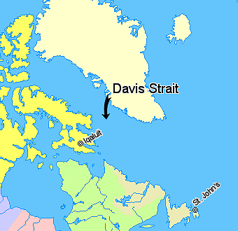
Davis Strait is a northern arm of the Atlantic Ocean that lies north of the Labrador Sea. It lies between mid-western Greenland and Baffin Island in Nunavut, Canada. To the north is Baffin Bay. The strait was named for the English explorer John Davis (1550–1605), who explored the area while seeking a Northwest Passage. By the 1650s it was used for whale hunting. Extent The International Hydrographic Organization defines the limits of the Davis Strait as follows: ''On the North.'' The Southern limit of Baffin Bay 70° North between Greenland and Baffin Island">Baffin Land]. ''On the East.'' The Southwest coast of Greenland. ''On the South.'' The parallel of 60th parallel north, 60° North between Greenland and Labrador. ''On the West.'' The Eastern limit of the Northwestern Passages South of 70° North he East coast of Baffin Island to East Bluff, its Southeastern extremityand of Hudson Strait line from East Bluff, the Southeast extreme of Baffin Island (), to Point ... [...More Info...] [...Related Items...] OR: [Wikipedia] [Google] [Baidu] |
Sisimiut
Sisimiut (), formerly known as Holsteinsborg, is the capital and largest city of the Qeqqata municipality, the second-largest city in Greenland, and the largest Arctic city in North America.The term 'city' is loosely used to describe any populated area in Greenland, given that the most populated place is Nuuk, the capital, with 16,454 inhabitants. The term 'Arctic' is interpreted as strictly the area within the Arctic Circle. It is located in central-western Greenland, on the coast of Davis Strait, approximately north of Nuuk. ''Sisimiut'' literally means "the residents at the foxholes" ( da, Beboerne ved rævehulerne). The site has been inhabited for the last 4,500 years, first by peoples of the Saqqaq culture, then Dorset culture, and then the Thule people, whose Inuit descendants form the majority of the current population. Artifacts from the early settlement era can be found throughout the region, favored in the past for its plentiful fauna, particularly the marine mammals ... [...More Info...] [...Related Items...] OR: [Wikipedia] [Google] [Baidu] |
Tasersuaq
Tasersuaq (old spelling: ''Taserssuaq'') is a large lake in the Qeqqata municipality in central-western Greenland. The name of the lake means ''large lake'' in the Greenlandic language, and is a common name shared by several lakes in the country. Geography Tasersuaq is a latitudinal lake of elongated sausage shape, extending from approximately in the west to in the east, located halfway between Sisimiut in the west and Kangerlussuaq in the east, approximately east of the former, and west of the latter. In the northwest the lake is bounded by tall mountains of the Pingu mountain group. The range flattens considerably towards the east in the area of Kangaamiut dike swarm north of Kangerlussuaq, due to pressure exerted by the Greenland ice sheet ( kl, Sermersuaq) for long periods in the past. The eastern end of the lake is located just west of the Tarajornitsut Tarajornitsut is an uninhabited tundra highland in the Qeqqata municipality in central-western Greenland, with ... [...More Info...] [...Related Items...] OR: [Wikipedia] [Google] [Baidu] |
Sarfannguit Island
Sarfannguit Island ( kl, Sarfannguit Nunataat, da, Sarfannguaqland) is an island in the Qeqqata municipality in western Greenland. Geography The island is of elongated shape, separated from the mainland of Greenland by Sarfannguit Channel, a narrow waterway at the eastern promontory occupied by the Sarfannguit settlement. To the south, the island is bounded by the Ikertooq Fjord, widening considerably at its mouth at approximately , where it empties into Davis Strait. The channel is unusual in that it connects the head of the narrower Amerloq Fjord Amerloq Fjord is a long fjord in the Qeqqata municipality in western Greenland. The fjord empties into the Davis Strait just south of Sisimiut, whose former Inuit name was also "Amerloq". History The Amerloq Fjord then known as Rammel's Fjord ... bounding the island from the north to the larger Ikertooq Fjord in the southeast. Several smaller islands trail Sarfannguit Island in the west, on the coastline of Davis Strait, of wh ... [...More Info...] [...Related Items...] OR: [Wikipedia] [Google] [Baidu] |
Amerloq Fjord
Amerloq Fjord is a long fjord in the Qeqqata municipality in western Greenland. The fjord empties into the Davis Strait just south of Sisimiut, whose former Inuit name was also "Amerloq". History The Amerloq Fjord then known as Rammel's Fjord was the scene of the Inuit murder of the Dano-English navigator James Hall on 12 or 22 July, 1612. The Inuit were still incensed at the Danish abduction of several people during one of Christian IV's expeditions in 1605, during which Hall served as pilot for John Cunningham. Geography The fjord mouth is located at approximately south of the town of Sisimiut. To the north, the fjord is bounded by the Nasaasaaq ridge, whose massif is spread out over in the west–east direction, constituting the terminal point of a long mountain range extending from the Pingu mountain group halfway between Davis Strait and the Greenland ice sheet ( kl, Sermersuaq). The range flattens considerably towards the east in the area of Kangaamiut dike swarm ... [...More Info...] [...Related Items...] OR: [Wikipedia] [Google] [Baidu] |
Sarfannguit
Sarfannguit (old spelling: ''Sarfannguaq / Sarfánguaq'') is a settlement in the Qeqqata municipality in central-western Greenland. Its population was 96 in 2020. The settlement was founded in 1843.Qeqqata Municipality The town is located within the Aasivissuit – Nipisat , inscribed on the World Heritage List in 2018 for its outstanding archeological sites representing the human occupation of Greenland for over 4000 years. [...More Info...] [...Related Items...] OR: [Wikipedia] [Google] [Baidu] |
Pingu (Greenland)
''Pingu'' is a stop-motion children's television series co-created by Otmar Gutmann and Erika Brueggemann. It was originally produced from 1990 to 2000 by Swiss company The Pygos Group (originally called Trickfilmstudio) for SF DRS in Switzerland. It was later revived from 2003 to 2006 for CBeebies by British companies HIT Entertainment and Hot Animation. The series focuses on a family of anthropomorphic emperor penguins who live in the South Pole; the main character is the family's son and title character, Pingu. The series originally ran for four series from 7 March 1990 to 9 April 2000 on SF DRS. It was then renewed for two more series from 1 August 2003 to 3 March 2006 on CBeebies. ''Pingu'' was also nominated for a BAFTA award in 2005. The pilot episode was made on 28 May 1986. Pingu became popular outside of Switzerland, in part due to its lack of a real spoken language: nearly all dialogue is in an invented grammelot "penguin language" referred to as 'Penguinese', co ... [...More Info...] [...Related Items...] OR: [Wikipedia] [Google] [Baidu] |
Greenland Ice Sheet
The Greenland ice sheet ( da, Grønlands indlandsis, kl, Sermersuaq) is a vast body of ice covering , roughly near 80% of the surface of Greenland. It is sometimes referred to as an ice cap, or under the term ''inland ice'', or its Danish equivalent, ''indlandsis''. An acronym, GIS, is frequently used in the scientific literature. It is the second largest ice body in the world, after the Antarctic ice sheet. The ice sheet is almost long in a north–south direction, and its greatest width is at a latitude of 77°N, near its northern margin. The average thickness is about and over at its thickest point. In addition to the large ice sheet, smaller ice caps (such as Maniitsoq and Flade Isblink) as well as glaciers, cover between around the periphery. The Greenland ice sheet is adversely affected by climate change. It is more vulnerable to climate change than the Antarctic ice sheet because of its position in the Arctic, where it is subject to the regional amplification o ... [...More Info...] [...Related Items...] OR: [Wikipedia] [Google] [Baidu] |

.jpg)


