|
I-85
Interstate 85 (I-85) is a major Interstate Highway in the Southeastern United States. Its southern terminus is at an interchange with Interstate 65, I-65 in Montgomery, Alabama; its northern terminus is an interchange with Interstate 95, I-95 in Petersburg, Virginia, near Richmond, Virginia, Richmond. It is nominally north–south as it carries an odd number, but it is physically oriented northeast–southwest and covers a larger east-west span than north-south. While most Interstates that end in a "5" are cross-country, I-85 is primarily a regional route serving five southeastern states: Virginia, North Carolina, South Carolina, Georgia (U.S. state), Georgia, and Alabama. Major metropolitan areas served by I-85 include the Greater Richmond Region in Virginia, the Research Triangle, Piedmont Triad, and Charlotte metropolitan area regions of North Carolina, Upstate South Carolina, the Atlanta metropolitan area in Georgia, and the Montgomery metropolitan area in Alabama. There ... [...More Info...] [...Related Items...] OR: [Wikipedia] [Google] [Baidu] |
Interstate 85 In Georgia
Interstate 85 (I-85) is a major Interstate Highway that travels northeast–southwest in the US state of Georgia. It enters the state at the Alabama state line near West Point, and Lanett, Alabama, traveling through the Atlanta metropolitan area and to the South Carolina state line, where it crosses the Savannah River near Lake Hartwell. I-85 connects North Georgia with Montgomery, Alabama, to the southwest, and with South Carolina, North Carolina, and Virginia to the northeast. Within Georgia, I-85 is also designated as the unsigned State Route 403 (SR 403). I-85 in Georgia usually travels roughly parallel with the route of US Route 29 (US 29). However, from Atlanta northeast to South Carolina, I-85 ventures away from that route, traveling about halfway between US 29 and the combination of US 23 and US 123. Within the city of Atlanta, I-85 has a concurrency with I-75 known as the "Downtown Connector". After splitting from Downtown ... [...More Info...] [...Related Items...] OR: [Wikipedia] [Google] [Baidu] |
Interstate 85 In South Carolina
Interstate 85 (I-85) in the US state of South Carolina runs northeast–southwest through Upstate South Carolina. Connecting regionally with Atlanta, Georgia, and Charlotte, North Carolina, it became the first Interstate Highway in South Carolina to have its originally planned mileage completed. Route description Georgia state line to Greenville I-85 enters South Carolina along the Vandiver Bridge from Georgia, crossing over Tugaloo River/Lake Hartwell. It is immediately followed by exit 1, where the welcome center and the start of South Carolina Highway 11 (SC 11; Cherokee Foothills Scenic Highway) are located. For the next , I-85 continues along the north shores of Lake Hartwell, crossing over some parts of it. At the US Highway 76 (US 76)/ SC 28 interchange (exit 19), the highway widens to six lanes. Continuing northeast, US 29 joins I-85 (exit 34), near Piedmont, as they run concurrently until after they cross the Saluda River ... [...More Info...] [...Related Items...] OR: [Wikipedia] [Google] [Baidu] |
Interstate 85 In Alabama
Interstate 85 (I-85) is a part of the Interstate Highway System that runs from Montgomery, Alabama, to Petersburg, Virginia. In Alabama, the Interstate Highway runs from I-65 in Montgomery northeast to the Georgia state line near Valley. I-85 is the primary highway between Montgomery and Atlanta. The Interstate also connects Montgomery with Tuskegee, Auburn, Opelika, and, indirectly, Phenix City and Columbus, Georgia. Route description I-85 begins at a six-ramp modified directional T interchange with I-65 southwest of downtown Montgomery. In addition to the ramps to and from I-65, the terminating Interstate's dual carriageways continue west a short distance and become Day Street; the interchange also includes a ramp from southbound I-65 to Day Street and from Day Street to northbound I-65. I-85 heads east toward downtown Montgomery as an eight-lane freeway. The highway has a pair of half diamond interchanges with Court Street (northbound exit, southbound entrance) and Uni ... [...More Info...] [...Related Items...] OR: [Wikipedia] [Google] [Baidu] |
Piedmont Triad
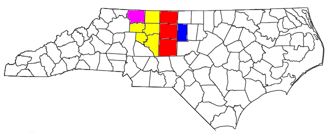
The Piedmont Triad (or simply the Triad) is a metropolitan region in the north-central part of the U.S. state of North Carolina anchored by three cities: Greensboro, North Carolina, Greensboro, Winston-Salem, North Carolina, Winston-Salem, and High Point, North Carolina, High Point. This close group of cities lies in the Piedmont (United States), Piedmont geographical region of the United States and forms the basis of the Greensboro–Winston-Salem–High Point Combined Statistical Area. As of 2012, the Piedmont Triad has an estimated population of 1,611,243 making it the 33rd largest combined statistical area in the United States. The metropolitan area is connected by Interstates Interstate 40 in North Carolina, 40, Interstate 85 in North Carolina, 85, I-73, 73, and Interstate 74 in North Carolina, 74 and is served by the Piedmont Triad International Airport. Long known as one of the primary manufacturing and transportation hubs of the southeastern United States, the Triad is al ... [...More Info...] [...Related Items...] OR: [Wikipedia] [Google] [Baidu] |
Research Triangle
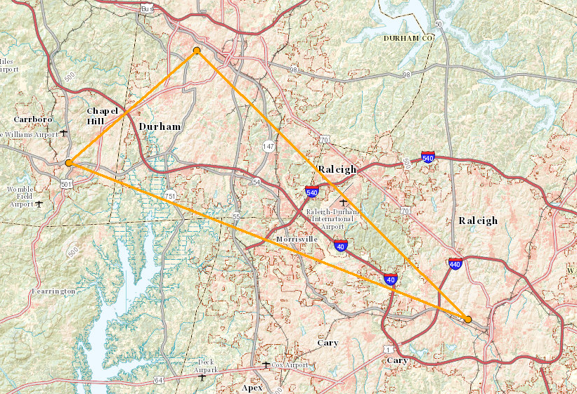
The Research Triangle, or simply The Triangle, are both common nicknames for a metropolitan area in the Piedmont region of North Carolina in the United States, anchored by the cities of Raleigh and Durham and the town of Chapel Hill, home to three major research universities: North Carolina State University, Duke University, and University of North Carolina at Chapel Hill, respectively. The nine-county region, officially named the Raleigh–Durham–Cary combined statistical area (CSA), comprises the Raleigh–Cary and Durham–Chapel Hill Metropolitan Statistical Areas and the Henderson Micropolitan Statistical Area. The "Triangle" name originated in the 1950s with the creation of Research Triangle Park, located between the three anchor cities and home to numerous high tech companies. A 2019 Census estimate put the population at 2,079,687, making it the second largest combined statistical area in the state of North Carolina behind Charlotte CSA. The Raleigh–Durham t ... [...More Info...] [...Related Items...] OR: [Wikipedia] [Google] [Baidu] |
Interstate 75
Interstate 75 (I-75) is a major north–south Interstate Highway in the Great Lakes and Southeastern regions of the United States. As with most Interstates that end in 5, it is a major cross-country, north–south route, traveling from State Road 826 (SR 826, Palmetto Expressway) and SR 924 (Gratigny Parkway) on the Hialeah–Miami Lakes border (northwest of Miami, Florida) to Sault Ste. Marie, Michigan, at the Canadian border. It is the second-longest north–south Interstate Highway (after I-95) and the seventh-longest Interstate Highway overall. I-75 passes through six different states. The highway runs the length of the Florida peninsula from the Miami area and up the Gulf Coast through Tampa. Farther north in Georgia, I-75 continues on through Macon and Atlanta before running through Chattanooga and Knoxville and the Cumberland Mountains in Tennessee. I-75 crosses Kentucky, passing through Lexington before crossing the Ohio River into Cincinnati, ... [...More Info...] [...Related Items...] OR: [Wikipedia] [Google] [Baidu] |
Atlanta
Atlanta ( ) is the capital and most populous city of the U.S. state of Georgia. It is the seat of Fulton County, the most populous county in Georgia, but its territory falls in both Fulton and DeKalb counties. With a population of 498,715 living within the city limits, it is the eighth most populous city in the Southeast and 38th most populous city in the United States according to the 2020 U.S. census. It is the core of the much larger Atlanta metropolitan area, which is home to more than 6.1 million people, making it the eighth-largest metropolitan area in the United States. Situated among the foothills of the Appalachian Mountains at an elevation of just over above sea level, it features unique topography that includes rolling hills, lush greenery, and the most dense urban tree coverage of any major city in the United States. Atlanta was originally founded as the terminus of a major state-sponsored railroad, but it soon became the convergence point among several rai ... [...More Info...] [...Related Items...] OR: [Wikipedia] [Google] [Baidu] |
Montgomery, Alabama
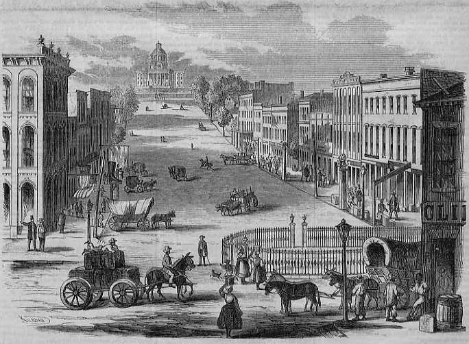
Montgomery is the capital city of the U.S. state of Alabama and the county seat of Montgomery County. Named for the Irish soldier Richard Montgomery, it stands beside the Alabama River, on the coastal Plain of the Gulf of Mexico. In the 2020 census, Montgomery's population was 200,603. It is the second most populous city in Alabama, after Huntsville, and is the 119th most populous in the United States. The Montgomery Metropolitan Statistical Area's population in 2020 was 386,047; it is the fourth largest in the state and 142nd among United States metropolitan areas. The city was incorporated in 1819 as a merger of two towns situated along the Alabama River. It became the state capital in 1846, representing the shift of power to the south-central area of Alabama with the growth of cotton as a commodity crop of the Black Belt and the rise of Mobile as a mercantile port on the Gulf Coast. In February 1861, Montgomery was chosen the first capital of the Confederate States of ... [...More Info...] [...Related Items...] OR: [Wikipedia] [Google] [Baidu] |
Greensboro, North Carolina
Greensboro (; formerly Greensborough) is a city in and the county seat of Guilford County, North Carolina, United States. It is the third-most populous city in North Carolina after Charlotte and Raleigh, the 69th-most populous city in the United States, and the largest city in the Piedmont Triad metropolitan region. At the 2020 census, its population was 299,035. Three major interstate highways (Interstate 40, Interstate 85, and Interstate 73) in the Piedmont region of central North Carolina were built to intersect at this city. In 1808, Greensborough (the spelling before 1895) was planned around a central courthouse square to succeed Guilford Court House as the county seat. The county courts were thus placed closer to the county's geographical center, a location more easily reached at the time by the majority of the county's citizens, who traveled by horse or on foot. In 2003, the previous Greensboro–Winston-Salem– High Point metropolitan statistical area was redefin ... [...More Info...] [...Related Items...] OR: [Wikipedia] [Google] [Baidu] |
Charlotte, North Carolina
Charlotte ( ) is the most populous city in the U.S. state of North Carolina. Located in the Piedmont region, it is the county seat of Mecklenburg County. The population was 874,579 at the 2020 census, making Charlotte the 16th-most populous city in the U.S., the seventh most populous city in the South, and the second most populous city in the Southeast behind Jacksonville, Florida. The city is the cultural, economic, and transportation center of the Charlotte metropolitan area, whose 2020 population of 2,660,329 ranked 22nd in the U.S. Metrolina is part of a sixteen-county market region or combined statistical area with a 2020 census-estimated population of 2,846,550. Between 2004 and 2014, Charlotte was ranked as the country's fastest-growing metro area, with 888,000 new residents. Based on U.S. Census data from 2005 to 2015, Charlotte tops the U.S. in millennial population growth. It is the third-fastest-growing major city in the United States. Residents are referr ... [...More Info...] [...Related Items...] OR: [Wikipedia] [Google] [Baidu] |
Atlanta Metropolitan Area
Metro Atlanta, designated by the United States Office of Management and Budget as the Atlanta–Sandy Springs–Alpharetta, GA Metropolitan Statistical Area, is the most populous metropolitan statistical area in the U.S. state of Georgia and the eighth-largest in the United States. Its economic, cultural and demographic center is Atlanta, and its total population was 6,144,050 according to the 2021 estimate from the U.S. Census Bureau. The metro area forms the core of a broader trading area, the Atlanta–Athens-Clarke–Sandy Springs Combined Statistical Area. The Combined Statistical Area spans up to 39 counties in north Georgia, and one county in Alabama, Chambers. The Combined Statistical Area recorded in the 2020 census a population of 6,930,423. Atlanta is the second-largest metropolitan area in the Census Bureau's Southeast region, behind that of Greater Washington, D.C. It surpassed the Greater Miami area in total population in 2021. Definitions By U.S. Census Bur ... [...More Info...] [...Related Items...] OR: [Wikipedia] [Google] [Baidu] |
Alabama
(We dare defend our rights) , anthem = "Alabama (state song), Alabama" , image_map = Alabama in United States.svg , seat = Montgomery, Alabama, Montgomery , LargestCity = Huntsville, Alabama, Huntsville , LargestCounty = Baldwin County, Alabama, Baldwin County , LargestMetro = Birmingham metropolitan area, Alabama, Greater Birmingham , area_total_km2 = 135,765 , area_total_sq_mi = 52,419 , area_land_km2 = 131,426 , area_land_sq_mi = 50,744 , area_water_km2 = 4,338 , area_water_sq_mi = 1,675 , area_water_percent = 3.2 , area_rank = 30th , length_km = 531 , length_mi = 330 , width_km = 305 , width_mi = 190 , Latitude = 30°11' N to 35° N , Longitude = 84°53' W to 88°28' W , elevation_m = 150 , elevation_ft = 500 , elevation_max_m = 735.5 , elevation_max_ft = 2,413 , elevation_max_point = Mount Cheaha , elevation_min_m = 0 , elevation_min_ft = 0 , elevation_min_point = Gulf of Mexico , OfficialLang = English language, English , Languages = * English ... [...More Info...] [...Related Items...] OR: [Wikipedia] [Google] [Baidu] |
.jpg)
.jpg)


