|
Hurley Common
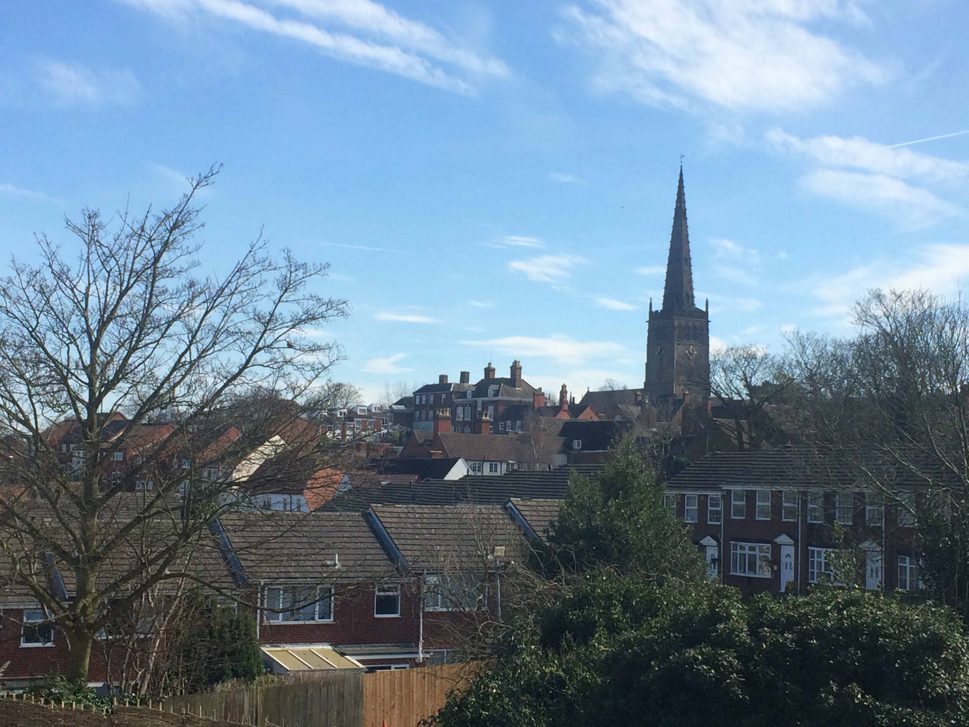
Hurley Common is a village in North Warwickshire, England, between Wood End, Atherstone, Wood End and Hurley, Warwickshire, Hurley, it consists of several houses and 2 Farms, Hurley common does not have its own Parish Church so it is technically a Hamlet (Place), hamlet. Population details for the 2011 Census can be found under Kingsbury, Warwickshire, Kingsbury. History Hurley Common dates from before the nearby village of Wood End, Atherstone, Wood End which was built in 1890. The name suggests that it was originally the common land to the village of Hurley, Warwickshire, Hurley. During the early 20th century there were several mines in the area; all have now closed. Demographics According to the 2001 UK Census, 2001 Census the population of the Hurley and Wood End ward was 3,642. Over 99.5% of people (3,550) describe themselves as White British with only 89 people from other ethnic groups. The most common distance travelled to work is , which is essentially to Tamworth, w ... [...More Info...] [...Related Items...] OR: [Wikipedia] [Google] [Baidu] |
North Warwickshire
North Warwickshire is a local government district with borough status in the ceremonial county of Warwickshire, West Midlands, England. Outlying settlements in the borough include the two towns of Atherstone (where the council is based) and Coleshill. Notable villages in the borough include Dordon, Polesworth, Kingsbury, Water Orton and Shustoke. The North Warwickshire district was created on 1 April 1974 by a merger of the Atherstone Rural District and parts of the Meriden Rural District (the rest of which was merged into the West Midlands county). North Warwickshire is a mostly rural area with several small market towns and a number of former mining villages. The area historically had a large coal mining industry, but this has now all died out. The last coal mine in the area, Daw Mill at Arley, closed in 2013. The district is relatively remote from the rest of Warwickshire, as the county is almost split in two by the West Midlands Boroughs of Solihull and Coventry. The boro ... [...More Info...] [...Related Items...] OR: [Wikipedia] [Google] [Baidu] |
Atherstone
Atherstone is a market town and civil parish in the North Warwickshire district of Warwickshire, England. Located in the far north of the county, Atherstone is on the A5 national route, and is adjacent to the border with Leicestershire which is here formed by the River Anker. It is only from Staffordshire. It lies between the larger towns of Tamworth and Nuneaton. Atherstone is the administrative centre of the North Warwickshire district, with the offices of North Warwickshire Borough Council located in the town. Atherstone is probably most well known for its tradition of holding an annual Shrove Tuesday Ball Game in the streets, which has been played almost continuously since the Middle Ages. In the 2021 census the population of the civil parish of Atherstone was at 9,212. The population of the larger built-up area which includes the adjoining village of Mancetter was 11,259. History Atherstone has a long history dating back to Roman times: The Roman road, the Watli ... [...More Info...] [...Related Items...] OR: [Wikipedia] [Google] [Baidu] |
M42 Motorway
The M42 motorway runs north east from Bromsgrove in Worcestershire to just south west of Ashby-de-la-Zouch in Leicestershire, passing Redditch, Solihull, the National Exhibition Centre (NEC) and Tamworth on the way, serving the east of the Birmingham metropolitan area. The section between the M40 and junction 4 of the M6 forms – though unsigned as such – a part of Euroroute E05. Northwards beyond junction 11, the route is continued as the A42; the junctions on this section, 12–14, are numbered like a continuation of the motorway, but the road has non-motorway status from here. History Planning and construction Plans for a new motorway by-passing the south and east of Birmingham, reaching Tamworth and connecting the M5 and M6 motorways, were announced in 1972. The first section opened in November 1976 linking Birmingham Airport with the M6 motorway. The curve around the south-eastern side of Solihull opened in September 1985 followed by the section from the M6 moto ... [...More Info...] [...Related Items...] OR: [Wikipedia] [Google] [Baidu] |
Snowdome
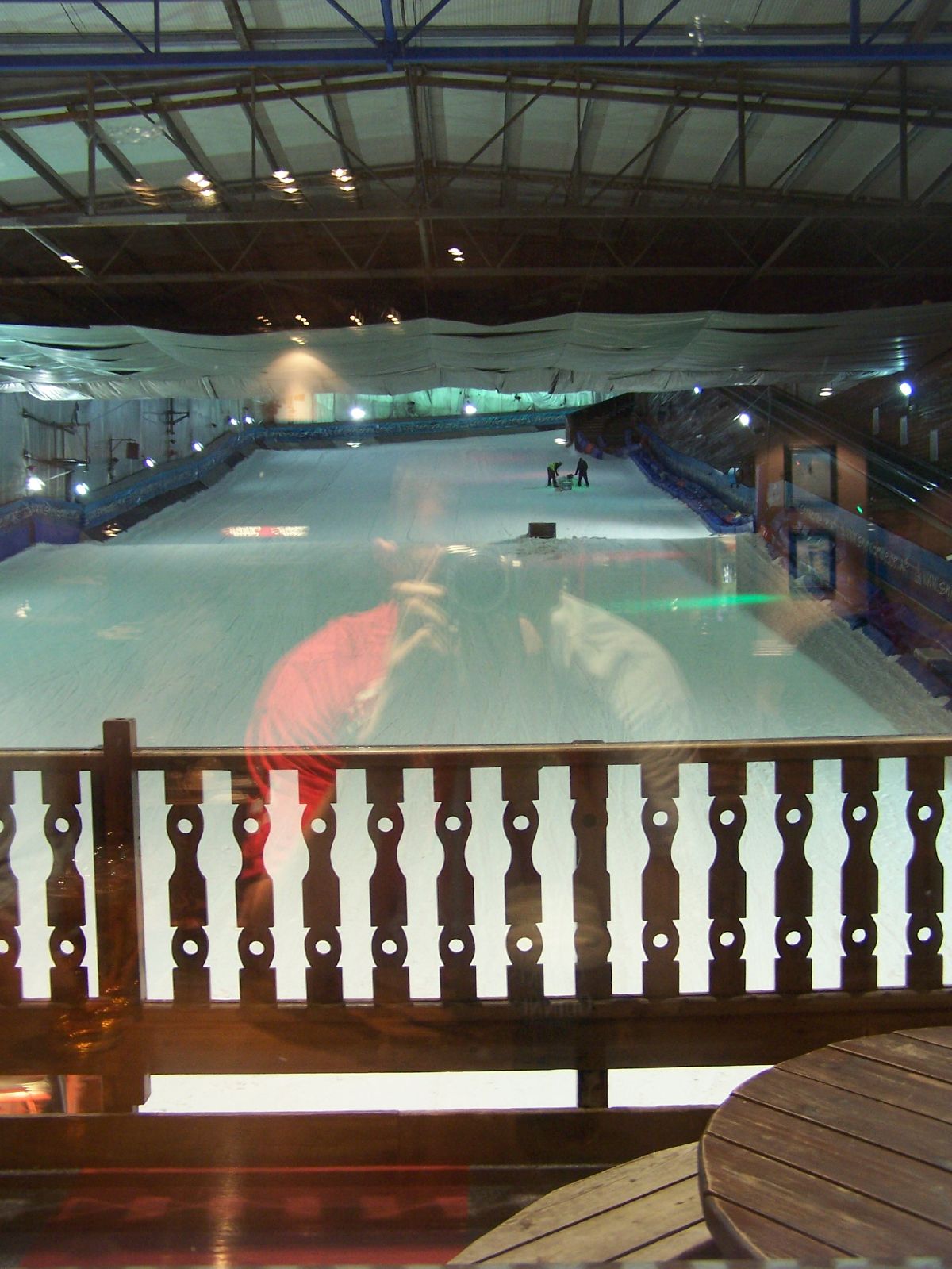
The Snowdome is an indoor ski slope just off the A5 road in Tamworth, Staffordshire, England. It opened in May 1994 and was the first full-sized recreational indoor ski slope in the UK. Facilities The slope is long by wide with an incline of around 1:7. There are also 2 serial 'travelator' lifts for access back to the top and two rope-tows. The Snowdome has a learner slope underneath the main slope. The main slope also holds regular 'ramp nights' in which several objects are added, including a gas pipe, mini rail and a quarter pipe. There is also one ice rink and one ice track - the UK’s only - which circles the real Snow Fun Park and the ice rink with a number of other things. The complex also contains a swimming pool and gym—formerly known as Peaks Leisure Centre, but now owned and managed by the Snowdome as 'Snowdome Swim' and 'Snowdome Fitness' respectively. There is also a bar (aspens), a shop Ellis Brigham, and a Starbucks Starbucks Corporation is an Am ... [...More Info...] [...Related Items...] OR: [Wikipedia] [Google] [Baidu] |
Church Of The Resurrection, Hurley
Church of the Resurrection is a small wooden Church of England church in Hurley, Warwickshire, England, dating from 1861 It is part of the parish of Baxterley with Hurley and Wood End. History The church was built in 1861 as a school. It was also used for Sunday services. the school later moved to a brick building behind the original wooden building. the later building was knocked down in 1998, when it was replaced by the current school building a short distance away. The foundations of the second building are still visible on the car park. Profile The Church is made of wood and cast iron and is a green colour, it sits on the edge of Hurley. There is a graveyard to the church a short distance away, containing two[...More Info...] [...Related Items...] OR: [Wikipedia] [Google] [Baidu] |
St Michael & All Angels Church, Wood End
St Michael & All Angels Church is a Church of England church in the village of Wood End, Warwickshire, England. Built in 1906, this small wooden church is part of the parish of Baxterley with Hurley and Wood End History The Church was built in 1906 for the village of Wood End which had been built in 1890. When the church was built it was on its own until it was surrounded by prefabricated housing which was re built during the 1980s. The church has no distinctive features and has just a small hall. Today The church is part of the Diocese of Birmingham, the archdeaconry of Aston, The Deanery of Polesworth and is in the parish of Baxterley with Hurley and Wood End. It is part of the Kingsbury and Baxterley group of churches along with Baxterley, Kingsbury, Merevale and Hurley Hurley may refer to: Places ;In the United Kingdom: * Hurley, Berkshire * Hurley, Warwickshire * Hurley Common, Warwickshire ;In the United States: * Hurley, Alabama * Hurley, Mississippi * Hurley ... [...More Info...] [...Related Items...] OR: [Wikipedia] [Google] [Baidu] |
United Kingdom Census 2001
A nationwide census, known as Census 2001, was conducted in the United Kingdom on Sunday, 29 April 2001. This was the 20th UK census and recorded a resident population of 58,789,194. The 2001 UK census was organised by the Office for National Statistics (ONS) in England and Wales, the General Register Office for Scotland (GROS) and the Northern Ireland Statistics and Research Agency (NISRA). Detailed results by region, council area, ward and output area are available from their respective websites. Organisation Similar to previous UK censuses, the 2001 census was organised by the three statistical agencies, ONS, GROS, and NISRA, and coordinated at the national level by the Office for National Statistics. The Orders in Council to conduct the census, specifying the people and information to be included in the census, were made under the authority of the Census Act 1920 in Great Britain, and the Census Act (Northern Ireland) 1969 in Northern Ireland. In England and Wales these re ... [...More Info...] [...Related Items...] OR: [Wikipedia] [Google] [Baidu] |
Sutton Coldfield
Sutton Coldfield or the Royal Town of Sutton Coldfield, known locally as Sutton ( ), is a town and civil parish in the City of Birmingham, West Midlands, England. The town lies around 8 miles northeast of Birmingham city centre, 9 miles south of Lichfield, 7 miles southwest of Tamworth and 7 miles east of Walsall. Sutton Coldfield and its surrounding suburbs are governed under Birmingham City Council for local government purposes but the town has its own town council which governs the town and its surrounding areas by running local services and electing a mayor to the council. It is in the Historic county of Warwickshire, and in 1974 it became part of Birmingham and the West Midlands metropolitan county under the Local Government Act 1972. History Etymology The etymology of the name Sutton appears to be from "South Town". The name "Sutton Coldfield" appears to come from this time, being the "south town" (i.e. south of Tamworth and/or Lichfield) on the edge of the "col f ... [...More Info...] [...Related Items...] OR: [Wikipedia] [Google] [Baidu] |
Good Hope Hospital
Good Hope Hospital is a teaching hospital in the Sutton Coldfield area of Birmingham, England. Covering north Birmingham and south east Staffordshire, it is managed by the University Hospitals Birmingham NHS Foundation Trust. History The hospital has its origins in a Victorian house built for the Rev. Riland Bedford, the local rector, in 1882. Originally known as Broomieclose, it became known as Good Hope House after a change of ownership in 1912. It was converted into a convalescent centre in 1943 and two single-storey wards were added in the 1950s to act as a facility for the potential evacuation of patients from Birmingham in the event of a nuclear attack. The Sheldon Unit and the Fothergill Block were added in 1967, the Richard Salt Unit opened in 1971 and new facilities for endoscopy, outpatients and diagnostic services followed in 2005. Services Good Hope is a teaching hospital with library and learning facilities in the Partnership Learning Centre, which is part-funded ... [...More Info...] [...Related Items...] OR: [Wikipedia] [Google] [Baidu] |
Emergency Department
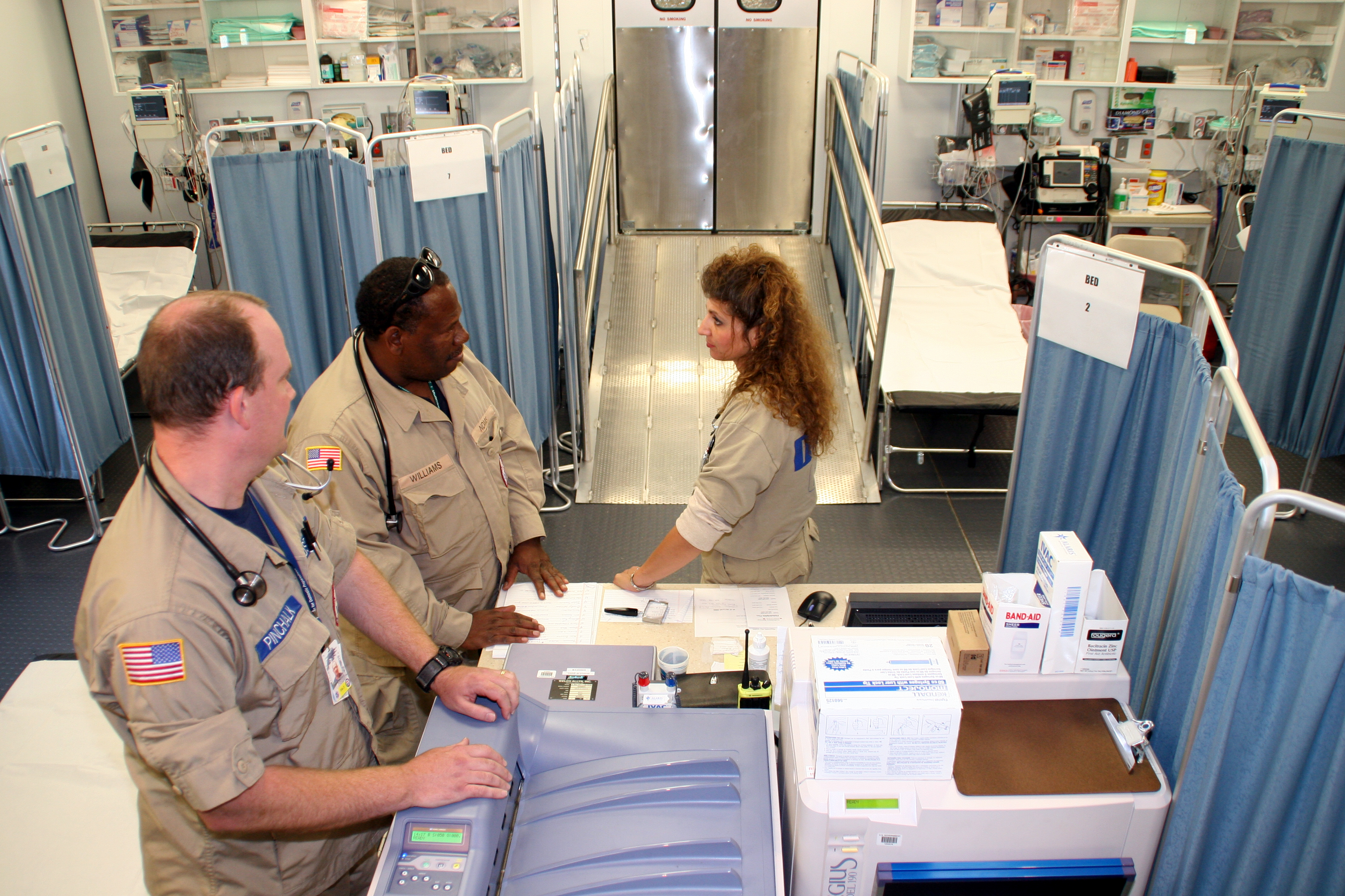
An emergency department (ED), also known as an accident and emergency department (A&E), emergency room (ER), emergency ward (EW) or casualty department, is a medical treatment facility specializing in emergency medicine, the acute care of patients who present without prior appointment; either by their own means or by that of an ambulance. The emergency department is usually found in a hospital or other primary care center. Due to the unplanned nature of patient attendance, the department must provide initial treatment for a broad spectrum of illnesses and injuries, some of which may be life-threatening and require immediate attention. In some countries, emergency departments have become important entry points for those without other means of access to medical care. The emergency departments of most hospitals operate 24 hours a day, although staffing levels may be varied in an attempt to reflect patient volume. History Accident services were provided by workmen's compensation ... [...More Info...] [...Related Items...] OR: [Wikipedia] [Google] [Baidu] |
Nuneaton
Nuneaton ( ) is a market town in the borough of Nuneaton and Bedworth in northern Warwickshire, England, close to the county border with Leicestershire and West Midlands County.OS Explorer Map 232 : Nuneaton & Tamworth: (1:25 000) : Nuneaton's population at the 2021 census was 94,634, an increase from 86,552 at the 2011 census making it the largest town in Warwickshire. The author George Eliot was born on a farm on the Arbury Estate just outside Nuneaton in 1819 and lived in the town for much of her early life. Her novel ''Scenes of Clerical Life'' (1858) depicts Nuneaton. There is a hospital named after her, The George Eliot Hospital. There is also a statue of George Eliot in the town centre. History Early history Nuneaton was originally an Anglo-Saxon settlement known as 'Etone' or 'Eaton', which translates literally as 'settlement by water', referring to the River Anker. 'Etone' was listed in the Domesday Book as a small farming settlement with a population of around 1 ... [...More Info...] [...Related Items...] OR: [Wikipedia] [Google] [Baidu] |
George Eliot Hospital
George Eliot Hospital is a single site hospital located in Nuneaton, Warwickshire, it is managed by the George Eliot Hospital NHS Trust. It provides a full range of emergency and elective medical services, including maternity services, to the local area. The Hospital is one of many local buildings named after Nuneaton-born author George Eliot. Additionally, many of the hospital's surgical and medical wards are named after characters within George Eliot novels (e.g. Felix Holt, Arbury lodge, Caterina, Adam Bede, Dolly Winthrop). The Hospital also has a set of operating theatres on the first floor. History The George Eliot Hospital opened in 1948. The hospital established its own museum in 1982: originally intended as a teaching aid, the museum evolved into one of the few NHS-owned museums in the country until cost-cutting measures forced it to close. The hospital expanded in July 1993, when the Manor Hospital, which had provided the Nuneaton's accident and emergency services, o ... [...More Info...] [...Related Items...] OR: [Wikipedia] [Google] [Baidu] |


