|
Hoxa, Orkney
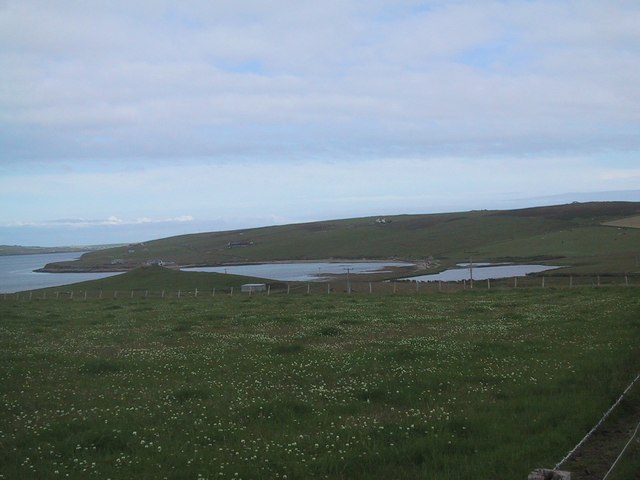
Hoxa is a small settlement on the island of South Ronaldsay in the Orkney Islands north of mainland Scotland. Hoxa is located west of St Margaret's Hope at the end of the B9043 road. Thorfinn Turf-Einarsson the 10th century Norse Earl of Orkney (aka Thorfinn Skullsplitter) may be buried at the site of The Howe broch A broch is an Iron Age drystone hollow-walled structure found in Scotland. Brochs belong to the classification "complex Atlantic roundhouse" devised by Scottish archaeologists in the 1980s. Their origin is a matter of some controversy. Origin ... just north of Hoxa.Wenham, Sheena "The South Isles" in Omand, Donald (ed.) (2003) The Orkney Book. Edinburgh. Birlinn. pp. 211-12 References External links The Megalithic Portal - Howe of HoxaCanmore - Hoxa Head Balfour Battery site recordNorthern Lighthouse Board Villages in Orkney Orkneyinga saga places {{Orkney-geo-stub ... [...More Info...] [...Related Items...] OR: [Wikipedia] [Google] [Baidu] |
Broch
A broch is an Iron Age drystone hollow-walled structure found in Scotland. Brochs belong to the classification "complex Atlantic roundhouse" devised by Scottish archaeologists in the 1980s. Their origin is a matter of some controversy. Origin and definition The word ''broch'' is derived from Lowland Scots 'brough', meaning (among other things) fort. In the mid-19th century Scottish antiquaries called brochs 'burgs', after Old Norse ', with the same meaning. Place names in Scandinavian Scotland such as Burgawater and Burgan show that Old Norse ' is the older word used for these structures in the north. Brochs are often referred to as ''duns'' in the west. Antiquarians began to use the spelling ''broch'' in the 1870s. A precise definition for the word has proved elusive. Brochs are the most spectacular of a complex class of roundhouse buildings found throughout Atlantic Scotland. The Shetland Amenity Trust lists about 120 sites in Shetland as candidate brochs, while the Royal C ... [...More Info...] [...Related Items...] OR: [Wikipedia] [Google] [Baidu] |
South Ronaldsay
South Ronaldsay (, also , sco, Sooth Ronalshee) is one of the Orkney Islands off the north coast of Scotland. It is linked to the Orkney Mainland by the Churchill Barriers, running via Burray, Glimps Holm and Lamb Holm. Name Along with North Ronaldsay, the island is named after St Ronald. The original name from which the English name derives, ''Rǫgnvaldsey'', comes from Old Norse; ''Rǫgnvalds'' ("Ronald's") + ''ey'' ("island"). Geography and geology With an area of , it is the fourth largest of the Orkney islands after The Mainland, Hoy and Sanday. Ferries sail from Burwick on the island to John o' Groats on the Scottish mainland and from St Margaret's Hope to Gills Bay.Wenham, Sheena "The South Isles" in Omand (2003) p. 212. South Ronaldsay's main village is St Margaret's Hope, Orkney's third largest settlement. It is named either after Margaret, Maid of Norway, the heir to the Scottish throne who died in Orkney age sevenWenham, Sheena "The South Isles" in Omand (200 ... [...More Info...] [...Related Items...] OR: [Wikipedia] [Google] [Baidu] |
Burray
Burray () is one of the Orkney Islands in Scotland. It lies to the east of Scapa Flow and is one of a chain of islands linked by the Churchill Barriers. Geography and geology Burray lies between Mainland, Orkney and South Ronaldsay, and is linked to both by the Churchill Barriers. Barriers 1, 2, and 3 connect Burray with Mainland, Orkney via the islets of Glimps Holm and Lamb Holm in Holm Sound to the north east. Barrier 4 links to South Ronaldsay, across Water Sound. To the west is the tidal island of Hunda, also joined by a causeway. Further west, across Scapa Flow, are the islands of Flotta and Calf of Flotta, approximately away. In 2001, the population of Burray was 357, a total that had grown to 409 by 2011. The main settlement, Burray Village, is a former fishing port on the south west coast. There are also settlements of Northtown, Southtown and Hillside on the island. Burray is made up of Old Red Sandstone of the Devonian period. The island is indented in the north w ... [...More Info...] [...Related Items...] OR: [Wikipedia] [Google] [Baidu] |
Orkney
Orkney (; sco, Orkney; on, Orkneyjar; nrn, Orknøjar), also known as the Orkney Islands, is an archipelago in the Northern Isles of Scotland, situated off the north coast of the island of Great Britain. Orkney is 10 miles (16 km) north of the coast of Caithness and has about 70 islands, of which 20 are inhabited. The largest island, the Mainland, Orkney, Mainland, has an area of , making it the List of islands of Scotland, sixth-largest Scottish island and the List of islands of the British Isles, tenth-largest island in the British Isles. Orkney’s largest settlement, and also its administrative centre, is Kirkwall. Orkney is one of the 32 Subdivisions of Scotland, council areas of Scotland, as well as a Orkney (Scottish Parliament constituency), constituency of the Scottish Parliament, a Lieutenancy areas of Scotland, lieutenancy area, and an counties of Scotland, historic county. The local council is Orkney Islands Council, one of only three councils in Scotland with ... [...More Info...] [...Related Items...] OR: [Wikipedia] [Google] [Baidu] |
Orkney And Shetland (UK Parliament Constituency)
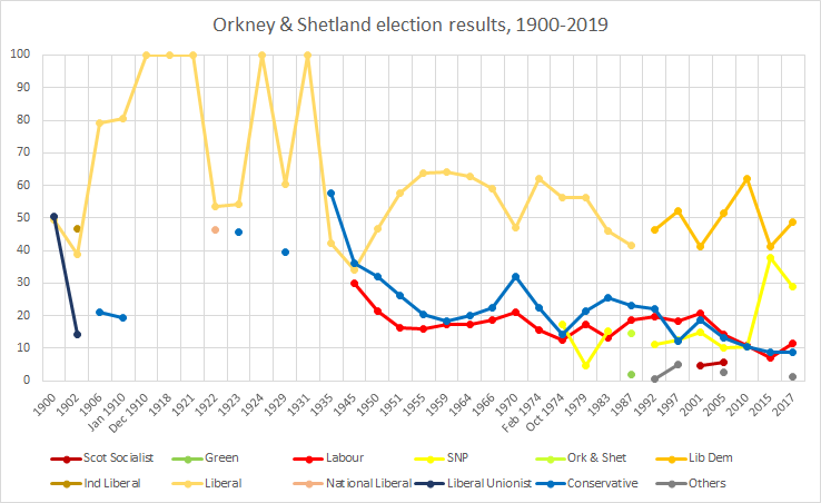
Orkney and Shetland is a constituency of the House of Commons of the Parliament of the United Kingdom. It elects one Member of Parliament (MP) by the first past the post system of election. In the Scottish Parliament, Orkney and Shetland are separate constituencies. The constituency was historically known as Orkney and Zetland (an alternative name for Shetland). In the 2014 Scottish independence referendum, 65.4% of the constituency's electors voted for Scotland to stay part of the United Kingdom. Creation The British parliamentary constituency was created in 1708 following the Acts of Union, 1707 and replaced the former Parliament of Scotland shire constituency of Orkney & Zetland. Boundaries The constituency is made up of the two northernmost island groups of Scotland, Orkney and Shetland. A constituency of this name has existed continuously since 1708. However, before 1918 the town of Kirkwall (the capital of Orkney) formed part of the Northern Burghs constituency. It i ... [...More Info...] [...Related Items...] OR: [Wikipedia] [Google] [Baidu] |
Orkney (Scottish Parliament Constituency)
Orkney is a constituency of the Scottish Parliament ( Holyrood) covering the council area of Orkney. It elects one Member of the Scottish Parliament (MSP) by the first past the post method of election. It is also one of eight constituencies in the Highlands and Islands electoral region, which elects seven additional members, in addition to the eight constituency MSPs, to produce a form of proportional representation for the region as a whole. Orkney has been held by the Liberal Democrats at all elections since the formation of the Scottish Parliament in 1999, with the current MSP being Liam McArthur, who won the seat at the 2007 Scottish Parliament election. The former Deputy First Minister Jim Wallace represented the constituency from 1999 to 2007. Electoral region Orkney is part of the Highlands and Islands electoral region; the other seven constituencies of are Argyll and Bute, Caithness, Sutherland and Ross, Inverness and Nairn, Moray, Na h-Eileanan an Iar, Shet ... [...More Info...] [...Related Items...] OR: [Wikipedia] [Google] [Baidu] |
Orkney Islands
Orkney (; sco, Orkney; on, Orkneyjar; nrn, Orknøjar), also known as the Orkney Islands, is an archipelago in the Northern Isles of Scotland, situated off the north coast of the island of Great Britain. Orkney is 10 miles (16 km) north of the coast of Caithness and has about 70 islands, of which 20 are inhabited. The largest island, the Mainland, has an area of , making it the sixth-largest Scottish island and the tenth-largest island in the British Isles. Orkney’s largest settlement, and also its administrative centre, is Kirkwall. Orkney is one of the 32 council areas of Scotland, as well as a constituency of the Scottish Parliament, a lieutenancy area, and an historic county. The local council is Orkney Islands Council, one of only three councils in Scotland with a majority of elected members who are independents. The islands have been inhabited for at least years, originally occupied by Mesolithic and Neolithic tribes and then by the Picts. Orkney was col ... [...More Info...] [...Related Items...] OR: [Wikipedia] [Google] [Baidu] |
Scotland
Scotland (, ) is a country that is part of the United Kingdom. Covering the northern third of the island of Great Britain, mainland Scotland has a border with England to the southeast and is otherwise surrounded by the Atlantic Ocean to the north and west, the North Sea to the northeast and east, and the Irish Sea to the south. It also contains more than 790 islands, principally in the archipelagos of the Hebrides and the Northern Isles. Most of the population, including the capital Edinburgh, is concentrated in the Central Belt—the plain between the Scottish Highlands and the Southern Uplands—in the Scottish Lowlands. Scotland is divided into 32 administrative subdivisions or local authorities, known as council areas. Glasgow City is the largest council area in terms of population, with Highland being the largest in terms of area. Limited self-governing power, covering matters such as education, social services and roads and transportation, is devolved from the Scott ... [...More Info...] [...Related Items...] OR: [Wikipedia] [Google] [Baidu] |
St Margaret's Hope
St Margaret's Hope is a village in the Orkney Islands, off the north coast of Scotland. It is known locally as "The Hope" or "The Hup". With a population of about 550, it is Orkney's third largest settlement after Kirkwall and Stromness. St Margaret's Hope is the main settlement of the island of South Ronaldsay. Situated off Water Sound at the head of a calm bay on the island's northern coast, it is connected to the Orkney Mainland by the A961 road running across the Churchill Barriers. St Margaret's Hope is believed to have been named after either Saint Margaret of Scotland (c.1045-1093), the wife of Malcolm III, or Margaret, Maid of Norway, who died in Orkney and possibly in this location in 1290. The village has a primary school, a small blacksmith's museum, a few shops and a cafe, a pub and a wine bar. Pentland Ferries run a reliable service from the pier in the bay to Gills Bay on the Scottish mainland. It is also known for its annual Boys' Ploughing Match A pl ... [...More Info...] [...Related Items...] OR: [Wikipedia] [Google] [Baidu] |
Gazetteer Of Scotland
The ''Gazetteer for Scotland'' is a gazetteer covering the geography, history and people of Scotland. It was conceived in 1995 by Bruce Gittings of the University of Edinburgh and David Munro of the Royal Scottish Geographical Society, and contains 25,870 entries as of July 2019. It claims to be "the largest dedicated Scottish resource created for the web". The Gazetteer for Scotland provides a carefully researched and editorially validated resource widely used by students, researchers, tourists and family historians with interests in Scotland. Following on from a strong Scottish tradition of geographical publishing, the ''Gazetteer for Scotland'' is the first comprehensive gazetteer to be produced for the country since Francis Groome's ''Ordnance Gazetteer of Scotland'' (1882-6) (the text of which is incorporated into relevant entries). The aim is not to produce a travel guide, of which there are many, but to write a substantive and thoroughly edited description of the count ... [...More Info...] [...Related Items...] OR: [Wikipedia] [Google] [Baidu] |
B9043 Road
B roads are numbered routes in Great Britain of lesser importance than A roads. See the article Great Britain road numbering scheme for the rationale behind the numbers allocated. Zone 9 (3 digits) Zone 9 (4 digits) References See also * A roads in Zone 9 of the Great Britain numbering scheme * List of motorways in the United Kingdom This list of motorways in the United Kingdom is a complete list of motorways in the United Kingdom. Note that the numbering scheme used for Great Britain does not include roads in Northern Ireland, which are allocated numbers on an ad hoc basis ... * Transport in Aberdeen#Roads * Transport in Edinburgh#Road network * Transport in Scotland#Road {{DEFAULTSORT:B Roads in Zone 9 of the Great Britain Numbering Scheme 9 ... [...More Info...] [...Related Items...] OR: [Wikipedia] [Google] [Baidu] |
Thorfinn Turf-Einarsson, Earl Of Orkney
Thorfinn Torf-EinarssonCrawford (1987) p. 63 also known as Thorfinn Skull-splitterThomson (2008) p. 57 (from the Old Norse ''Þorfinnr hausakljúfr'') was a 10th-century Earl of Orkney. He appears in the '' Orkneyinga saga'' and briefly in '' St Olaf's Saga'', as incorporated into the ''Heimskringla''. These stories were first written down in Iceland in the early 13th century and much of the information they contain is "hard to corroborate". Family Thorfinn was the youngest son of Torf-Einarr, himself the son of Rognvald Eysteinsson, the first Earl of Orkney. Torf-Einarr had two other sons, Arnkel and Erlend who "fell in a war expedition"Sturlason, Snorri Chapter 99. "History of the Earls of Orkney". at an unspecified location in England along with Erik Bloodaxe.''Orkneyinga Saga'' (1981) Chapter 8. p. 33 Erik's widow, Gunnhildr then fled north to Orkney with her sons who used the islands as a base for summer raiding expeditions. Thorfinn had five sons: Arnfinn, Havard, Hlodvir ... [...More Info...] [...Related Items...] OR: [Wikipedia] [Google] [Baidu] |


