|
Henri Parmentier
Henri Parmentier (french: Henri Ernest Jean Parmentier) was a French architect, art historian and archaeologist. Parmentier became one of the first European specialists in the archaeology of Indochina. He has documented, depicted and preserved many Khmer, Cham and Lao monuments. Early years Henri Ernest was born on 3 January 1870 in Paris; his father was a painter working in ''Lycée de Reims''. In 1891 Parmentier entered the École nationale supérieure des Beaux-Arts graduating in 1905 with a diploma in architecture. In 1896 he got employed by the colonial administration in Tunisia and over time he developed a profound interest in archaeology. During this period Parmentier created a detailed plan of the in Dougga to assist with its restoration. This job was awarded with an honourable mention on the exhibition of Société des Artistes Français. In 1900 Parmentier joined archaeologist Henri Dufour and photograph Charles Carpeaux in the Archaeological mission in Indochina (l ... [...More Info...] [...Related Items...] OR: [Wikipedia] [Google] [Baidu] |
French School Of The Far East
The French School of the Far East (french: École française d'Extrême-Orient, ), abbreviated EFEO, is an associated college of PSL University dedicated to the study of Asian societies. It was founded in 1900 with headquarters in Hanoi in what was then French Indochina. After the independence of Vietnam, its headquarters were transferred to Phnom Penh in 1957 and subsequently to Paris in 1975. Its main fields of research are archaeology, philology and the study of modern Asian societies. Since 1907, the EFEO has been in charge of conservation work at the archeological site of Angkor. EFEO romanization system A romanization system for Mandarin was developed by the EFEO. It shares a few similarities with Wade-Giles and Hanyu Pinyin. In modern times, it has been superseded by Hanyu Pinyin. The differences between the three romanization systems are shown in the following table: Directors *1900: Louis Finot *1905: Alfred Foucher *1908: Claude-Eugène Maitre *1920: Lo ... [...More Info...] [...Related Items...] OR: [Wikipedia] [Google] [Baidu] |
Bayon Temple, Angkor - Panoramio
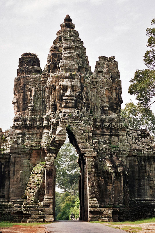
The Bayon ( km, ប្រាសាទបាយ័ន, ) is a richly decorated Khmer temple related to Buddhism at Angkor in Cambodia. Built in the late 12th or early 13th century as the state temple of the King Jayavarman VII ( km, ព្រះបាទជ័យវរ្ម័នទី ៧), the Bayon stands at the centre of Jayavarman's capital, Angkor Thom ( km, អង្គរធំ).Higham, C., 2001, The Civilization of Angkor, London: Weidenfeld & Nicolson, , p.121Higham, C., 2014, Early Mainland Southeast Asia, Bangkok: River Books Co., Ltd., pp.378-382 The Bayon's most distinctive feature is the multitude (4 on each tower pointing to the 4 sides) of serene and smiling stone faces of Brahma on the many towers which jut out from the upper terrace and cluster around its central peak.Freeman and Jacques, p.78. The main conservatory body, the Japanese Government Team for the Safeguarding of Angkor (the JSA) has described the temple as "the most striking expression of the ba ... [...More Info...] [...Related Items...] OR: [Wikipedia] [Google] [Baidu] |
Da Nang
Nang or DanangSee also Danang Dragons ( ; vi, Đà Nẵng, ) is a class-1 municipality and the fifth-largest city in Vietnam by municipal population. It lies on the coast of the East Sea of Vietnam at the mouth of the Hàn River, and is one of Vietnam's most important port cities. As one of the country's five direct-controlled municipalities, it falls under the administration of the central government. Da Nang is the commercial and educational centre of Central Vietnam and is the largest city in the region. It has a well-sheltered, easily accessible port, and its location on National Route 1 and the North–South Railway makes it a transport hub. It is within of several UNESCO World Heritage Sites, including the Imperial City of Huế, the Old Town of Hội An, and the Mỹ Sơn ruins. The city was known as during early Đại Việt settlement, and as (or ''Turon'') during French colonial rule. Before 1997, the city was part of Quang Nam - Da Nang Province. On 1 Janua ... [...More Info...] [...Related Items...] OR: [Wikipedia] [Google] [Baidu] |
Museum Of Cham Sculpture
The Museum of Cham Sculpture is a museum located in Hải Châu District, Đà Nẵng, central Vietnam, near the Han River. The establishment of a Cham sculpture museum in Da Nang was first proposed in 1902 by the Department of Archaeology of EFEO. Henri Parmentier, a prominent archaeologist of the department, made great contributions to the campaign for its construction. Reportedly founded in 1915 as the ''Musée Henri Parmentier'', its first building opened in 1919 and was designed by two French architects, M. Deleval and M. Auclair, who were inspired by Parmentier to use some traditional Cham elements in the composition. Prior to the establishment of the museum, the site was known as the "garden of sculptures" and many Cham sculptures that had been collected in Da Nang, Quảng Nam and elsewhere had been brought there over the preceding twenty years. The museum has been expanded twice. The first expansion was in the mid-1930s, with two new galleries providing display ... [...More Info...] [...Related Items...] OR: [Wikipedia] [Google] [Baidu] |
Banteay Prey Nokor
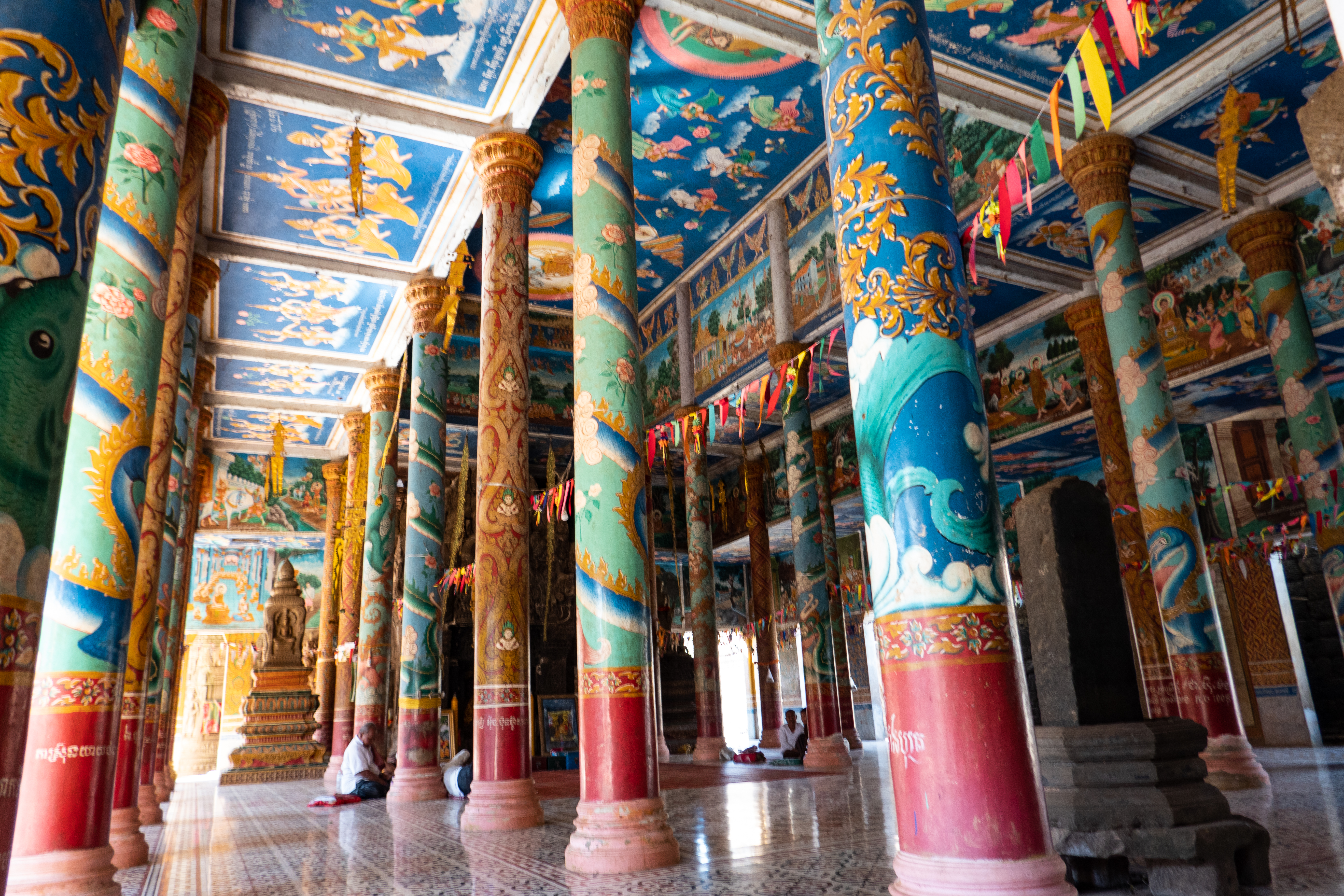
Banteay Prei Nokor ( km, បន្ទាយព្រៃនគរ) is an ancient temple complex in the northwest of Kompong Cham, Cambodia. Known locally as temple of "Wat Nokor in Khum of Kompong Siem", or "Wat Angkor", around 2km from the provincial capital Kampong Cham (city). though a sign at the entrance now officially designates the name of the temple as Nokor Bachey Temple ( km, ប្រាសាទនគរបាជ័យ). Layout The complex faces east at a bearing of 84.5°E, and covers 15ha. the site is composed of an outer rectangular laterite wall approximately 420x370m, an inner wall approximately 100x130m. A large reservoir or Baray ( km, បារាយណ៍) some 950 meters long and 480 meters wide is located 350 meters east of the site. Now abandoned, the reservoir area was used in the mid 20th century as a hippodrome, evidence of which can still be seen by visitors. History The monument was built out of sandstone and laterite, and dates from t ... [...More Info...] [...Related Items...] OR: [Wikipedia] [Google] [Baidu] |
Kampong Thom City
Kampong Thom ( km, ក្រុងកំពង់ធំ), also Krong Kampong Thom, is the capital city of Kampong Thom Province, Cambodia lying on the bank of the Steung Saen River. It is a mid-way stopover on the National Highway No 6 halfway between Phnom Penh Phnom Penh (; km, ភ្នំពេញ, ) is the capital and most populous city of Cambodia. It has been the national capital since the French protectorate of Cambodia and has grown to become the nation's primate city and its economic, indus ... and Siem Reap.Matt Jacobson ''Adventure Cambodia: An Explorer's Travel Guide'' 9749575539 2004 p131 "Highway 6 continues on to the left, going to Kampong Thom and Siem Reap." The Kampong Thom High School is North of the river bridge, and the Kampong Thom Market is on the south side of the bridge, followed by the main street and dual carriageway. Further south along the road is Steung Saen ( km, ក្រុងស្ទឹងសែន) also a district in Kampong Th ... [...More Info...] [...Related Items...] OR: [Wikipedia] [Google] [Baidu] |
Sambor Prei Kuk
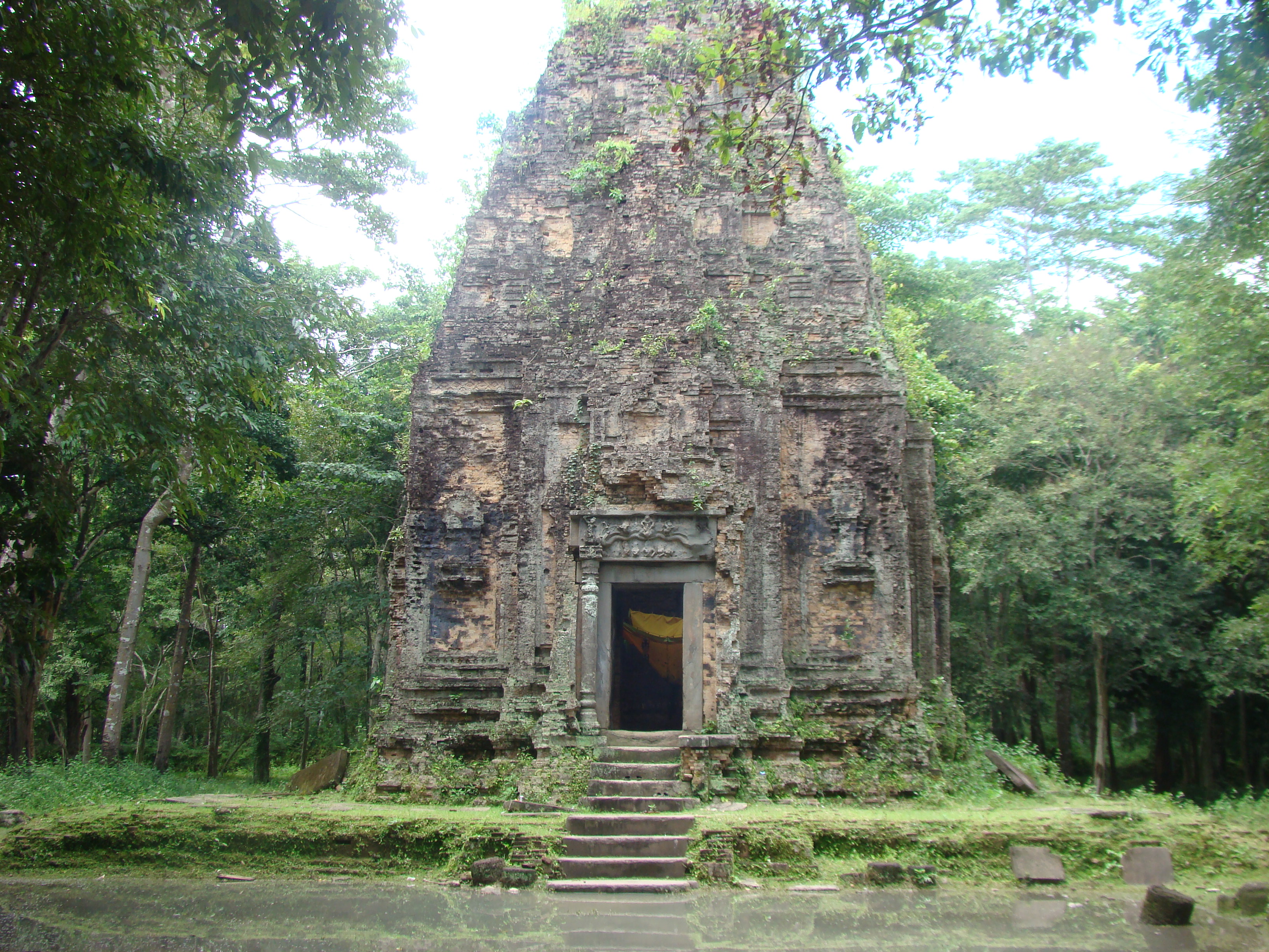
Sambor Prei Kuk ( km, សំបូរព្រៃគុហ៍, ) is an archaeological site in Cambodia located in Kampong Thom Province, north of Kampong Thom, the provincial capital, east of Angkor and north of Phnom Penh. The now ruined complex dates back to the Pre-Angkorian Chenla Kingdom (late 6th to 9th century), established by king Isanavarman I as central royal sanctuary and capital, known then as "Isanapura" ( km, ឦសានបុរៈ, ).Higham, C., 2014, ''Early Mainland Southeast Asia'', Bangkok: River Books Co., Ltd., In 2017, Sambor Prei Kuk was declared a UNESCO World Heritage Site. Located on the Eastern bank of the Tonle Sap lake, close to the Steung Saen River, the central part of Sambor Prei Kuk is divided into three main groups. Each group has a square layout surrounded by a brick wall. The structures of the overall archaeological area were constructed at variable times: the southern and north groups (7th century) by Isanavarman I, who is consid ... [...More Info...] [...Related Items...] OR: [Wikipedia] [Google] [Baidu] |
Po Klong Garai
Po Klaung Yăgrai (1151 - 1205) was king of the Champa polity of Panduranga.In what is now Phan Rang in southern Vietnam Title Po Klaung Yăgrai is the royal title, not the name. According to legend, he came from the popular types with name Jatol. His title ''Po Klaung Yăgrai'' means the "king of dragons" or "dragon king of Jarai people" in the Cham language. It includes of "Po" is the king, "klaung" is the dragon and "Yăgrai" is the Jarai people. History Po Klaung Yăgrai ruled from 1167 to his death and is credited to have built many irrigation works and dams. He probably is the same person as Champa king, Jaya Indravarman IV. He is worshipped at the Po Klong Garai Temple, built by Champa King Jaya Sinhavarman III (Chế Mân). Legend He started life as a lowly cowherd, but became king of Champa by destiny, ruling wisely and for the good of the people. When the Khmer of Cambodia invaded his kingdom, he challenged them to settle the matter peacefully in a tower-building ... [...More Info...] [...Related Items...] OR: [Wikipedia] [Google] [Baidu] |
Bayon
The Bayon ( km, ប្រាសាទបាយ័ន, ) is a richly decorated Khmer temple related to Buddhism at Angkor in Cambodia. Built in the late 12th or early 13th century as the state temple of the King Jayavarman VII ( km, ព្រះបាទជ័យវរ្ម័នទី ៧), the Bayon stands at the centre of Jayavarman's capital, Angkor Thom ( km, អង្គរធំ).Higham, C., 2001, The Civilization of Angkor, London: Weidenfeld & Nicolson, , p.121Higham, C., 2014, Early Mainland Southeast Asia, Bangkok: River Books Co., Ltd., pp.378-382 The Bayon's most distinctive feature is the multitude (4 on each tower pointing to the 4 sides) of serene and smiling stone faces of Brahma on the many towers which jut out from the upper terrace and cluster around its central peak.Freeman and Jacques, p.78. The main conservatory body, the Japanese Government Team for the Safeguarding of Angkor (the JSA) has described the temple as "the most striking expression of the ba ... [...More Info...] [...Related Items...] OR: [Wikipedia] [Google] [Baidu] |
Angkor
Angkor ( km, អង្គរ , 'Capital city'), also known as Yasodharapura ( km, យសោធរបុរៈ; sa, यशोधरपुर),Headly, Robert K.; Chhor, Kylin; Lim, Lam Kheng; Kheang, Lim Hak; Chun, Chen. 1977. ''Cambodian-English Dictionary''. Bureau of Special Research in Modern Languages. The Catholic University of America Press. Washington, D.C. Chuon Nath Khmer Dictionary (1966, Buddhist Institute, Phnom Penh). was the capital city of the Khmer Empire. The city and empire flourished from approximately the 9th to the 15th centuries. The city houses the Angkor Wat, one of Cambodia's most popular tourist attractions. The name ''Angkor'' is derived from ''nokor'' (), a Khmer word meaning "kingdom" which in turn derived from Sanskrit ''nagara'' (), meaning "city". The Angkorian period began in AD 802, when the Khmer Hindu monarch Jayavarman II declared himself a "universal monarch" and "god-king", and lasted until the late 14th century, first falling under ... [...More Info...] [...Related Items...] OR: [Wikipedia] [Google] [Baidu] |


