|
Harlowton
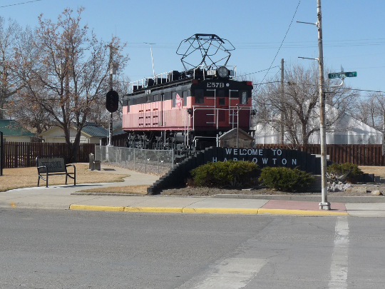
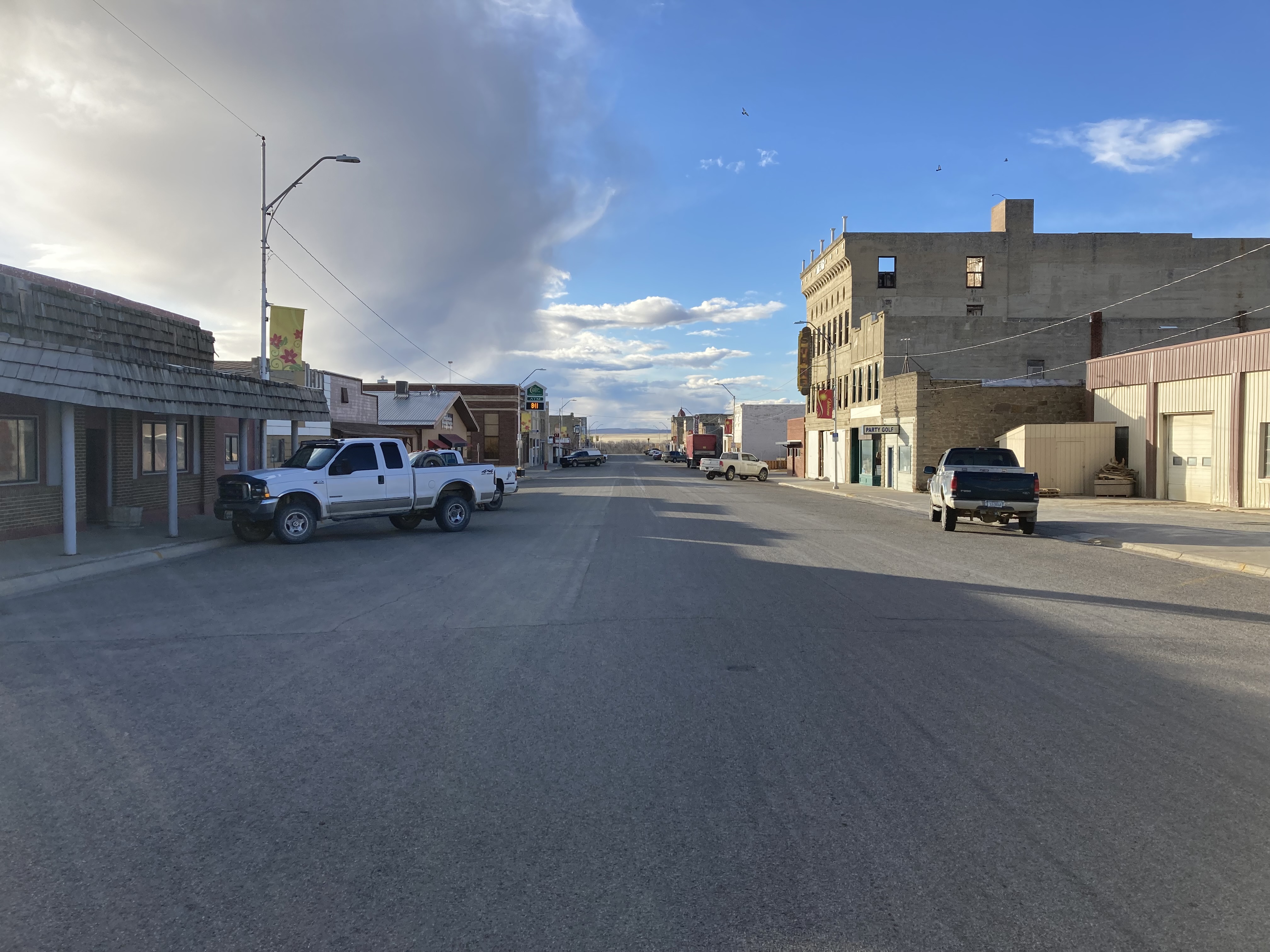
Harlowton is a city in and the county seat of Wheatland County, Montana, United States. The population was 955 at the 2020 census. Description The city was once the eastern terminus of electric operations (1914–74) for the "Pacific Extension" of the Chicago, Milwaukee, St. Paul and Pacific Railroad ("Milwaukee Road"). Here, steam or diesel locomotives were changed or hooked up to electric locomotives for trip through the Rocky Mountains to Avery, Idaho. Harlowton was founded in 1900 as a station stop on the Montana Railroad, a predecessor to the Milwaukee, and was named for Richard A. Harlow, the Montana Railroad's president. The area around Harlowton is rich in agriculture, the leading products being wheat, barley, cattle, sheep and honey bees. Major employers are Wheatland Memorial Healthcare, Harlowton High School, Hillcrest Elementary School, Musselshell Ranger District, Midtown Market 2 Grocery Store, Rays Sport and Western Wear, Cream of the West, Rocky Mountain Cook ... [...More Info...] [...Related Items...] OR: [Wikipedia] [Google] [Baidu] |
Harlowton Montana Monument2
Harlowton is a city in and the county seat of Wheatland County, Montana, United States. The population was 955 at the 2020 census. Description The city was once the eastern terminus of electric operations (1914–74) for the "Pacific Extension" of the Chicago, Milwaukee, St. Paul and Pacific Railroad ("Milwaukee Road"). Here, steam or diesel locomotives were changed or hooked up to electric locomotives for trip through the Rocky Mountains to Avery, Idaho. Harlowton was founded in 1900 as a station stop on the Montana Railroad, a predecessor to the Milwaukee, and was named for Richard A. Harlow, the Montana Railroad's president. The area around Harlowton is rich in agriculture, the leading products being wheat, barley, cattle, sheep and honey bees. Major employers are Wheatland Memorial Healthcare, Harlowton High School, Hillcrest Elementary School, Musselshell Ranger District, Midtown Market 2 Grocery Store, Rays Sport and Western Wear, Cream of the West, Rocky Mountain Cook ... [...More Info...] [...Related Items...] OR: [Wikipedia] [Google] [Baidu] |
Wheatland County, Montana
Wheatland County is a county in the U.S. state of Montana. As of the 2020 census, the population was 2,069. Its county seat is Harlowton. Wheatland County was established on February 22, 1917, with areas partitioned from Meagher and Sweet Grass counties. It was named for the abundant wheat-growing areas across the center portion of the new county's area. Geography According to the United States Census Bureau, the county has a total area of , of which is land and (0.4%) is water. Major highways * U.S. Highway 12 * U.S. Highway 191 * Montana Highway 3 Adjacent counties * Judith Basin County - north * Fergus County - north * Golden Valley County - east * Sweet Grass County - south * Meagher County - west National protected area * Lewis and Clark National Forest (part) Demographics 2000 census As of the 2000 United States census, there were 2,259 people, 853 households, and 540 families in the county. The population density was 2 people per square mile (1/km2). T ... [...More Info...] [...Related Items...] OR: [Wikipedia] [Google] [Baidu] |
Musselshell River
The Musselshell River is a tributary of the Missouri River, long from its origins at the confluence of its North and South Forks near Martinsdale, Montana to its mouth on the Missouri River. It is located east of the Continental divide entirely within Montana in the United States. Counting its pre-confluence tributaries, it measures in length. It rises in several forks in the Crazy, Little Belt, and Castle mountains in central Montana. The main branch is formed by the confluence of the North Fork and South Fork in Meagher County, about east of White Sulphur Springs, Montana, just east of Martinsdale, north of Martinsdale Reservoir, and just west of Meagher County's border with Wheatland County. The North Fork flows south from the Little Belt Mountains through Bair Reservoir, then southeast. The South Fork flows northeast from the Crazy Mountains. From the confluence of these two waterways, the main branch flows roughly due east past Two Dot, Harlowton, and Roundup, t ... [...More Info...] [...Related Items...] OR: [Wikipedia] [Google] [Baidu] |
Montana Railroad
The Montana Railroad was an American railroad built and operated between the towns of Lombard and Lewistown, Montana, a distance of approximately 157 miles. The railroad connected with the national railway network via a connection with the Northern Pacific Railway at Lombard. The Montana Railroad line was constructed between 1895 and 1903, and operated independently until 1908, when it was acquired by the Chicago, Milwaukee, St. Paul and Pacific Railroad ("the Milwaukee Road"). The railroad was colloquially known as "the Jawbone", because of the contrast between the promising statements of the line's promoters and the company's perennially-weak financial position. History The Montana Railroad was the brainchild of Richard A. Harlow, a Helena, Montana attorney and entrepreneur, who envisioned the construction of a railway eastward from Helena to serve the mining and agricultural regions of central Montana. His first attempt at such a project, the Montana Midland, began constru ... [...More Info...] [...Related Items...] OR: [Wikipedia] [Google] [Baidu] |
Area Code 406
Image:Area_code_MT.png, Map of Montana area code in blue (with border states and provinces) poly 67 33 0 20 1 1 51 0 58 24 Area code 250 poly 66 33 57 25 52 0 198 0 198 54 Area code 403 poly 198 55 198 0 419 0 418 72 265 63 Area code 306 poly 373 71 419 71 419 212 364 210 Area code 701 poly 364 212 363 267 419 267 419 212 Area code 605 poly 140 233 133 268 363 269 362 255 Area code 307 poly 1 21 15 23 6 70 12 85 12 99 37 137 47 141 36 165 39 178 31 179 32 187 35 195 51 188 58 216 65 222 60 221 61 230 71 230 71 248 77 254 79 247 92 253 93 246 110 250 121 250 125 243 130 256 135 259 134 268 1 267 Area codes 208 and 986 desc top-right Area code 406 is the telephone area code covering the entire state of Montana. It has been Montana's only area code since area codes were created in 1947. As of 2013, there were 1.7 million lines served by 47 carriers; all but two wireline providers support local number portability (the exceptions are small rur ... [...More Info...] [...Related Items...] OR: [Wikipedia] [Google] [Baidu] |
Lewis And Clark National Forest
Lewis and Clark National Forest is located in west central Montana, United States. Spanning , the forest is managed as two separate zones. The eastern sections, under the Jefferson Division, is a mixture of grass and shrublands dotted with "island" pockets of forested areas. Here, cattle leases to local ranchers as well as timber harvesting are the norm. The western Rocky Mountain Division, which straddles the Continental divide, is managed chiefly for environmental preservation, as much of the land has been designated as wilderness. Forest headquarters are located in Great Falls, Montana. Local ranger district offices have been established in Choteau, Harlowton, Neihart, Stanford, and White Sulphur Springs. The forest lands were defined and established by the federal government in 1897, following its Treaty of 1896 with the Blackfeet establishing their adjacent reservation. This forest is one of the oldest forest preserves in the U.S. The forest is named in honor of the mem ... [...More Info...] [...Related Items...] OR: [Wikipedia] [Google] [Baidu] |
List Of Counties In Montana
This is a list of the counties in the U.S. state of Montana. There are 56 counties in the state. Montana has two consolidated city-counties— Anaconda with Deer Lodge County and Butte with Silver Bow County. The portion of Yellowstone National Park that lies within Montana was not part of any county until 1978, when part of it was nominally added to Gallatin County, and the rest of it to Park County. Montana's postal abbreviation is MT and its FIPS state code is 30. Counties The Federal Information Processing Standard (FIPS) code, which is used by the United States government to uniquely identify counties, is provided for each county. The FIPS code for each county links to census data for that county. Previous counties *St. Charles County, Missouri Territory created October 1, 1812, moved 1813 *Vancouver County, Oregon Territory created August 13, 1848, renamed Clarke County, Oregon Territory Septem ... [...More Info...] [...Related Items...] OR: [Wikipedia] [Google] [Baidu] |
Avery, Idaho
Avery is a small unincorporated community in the northwest United States, located in the St. Joe River Valley in Shoshone County, Idaho. Avery is located in the middle of the St. Joe District of the Idaho Panhandle National Forest, and is a tourist attraction in the Idaho Panhandle known for its wilderness and outdoor recreation. It is upstream and east of St. Maries, the county seat of Benewah County. Geography Avery is located at a latitude of 47.25 ºN, longitude 115.81 ºW, and an elevation of 2562 ft (781m) above sea level. Climate This climatic region is typified by large seasonal temperature differences, with warm to hot (and often humid) summers and cold (sometimes severely cold) winters. According to the Köppen Climate Classification system, Avery has a humid continental climate, abbreviated "Dfb" on climate maps. Demographics As of 2013, Avery had a population of 25 permanent residents. The temporary population is higher in the summer though due to sea ... [...More Info...] [...Related Items...] OR: [Wikipedia] [Google] [Baidu] |
Kiwanis
Kiwanis International ( ) is an international service club founded in 1915 in Detroit, Michigan. It is headquartered in Indianapolis, Indiana, United States, and is found in more than 80 nations and geographic areas. Since 1987, the organization has also accepted women as members. Membership in Kiwanis and its family of clubs is more than 600,000 members. Each year, Kiwanis clubs raise more than US$100 million and report more than 18.5 million volunteer hours to strengthen communities and serve children. Kiwanis International is a volunteer-led organization headed by a Board of Trustees consisting of 19 members: 15 trustees, four elected officers, and an executive director. The trustees serve three-year terms, with five trustees elected each year. As set out in the bylaws, nine trustees are elected from the United States and Pacific Canada Region, one trustee is elected from the Canada and Caribbean Region, two trustees are elected from the European Region, two trustees are elec ... [...More Info...] [...Related Items...] OR: [Wikipedia] [Google] [Baidu] |
Snowmobiling
A snowmobile, also known as a Ski-Doo, snowmachine, sled, motor sled, motor sledge, skimobile, or snow scooter, is a motorized vehicle designed for winter travel and recreation on snow. It is designed to be operated on snow and ice and does not require a road or trail, but most are driven on open terrain or trails. Snowmobiling is a sport that many people have taken on as a serious hobby. Older snowmobiles could generally accommodate two people; however, most snowmobiles manufactured since the 1990s have been designed to only accommodate one person. Snowmobiles built with the ability to accommodate two people are referred to as "2-up" snowmobiles or "touring" models and make up an extremely small share of the market. Most snowmobiles do not have any enclosures, except for a windshield, and their engines normally drive a continuous track at the rear. Skis at the front provide directional control. Early snowmobiles used simple rubber tracks, but modern snowmobiles' tracks are us ... [...More Info...] [...Related Items...] OR: [Wikipedia] [Google] [Baidu] |
City
A city is a human settlement of notable size.Goodall, B. (1987) ''The Penguin Dictionary of Human Geography''. London: Penguin.Kuper, A. and Kuper, J., eds (1996) ''The Social Science Encyclopedia''. 2nd edition. London: Routledge. It can be defined as a permanent and densely settled place with administratively defined boundaries whose members work primarily on non-agricultural tasks. Cities generally have extensive systems for housing, transportation, sanitation, utilities, land use, production of goods, and communication. Their density facilitates interaction between people, government organisations and businesses, sometimes benefiting different parties in the process, such as improving efficiency of goods and service distribution. Historically, city-dwellers have been a small proportion of humanity overall, but following two centuries of unprecedented and rapid urbanization, more than half of the world population now lives in cities, which has had profound consequ ... [...More Info...] [...Related Items...] OR: [Wikipedia] [Google] [Baidu] |
Nez Perce National Historic Trail
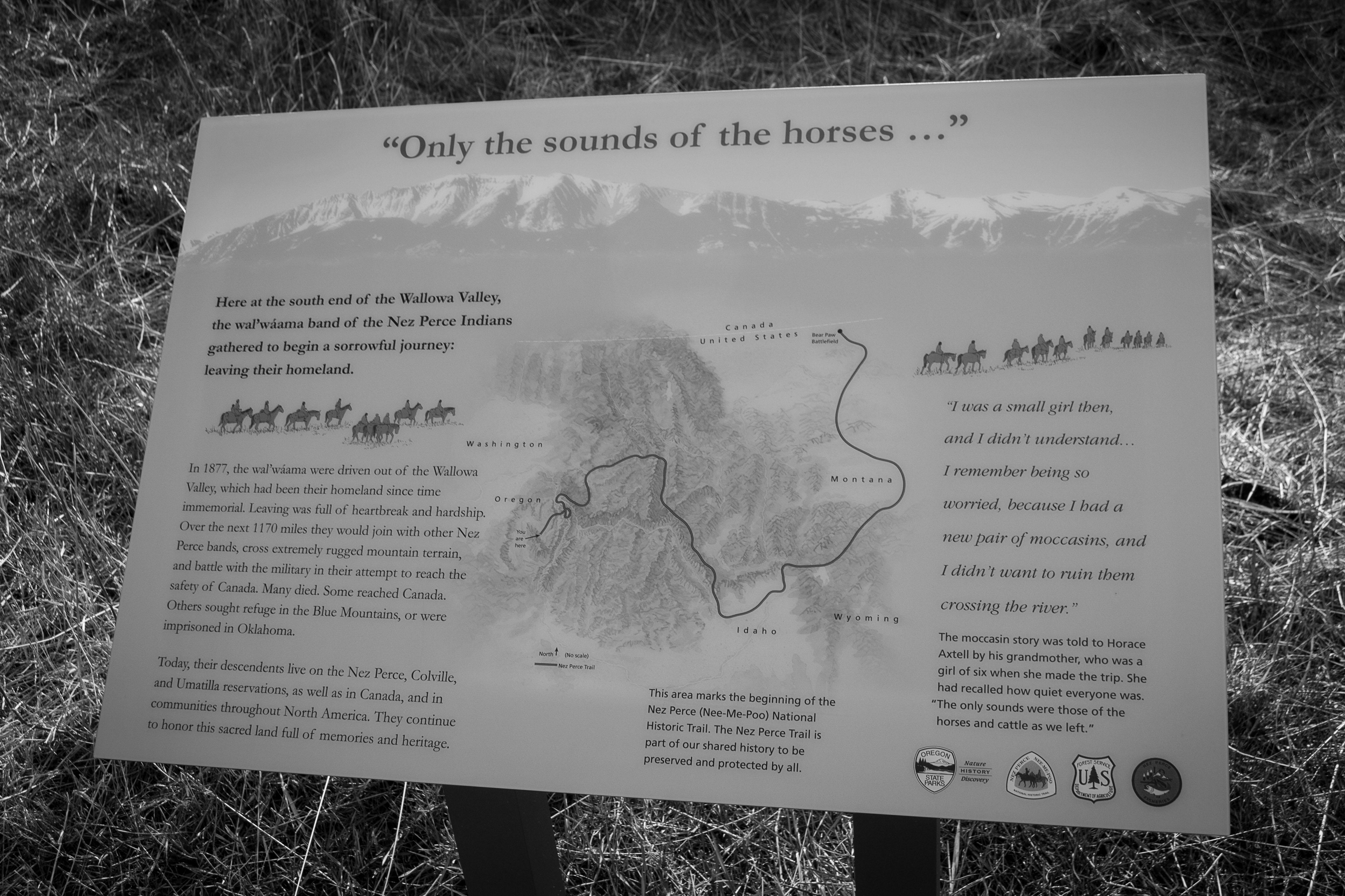
The Nez Perce (Nee-Me-Poo) National Historic Trail follows the route taken by a large group of the Nez Perce tribe in 1877 to avoid being forced onto a reservation. The 1,170-mile (1,883 km) trail was created in 1986 as part of the National Trails System Act and is managed by the U.S. Forest Service. The trail traverses through portions of the U.S. states of Oregon, Idaho, Wyoming, and Montana and connects sites across these states that commemorate significant events of the Nez Perce War that took place between June and October 1877, as several bands of the Nez Perce tried to escape capture by the U.S. Cavalry. The sites are among the 38 that are part of the National Park service's Nez Perce National Historical Park, managed over all by the National Park Service, with some sites managed by local and state affiliated organizations. History A band of 750 Nez Perce warriors and women, children and elders made the journey. They were parties to the 1855 Treaty of Walla Wall ... [...More Info...] [...Related Items...] OR: [Wikipedia] [Google] [Baidu] |


