|
Musselshell River
The Musselshell River is a tributary of the Missouri River, long from its origins at the confluence of its North and South Forks near Martinsdale, Montana to its mouth on the Missouri River. It is located east of the Continental divide entirely within Montana in the United States. Counting its pre-confluence tributaries, it measures in length. It rises in several forks in the Crazy, Little Belt, and Castle mountains in central Montana. The main branch is formed by the confluence of the North Fork and South Fork in Meagher County, about east of White Sulphur Springs, Montana, just east of Martinsdale, north of Martinsdale Reservoir, and just west of Meagher County's border with Wheatland County. The North Fork flows south from the Little Belt Mountains through Bair Reservoir, then southeast. The South Fork flows northeast from the Crazy Mountains. From the confluence of these two waterways, the main branch flows roughly due east past Two Dot, Harlowton, and Roundup, t ... [...More Info...] [...Related Items...] OR: [Wikipedia] [Google] [Baidu] |
Petroleum County, Montana
Petroleum County is a county in the U.S. state of Montana. As of the 2020 census, the population was 496, making it the least populous county in Montana and the eighth-least populous in the United States. Its county seat is Winnett. The county's area was partitioned from Fergus County to become the last of Montana's 56 counties to be organized. History The area was home to Native American tribes of the Crow, Blackfoot, Nez Perce, and Sioux. In 1868 a trading post was established at the mouth of Musselshell River; it was named "Musselshell". Walter John Winnett, a rancher who had been adopted into the Sioux tribe, started a ranch in Montana Territory in 1879. His ranch house (built 1900) became a gathering place for the area. In 1910, he built a store and petitioned for a post office; thus Winnett became an official town. Fort Magginis (built in western Fergus County in 1880) subdued Indian raids in the area, allowing cattle raising to prosper. Gold was also discovered in t ... [...More Info...] [...Related Items...] OR: [Wikipedia] [Google] [Baidu] |
South Fork Musselshell River
The South Fork Musselshell River is a tributary of the Musselshell River in south central Montana in the United States. It rises in the Lewis and Clark National Forest in the Crazy Mountains in southern Meagher County. It flows northeast, joining the North Fork to form the Musselshell near Martinsdale just west of county line with Wheatland County. See also *List of rivers of Montana *Montana Stream Access Law The Montana Stream Access Law says that anglers, floaters and other recreationists in Montana have full use of most natural waterways between the high-water marks for fishing and floating, along with swimming and other river or stream-related act ... Rivers of Montana Rivers of Meagher County, Montana {{Montana-river-stub ... [...More Info...] [...Related Items...] OR: [Wikipedia] [Google] [Baidu] |
Bush Banks Selkirk2
Bush commonly refers to: * Shrub, a small or medium woody plant Bush, Bushes, or the bush may also refer to: People * Bush (surname), including any of several people with that name **Bush family, a prominent American family that includes: ***George H. W. Bush (1924–2018), former president of the United States ***George W. Bush (born 1946), former president of the United States and son of George H. W. Bush ***Jeb Bush (born 1953), former governor of Florida and candidate for US president **Vannevar Bush (1890–1974), American engineer, inventor and science administrator **Kate Bush (born 1958), British singer, songwriter, pianist, dancer, and record producer Places United States * Bush, Illinois * Bush, Louisiana * Bush, Washington * Bush, former name of the Ralph Waldo Emerson House in Concord, Massachusetts * The Bush (Alaska) *"The Bush," a small neighborhood within Chicago's community area of South Chicago Elsewhere * Bush, Cornwall, a hamlet in England * Bush Island (Nu ... [...More Info...] [...Related Items...] OR: [Wikipedia] [Google] [Baidu] |
Blackfoot Confederacy
The Blackfoot Confederacy, ''Niitsitapi'' or ''Siksikaitsitapi'' (ᖹᐟᒧᐧᒣᑯ, meaning "the people" or " Blackfoot-speaking real people"), is a historic collective name for linguistically related groups that make up the Blackfoot or Blackfeet people: the '' Siksika'' ("Blackfoot"), the '' Kainai or Blood'' ("Many Chiefs"), and two sections of the Peigan or Piikani ("Splotchy Robe") – the Northern Piikani (''Aapátohsipikáni'') and the Southern Piikani (''Amskapi Piikani'' or ''Pikuni''). Broader definitions include groups such as the ''Tsúùtínà'' ( Sarcee) and ''A'aninin'' ( Gros Ventre) who spoke quite different languages but allied with or joined the Blackfoot Confederacy. Historically, the member peoples of the Confederacy were nomadic bison hunters and trout fishermen, who ranged across large areas of the northern Great Plains of western North America, specifically the semi-arid shortgrass prairie ecological region. They followed the bison herds as they ... [...More Info...] [...Related Items...] OR: [Wikipedia] [Google] [Baidu] |
Hidatsa
The Hidatsa are a Siouan people. They are enrolled in the federally recognized Three Affiliated Tribes of the Fort Berthold Reservation in North Dakota. Their language is related to that of the Crow, and they are sometimes considered a parent tribe to the modern Crow in Montana. Name The Hidatsa's autonym is Hiraacá. According to the tribal tradition, the word ''hiraacá'' derives from the word "willow"; however, the etymology is not transparent and the similarity to ''mirahací'' ‘willows’ inconclusive. The present name ''Hidatsa'' was formerly borne by one of the three tribal villages. When the villages consolidated, the name was adopted for the tribe as a whole. They are called the ''Mį́nįtaree'' (″to cross the water″) by their allies, the Mandan; in Assiniboine the Assiniboine (called Hidusidi by the Hidatsa) know them as: ''wakmúhaza yúde, ȟewáktųkta'' Occasionally they have also been confused with the Gros Ventres in present-day Montana and Pr ... [...More Info...] [...Related Items...] OR: [Wikipedia] [Google] [Baidu] |
Freshwater Bivalve
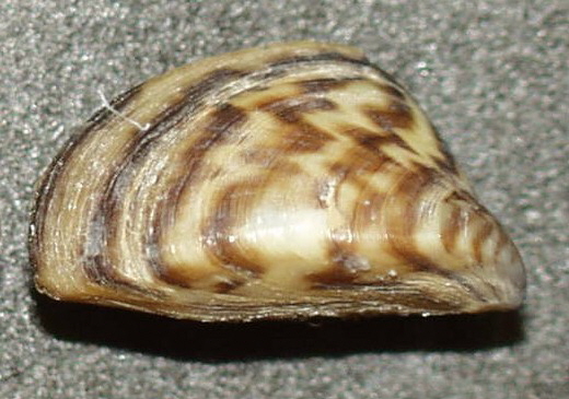
Freshwater bivalves are one kind of freshwater mollusc, along with freshwater snails. They are bivalves that live in fresh water as opposed to salt water, which is the main habitat type for bivalves. The majority of species of bivalve molluscs live in the sea, but in addition, a number of different families live in fresh water (and in some cases, also in brackish water). These families belong to two different evolutionary lineages (freshwater mussels and freshwater clams), and the two groups are not closely related. Freshwater bivalves have a simple morphology that varies among taxa, and are distributed around most regions of the world. Species in the two groups vary greatly in size. Some pea clams ('' Pisidium'' species) have an adult size of only 3 mm. In contrast, one of the largest species of freshwater bivalves is the swan mussel, in the family Unionidae; it can grow to a length of 20 cm, and usually lives in lakes or slow rivers. Freshwater pearl mussels are eco ... [...More Info...] [...Related Items...] OR: [Wikipedia] [Google] [Baidu] |
Lewis And Clark Expedition
The Lewis and Clark Expedition, also known as the Corps of Discovery Expedition, was the United States expedition to cross the newly acquired western portion of the country after the Louisiana Purchase. The Corps of Discovery was a select group of U.S. Army and civilian volunteers under the command of Captain Meriwether Lewis and his close friend Second Lieutenant William Clark. Clark and 30 members set out from Camp Dubois, Illinois, on May 14, 1804, met Lewis and ten other members of the group in St. Charles, Missouri, then went up the Missouri River. The expedition crossed the Continental Divide of the Americas near the Lemhi Pass, eventually coming to the Columbia River, and the Pacific Ocean in 1805. The return voyage began on March 23, 1806, at Fort Clatsop, Oregon, and ended on September 23 of the same year. President Thomas Jefferson commissioned the expedition shortly after the Louisiana Purchase in 1803 to explore and to map the newly acquired territory, to ... [...More Info...] [...Related Items...] OR: [Wikipedia] [Google] [Baidu] |
Fort Peck Dam
The Fort Peck Dam is the highest of six major dams along the Missouri River, located in northeast Montana in the United States, near Glasgow, and adjacent to the community of Fort Peck. At in length and over in height, it is the largest hydraulically filled dam in the United States, and creates Fort Peck Lake, the fifth largest artificial lake in the U.S., more than long, deep, and it has a shoreline which is longer than the state of California's coastline. It lies within the Charles M. Russell National Wildlife Refuge. The dam and the lake are owned and operated by the U.S. Army Corps of Engineers and exist for the purposes of hydroelectric power generation, flood control, and water quality management. The dam presently has a nameplate capacity of 185.25 megawatts, divided among 5 generating units (which in turn are divided between the Western and Eastern grids). Three units in powerhouse number one, completed in 1951, have a capacity of 105 MW. Completed in 1961, ... [...More Info...] [...Related Items...] OR: [Wikipedia] [Google] [Baidu] |
UL Bend National Wildlife Refuge
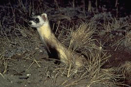
UL Bend National Wildlife Refuge is a protected area that is located in central Montana, United States. The refuge, located at the extreme southernmost tip of Phillips County, is managed and bordered on three sides by the Charles M. Russell National Wildlife Refuge and the Fort Peck Reservoir on the Missouri River. The refuge is an integral part of the Charles M. Russell National Wildlife Refuge Complex. The UL Bend Wilderness comprises almost half the refuge and provides a high level of protection to the most remote regions. Fauna A large species population of red fox, bald eagle, bighorn sheep, golden eagle, black bear, great horned owl, moose, burrowing owl, coyote, elk, swift fox, bobcat, pronghorn, mule deer, and cougar inhabit this refuge. Prairie dogs are abundant and are the primary food source for the black-footed ferret, which is listed as an endangered species. The Black-footed ferret has been reintroduced into the refuge after nearing extinction yet the sustainabi ... [...More Info...] [...Related Items...] OR: [Wikipedia] [Google] [Baidu] |
Melstone, Montana
Melstone is a rural small town in far eastern Musselshell County, Montana, United States, along U.S. Route 12. The population was 126 at the 2020 census. The town was established in 1908 as a base for operating crews on the Chicago, Milwaukee, St. Paul and Pacific Railroad, then under construction in Montana. Although the railroad was abandoned in 1980, Melstone survives as a community center for farmers and ranchers in the lower Musselshell River valley. It has a K-12 school with a staff of 16, which in the Fall of 2017 successfully began a 4-day school week. The Melstone Oil Field west of town developed in the 1950s and saw renewed production in the 1990s. Geography Melstone is located at (46.599081, -107.869851). According to the United States Census Bureau, the town has a total area of , all of it land. Climate According to the Köppen Climate Classification system, Melstone has a semi-arid climate, abbreviated "BSk" on climate maps. Demographics 2010 census As of ... [...More Info...] [...Related Items...] OR: [Wikipedia] [Google] [Baidu] |
Roundup, Montana
Roundup is a city in and the county seat of Musselshell County, Montana, United States. The population was 1,742 during the 2020 census. History Roundup served as a place for cattlemen to "round up" their cattle along the Musselshell River. It was the trailhead in the Great Montana Centennial Cattle Drive and now drives happen annually. The post office opened in 1883. In 1907, the Milwaukee Road reached Roundup. The area has coal mines, which combined with the agriculture, maintained the economy of the town. The Musselshell Valley Historical Museum captures the coal history as well as fossils and Indian artifacts. ''From Hell to Breakfast in Old Montana'', by Leland Blanchard, tells the story of pioneers who lived and worked in Roundup in the early 1900s. Roundup is a hub in Amazon.com's supply chain with a growing industry of prep centers, or businesses that specialize in packing goods to meet the requirements of Amazon's highly automated warehouses. Geography and climate ... [...More Info...] [...Related Items...] OR: [Wikipedia] [Google] [Baidu] |
Harlowton, Montana
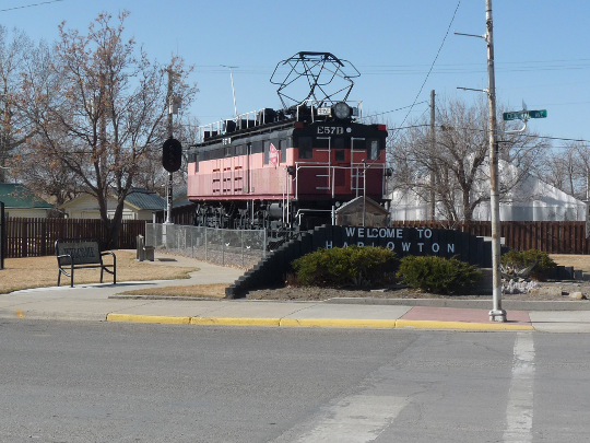
Harlowton is a city in and the county seat of Wheatland County, Montana, United States. The population was 955 at the 2020 census. Description The city was once the eastern terminus of electric operations (1914–74) for the "Pacific Extension" of the Chicago, Milwaukee, St. Paul and Pacific Railroad ("Milwaukee Road"). Here, steam or diesel locomotives were changed or hooked up to electric locomotives for trip through the Rocky Mountains to Avery, Idaho. Harlowton was founded in 1900 as a station stop on the Montana Railroad, a predecessor to the Milwaukee, and was named for Richard A. Harlow, the Montana Railroad's president. The area around Harlowton is rich in agriculture, the leading products being wheat, barley, cattle, sheep and honey bees. Major employers are Wheatland Memorial Healthcare, Harlowton High School, Hillcrest Elementary School, Musselshell Ranger District, Midtown Market 2 Grocery Store, Rays Sport and Western Wear, Cream of the West, Rocky Mountain C ... [...More Info...] [...Related Items...] OR: [Wikipedia] [Google] [Baidu] |


