|
HNLMS Utrecht (1898)
HNLMS ''Utrecht'' ( nl, Hr.Ms. Utrecht) was a protected cruiser of the Royal Netherlands Navy. Design The ship was Staatsbegrooting voor het dienstjaar 1903, Bijlage A . VI. 5./ref> long, had a beam of , a draught of , and had a displacement of 4,033 ton. The ship was equipped with 2 shaft reciprocating engines, which were rated at and produced a top speed of . The ship had a deck armour of . Two single turret guns provided the ship's main armament, and these were augmented by six single guns and four single guns. The ship had a complement of 324 men. Service history The ship was built at the '' Rijkswerf'' in Amsterdam and launched on 14 July 1898. The ship was commissioned on 1 March 1901. On 6 May that year ''Utrecht'' made a trip with adelborsten to the Mediterranean Sea. The ports of Cádiz, La Spezia, Naples and Toulon were visited. On 22 July, the ship arrived in the port of Flushing concluding the trip. In 1902, ''Utrecht'' was sent to Venezuela together with ... [...More Info...] [...Related Items...] OR: [Wikipedia] [Google] [Baidu] |
Curaçao
Curaçao ( ; ; pap, Kòrsou, ), officially the Country of Curaçao ( nl, Land Curaçao; pap, Pais Kòrsou), is a Lesser Antilles island country in the southern Caribbean Sea and the Dutch Caribbean region, about north of the Venezuela coast. It is a constituent country of the Kingdom of the Netherlands. Together with Aruba and Bonaire, it forms the ABC islands. Collectively, Curaçao, Aruba, and other Dutch islands in the Caribbean are often called the Dutch Caribbean. Curaçao was formerly part of the Curaçao and Dependencies colony from 1815 to 1954 and later the Netherlands Antilles from 1954 to 2010, as Island Territory of Curaçao ( nl, Eilandgebied Curaçao, links=no, pap, Teritorio Insular di Kòrsou, links=no), and is now formally called the Country of Curaçao. It includes the main island of Curaçao and the much smaller, uninhabited island of Klein Curaçao ("Little Curaçao"). Curaçao has a population of 158,665 (January 2019 est.), with an area of ; its ... [...More Info...] [...Related Items...] OR: [Wikipedia] [Google] [Baidu] |
Sumatra
Sumatra is one of the Sunda Islands of western Indonesia. It is the largest island that is fully within Indonesian territory, as well as the sixth-largest island in the world at 473,481 km2 (182,812 mi.2), not including adjacent islands such as the Simeulue, Nias, Mentawai, Enggano, Riau Islands, Bangka Belitung and Krakatoa archipelago. Sumatra is an elongated landmass spanning a diagonal northwest–southeast axis. The Indian Ocean borders the northwest, west, and southwest coasts of Sumatra, with the island chain of Simeulue, Nias, Mentawai, and Enggano off the western coast. In the northeast, the narrow Strait of Malacca separates the island from the Malay Peninsula, which is an extension of the Eurasian continent. In the southeast, the narrow Sunda Strait, containing the Krakatoa Archipelago, separates Sumatra from Java. The northern tip of Sumatra is near the Andaman Islands, while off the southeastern coast lie the islands of Bangka and Belitung, Karim ... [...More Info...] [...Related Items...] OR: [Wikipedia] [Google] [Baidu] |
Henry Hudson
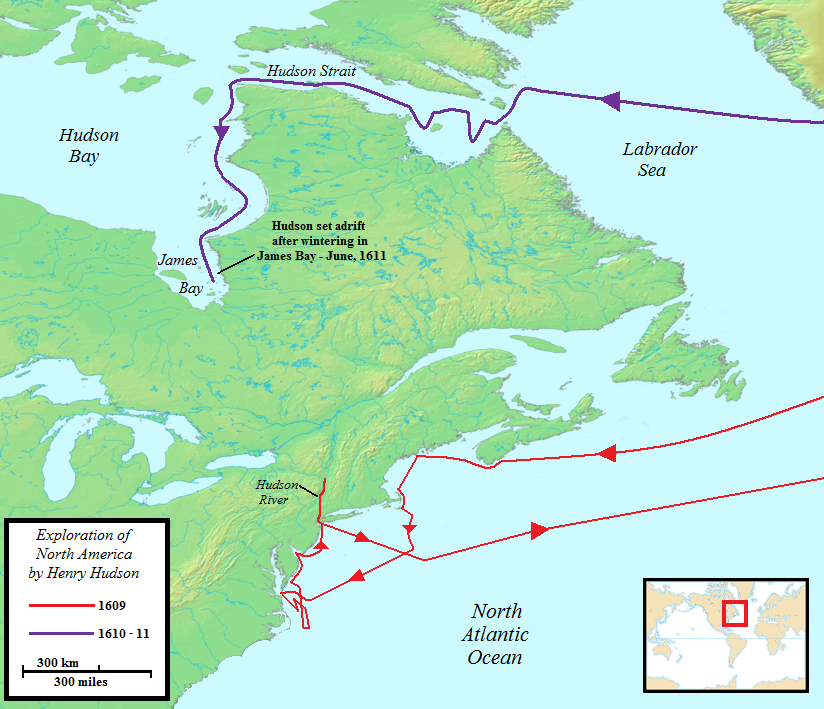
Henry Hudson ( 1565 – disappeared 23 June 1611) was an English sea explorer and navigator during the early 17th century, best known for his explorations of present-day Canada and parts of the northeastern United States. In 1607 and 1608, Hudson made two attempts on behalf of English merchants to find a rumoured Northeast Passage to Cathay via a route above the Arctic Circle. In 1609, he landed in North America on behalf of the Dutch East India Company and explored the region around the modern New York metropolitan area. Looking for a Northwest Passage to Asia on his ship ''Halve Maen'' ("Half Moon"), he sailed up the Hudson River, which was later named after him, and thereby laid the foundation for Dutch colonization of the region. On his final expedition, while still searching for the Northwest Passage, Hudson became the first European to see Hudson Strait and the immense Hudson Bay. In 1611, after wintering on the shore of James Bay, Hudson wanted to press on to t ... [...More Info...] [...Related Items...] OR: [Wikipedia] [Google] [Baidu] |
Hudson–Fulton Celebration
The Hudson–Fulton Celebration from September 25 to October 9, 1909 in New York and New Jersey was an elaborate commemoration of the 300th anniversary of Henry Hudson’s discovery of the Hudson River and the 100th anniversary of Robert Fulton's first successful commercial application of the paddle steamer." 1909 Hudson–Fulton Celebration of the Discovery of the Hudson River and the First Successful Application of Steam to Navigation" Hudson River Maritime Museum. The image above of the Celebration program shows the event closing on Saturday, October 9, 1909. A report to the New York state legislature in 1910 by the official celebration Commission, as shown on the website of this reference, lists the celebr ... [...More Info...] [...Related Items...] OR: [Wikipedia] [Google] [Baidu] |
New York City
New York, often called New York City or NYC, is the List of United States cities by population, most populous city in the United States. With a 2020 population of 8,804,190 distributed over , New York City is also the List of United States cities by population density, most densely populated major city in the United States, and is more than twice as populous as second-place Los Angeles. New York City lies at the southern tip of New York (state), New York State, and constitutes the geographical and demographic center of both the Northeast megalopolis and the New York metropolitan area, the largest metropolitan area in the world by urban area, urban landmass. With over 20.1 million people in its metropolitan statistical area and 23.5 million in its combined statistical area as of 2020, New York is one of the world's most populous Megacity, megacities, and over 58 million people live within of the city. New York City is a global city, global Culture of New ... [...More Info...] [...Related Items...] OR: [Wikipedia] [Google] [Baidu] |
Suriname
Suriname (; srn, Sranankondre or ), officially the Republic of Suriname ( nl, Republiek Suriname , srn, Ripolik fu Sranan), is a country on the northeastern Atlantic coast of South America. It is bordered by the Atlantic Ocean to the north, French Guiana to the east, Guyana to the west, and Brazil to the south. At just under , it is the smallest sovereign state in South America. It has a population of approximately , dominated by descendants from the slaves and labourers brought in from Africa and Asia by the Dutch Empire and Republic. Most of the people live by the country's (north) coast, in and around its capital and largest city, Paramaribo. It is also List of countries and dependencies by population density, one of the least densely populated countries on Earth. Situated slightly north of the equator, Suriname is a tropical country dominated by rainforests. Its extensive tree cover is vital to the country's efforts to Climate change in Suriname, mitigate climate ch ... [...More Info...] [...Related Items...] OR: [Wikipedia] [Google] [Baidu] |
Den Helder
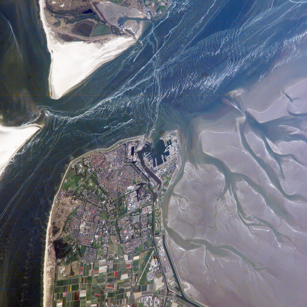
Den Helder () is a municipality and a city in the Netherlands, in the province of North Holland. Den Helder occupies the northernmost point of the North Holland peninsula. It is home to the country's main naval base. From here the Royal TESO ferryboat service operates the transportation link between Den Helder and the nearby Dutch Wadden island of Texel to the north. Etymology Before the year 1928 the official name of Den Helder was Helder. The origin of the name Helder is not entirely clear. The name Helder may have come from ''Helle/Helde'', which means "hill" or "hilly grounds", or from ''Helre'', which means a sandy ridge. Another explanation is that the name derived from ''Helsdeur'' (Hell's Door), likely because in the water between Den Helder and Texel (called Marsdiep) the current was so strong that many ships were lost. History Huisduinen was the original older part of the city, whereas Helder itself was a nearby smaller hamlet. When a harbour was built near Hel ... [...More Info...] [...Related Items...] OR: [Wikipedia] [Google] [Baidu] |
Tangier
Tangier ( ; ; ar, طنجة, Ṭanja) is a city in northwestern Morocco. It is on the Moroccan coast at the western entrance to the Strait of Gibraltar, where the Mediterranean Sea meets the Atlantic Ocean off Cape Spartel. The town is the capital of the Tanger-Tetouan-Al Hoceima region, as well as the Ṭanja-Aẓila Prefecture of Morocco. Many civilisations and cultures have influenced the history of Tangier, starting from before the 10th centuryBCE. Between the period of being a strategic Berber town and then a Phoenician trading centre to Morocco's independence era around the 1950s, Tangier was a nexus for many cultures. In 1923, it was considered as having international status by foreign colonial powers and became a destination for many European and American diplomats, spies, bohemians, writers and businessmen. The city is undergoing rapid development and modernisation. Projects include tourism projects along the bay, a modern business district called Tangier City Cent ... [...More Info...] [...Related Items...] OR: [Wikipedia] [Google] [Baidu] |
Algiers
Algiers ( ; ar, الجزائر, al-Jazāʾir; ber, Dzayer, script=Latn; french: Alger, ) is the capital and largest city of Algeria. The city's population at the 2008 Census was 2,988,145Census 14 April 2008: Office National des Statistiques de l'Algérie (web). and in 2020 was estimated to be around 4,500,000. Algiers is located on the Mediterranean Sea and in the north-central portion of Algeria. Algiers is situated on the west side of a bay of the Mediterranean Sea. The modern part of the city is built on the level ground by the seashore; the old part, the ancient city of the deys, climbs the steep hill behind the modern town and is crowned by the Casbah or citadel (a UNESCO World Heritage Site), above the sea. The casbah and the two quays form a triangle. Names The city's name is derived via French and Catalan ''Origins of Algiers'' by Louis Leschi, speech delivered June 16, 1941, published in ''El Djezair Sheets'', July 194History of Algeria . from the Arabic name '' ... [...More Info...] [...Related Items...] OR: [Wikipedia] [Google] [Baidu] |
Port Said
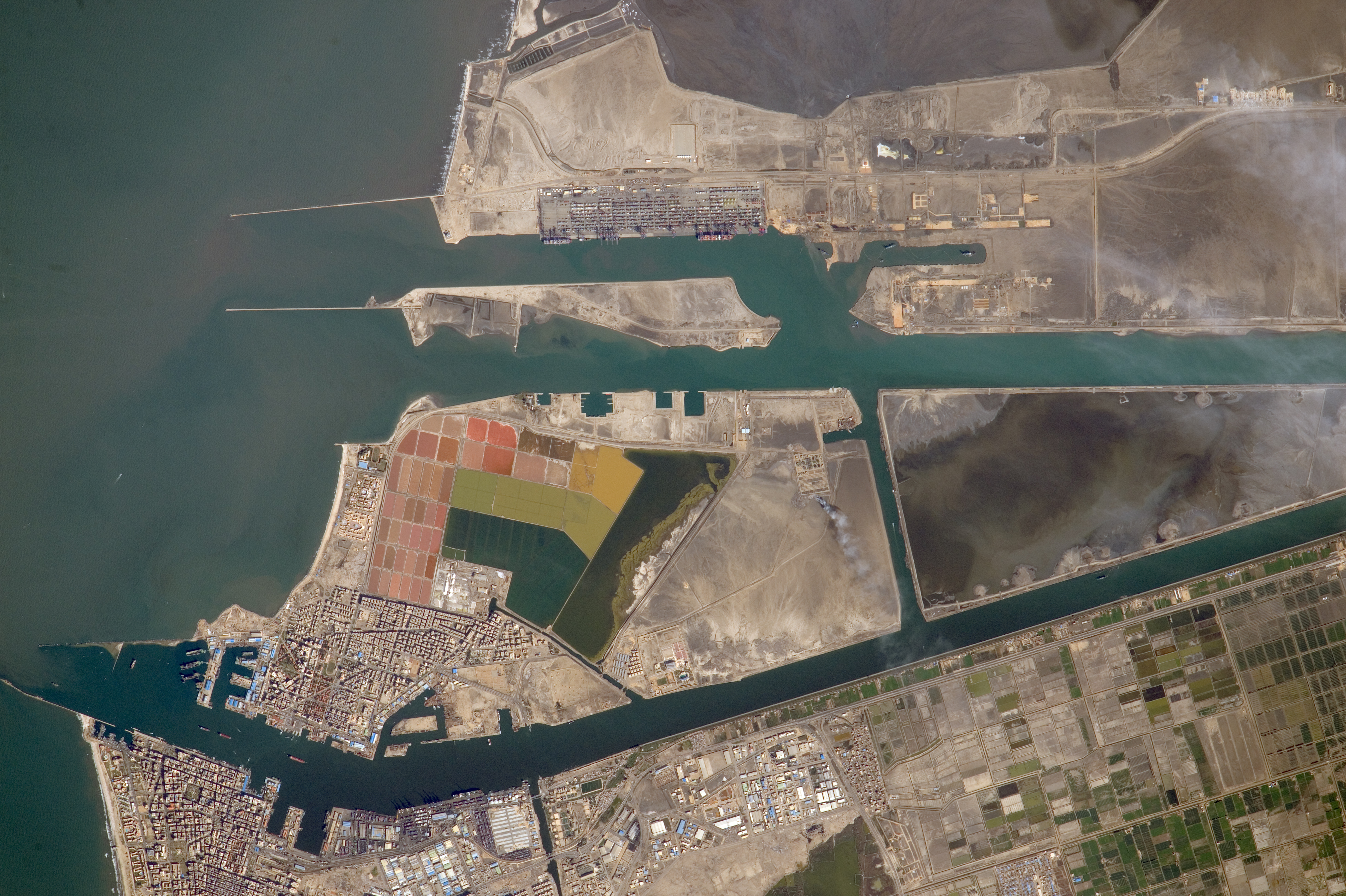
Port Said ( ar, بورسعيد, Būrsaʿīd, ; grc, Πηλούσιον, Pēlousion) is a city that lies in northeast Egypt extending about along the coast of the Mediterranean Sea, north of the Suez Canal. With an approximate population of 603,787 (2010), it is the List of cities and towns in Egypt, fifth-largest city in Egypt. The city was established in 1859 during the building of the Suez Canal. There are numerous old houses with grand balconies on all floors, giving the city a distinctive look. Port Said's twin city is Port Fuad, which lies on the eastern bank of the Suez Canal. The two cities coexist, to the extent that there is hardly any town centre in Port Fuad. The cities are connected by free Ferry, ferries running all through the day, and together they form a metropolitan area with over a million residents that extends both on the African and the Asian sides of the Suez Canal. The only other metropolitan area in the world that also spans two continents is Istanbul. ... [...More Info...] [...Related Items...] OR: [Wikipedia] [Google] [Baidu] |
Perim
Perim ( ar, بريم 'Barīm'', also called Mayyun in Arabic, is a volcanic island in the Strait of Mandeb at the south entrance into the Red Sea, off the south-west coast of Yemen and belonging to Yemen. It administratively belongs to Dhubab District or Bab al-Mandab District, Taiz Governorate. The island of Perim divides the strait of Mandeb into two channels. The island, as a dependency of Aden, was a part of the British Empire between 1857 and 1967. Name In ancient time, it was called "the island of Diodorus" ( el, Διοδώρου νῆσος, la, Diodori insula). It is mentioned by Pliny the Elder, by the author of the ''Periplus of the Erythraean Sea'' and in Ptolemy's Geography. ''Perim'' possibly derives from the Arab term ''Barim'' (chain) associated with the history of the Straits and one of its Arab names, the other Arab name being Mayyun. The Portuguese called it Majun or Meho (from Mayyun), although Albuquerque had solemnly named the island ''Vera Cruz'' in 1 ... [...More Info...] [...Related Items...] OR: [Wikipedia] [Google] [Baidu] |
Mahé, India
Mahé, also known as Mayyazhi, is a small town in the Mahé district of the Puducherry Union Territory. It is situated at the mouth of the Mahé River and is surrounded by the State of Kerala. The Kannur District surrounds Mahé on three sides and Kozhikode District from one side. Formerly part of French India, Mahé now forms a municipality in Mahé district, one of the four districts of the Union Territory of Puducherry. Mahé has one representative in the Puducherry Legislative Assembly. Etymology The name ''Mahé'' derives from ''Mayyazhi'', the name given to the local river and region in the Malayalam language.The original spelling found on French documents from the early 1720s is ''Mayé'', with ''Mahé'' and ''Mahié'' also found on documents, maps and geographical dictionaries until the early 19th century when the spelling Mahé became the norm. Therefore, the belief that the name of the town was given in honour of Bertrand François Mahé de La Bourdonnais (1699– ... [...More Info...] [...Related Items...] OR: [Wikipedia] [Google] [Baidu] |


