|
Hürben (Krumbach)
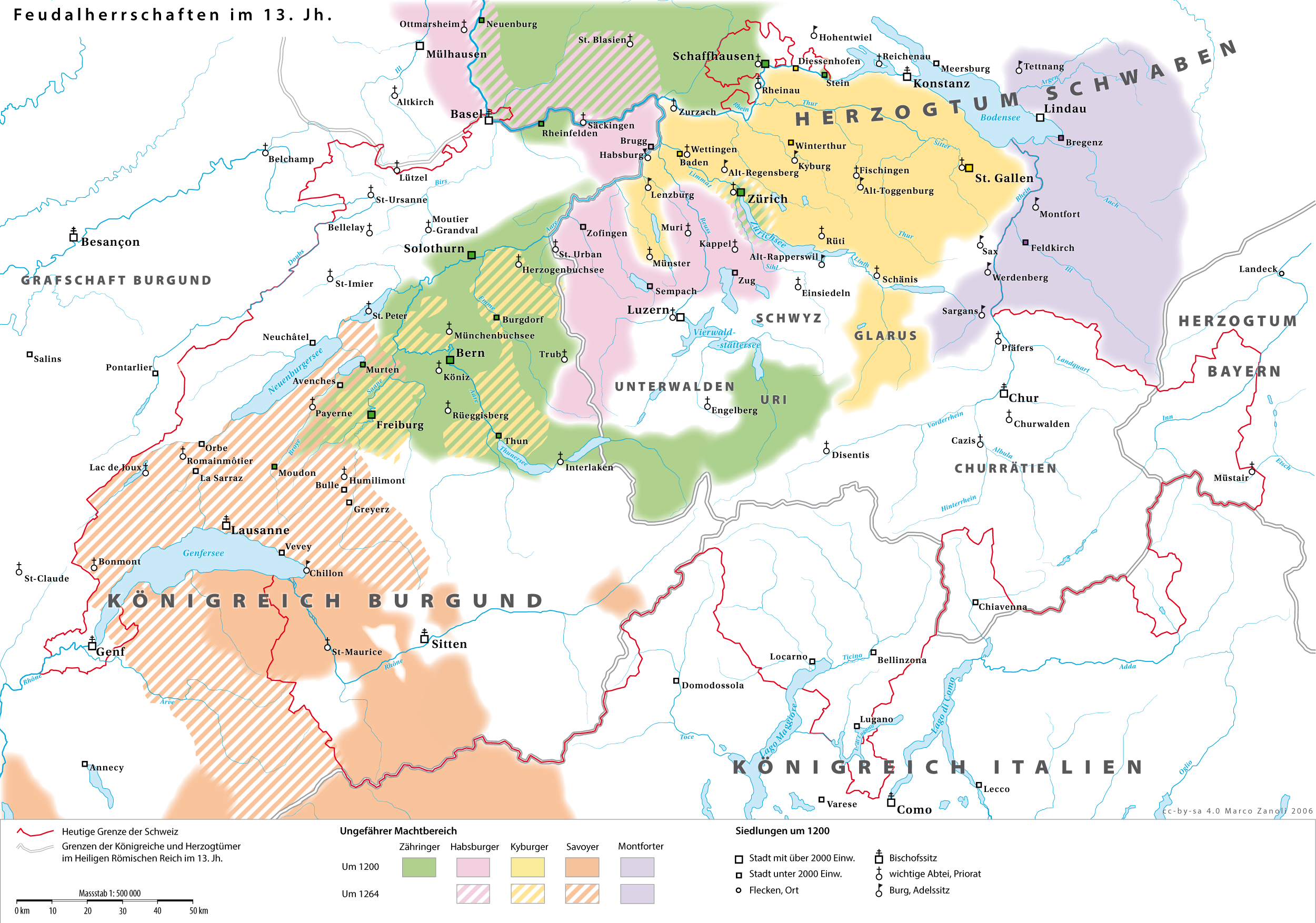
Hürben, today the eastern part of Krumbach, Bavaria, Krumbach in Bavarian Swabia, was an independent village before it was incorporated into the neighbouring town of Krumbach in the year 1902. The Kammel was in most parts the border between Krumbach and Hürben. History Hürben was found around the year 1000. Until 1805 Hürben was part of the Burgau#History, Margraviate of Burgau, which was part of the Habsburg Further Austria. In the year 1805 Hürben became Bavarian by the Peace of Pressburg (1805), Peace of Pressburg. In the year 1902 Hürben became part of Krumbach, which receive seven years before its town charter. Until the time of the Third Reich Hürben had a high percentage of Jewish residents in comparison to the Bavarian average. Gallery File:KRU-WaSchl01.jpg, moated castle of Hürben File:KRU-MuehlK01.jpg, ''Mühlkapelle'' at the stream Kammel File:St Ulrich Krumbach Huerben 2.jpg, church St. Ulrich File:Lindlkirche Krumbach 2.jpg, ''Lindlkirche'' File:Krumbache ... [...More Info...] [...Related Items...] OR: [Wikipedia] [Google] [Baidu] |
Krumbach, Bavaria
Krumbach (also: ''Krumbach (Schwaben)'') is a town with 13,000 residents in the district Günzburg in Swabia, Bavaria, Germany. It is the second biggest town in the district. Geography Krumbach (elevation 512 m (1680 ft)) is situated in Mittelschwaben in the natural region Lower Iller-Lech Gravel Plateau (a part of the region between Danube and the Alps) in the valley of the Kammel, a left tributary of the Mindel river and so an indirect tributary of the Danube river. The landscape is marked by forests and areas in agricultural acreage (fields and grassland). The next bigger cities respectively towns are Ulm, approximately 40 kilometres northwest of Krumbach, Augsburg, 48 kilometres northeast of Krumbach, Memmingen, about 40 kilometres southwest of Krumbach, Mindelheim, 30 kilometres south of Krumbach and Günzburg, 27 kilometres north of Krumbach. The distance to Munich is approximately 120 kilometres. History In 1156 Krumbach was mentioned in documents the first ... [...More Info...] [...Related Items...] OR: [Wikipedia] [Google] [Baidu] |
Bavarian Swabia
Swabia (german: Schwaben, ) is one of the seven administrative regions of Bavaria, Germany. Governance The county of Swabia is located in southwest Bavaria. It was annexed by Bavaria in 1803, is part of the historic region of Swabia and was formerly ruled by dukes of the Hohenstaufen dynasty. During the Nazi period, the area was separated from the rest of Bavaria to become the Gau Swabia. It was re-incorporated into Bavaria after the war. The Regierungsbezirk is subdivided into 3 regions (''Planungsregionen''): Allgäu, Augsburg, and Donau-Iller. Donau-Iller also includes two districts and one city of Baden-Württemberg. * Part of the Swabian Keuper Land Districts and district-free towns before the regional reorganization in 1972 Population Historical population of Swabia: *1939: 934,311 *1950: 1,293,734 *1961: 1,340,217 *1970: 1,467,454 *1987: 1,546,504 *2002: 1,776,465 *2005: 1,788,919 *2006: 1,786,764 *2008: 1,787,995 *2010: 1,785,875 *2015: 1,846,020 *2019: 1,8 ... [...More Info...] [...Related Items...] OR: [Wikipedia] [Google] [Baidu] |
Kammel
The Kammel is a river in Bavaria, southern Germany. The Kammel originates west of Mindelheim, in the district Unterallgäu, and flows generally north. It flows into the Mindel (left tributary) south of ''Offingen at the Danube'', east of Günzburg in the district Günzburg. So it is an indirect right tributary of the Danube. The difference in altitude between the origin and the mouth is 265 m. Tributaries Tributaries which flow into the Kammel are (from south to north): * the Krumbach (left tributary); confluence with the Kammel in Krumbach * the Haselbach (right tributary); confluence with the Kammel in Naichen, municipality: Neuburg an der Kammel * the Krähenbach (right tributary); confluence with the Kammel in Ettenbeuren, municipality: Kammeltal Municipalities the Kammel flows through Municipalities which are passed by the Kammel are (from south to north): in the district Unterallgäu: Stetten, Kammlach, Oberrieden, Pfaffenhausen and Breitenbrunn; in the district ... [...More Info...] [...Related Items...] OR: [Wikipedia] [Google] [Baidu] |
Burgau
Burgau is a town in the district of Günzburg in Swabia, Bavaria. Burgau lies on the river Mindel and has a population of just under 10,000. History The territory around Burgau was originally part of the stem duchy of Swabia. The death of Conradin and the resulting extinction of the Hohenstaufen line in 1268 led to the collapse of the integrity of the duchy and its division into lands, after local nobles resisted the Habsburg Holy Roman Emperor Rudolph's attempts to annex the duchy. The Lords of Burgau are first found in documentary mention in 1147, as . Burgau was raised to a margraviate in 1212. With the death of Margrave Henry III in 1301, the margravial line fell extinct and the Empire claimed the fief. Albert I of Germany transferred the feudal rights to his two sons, thereby permanently adding the territory to the Habsburg dominions, with Henry III's widow purchasing the allodial rights. Four different titles were awarded: that of allodial rights, Imperial feudal ... [...More Info...] [...Related Items...] OR: [Wikipedia] [Google] [Baidu] |
Habsburg
The House of Habsburg (), alternatively spelled Hapsburg in Englishgerman: Haus Habsburg, ; es, Casa de Habsburgo; hu, Habsburg család, it, Casa di Asburgo, nl, Huis van Habsburg, pl, dom Habsburgów, pt, Casa de Habsburgo, la, Domus Habsburg, french: Maison des Habsbourg and also known as the House of Austriagerman: link=no, Haus Österreich, ; es, link=no, Casa de Austria; nl, Huis van Oostenrijk, pl, dom Austrii, la, Domus Austriæ, french: Maison d'Autriche; hu, Ausztria Háza; it, Casa d'Austria; pt, Casa da Áustria is one of the most prominent and important dynasties in European history. The house takes its name from Habsburg Castle, a fortress built in the 1020s in present-day Switzerland by Radbot of Klettgau, who named his fortress Habsburg. His grandson Otto II, Count of Habsburg, Otto II was the first to take the fortress name as his own, adding "Count of Habsburg" to his title. In 1273, Count Radbot's seventh-generation descendant Rudolph I of German ... [...More Info...] [...Related Items...] OR: [Wikipedia] [Google] [Baidu] |
Further Austria
Further Austria, Outer Austria or Anterior Austria (german: Vorderösterreich, formerly ''die Vorlande'' (pl.)) was the collective name for the early (and later) possessions of the House of Habsburg in the former Swabian stem duchy of south-western Germany, including territories in the Alsace region west of the Rhine and in Vorarlberg. While the territories of Further Austria west of the Rhine and south of Lake Constance (except Konstanz itself) were gradually lost to France and the Swiss Confederacy, those in Swabia and Vorarlberg remained under Habsburg control until the Napoleonic Era. Geography Further Austria mainly comprised the Alsatian County of Ferrette in the Sundgau, including the town of Belfort, and the adjacent Breisgau region east of the Rhine, including Freiburg im Breisgau after 1368. Also ruled from the Habsburg residence in Ensisheim near Mühlhausen were numerous scattered territories stretching from Upper Swabia to the Allgäu region in the east, the large ... [...More Info...] [...Related Items...] OR: [Wikipedia] [Google] [Baidu] |
Peace Of Pressburg (1805)
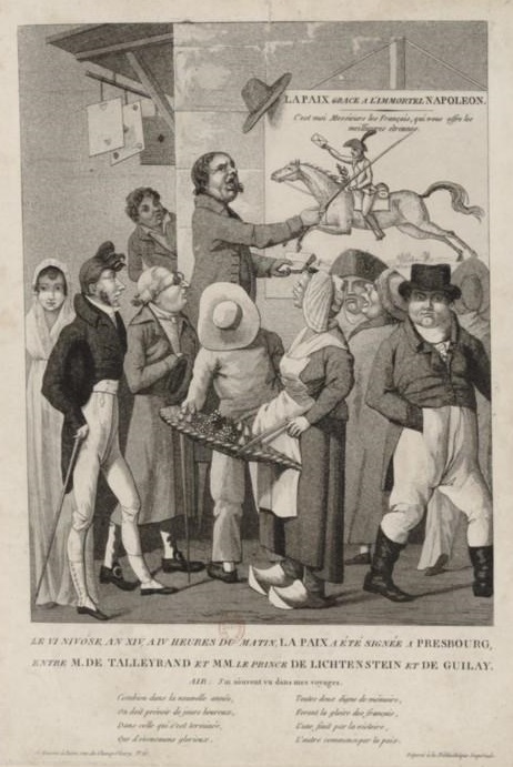
The Peace of Pressburg; french: Traité de Presbourg was signed in Pressburg (today Bratislava) on 26 December 1805 between French Emperor Napoleon Bonaparte and Holy Roman Emperor Francis II, as a consequence of the French victory over the Russians and Austrians at the Battle of Austerlitz (2 December). A truce was agreed on 4 December, and negotiations for the treaty began. The treaty was signed by Johann I Joseph, Prince of Liechtenstein, and the Hungarian Count Ignác Gyulay for the Austrian Empire and Charles Maurice de Talleyrand for France. Beyond the clauses establishing "peace and amity" and the Austrian withdrawal from the Third Coalition, the treaty also mandated substantial territorial concessions by the Austrian Empire. The French gains of the previous treaties of Campo Formio and Lunéville were reiterated, while recent Austrian acquisitions in Italy and southern Germany were ceded to France and Bavaria, respectively. The scattered Austrian holdings in Swabia were ... [...More Info...] [...Related Items...] OR: [Wikipedia] [Google] [Baidu] |
Villages In Bavaria
A village is a clustered human settlement or community, larger than a hamlet but smaller than a town (although the word is often used to describe both hamlets and smaller towns), with a population typically ranging from a few hundred to a few thousand. Though villages are often located in rural areas, the term urban village is also applied to certain urban neighborhoods. Villages are normally permanent, with fixed dwellings; however, transient villages can occur. Further, the dwellings of a village are fairly close to one another, not scattered broadly over the landscape, as a dispersed settlement. In the past, villages were a usual form of community for societies that practice subsistence agriculture, and also for some non-agricultural societies. In Great Britain, a hamlet earned the right to be called a village when it built a church. [...More Info...] [...Related Items...] OR: [Wikipedia] [Google] [Baidu] |


