|
Hösbach
Hösbach is a market community and municipality in the Aschaffenburg (district), Aschaffenburg district in the ''Regierungsbezirk'' of Lower Franconia (''Unterfranken'') in Bavaria, Germany. As of 2023, It has a population of 13,323. Geography Location The municipality lies in the part of the ''Mittelgebirge'' Spessart known as ''Vorspessart'', 5 km from Aschaffenburg, roughly 70 km from Würzburg and roughly 50 km from Frankfurt, Frankfurt am Main. The Hösbach (river), Hösbach, from which the community's name is derived, flows into the Aschaff in the municipal territory. The central village of Hösbach is located in the valley of the Aschaff, next to the Bundesautobahn 3. However, the outlying centres are located in side valleys and, in the case of Feldkahl and Rottenberg, actually in another watershed, that of the Kahl (river), Kahl. Constituent communities Hösbach has ten ''Ortsteile'' located on five ''Gemarkungen'' (traditional cadastral areas). These a ... [...More Info...] [...Related Items...] OR: [Wikipedia] [Google] [Baidu] |
Hösbach (river)
Hösbach is a river of Bavaria, Germany, at the market community Hösbach in the Aschaffenburg district in the ''Regierungsbezirk'' of Lower Franconia (''Unterfranken''). It is about 5 km (3 mi) long and a right tributary of the Aschaff. See also *List of rivers of Bavaria A list of rivers of Bavaria, Germany: A * Aalbach * Abens * Ach * Afferbach * Affinger Bach * Ailsbach * Aisch * Aiterach * Alpbach *Alster * Altmühl * Alz * Amper * Anlauter * Arbach * Arbachgraben * Aschaff * Aschbach * Attel * Aubach, tributa ... Rivers of Bavaria Rivers of the Spessart Rivers of Germany {{Bavaria-river-stub ... [...More Info...] [...Related Items...] OR: [Wikipedia] [Google] [Baidu] |
Bundesautobahn 3
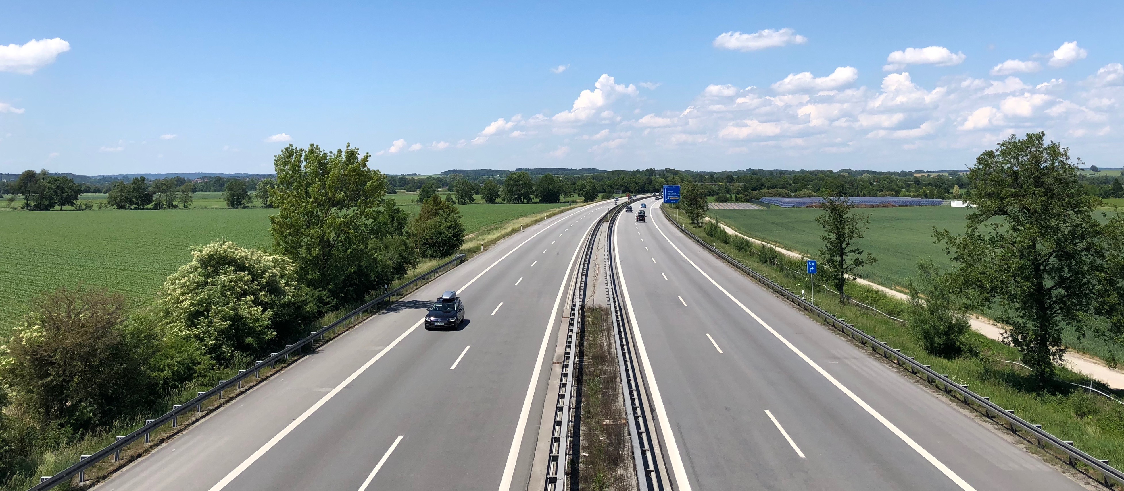
is an autobahn in Germany running from the Germany-Netherlands border near Wesel in the northwest to the Germany-Austria border near Passau. Major cities along its total length of 778 km (483 mi) include Oberhausen, Duisburg, Düsseldorf, Leverkusen, Cologne, Wiesbaden, Frankfurt, Würzburg, Nuremberg and Regensburg. The A 3 is a major connection between the Rhine-Ruhr area and southern Germany, resulting in heavy traffic. Consequently, large parts have three lanes (plus a hard shoulder) in each direction, including a 300 km (187.5 mi) section between Oberhausen and Aschaffenburg. The A3 passes close to Frankfurt Airport. Route The A 3 begins at the border crossing Elten in North Rhine-Westphalia as a four-lane continuation of the Dutch A 12. Until Oberhausen the highway runs on the right bank of the Lower Rhine past the cities Emmerich, Wesel and Dinslaken and reaches the Ruhrgebiet. Beginning at the ''Kreuz Oberhausen'' with A 516 and A 2, the A ... [...More Info...] [...Related Items...] OR: [Wikipedia] [Google] [Baidu] |
Goldbach, Bavaria
Goldbach () is a market community in the Aschaffenburg district in the ''Regierungsbezirk'' of Lower Franconia (''Unterfranken'') in Bavaria, Germany. Geography Location The market community is one of the most heavily populated communities in the Aschaffenburg district and is well known for the "housing" that encloses the Autobahn A 3. It is believed that the name has its roots in the yellow loess soil, which during heavy rainfalls colours the local brook, also called the Goldbach, with a somewhat golden tinge. ''Gold'' is also the German word for gold, and ''Bach'' means "brook". Supposedly, the place was first called ''Gelbbach'', ''gelb'' being the word for "yellow". Constituent communities On 1 July 1971, the formerly self-administering community of Unterafferbach was amalgamated with Goldbach. History In 1218, Goldbach had its first documentary mention. From the mid 15th century, Goldbach was under the authority of the Archbishop of Mainz. In 1814, Goldbach was ... [...More Info...] [...Related Items...] OR: [Wikipedia] [Google] [Baidu] |
Aschaff
The Aschaff (in its uppermost course: ''Kleinaschaff'') is a river in the northern Spessart in Bavaria, Germany. It is a right tributary of the Main and is long. It begins at the Aschaffquelle near Waldaschaff. Loosely translated the name Aschaff means " ash water". The largest tributary is the Laufach. The river flows mostly parallel to the Bundesautobahn 3 (Motorway). For the construction of the noise barrier A noise barrier (also called a soundwall, noise wall, sound berm, sound barrier, or acoustical barrier) is an exterior structure designed to protect inhabitants of sensitive land use areas from noise pollution. Noise barriers are the most effecti ... there, the river bed was moved and straightened. Now the Aschaff flows in the city of Aschaffenburg. It flows through the districts Damm and Strietwald. In Mainaschaff near the city limits of Aschaffenburg the Aschaff empties into the Main. Tributaries Tributary, Tributaries from source to mouth: Left * Bessenbach ... [...More Info...] [...Related Items...] OR: [Wikipedia] [Google] [Baidu] |
Sailauf
Sailauf is a municipality in the Aschaffenburg (district), Aschaffenburg district in the ''Regierungsbezirk'' of Lower Franconia (''Unterfranken'') in Bavaria, Germany. It has a population of around 3,600. Geography Location The community lies in the area of the Spessart (range) known as ''Vorspessart'' near Aschaffenburg. It is located on the Sailaufbach, a tributary of the Laufach (river), Laufach. Subdivisions Sailauf has two ''Ortsteile'': * (population 2013: 788) * Sailauf (2,861) In addition the hamlet is part of Sailauf. It consists of an industrial area near the Bundesautobahn 3 and the '. Moreover, the municipal territory includes 19 small exclaves to the northeast (see map) surrounded by the Sailaufer Forst. Neighbouring communities Sailauf borders on (from the north, clockwise): Blankenbach, Sommerkahl, the unincorporated area , Laufach, Bessenbach and Hösbach. History Sailauf is among the ''Vorspessart's'' oldest settlements. As early as 1089, the original par ... [...More Info...] [...Related Items...] OR: [Wikipedia] [Google] [Baidu] |
Spessart
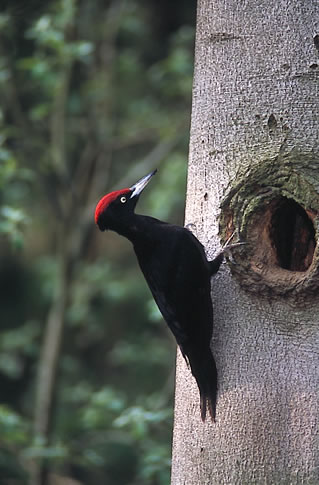
Spessart () is a ''Mittelgebirge'', a range of low wooded mountains, in the States of Bavaria and Hesse in Germany. It is bordered by the Vogelsberg, Rhön and Odenwald. The highest elevation is the Geiersberg (Spessart), Geiersberg at 586 metres above sea level. Etymology The name is derived from "Spechtshardt". ''Specht'' is the German word for woodpecker and ''Hardt'' is an outdated word meaning "hilly forest". Geography Location The Spessart is a ''Mittelgebirge'', part of the German Central Uplands, located in the Lower Franconia region of Bavaria and in Hesse, Germany. It is bordered by other ranges of hills: the Vogelsberg in the north, Rhön in the northeast and Odenwald in the southwest. Another way of describing the extent of the range is by naming the rivers that border it: the Main (river), Main in the south and west, the Kinzig (Main), Kinzig in the north and the Sinn (river), Sinn in the northeast. The area of the Spessart totals around 2,440 square kilometre ... [...More Info...] [...Related Items...] OR: [Wikipedia] [Google] [Baidu] |
Böhse Onkelz
Böhse Onkelz (; sensational spelling of (German for "evil uncles")) is a German rock band formed in Frankfurt in 1980. The band reunited in 2014. Despite mass-media criticism concerning their past as skinheads, several of their later records topped the German album charts (selling over 5,338,000 records and 425,000 videos or DVDs).ChartquellenDE /ref> '' E.I.N.S.'' was their most successful album, with over 510,000 copies sold. History 1980–1981: Founding [...More Info...] [...Related Items...] OR: [Wikipedia] [Google] [Baidu] |
Aschaffenburg (district)
Aschaffenburg (Low Franconian: ) is a (district) in Bavaria, Germany. It is bounded by (from the west and clockwise) the districts of Darmstadt-Dieburg, Offenbach, Main-Kinzig (all in the state of Hesse), the districts Main-Spessart and Miltenberg, and the City of Aschaffenburg. History The history of Aschaffenburg goes back as far as the year 957. Initially a Roman settlement, it came under the authority of the electors of Mainz in 982 and was chartered in 1173. Remains of Roman settlements were found on the river Main. There was a Roman military camp in today's municipality of Stockstadt am Main. After the Roman retreat, the region became subject to Alemanni and Franks before becoming a part of the Electorate of Mainz. While the banks of the Main were populated all these centuries, the hills of the Spessart were virtually unsettled until the 13th century. The districts of Aschaffenburg and Alzenau were established in 1862, half a century after the state of Bavaria had a ... [...More Info...] [...Related Items...] OR: [Wikipedia] [Google] [Baidu] |
Second World War
World War II or the Second World War (1 September 1939 – 2 September 1945) was a World war, global conflict between two coalitions: the Allies of World War II, Allies and the Axis powers. World War II by country, Nearly all of the world's countries participated, with many nations mobilising all resources in pursuit of total war. Tanks in World War II, Tanks and Air warfare of World War II, aircraft played major roles, enabling the strategic bombing of cities and delivery of the Atomic bombings of Hiroshima and Nagasaki, first and only nuclear weapons ever used in war. World War II is the List of wars by death toll, deadliest conflict in history, causing World War II casualties, the death of 70 to 85 million people, more than half of whom were civilians. Millions died in genocides, including the Holocaust, and by massacres, starvation, and disease. After the Allied victory, Allied-occupied Germany, Germany, Allied-occupied Austria, Austria, Occupation of Japan, Japan, a ... [...More Info...] [...Related Items...] OR: [Wikipedia] [Google] [Baidu] |
Industrialization
Industrialisation (British English, UK) American and British English spelling differences, or industrialization (American English, US) is the period of social and economic change that transforms a human group from an agrarian society into an industrial society. This involves an extensive reorganisation of an economy for the purpose of manufacturing. Industrialisation is associated with increase of Pollution, polluting industries heavily dependent on fossil fuels. With the increasing focus on sustainable development and green industrial policy practices, industrialisation increasingly includes Leapfrogging, technological leapfrogging, with direct investment in more advanced, cleaner technologies. The reorganisation of the economy has many unintended consequences both economically and socially. As industrial workers' incomes rise, markets for consumer goods and services of all kinds tend to expand and provide a further stimulus to industrial investment and economic growth. Moreo ... [...More Info...] [...Related Items...] OR: [Wikipedia] [Google] [Baidu] |
Ius Patronatus
The right of patronage (in Latin ''jus patronatus'' or ''ius patronatus'') in Roman Catholic canon law is a set of rights and obligations of someone, known as the patron in connection with a gift of land (benefice). It is a grant made by the church out of gratitude towards a benefactor. Its counterpart in English law and in the Church of England is called an advowson. The right of patronage is designated in papal letters as ''"ius spirituali annexum"'' and is therefore subject to ecclesiastical legislation and jurisdiction as well as civil laws relating to the ownership of property. Background In the Eastern Catholic Churches, the founder of a church was permitted to nominate an administrator for the temporal goods and indicate to the bishop a cleric suitable for appointment. In the Latin Church, the Synod of Orange in 441 granted a right of "presentation" to a bishop who had built a church in another diocese and the Synod of Toledo in 655 gave a layman this privilege for e ... [...More Info...] [...Related Items...] OR: [Wikipedia] [Google] [Baidu] |
Blankenbach
Blankenbach is a community in the Aschaffenburg (district), Aschaffenburg district in the ''Regierungsbezirk'' of Lower Franconia (''Unterfranken'') in Bavaria, Germany, and a member of the ''Verwaltungsgemeinschaft'' (Administrative Community) of Schöllkrippen. Geography Location The community lies some 17 km from Aschaffenburg and Alzenau. Together with the communities of Kleinkahl, Krombach, Bavaria, Krombach, Schöllkrippen, Sommerkahl, Westerngrund and Wiesen, Bavaria, Wiesen, Blankenbach forms the ''Verwaltungsgemeinschaft'' (Administrative Community) of Schöllkrippen in the Kahlgrund. History Amalgamations In 1966, the two communities of Großblankenbach and Kleinblankenbach, which lay on the Kahl's right and left banks respectively, merged into the community of Blankenbach. While Großblankenbach had formerly belonged to the Counts of Schönborn, Kleinblankenbach had been an Archbishopric of Mainz, Electoral Mainz holding. Politics Community council The counc ... [...More Info...] [...Related Items...] OR: [Wikipedia] [Google] [Baidu] |


