|
Hurden Railway Station
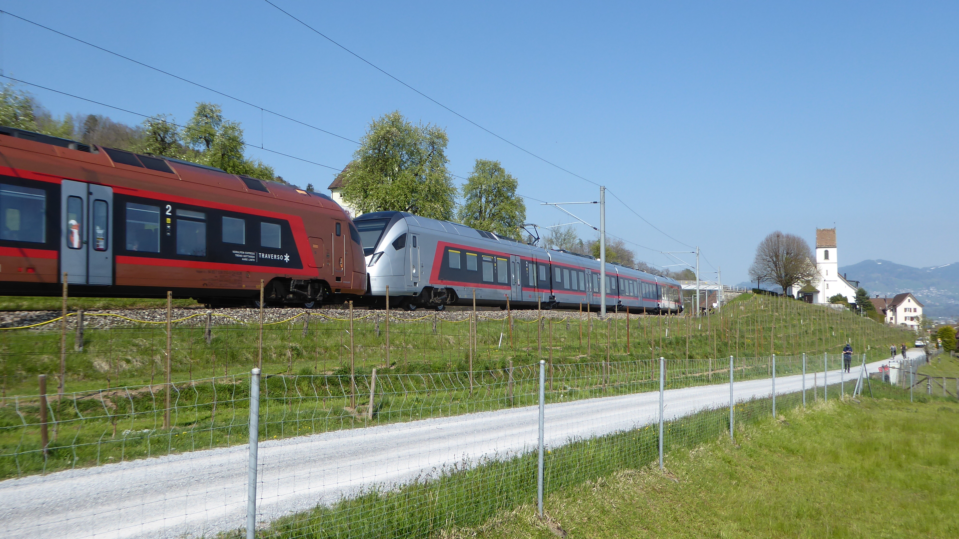
Hurden railway station is a railway station in the Swiss canton of Schwyz and municipality of Freienbach. The station is located on the Rapperswil to Pfäffikon line that crosses the Seedamm between the two shores of Lake Zurich. It takes its name from the nearby village of Hurden. Services The station is an intermediate stop on Zurich S-Bahn service S40. During weekends, there is also a nighttime S-Bahn service (SN5) offered by ZVV. * Zürich S-Bahn: ** : half-hourly service to via and . ** Nighttime S-Bahn (only during weekends):https://www.zvv.ch/zvv-assets/fahrplan/pdf/nachtnetz.pdf *** : hourly service between and (via ). References External links * Hurden Hurden Hurden is a village in the municipality of Freienbach in the canton of Schwyz in Switzerland. First mentioned in 1217, the name "de Hurden" was used for the peninsula and for the fish traps made of woven work, called "Hürden" or "Hurden", which w ... Freienbach {{switzerland-railstat ... [...More Info...] [...Related Items...] OR: [Wikipedia] [Google] [Baidu] |
Hurden (Freienbach)
Hurden is a village in the municipality of Freienbach in the canton of Schwyz in Switzerland. First mentioned in 1217, the name "de Hurden" was used for the peninsula and for the fish traps made of woven work, called "Hürden" or "Hurden", which were used by the locals. Geography The village of Hurden is located on a peninsula protruding from the southern shore of Lake Zürich at its narrowest point. The peninsula has its origin in the retreat of the Linth glacier at the end of the last glacial period when Lake Zürich was formed. This retreat left a moraine across the valley now occupied by Lake Zürich. The higher southern section of this moraine extends above the lake's water level and forms the peninsula, whilst the lower northern section forms a shallow section in the otherwise deep lake. Together these separate Lake Zürich into two parts, the larger lower lake to the north-west, and the smaller upper lake ( ''Obersee'') to the east. The artificial Seedamm uses a c ... [...More Info...] [...Related Items...] OR: [Wikipedia] [Google] [Baidu] |
Freienbach
Freienbach is a municipality in Höfe District in the canton of Schwyz in Switzerland. History Freienbach is first mentioned in 972 as ''Friginbach''. Geography Freienbach has an area, , of . Of this area, 40.7% is used for agricultural purposes, while 23.8% is forested. Of the rest of the land, 31% is settled (buildings or roads) and the remainder (4.5%) is non-productive (rivers, glaciers or mountains). The municipality is located on Lake Zurich and stretches from the lake (elevation ) to the Etzel mountain (elevation ). It consists of the villages of Freienbach, Pfäffikon (not to be confused with Pfäffikon in the canton of Zurich), Wilen, Bäch, Hurden (located on the Seedamm) and the two islands of Lützelau and Ufenau (Ufnau). Demographics Freienbach has a population (as of ) of . , 23.2% of the population was made up of foreign nationals. Over the last 10 years the population has grown at a rate of 23.8%. Most of the population () speaks German (87.9%), with Ita ... [...More Info...] [...Related Items...] OR: [Wikipedia] [Google] [Baidu] |
Canton Of Schwyz
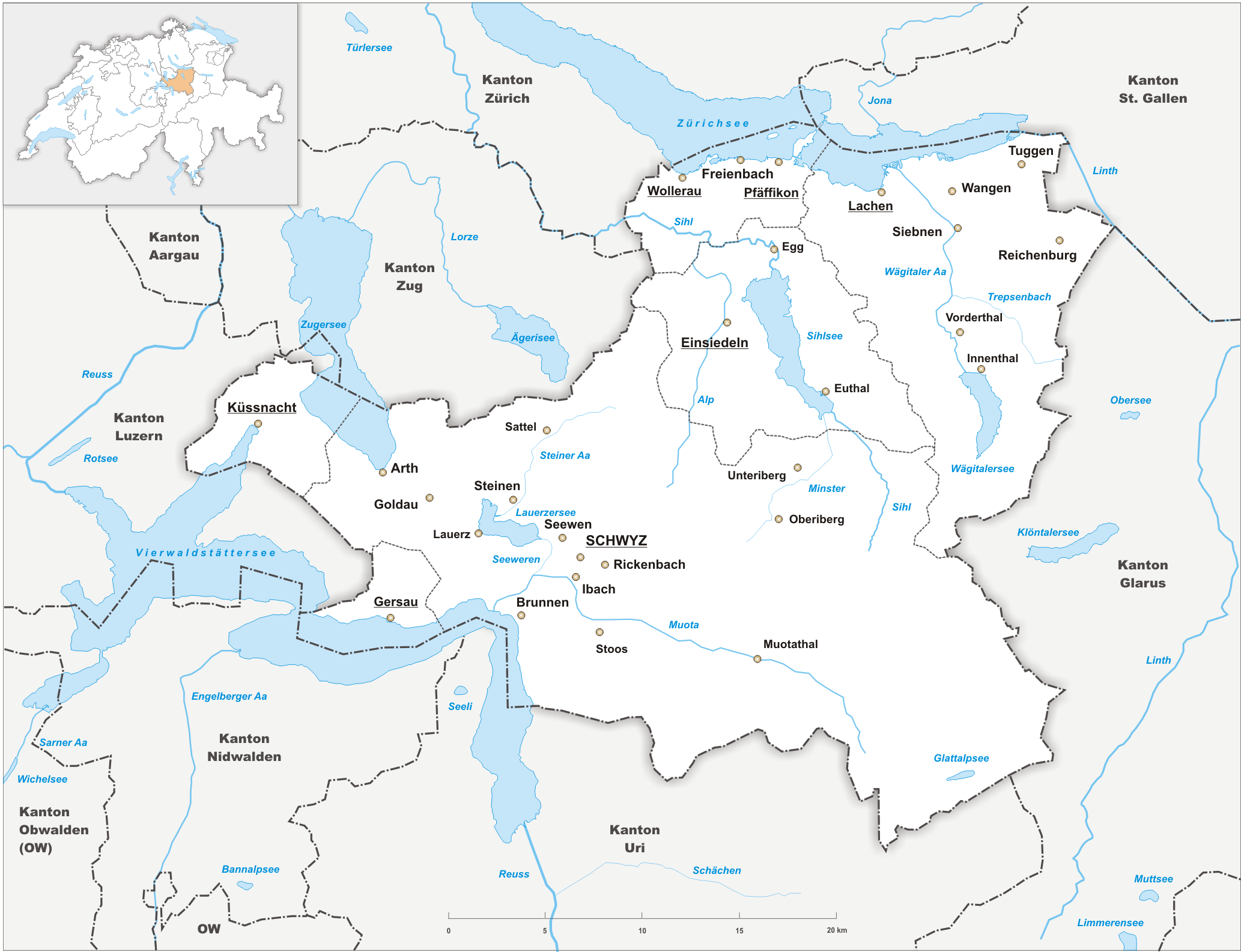
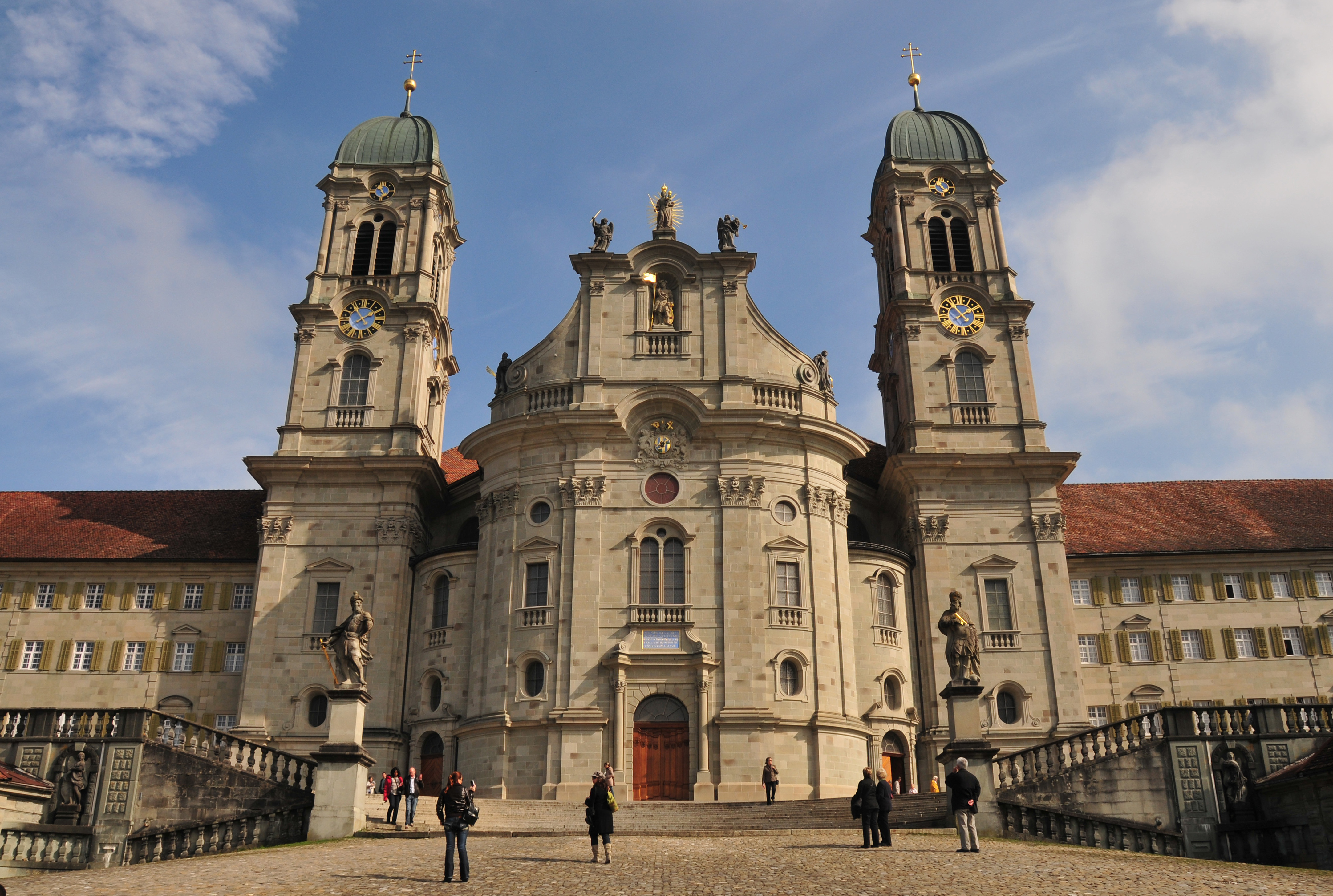
The canton of Schwyz (german: Kanton Schwyz rm, Chantun Sviz; french: Canton de Schwytz; it, Canton Svitto) is a canton in central Switzerland between the Alps in the south, Lake Lucerne to the west and Lake Zürich in the north, centred on and named after the town of Schwyz. It is one of the founding cantons of Switzerland; Switzerland's name is derived from the name of the canton, and the flag of Switzerland from its coat of arms. For the history of the name, see Schwyz. The Swiss Federal Charter is on display in Schwyz. Northeast of the town of Schwyz is Einsiedeln Abbey. History Prehistory to the Roman era The earliest traces of humans in Schwyz are from the Upper Paleolithic and Early Mesolithic, or about 12,500 BC. An excavation of the karst caves in the valley of the Muota river (''Muotatal'') revealed numerous sites, some dating to the Younger Dryas period (c. 10,000 BC). The alpine meadows at Bödmeren, Twärenen and Silberen were Stone Age hunter-gatherer camps. ... [...More Info...] [...Related Items...] OR: [Wikipedia] [Google] [Baidu] |
Südostbahn
The Südostbahn (German, literally meaning "South-Eastern Railway") – commonly abbreviated to SOB – is a Swiss adhesion railway company, and a network in Central and Eastern Switzerland. It resulted from the merger of the original SOB with the Bodensee–Toggenburg railway (BT) at the end of 2001. The Schweizerische Südostbahn AG (Swiss South-Eastern Railway SA) is a small private railway jointly owned by the cantonal and federal governments as an Aktiengesellschaft (AG). Network The rail network of the Südostbahn (SOB) consists of that formerly owned by BT in northeast Switzerland (between Lake Constance and Toggenburg): * Romanshorn– St. Gallen St. Fiden line, * St. Gallen–Herisau–Degersheim–Wattwil line, and * (Wattwil–)Ebnat-Kappel–Krummenau– Nesslau-Neu Sankt Johann line, and that previously owned by the original SOB located predominantly in Central Switzerland: * Rapperswil–Pfäffikon SZ line, * Pfäffikon S ... [...More Info...] [...Related Items...] OR: [Wikipedia] [Google] [Baidu] |
Railway Station
Rail transport (also known as train transport) is a means of transport that transfers passengers and goods on wheeled vehicles running on rails, which are incorporated in tracks. In contrast to road transport, where the vehicles run on a prepared flat surface, rail vehicles (rolling stock) are directionally guided by the tracks on which they run. Tracks usually consist of steel rails, installed on sleepers (ties) set in ballast, on which the rolling stock, usually fitted with metal wheels, moves. Other variations are also possible, such as "slab track", in which the rails are fastened to a concrete foundation resting on a prepared subsurface. Rolling stock in a rail transport system generally encounters lower frictional resistance than rubber-tyred road vehicles, so passenger and freight cars (carriages and wagons) can be coupled into longer trains. The operation is carried out by a railway company, providing transport between train stations or freight customer facilit ... [...More Info...] [...Related Items...] OR: [Wikipedia] [Google] [Baidu] |
Switzerland
). Swiss law does not designate a ''capital'' as such, but the federal parliament and government are installed in Bern, while other federal institutions, such as the federal courts, are in other cities (Bellinzona, Lausanne, Luzern, Neuchâtel, St. Gallen a.o.). , coordinates = , largest_city = Zürich , official_languages = , englishmotto = "One for all, all for one" , religion_year = 2020 , religion_ref = , religion = , demonym = , german: Schweizer/Schweizerin, french: Suisse/Suissesse, it, svizzero/svizzera or , rm, Svizzer/Svizra , government_type = Federalism, Federal assembly-independent Directorial system, directorial republic with elements of a direct democracy , leader_title1 = Federal Council (Switzerland), Federal Council , leader_name1 = , leader_title2 = , leader_name2 = Walter Thurnherr , legislature = Fe ... [...More Info...] [...Related Items...] OR: [Wikipedia] [Google] [Baidu] |
Canton Of Schwyz
The canton of Schwyz (german: Kanton Schwyz rm, Chantun Sviz; french: Canton de Schwytz; it, Canton Svitto) is a canton in central Switzerland between the Alps in the south, Lake Lucerne to the west and Lake Zürich in the north, centred on and named after the town of Schwyz. It is one of the founding cantons of Switzerland; Switzerland's name is derived from the name of the canton, and the flag of Switzerland from its coat of arms. For the history of the name, see Schwyz. The Swiss Federal Charter is on display in Schwyz. Northeast of the town of Schwyz is Einsiedeln Abbey. History Prehistory to the Roman era The earliest traces of humans in Schwyz are from the Upper Paleolithic and Early Mesolithic, or about 12,500 BC. An excavation of the karst caves in the valley of the Muota river (''Muotatal'') revealed numerous sites, some dating to the Younger Dryas period (c. 10,000 BC). The alpine meadows at Bödmeren, Twärenen and Silberen were Stone Age hunter-gatherer camps. ... [...More Info...] [...Related Items...] OR: [Wikipedia] [Google] [Baidu] |
Seedamm
The Rapperswil Seedamm is the partially artificial causeway and bridge at the most narrow area of Lake Zurich, between Hurden (SZ) and Rapperswil (SG). The Seedamm carries a road and a railway across the lake, with the railway being used by the S5 and S40 lines of the S-Bahn Zürich and by the Südostbahn Voralpen Express. Geography and location The Seedam was built on an ice age moraine located between the three Swiss cantons of Schwyz, St. Gallen and Zürich. This morain forms a peninsula protruding from the south shore of the lake containing the village of Hurden, a small island to the Rapperswil side of the lake, and a section of shallow water dividing Lake Zürich and its upper part, ''Obersee''. The causeway and two bridges that span this area of shallow water, are in length and carry a road and a railway line. To the east of the modern causeway and bridges is the ''Holzbrücke Rapperswil-Hurden'' (wooden pedestrian bridge), built in 2001 as a reconstructio ... [...More Info...] [...Related Items...] OR: [Wikipedia] [Google] [Baidu] |
Lake Zurich
__NOTOC__ Lake Zurich ( Swiss German/Alemannic: ''Zürisee''; German: ''Zürichsee''; rm, Lai da Turitg) is a lake in Switzerland, extending southeast of the city of Zürich. Depending on the context, Lake Zurich or ''Zürichsee'' can be used to describe the lake as a whole, or just that part of the lake downstream of the Seedamm at Rapperswil, whilst the part upstream of Rapperswil may be called the ''Obersee'' or Upper Lake. Geography Lake Zurich is formed by the Linth river, which rises in the glaciers of the Glarus Alps and was diverted by the Escher canal (completed in 1811) into Lake Walen from where its waters are carried to the east end of Lake Zurich by means of the Linth canal (completed in 1816). The waters of the Lake of Zurich flow out of the lake at its north-west end ( Quaibrücke), passing through the city of Zürich; however, the outflow is then called the Limmat. The culminating point of the lake's drainage basin is the Tödi at 3,614 metres above sea level. ... [...More Info...] [...Related Items...] OR: [Wikipedia] [Google] [Baidu] |
S40 (ZVV)
The S40 is a regional railway line of the S-Bahn Zürich on the Zürcher Verkehrsverbund (ZVV), Zürich transportation network, in the cantons of Schwyz, St. Gallen and Zürich. Route * The line runs from Einsiedeln (SZ) and heads, crossing the Seedamm, for Rapperswil (SG); it is operated by the Südostbahn (SOB). Stations * Einsiedeln * Biberbrugg * Schindellegi-Feusisberg * Samstagern * Riedmatt * Wollerau * Wilen bei Wollerau * Freienbach SOB * Pfäffikon SZ * Hurden * Rapperswil Rolling stock All services use Südostbahn rolling stock. Scheduling The train frequency is usually 30 minutes, and the trip takes 37 minutes. See also * Rail transport in Switzerland * Trams in Zürich Trams make an important contribution to public transport in the city of Zürich in Switzerland. The tram network serves most city neighbourhoods, and is the backbone of public transport within the city, albeit supplemented by the inner sections o ... References ZVV officia ... [...More Info...] [...Related Items...] OR: [Wikipedia] [Google] [Baidu] |


