|
Südostbahn
The Südostbahn (German language, German, ) – commonly abbreviated to SOB – is a Switzerland, Swiss railway company, and a network in Central Switzerland, Central and Eastern Switzerland. It resulted from the merger of the Schweizerische Südostbahn (1890), original SOB with the Bodensee–Toggenburg railway (BT) at the end of 2001. The Schweizerische Südostbahn AG (Swiss South-Eastern Railway SA) is a small private railway jointly owned by the Canton of St. Gallen, cantonal and Federal administration of Switzerland, federal governments as an Aktiengesellschaft (AG). Network The rail network of the Südostbahn (SOB) consists of that formerly owned by Bodensee–Toggenburg railway, BT in Eastern Switzerland, northeast Switzerland (between Lake Constance and Toggenburg): * Romanshorn–St. Gallen St. Fiden railway station, St. Gallen St. Fiden line, * St. Gallen–Herisau–Degersheim–Wattwil line, and * (Wattwil–)Ebnat-Kappel–Krummenau–Nesslau, Nesslau-Neu Sank ... [...More Info...] [...Related Items...] OR: [Wikipedia] [Google] [Baidu] |
Bodensee–Toggenburg Railway
The Bodensee–Toggenburg railway is a mainly single-track standard-gauge line connecting on Lake Constance (''Bodensee'' in German) and the Toggenburg region in Eastern Switzerland. It was built by the Bodensee-Toggenburg-Bahn (BT), a former railway company, which existed from 1910 until its merger with the Schweizerische Südostbahn (1890), "old" Südostbahn (SOB) to form the Südostbahn, "new" Südostbahn (SOB) on 1 January 2001. Today, the line together with the Wil–Ebnat-Kappel railway, Wattwil–Ebnat-Kappel section forms the eastern network of the Südostbahn. The BT consisted of the standard gauge adhesion railway from Romanshorn to St. Gallen St. Fiden (19.13 km) opened on 3 October 1910 and the standard gauge adhesion line from to Wattwil (31.74 km), as well as the line from Ebnat-Kappel to Nesslau, Nesslau-Neu St. Johann (7.85 km) opened on 1 October 1912. The connecting sections of line from St. Gallen St. Fiden to St. Gallen HB and fr ... [...More Info...] [...Related Items...] OR: [Wikipedia] [Google] [Baidu] |
Schweizerische Südostbahn (1890)
The original Schweizerische Südostbahn (Swiss Southeastern Railway; SOB) was a railway company in Central Switzerland with its headquarters in Wädenswil. It was created in 1890 by the merger of the Wädenswil-Einsiedeln-Bahn and the Zürichsee–Gotthardbahn (Lake Zürich-Gotthard Railway) and operated the standard gauge adhesion railways on the – and the – routes. It merged in 2001 with the Bodensee–Toggenburg railway (''Bodensee-Toggenburg-Bahn'') to form the "new" Südostbahn. History Predecessors and construction The ''Wädenswil-Einsiedeln-Bahn'' (Wädenswil-Einsiedeln Railway; WE) opened the Wädenswil–Einsiedeln railway in 1877 to open up the pilgrimage site of Einsiedeln. Although the Uetliberg Railway had operated at a grade of more than 7.0% since 1875, the WE wanted to use a system called the ''Walzenradsystems Wetli'' (the Wetli Roller Wheel System) to increase the grip of the rail because of the expected substantial pilgrim traffic. A serious accident occu ... [...More Info...] [...Related Items...] OR: [Wikipedia] [Google] [Baidu] |
Stadler FLIRT
Stadler FLIRT (, ) is a passenger multiple unit trainset made by Stadler Rail of Switzerland. The baseline design of FLIRT is an electric multiple unit Articulated car, articulated trainset that can come in units of two to twelve cars with two to six motorized axles. The maximum speed is . Standard floor height is , but high floors are also available for platform heights of . The FLIRT train was originally developed for the Swiss Federal Railways and was first delivered in 2004. The trains quickly became a success and were ordered by operators in Algeria, Azerbaijan, Belarus, Canada, the Czech Republic, Estonia, Finland, Germany, Hungary, Italy, Lithuania, the Netherlands, Norway, Poland, Serbia, Slovenia, Sweden, Switzerland, the United Kingdom, and the United States. As of October 2021, more than 2500 units have been sold. Aside from being electric (Electric multiple unit, EMU), the FLIRT is available in diesel-electric (Diesel multiple unit#Diesel–electric, DEMU), Battery ... [...More Info...] [...Related Items...] OR: [Wikipedia] [Google] [Baidu] |
Lake Constance
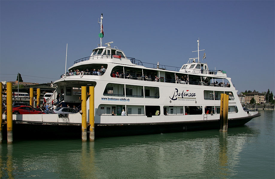
Lake Constance (, ) refers to three bodies of water on the Rhine at the northern foot of the Alps: Upper Lake Constance (''Obersee''), Lower Lake Constance (''Untersee''), and a connecting stretch of the Rhine, called the Seerhein (). These waterbodies lie within the Lake Constance Basin () in the Alpine Foreland through which the Rhine flows. The nearby '' Mindelsee'' is not considered part of Lake Constance. The lake is situated where Germany, Switzerland, and Austria meet. Its shorelines lie in the German states of Baden-Württemberg and Bavaria; the Swiss cantons of St. Gallen, Thurgau, and Schaffhausen; and the Austrian state of Vorarlberg. The actual locations of the country borders within the lake are disputed. The Alpine Rhine forms, in its original course ( Alter Rhein), the Austro-Swiss border and flows into the lake from the south. The High Rhine flows westbound out of the lake and forms (with the exception of the Canton of Schaffhausen, Rafzerfeld and Bas ... [...More Info...] [...Related Items...] OR: [Wikipedia] [Google] [Baidu] |
Seedamm
The Rapperswil Seedamm is the artificial causeway at the narrowest area of Lake Zurich between Hurden, Hurden (SZ) and Rapperswil (SG). The structure contains two bridge segments and is approximately long. The Seedamm carries a road () and a Rapperswil–Pfäffikon railway, railway across the lake, with the railway being used by the S5 (ZVV), S5 and S40 (ZVV), S40 services of Zurich S-Bahn and by Südostbahn's Voralpen Express. The Melide causeway across a narrow section at Lake Lugano is comparable to the Seedamm. Geography and location The Seedamm connects the Switzerland, Swiss cantons of Canton of Schwyz, Schwyz (Hurden) and Canton of St. Gallen, St. Gallen (Rapperswil). The village of Hurden is located on a peninsula protruding from the south shore of Lake Zurich. This peninsula, a terminal moraine, was formed by an ice age glacier (Linth glacier) ca. 17'000 years ago. The Hurden peninsula and the Seedamm divide the main part of Lake Zurich from its upper part, the O ... [...More Info...] [...Related Items...] OR: [Wikipedia] [Google] [Baidu] |
Swiss Franc
The Swiss franc, or simply the franc, is the currency and legal tender of Switzerland and Liechtenstein. It is also legal tender in the Italian exclave of Campione d'Italia which is surrounded by Swiss territory. The Swiss National Bank (SNB) issues banknotes and the federal mint Swissmint issues coins. It is also designated through currency signs ''Fr.'' (in German language), ''fr.'' (in French language, French, Italian language, Italian, Romansh languages), as well as in any other language, or internationally as ''CHF'' which stands for Franc. This acronym also serves as the ISO 4217 currency code, used by banks and financial institutions. The smaller denomination, a hundredth of a franc, is a (Rp.) in German, (c.) in French, (ct.) in Italian, and (rp.) in Romansh. The official symbols ''Fr.'' (German symbol) and ''fr.'' (Latin languages) are widely used by businesses and advertisers, also for the English language. According to ''Art. 1 SR/RS 941.101'' of the federal law ... [...More Info...] [...Related Items...] OR: [Wikipedia] [Google] [Baidu] |
Rapperswil
Rapperswil (Swiss German: or ;Andres Kristol, ''Rapperswil SG (See)'' in: ''Dictionnaire toponymique des communes suisses – Lexikon der schweizerischen Gemeindenamen – Dizionario toponomastico dei comuni svizzeri (DTS, LSG)'', Centre de dialectologie, Université de Neuchâtel, Verlag Huber, Frauenfeld/Stuttgart/Wien 2005, and Éditions Payot, Lausanne 2005, , p. 727. short: ''Rappi'') is a former municipality and since January 2007 part of the Municipalities of Switzerland, municipality of Rapperswil-Jona in the ''Wahlkreis'' (constituency) of See-Gaster (Wahlkreis), See-Gaster in the Cantons of Switzerland, canton of St. Gallen (canton), St. Gallen in Switzerland, located between ''Obersee (Lake Zurich), Obersee'' and the main part of Lake Zurich. Geography Rapperswil is located on the northern shore of Lake Zurich at the point at which the lake is cut in two by the Seedamm isthmus, which is an ice age moraine. The upper (or eastern) part of Lake Zurich is called ''Ob ... [...More Info...] [...Related Items...] OR: [Wikipedia] [Google] [Baidu] |
Degersheim
Degersheim is a Municipalities of Switzerland, municipality in the ''Wahlkreis'' (constituency) of Wil (Wahlkreis), Wil in the Cantons of Switzerland, canton of St. Gallen (canton), St. Gallen in Switzerland. History Degersheim is first mentioned in 837 as ''Tegarascai''. It was known as ''Tegerschen'' until 1803, when Degersheim became the official name. The village of Wolfertswil is mentioned in 838 as ''Wolfrideswilare''. Geography Degersheim has an area, , of . Of this area, 53.4% is used for agricultural purposes, while 36.5% is forested. Of the rest of the land, 10% is settled (buildings or roads) and the remainder (0.1%) is non-productive (rivers or lakes). It consists of the village of Degersheim and the hamlet (place), hamlets of Magdenau with the abbey, Wolfertswil, Hinterschwil, the exclave Obergampen and a number of scattered farm houses. Coat of arms The blazon of the municipal coat of arms is ''Per pale sable an Ash tree eradicated Or and Or a Cross Lorraine Sa ... [...More Info...] [...Related Items...] OR: [Wikipedia] [Google] [Baidu] |
Toggenburg
Toggenburg is a region of Switzerland. It corresponds to the upper valley of the River Thur (Switzerland), Thur and that of the Necker (river), Necker, one of its afluents. Since 1 January 2003, Toggenburg has been a constituency (''Wahlkreis'') of the canton of St. Gallen (Community Identification Number#Switzerland, SFOS number 1727). Geography The valley descends in a northwestern direction from the watershed between the Rhine and the Thur, and is enclosed on the northeast by the chain of the Säntis () and on the southwest by that of the Churfirsten () and of the Speer (mountain), Speer (). It is a fertile valley of about in length from the source of the river to Wil. At Wildhaus, the highest village (), the house wherein Huldrych Zwingli, the Swiss Reformer, was born in 1484, is still shown. Other villages are Lichtensteig, Kirchberg, St. Gallen, Kirchberg and Wattwil. History There are traces of the Paleolithic Mousterian Industry throughout the Appenzell Alps, in the ... [...More Info...] [...Related Items...] OR: [Wikipedia] [Google] [Baidu] |
Romanshorn
Romanshorn is a Municipalities of Switzerland, municipality in the district of Arbon (district), Arbon in the Cantons of Switzerland, canton of Thurgau in Switzerland. History Romanshorn was probably settled in the 7th century, and is first mentioned in 779 as ''Rumanishorn'' in a land grant from Waldrata to the Abbey of St. Gall. During the Late Middle Ages and until 1367, the bailiwick of Romanshorn was partially owned by the Landsberg family. In 1455 Abbot Kaspar Landsberg sold the Romanshorn estate to the city of St. Gallen, but his religious superiors forced the courts to repeal the sale. Until 1798, the Abbey of St. Gall owned the taxation, appellate court and the Homage (medieval), homage rights (mostly in Täschlishusen at Häggenschwil) with the remaining sovereignty owned by the County of Thurgau. In 779 a church was mentioned in Romanshorn. In 1275, the records of the church indicate that the Provost (religion), Provost was paid 16 pounds. In 1480 St. Gallen incorp ... [...More Info...] [...Related Items...] OR: [Wikipedia] [Google] [Baidu] |
Herisau
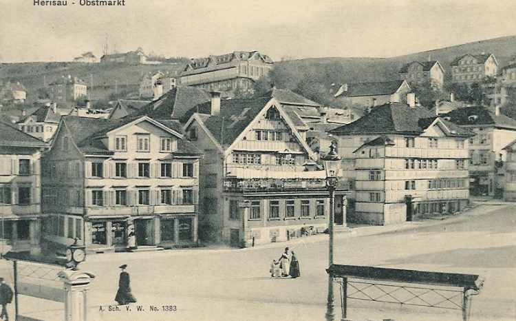
Herisau is a municipalities of Switzerland, municipality and the capital of the Cantons of Switzerland, canton of Appenzell Ausserrhoden in Switzerland. It is the seat of the canton's government and parliament; the judicial authorities are situated in Trogen, Switzerland, Trogen. The central hamlet and the houses around the central square, the Protestant church of 1580, the houses ''Wetter'' and ''zur Rose'' (both 1737), the hamlet ''Schwänberg'' and the government building with the state archive are listed as Swiss inventory of cultural property of national and regional significance, heritage sites of national significance.Swiss inventory of cultural property of national and regional significance (1995), p. 55. Together with other Alpine towns Herisau engages in the Alpine Town of the Year Association for the implementation of the Alpine Convention to achieve sustainable development in the Alpine Arc. Herisau was awarded Alpine Town of the Year 2003. History Herisau was first ... [...More Info...] [...Related Items...] OR: [Wikipedia] [Google] [Baidu] |
Canton Of St
Canton may refer to: Administrative divisions * Canton (administrative division), territorial/administrative division in some countries * Township (Canada), known as ''canton'' in Canadian French Arts and entertainment * Canton (band), an Italian synth pop group * "Canton" (song) by Japan * Canton, a fictional town in " Jaynestown", an episode of ''Firefly'' Design * Canton (building), a corner pilaster * Canton (flag), an emblem placed in the top left quarter of a flag * Canton (heraldry), a square or other charge (symbol) occupying the upper left corner of a coat of arms * Canton porcelain, Chinese ceramic ware People * Canton (surname), and list of people with the surname * Canton Jones, American Christian music/hip-hop artist Places Canada * Canton, New Brunswick, a community in Drummond Parish, New Brunswick * Canton, Ontario China * Guangdong (Canton Province), province in southern China * Guangzhou (Canton City), capital of Guangdong Province * Cant ... [...More Info...] [...Related Items...] OR: [Wikipedia] [Google] [Baidu] |


