|
Humboldt Fault
The Humboldt Fault or Humboldt Fault Zone, is a normal fault or series of faults, that extends from Nebraska southwestwardly through most of Kansas.from the Kansas Geological Survey (at the University of Kansassite oil geology page, accessed on December 16, 2006 Kansas is not particularly earthquake prone, ranking 45th out of 50 states by damage caused. KGS cite of Federal Emergency Management Agencybr>report accessed on December 16, 2006 However, the north-central part of the state, particularly Riley and Pottawatomie counties, is the most prone to earthquakes. The Humboldt Fault had the largest earthquake in Kansas history with the 1867 Manhattan, Kansas earthquake. It happened near the town of Wamego and was estimated at 5.5 on the Richter scale. Reportedly it was felt as far away as Dubuque, Iowa. See also * Midcontinent Rift System The Midcontinent Rift System (MRS) or Keweenawan Rift is a long geological rift in the center of the North American continent and south-cent ... [...More Info...] [...Related Items...] OR: [Wikipedia] [Google] [Baidu] |
Wamego, Kansas
Wamego is a city in Pottawatomie County, Kansas, United States. As of the 2020 census, the population of the city was 4,841. History Wamego was platted in 1866. It was named for a Potawatomi Native American chief. The first post office in Wamego was established in October 1866. Geography Wamego is located at (39.204074, -96.308328). According to the United States Census Bureau, the city has a total area of , of which is land and is water. Wamego is located at the intersection of U.S. Route 24 and K-99. It is approximately east of Manhattan; and about west-northwest of Topeka. The Kansas River flows along the southern edge of the city. Climate The climate in this area is characterized by hot, humid summers and generally mild to cool winters. According to the Köppen Climate Classification system, Wamego has a humid subtropical climate, abbreviated "Cfa" on climate maps. Demographics Wamego is part of the Manhattan, Kansas Metropolitan Statistical Area. 2010 cen ... [...More Info...] [...Related Items...] OR: [Wikipedia] [Google] [Baidu] |
Geology Of Nebraska
The geology of Nebraska is part of the broader geology of the Great Plains of the central United States. Nebraska's landscape is dominated by surface features, soil and aquifers in loosely compacted sediments, with areas of the state where thick layers of sedimentary rock outcrop. Nebraska's sediments and sedimentary rocks lie atop a basement of crystalline rock known only through drilling. Geologic history, bedrock geology and stratigraphy The land that is today Nebraska originated as a juvenile crust expansion of the continent Laurentia—today part of the North American Craton and the core of the North American continent—between 1.8 and 1.6 billion years ago (Ga). Tectonic models suggest that Laurentia was part of the supercontinent Columbia but returned to being an independent continent between 1.35 and 1.3 billion years ago after which it became joined first to Protorodinia and the supercontinent Rodinia by 1.07 Billion years ago (Ga). The Precambrian basement rocks of Ne ... [...More Info...] [...Related Items...] OR: [Wikipedia] [Google] [Baidu] |
Geology Of Kansas
The geology of Kansas encompasses the geologic history and the presently exposed rock and soil. Rock that crops out in the US state of Kansas was formed during the Phanerozoic eon, which consists of three geologic eras: the Paleozoic, Mesozoic and Cenozoic. Paleozoic rocks at the surface in Kansas are primarily from the Mississippian, Pennsylvanian, and Permian periods. Paleozoic Era The oldest rocks at the surface in Kansas are Mississippian rocks that consist of limestones, shale, dolomite, chert, sandstones, and siltstones. The Mississippian consisted of an environment similar to present. Fast moving streams and rivers cut into the limestone bedrock, and in some places, create caverns and sinkholes.Buchanan, R., ''Kansas Geology: An Introduction to Landscapes, Rock, Minerals, and Fossils,'' University Press of Kansas, 1984, Ch 1, p. 10 ff Pennsylvanian rocks consist predominantly of alternating marine and non-marine shales and limestones with some sandstone, coal, chert, ... [...More Info...] [...Related Items...] OR: [Wikipedia] [Google] [Baidu] |
Nemaha Ridge
The Nemaha Ridge (also called the Nemaha Uplift and the Nemaha Anticline) is located in the Central United States. It is a buried structural zone associated with a granite high in the Pre-Cambrian basement that extends from approximately Omaha, Nebraska to Oklahoma City, Oklahoma. The ridge is associated with the seismically active Humboldt Fault zone. It is also associated with the Proterozoic Midcontinent Rift System, which extends into northern Kansas about fifty miles west of the Nemaha.Kansas Geological Survey, Current Research in Earth Sciences, Bulletin 250, part 1 "Review of the Nemaha Ridge: A New Look at an Old Structure" Along the Nemaha Ridge is a series of faults referred to as the "Nemaha Fault Zone". The long term uplift ... [...More Info...] [...Related Items...] OR: [Wikipedia] [Google] [Baidu] |
Midcontinent Rift System
The Midcontinent Rift System (MRS) or Keweenawan Rift is a long geological rift in the center of the North American continent and south-central part of the North American plate. It formed when the continent's core, the North American craton, began to split apart during the Mesoproterozoic era of the Precambrian, about 1.1 billion years ago. The rift failed, leaving behind thick layers of igneous rock that are exposed in its northern reaches, but buried beneath later sedimentary formations along most of its western and eastern arms. Those arms meet at Lake Superior, which is contained within the rift valley. The lake's north shore in Ontario and Minnesota defines the northern arc of the rift. From the lake, the rift's eastern arm trends south to central lower Michigan, and possibly into Indiana, Ohio, Kentucky, Tennessee, and Alabama. The western arm runs from Lake Superior southwest through portions of Wisconsin, Minnesota, Iowa, and Nebraska to northeastern Kansas, and po ... [...More Info...] [...Related Items...] OR: [Wikipedia] [Google] [Baidu] |
Iowa
Iowa () is a state in the Midwestern region of the United States, bordered by the Mississippi River to the east and the Missouri River and Big Sioux River to the west. It is bordered by six states: Wisconsin to the northeast, Illinois to the east and southeast, Missouri to the south, Nebraska to the west, South Dakota to the northwest, and Minnesota to the north. During the 18th and early 19th centuries, Iowa was a part of French Louisiana and Spanish Louisiana; its state flag is patterned after the flag of France. After the Louisiana Purchase, people laid the foundation for an agriculture-based economy in the heart of the Corn Belt. In the latter half of the 20th century, Iowa's agricultural economy transitioned to a diversified economy of advanced manufacturing, processing, financial services, information technology, biotechnology, and green energy production. Iowa is the 26th most extensive in total area and the 31st most populous of the 50 U.S. states, with a populat ... [...More Info...] [...Related Items...] OR: [Wikipedia] [Google] [Baidu] |
Dubuque, Iowa
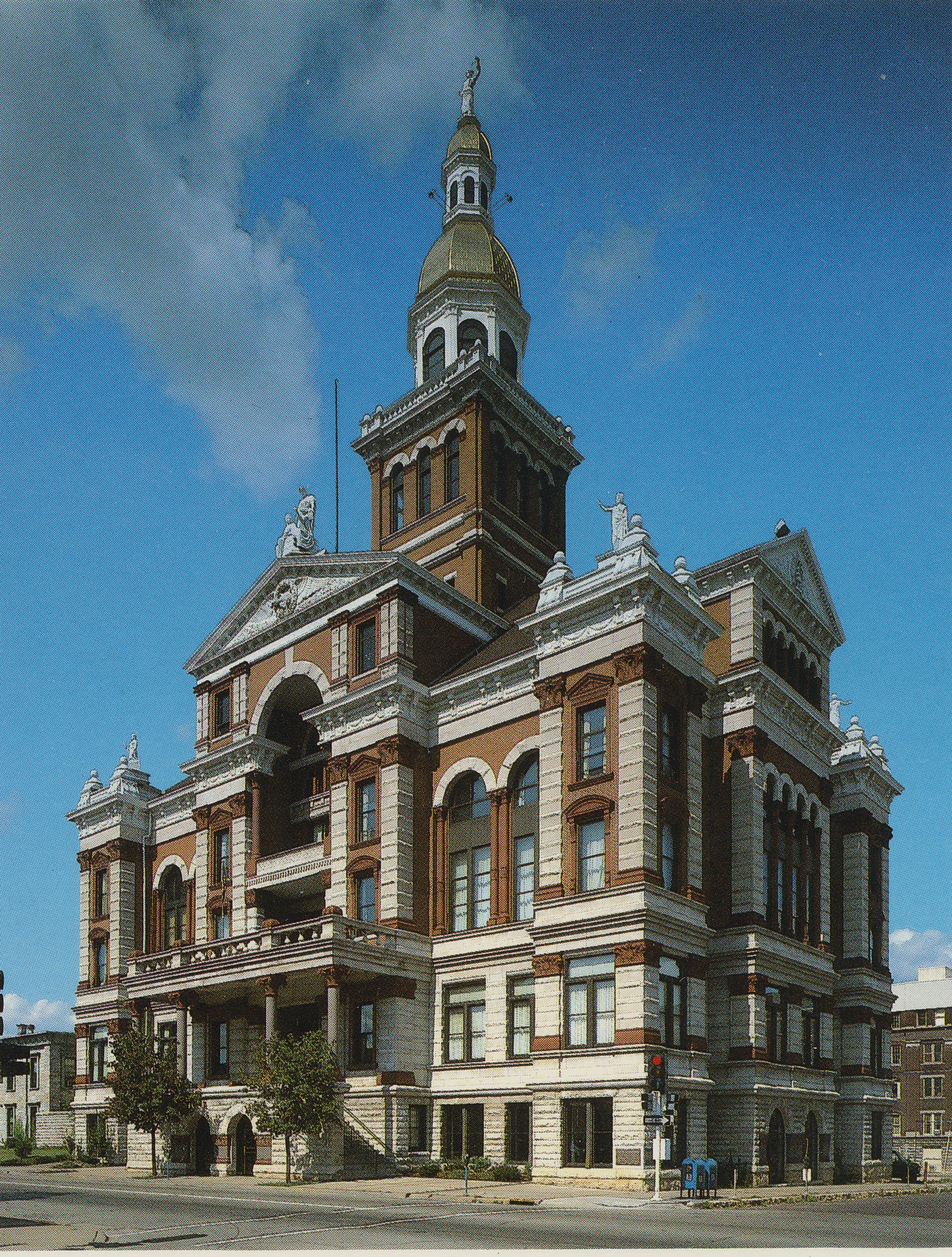
Dubuque (, ) is the county seat of Dubuque County, Iowa, United States, located along the Mississippi River. At the time of the 2020 United States Census, 2020 census, the population of Dubuque was 59,667. The city lies at the junction of Iowa, Illinois, and Wisconsin, a region locally known as the Dubuque area, Tri-State Area. It serves as the main commercial, industrial, educational, and cultural center for the area. Geographically, it is part of the Driftless Area, a portion of North America that escaped all three phases of the Wisconsin Glaciation. Dubuque is a tourist destination featuring the city's unique architecture and river location. It is home to five institutions of higher education, making it a center for culture and learning. Dubuque has long been a center of manufacturing, the local economy has also diversified to other areas in the 21st century. Alongside previously mentioned industries, the city has large health care, publishing, and financial service sectors. Hi ... [...More Info...] [...Related Items...] OR: [Wikipedia] [Google] [Baidu] |
Richter Magnitude Scale
The Richter scale —also called the Richter magnitude scale, Richter's magnitude scale, and the Gutenberg–Richter scale—is a measure of the strength of earthquakes, developed by Charles Francis Richter and presented in his landmark 1935 paper, where he called it the "magnitude scale". This was later revised and renamed the local magnitude scale, denoted as ML or . Because of various shortcomings of the original scale, most seismological authorities now use other similar scales such as the moment magnitude scale () to report earthquake magnitudes, but much of the news media still erroneously refers to these as "Richter" magnitudes. All magnitude scales retain the logarithmic character of the original and are scaled to have roughly comparable numeric values (typically in the middle of the scale). Due to the variance in earthquakes, it is essential to understand the Richter scale uses logarithms simply to make the measurements manageable (i.e., a magnitude 3 quake factors ... [...More Info...] [...Related Items...] OR: [Wikipedia] [Google] [Baidu] |
1867 Manhattan, Kansas Earthquake
The 1867 Manhattan earthquake struck Riley County, Kansas, in the United States on April 24, 1867, at 20:22 UTC, or about . The strongest earthquake to originate in the state, it measured 5.1 on a seismic scale that is based on an isoseismal map or the event's felt area. The earthquake's epicenter was near the town of Manhattan. The earthquake had a maximum perceived intensity of VII (''Very strong'') on the Mercalli intensity scale. It caused minor damage, reports of which were confined to Kansas, Iowa, and Missouri, according to the United States Geological Survey. Felt over an area of , the earthquake reached the states of Indiana, Illinois, and possibly Ohio, though the latter reports have been questioned. Manhattan is near the Nemaha Ridge, a long anticline structure that is bounded by several faults. The nearby in particular poses a threat to the city. Kansas is not known for earthquake activity, but an earthquake could occur at any time. A 2016 hazard map from the Uni ... [...More Info...] [...Related Items...] OR: [Wikipedia] [Google] [Baidu] |


