|
Hrútafjörður
Hrútafjörður () is a fjord in the north-west of Iceland. It is around 36 km long and lies to the south of Húnaflói (, ) is a bay of the Iceland Sea in Northwestern Region (Iceland), Northwestern Region and Westfjords, Iceland. It is situated between the village of Strandir on peninsula to the west and the of Skagi peninsula to the east. Spanning , it has a ... bay. There are a few farmsteads on the shores of the fjord, and one (tiny) village, Borðeyri, with 16 inhabitants. The junction and farmstead of Brú is at its southern tip; it serves as a local agricultural service station. "Hrúta" is plural possessive of "Hrútur" which means the male sheep. File:Bortheyri.JPG, Borðeyri Image:Southern end of Hrútafjörður.jpg, Southern end of Hrútafjörður File:Hrútafjörður.jpg, Hrútafjörður See also * Fjords of Iceland {{iceland-fjord-stub ... [...More Info...] [...Related Items...] OR: [Wikipedia] [Google] [Baidu] |
Borðeyri
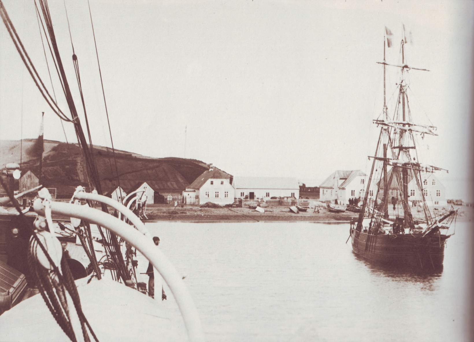
Borðeyri () is a hamlet in Húnaþing vestra municipality of the Westfjords in northwest Iceland. It is a minor commercial centre for nearby farms. The population on 15 July 2018 was 16. Borðeyri was previously part of the municipality Bæjarhreppur, which was one of the smallest in Iceland – having a population of about 100 in 2010 – and covered the west part of Hrútafjörður fjord. Bæjarhreppur merged into Húnaþing vestra on 1 January 2012. In Borðeyri, there is a pre-school and an elementary school, a garage, and a guesthouse. Prime Minister Sigurdur Eggerz and the painters Þorvaldur Skúlason and Karl Kvaran were born in Borðeyri. Borðeyri became a licensed trading place in 1846 and remained so until the 21st century. In the second half of the 19th century, Borðeyri became a very important seaport of the time. The export of sheep to Britain was the main source of Borðeyri's economy, but many of those who moved west across the ocean began heading west to Amer ... [...More Info...] [...Related Items...] OR: [Wikipedia] [Google] [Baidu] |
Brú
Brú () is a farmstead and road junction in northwestern Iceland in Vestur-Húnavatnssýsla county. It is located in the Northwest Political constituency. It has a filling station and a guesthouse. It is located at the southern tip of Hrútafjörður where the river Hrútafjarðará has its estuary with the Arctic Ocean The Arctic Ocean is the smallest and shallowest of the world's five oceanic divisions. It spans an area of approximately and is the coldest of the world's oceans. The International Hydrographic Organization (IHO) recognizes it as an ocean, .... References {{DEFAULTSORT:Bru Populated places in Iceland ... [...More Info...] [...Related Items...] OR: [Wikipedia] [Google] [Baidu] |
Fjord
In physical geography, a fjord (also spelled fiord in New Zealand English; ) is a long, narrow sea inlet with steep sides or cliffs, created by a glacier. Fjords exist on the coasts of Antarctica, the Arctic, and surrounding landmasses of the northern and southern hemispheres. Norway's coastline is estimated to be long with its nearly 1,200 fjords, but only long excluding the fjords. Formation A true fjord is formed when a glacier cuts a U-shaped valley by ice segregation and abrasion of the surrounding bedrock. According to the standard model, glaciers formed in pre-glacial valleys with a gently sloping valley floor. The work of the glacier then left an overdeepened U-shaped valley that ends abruptly at a valley or trough end. Such valleys are fjords when flooded by the ocean. Thresholds above sea level create freshwater lakes. Glacial melting is accompanied by the rebounding of Earth's crust as the ice load and eroded sediment is removed (also called isostasy or gla ... [...More Info...] [...Related Items...] OR: [Wikipedia] [Google] [Baidu] |
Iceland
Iceland is a Nordic countries, Nordic island country between the Atlantic Ocean, North Atlantic and Arctic Oceans, on the Mid-Atlantic Ridge between North America and Europe. It is culturally and politically linked with Europe and is the region's westernmost and most list of countries and dependencies by population density, sparsely populated country. Its Capital city, capital and largest city is Reykjavík, which is home to about 36% of the country's roughly 380,000 residents (excluding nearby towns/suburbs, which are separate municipalities). The official language of the country is Icelandic language, Icelandic. Iceland is on a rift between Plate tectonics, tectonic plates, and its geologic activity includes geysers and frequent Types of volcanic eruptions, volcanic eruptions. The interior consists of a volcanic plateau with sand and lava fields, mountains and glaciers, and many Glacial stream, glacial rivers flow to the sea through the Upland and lowland, lowlands. Iceland i ... [...More Info...] [...Related Items...] OR: [Wikipedia] [Google] [Baidu] |
Húnaflói
(, ) is a bay of the Iceland Sea in Northwestern Region (Iceland), Northwestern Region and Westfjords, Iceland. It is situated between the village of Strandir on peninsula to the west and the of Skagi peninsula to the east. Spanning , it has a maximum width of about and length of . The Battle of the Gulf () was a naval battle on 25 June 1244 in , during the Age of the Sturlungs civil war. A detailed description of the battle can be found in . Fauna The bay has been proposed as a protected area for harbor seals. References Bays of Iceland {{iceland-fjord-stub ... [...More Info...] [...Related Items...] OR: [Wikipedia] [Google] [Baidu] |

