|
Hrynky, Poltava Oblast
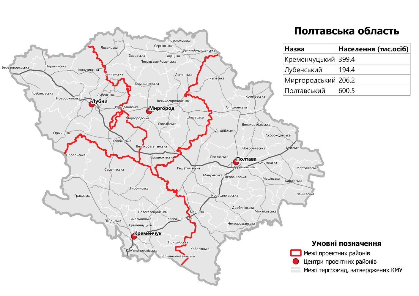
Hrynky ( uk, Гриньки) is a village in Kremenchuk Raion of Poltava Oblast in Ukraine. History Hrynky was formed in the late 17th/early 18th century by escaped serfs who settled here. In 1780, the village consisted of 53 huts, which grew to 189 households with 1245 residents by 1859. Hrynky was previously located in the Hlobyne Raion until it was abolished on 18 July 2020 as part of the administrative reform of Ukraine, which reduced the number of raions of Poltava Oblast to four. The area of Hlobyne Raion was merged into Kremenchuk Raion. Geography Hrynky is located not far north of the Highway H08 on the T-1721 territorial road, northwest of Hlobyne, north of Kremenchuk and west of Poltava. Demographics Native language as of the Ukrainian Census of 2001: [...More Info...] [...Related Items...] OR: [Wikipedia] [Google] [Baidu] |
List Of Sovereign States
The following is a list providing an overview of sovereign states around the world with information on their status and recognition of their sovereignty. The 206 listed states can be divided into three categories based on membership within the United Nations System: 193 member states of the United Nations, UN member states, 2 United Nations General Assembly observers#Present non-member observers, UN General Assembly non-member observer states, and 11 other states. The ''sovereignty dispute'' column indicates states having undisputed sovereignty (188 states, of which there are 187 UN member states and 1 UN General Assembly non-member observer state), states having disputed sovereignty (16 states, of which there are 6 UN member states, 1 UN General Assembly non-member observer state, and 9 de facto states), and states having a political status of the Cook Islands and Niue, special political status (2 states, both in associated state, free association with New Zealand). Compi ... [...More Info...] [...Related Items...] OR: [Wikipedia] [Google] [Baidu] |
Oblasts Of Ukraine
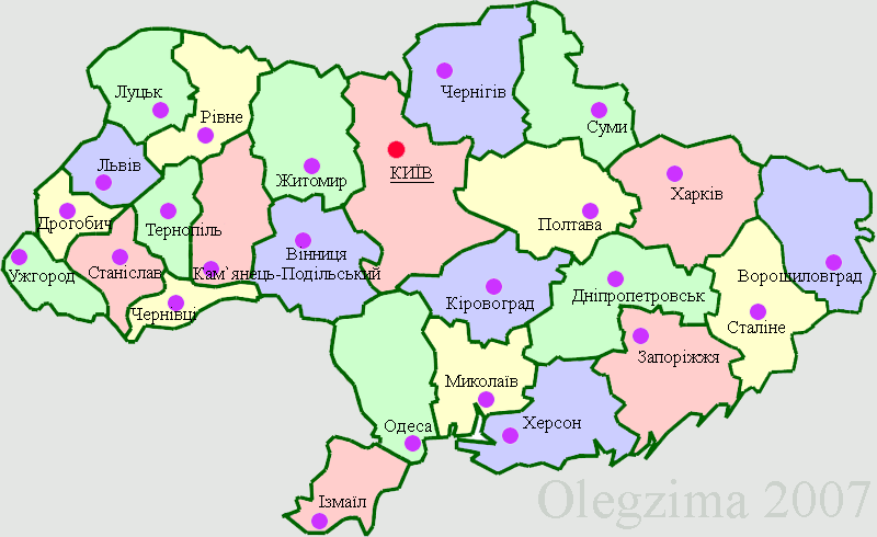
An oblast ( uk, о́бласть; ) in Ukraine, often called a region or province, is the main type of first-level administrative division of the country. Ukraine's territory is divided into 24 oblasts, as well as one autonomous republic, Crimea, and two cities with special status, Kyiv and Sevastopol. Ukraine is a unitary state, thus the oblasts do not have much legal scope of competence other than that which is established in the Ukrainian Constitution and by law. Articles 140–146 of Chapter XI of the constitution deal directly with local authorities and their competency. Oblasts are subdivided into raions (districts), each oblast having from 3 to 10 raions following the July 2020 reform. General characteristics In Ukraine, the term '' oblast'' denotes a primary administrative division. Under the Russian Empire and into the 1920s, Ukraine was divided between several governorates. The term ''oblast'' was introduced in 1932 by Soviet authorities when the Ukrainian SSR ... [...More Info...] [...Related Items...] OR: [Wikipedia] [Google] [Baidu] |
Raions Of Ukraine
Raions of Ukraine (often translated as "districts"; Ukrainian: ра́йон, tr. ''raion''; plural: райо́ни, tr. ''raiony'') are the second level of administrative division in Ukraine, below the oblast. Raions were created in a 1922 administrative reform of the Soviet Union, to which Ukraine, as the Ukrainian Soviet Socialist Republic, belonged. On 17 July 2020, the Verkhovna Rada (Ukraine's parliament) approved an administrative reform to merge most of the 490 raions, along with the " cities of regional significance", which were previously outside the raions, into just 136 reformed raions. Most tasks of the raions (education, healthcare, sport facilities, culture, and social welfare) were taken over by new hromadas, the subdivisions of raions. [...More Info...] [...Related Items...] OR: [Wikipedia] [Google] [Baidu] |
Flag Of Kremenchuk Raion
A flag is a piece of fabric (most often rectangular or quadrilateral) with a distinctive design and colours. It is used as a symbol, a signalling device, or for decoration. The term ''flag'' is also used to refer to the graphic design employed, and flags have evolved into a general tool for rudimentary signalling and identification, especially in environments where communication is challenging (such as the maritime environment, where semaphore is used). Many flags fall into groups of similar designs called flag families. The study of flags is known as "vexillology" from the Latin , meaning "flag" or "banner". National flags are patriotic symbols with widely varied interpretations that often include strong military associations because of their original and ongoing use for that purpose. Flags are also used in messaging, advertising, or for decorative purposes. Some military units are called "flags" after their use of flags. A ''flag'' (Arabic: ) is equivalent to a br ... [...More Info...] [...Related Items...] OR: [Wikipedia] [Google] [Baidu] |
Kremenchuk Raion
Kremenchuk Raion ( uk, Кременчуцький район; translit.: ''Kremenchutskyi raion'') is a raion (district) in Poltava Oblast of central Ukraine. The raion's administrative center is the city of Kremenchuk. Population: On 18 July 2020, as part of the administrative reform of Ukraine, the number of raions of Poltava Oblast was reduced to four, and the area of Kremenchuk Raion was significantly expanded. The January 2020 estimate of the raion population was Important rivers within the Kremenchutskyi Raion include the Psel and the Dnieper } The Dnieper () or Dnipro (); , ; . is one of the major transboundary rivers of Europe, rising in the Valdai Hills near Smolensk, Russia, before flowing through Belarus and Ukraine to the Black Sea. It is the longest river of Ukraine and B .... The raion was established in 1939. Settlements References Raions of Poltava Oblast Kremenchuk 1939 establishments in Ukraine {{Poltava-geo-stub ... [...More Info...] [...Related Items...] OR: [Wikipedia] [Google] [Baidu] |
Poltava Oblast
Poltava Oblast ( uk, Полта́вська о́бласть, translit=Poltavska oblast; also referred to as Poltavshchyna – uk, Полта́вщина, literally 'Poltava Country') is an oblast (province) of central Ukraine. The administrative center of the oblast is the city of Poltava. Most of its territory is part of the historic Cossack Hetmanate (its southern regions: Poltava, Myrhorod, Lubny, and Hadiach). Population: Two other important cities there are Horishni Plavni and Kremenchuk. History During the 2022 Russian Invasion of Ukraine, the town of Myrhorod was bombed. However as of April 2022, there has been no ground fighting and the province remains completely under Ukrainian control. Geography Poltava Oblast is situated in the central part of Ukraine. Located on the left bank of Dnieper, Poltava region was part of the Cossack Hetmanate. It has an area of 28,800 km2. The oblast borders upon Chernihiv, Sumy, Kharkiv, Dnipropetrovsk, Kirovohrad, Cherkasy and ... [...More Info...] [...Related Items...] OR: [Wikipedia] [Google] [Baidu] |
Ukraine
Ukraine ( uk, Україна, Ukraïna, ) is a country in Eastern Europe. It is the second-largest European country after Russia, which it borders to the east and northeast. Ukraine covers approximately . Prior to the ongoing Russian invasion, it was the eighth-most populous country in Europe, with a population of around 41 million people. It is also bordered by Belarus to the north; by Poland, Slovakia, and Hungary to the west; and by Romania and Moldova to the southwest; with a coastline along the Black Sea and the Sea of Azov to the south and southeast. Kyiv is the nation's capital and largest city. Ukraine's state language is Ukrainian; Russian is also widely spoken, especially in the east and south. During the Middle Ages, Ukraine was the site of early Slavic expansion and the area later became a key centre of East Slavic culture under the state of Kievan Rus', which emerged in the 9th century. The state eventually disintegrated into rival regional powers and ... [...More Info...] [...Related Items...] OR: [Wikipedia] [Google] [Baidu] |
Hlobyne Raion
Hlobyne Raion ( uk, Глобинський район) was a raion (district) in Poltava Oblast in central Ukraine. The raion's administrative center was the town of Hlobyne. The raion was abolished and its territory was merged into Kremenchuk Raion on 18 July 2020 as part of the administrative reform of Ukraine, which reduced the number of raions of Poltava Oblast to four. The last estimate of the raion population was References Former raions of Poltava Oblast 1923 establishments in Ukraine Ukrainian raions abolished during the 2020 administrative reform {{Poltava-geo-stub ... [...More Info...] [...Related Items...] OR: [Wikipedia] [Google] [Baidu] |
Highway H08 (Ukraine)
H08 is an important Ukraine national highway ( H-highway) in Kyiv, Cherkasy, Poltava, Kirovohrad, Dnipropetrovsk, Zaporizhzhia and Donetsk Oblasts. H08 begins in Boryspil, passes through Pereyaslav, Zolotonosha, Hradyzk, Kremenchuk, Verkhnodniprovsk, Kamianske and Dnipro. Until 9 August 2017, the highway ended in the city of Zaporizhzhia, but a resolution of the Cabinet of Ministers changed its final destination to Mariupol Mariupol (, ; uk, Маріу́поль ; russian: Мариу́поль) is a city in Donetsk Oblast, Ukraine. It is situated on the northern coast ( Pryazovia) of the Sea of Azov, at the mouth of the Kalmius River. Prior to the 2022 Russi .... In October 2020, work began on the construction of the southern bypass of Dnipro (7 km long). The new road will connect the H08 motorway with the South Bridge, then the M18- E105 international highway, as well as the junction with the new airport. See also * Roads in Ukraine * Ukraine State Highways ... [...More Info...] [...Related Items...] OR: [Wikipedia] [Google] [Baidu] |
Hlobyne
Hlobyne (, ; ) is a city in Poltava Oblast, Ukraine. It is the administrative center of Hlobyne Raion. Population: History It was a village in Poltava Governorate of the Russian Empire. During World War II it was occupied by German troops since September 1941 until September 1943. A Nazi concentration camp was established in the buildings of the local sugar factory. It became an urban-type settlement in April 1957. City since December 1976.Глобино // Большой энциклопедический словарь (в 2-х тт.). / редколл., гл. ред. А. М. Прохоров. том 1. М., "Советская энциклопедия", 1991. стр.312 In January 1989 the population was 13 717 people. In January 2013 the population was 10 043 people. Other settlements in Hlobyne municipality Village * Dikovo (until 2009) Gallery File:Т. Г. Шевченко.JPG, Taras Shevchenko Taras Hryhorovych Shevchenko ( uk, Тарас Григоров ... [...More Info...] [...Related Items...] OR: [Wikipedia] [Google] [Baidu] |
Kremenchuk
Kremenchuk (; uk, Кременчу́к, Kremenchuk ) is an industrial city in central Ukraine which stands on the banks of the Dnipro Dnipro, previously called Dnipropetrovsk from 1926 until May 2016, is Ukraine's fourth-largest city, with about one million inhabitants. It is located in the eastern part of Ukraine, southeast of the Ukrainian capital Kyiv on the Dnieper R ... River. The city serves as the Capital city, administrative center of the Kremenchuk Raion (Raion, district) in Poltava Oblast (Oblast, province). Kremenchuk is administratively incorporated as a City of regional significance (Ukraine), city of oblast significance administered by its own city council and does not form a part of the Raions of Ukraine, raion. Its population is approximately Along with its Satellite town, city-satellites Svitlovodsk and Horishni Plavni, it is an urban agglomeration and transportation hub. Although not as large as some other oblast centers and cities of regional signi ... [...More Info...] [...Related Items...] OR: [Wikipedia] [Google] [Baidu] |
Poltava
Poltava (, ; uk, Полтава ) is a city located on the Vorskla River in central Ukraine. It is the capital city of the Poltava Oblast (province) and of the surrounding Poltava Raion (district) of the oblast. Poltava is administratively incorporated as a city of oblast significance and does not belong to the raion. It has a population of History It is still unknown when Poltava was founded, although the town was not attested before 1174. However, for reasons unknown, municipal authorities chose to celebrate the city's 1100th anniversary in 1999. The settlement is indeed an old one, as archeologists unearthed a Paleolithic dwelling as well as Scythian remains within the city limits. Middle Ages The present name of the city is traditionally connected to the settlement Ltava which is mentioned in the Hypatian Chronicle in 1174. [...More Info...] [...Related Items...] OR: [Wikipedia] [Google] [Baidu] |


