|
Holzwipper
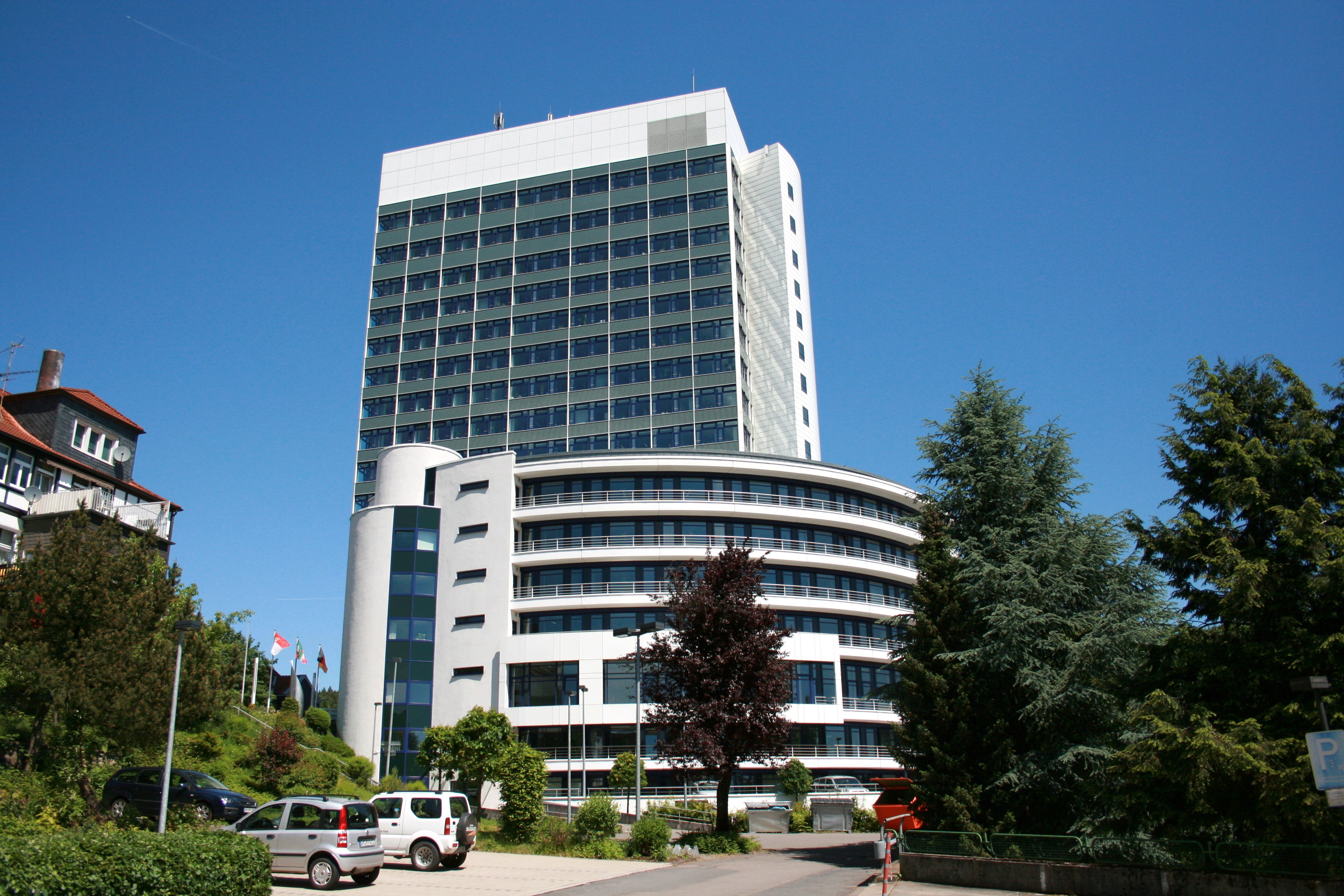
Marienheide is a municipality in the Oberbergischer Kreis, in North Rhine-Westphalia, Germany. Geography Marienheide is located about 50 km east of Cologne. Neighbouring places The neighbouring towns are Gummersbach and Wipperfürth as well as in Märkischer Kreis - Meinerzhagen and Kierspe, and the neighbouring municipalities are Engelskirchen and Lindlar. Division of the municipality History The first documentary mention of the place was in 1417 " in a sales document is called Heydenreich of our dear Mrs. Knecht on the Mergenheyde " (Documentary first namings of oberbergischer places v. Klaus Pampus). The manner of writing of the first naming was: Mergenheyde. On the altar lights of the old pilgrimage church a signed coat of arms of 1601 which carries the name "Mergenheyd" is to be seen. An old brochure of the Catholic vicarage Marienheide states: " The origin of the mercy place Marienheide dates back to 1420 and to one particular man. " This person, a simple man call ... [...More Info...] [...Related Items...] OR: [Wikipedia] [Google] [Baidu] |
Hagen–Dieringhausen Railway
The Hagen–Dieringhausen railway (also called the ''Volmetalbahn'': Volme Valley Railway) is a mostly single-track (continuously double track as far as Lüdenscheid-Brügge) and non-electrified railway line from Hagen Hauptbahnhof via Lüdenscheid-Brügge, Meinerzhagen and Gummersbach to Gummersbach-Dieringhausen in the German state of North Rhine-Westphalia. The ''Volmetalbahn'' is also the name of the trains running on this line as Regionalbahn service RB 52, from Lüdenscheid via Hagen to Dortmund. The RB 25 (Oberbergische Bahn) service runs from Lüdenscheid via Lüdenscheid-Brügge and Marienheide to Cologne on the line. The railway and the Regionalbahn service are both named after the Volme river, which they both follow for most of their route. History The route was studied in the 1840s as an alternative to the route of the Ruhr–Sieg railway. In May 1870, the Bergisch-Märkische Railway Company (''Bergisch-Märkischen Eisenbahn-Gesellschaft'', BME) began constru ... [...More Info...] [...Related Items...] OR: [Wikipedia] [Google] [Baidu] |
Oberbergischer Kreis
The Oberbergischer Kreis ( ksh, Boverbärjische Kreiß) is a ''Kreis'' (district) in the state of North Rhine-Westphalia, Germany. Neighboring districts are Ennepe-Ruhr, Märkischer Kreis, Olpe, Altenkirchen, Rhein-Sieg, Rheinisch-Bergischer Kreis, and the urban districts Remscheid and Wuppertal. Name The district was named after the region known as ''Bergisches Land'', which belonged to the County of Berg for most of the medieval era. What is called "Oberbergisch" ("upper Bergian") lies in the southeast of that earldom. By 1740, descriptions of the area distinguished between "Niederbergisch", which was north of the river Wupper, and "Oberbergisch" to its south. In 1816, after the entire Rhineland was annexed to Prussia, the districts of Waldbröl, Homburg, Gimborn, Wipperfürth, and Lennep were created within the area now covered by the district. In 1825 the districts Gimborn and Homburg were merged into the district Gummersbach. In 1932 it was merged with the district of Waldbr ... [...More Info...] [...Related Items...] OR: [Wikipedia] [Google] [Baidu] |
Sovereignty
Sovereignty is the defining authority within individual consciousness, social construct, or territory. Sovereignty entails hierarchy within the state, as well as external autonomy for states. In any state, sovereignty is assigned to the person, body, or institution that has the ultimate authority over other people in order to establish a law or change an existing law. In political theory, sovereignty is a substantive term designating supreme legitimate authority over some polity. In international law, sovereignty is the exercise of power by a state. ''De jure'' sovereignty refers to the legal right to do so; ''de facto'' sovereignty refers to the factual ability to do so. This can become an issue of special concern upon the failure of the usual expectation that ''de jure'' and ''de facto'' sovereignty exist at the place and time of concern, and reside within the same organization. Etymology The term arises from the unattested Vulgar Latin's ''*superanus'', (itself derived ... [...More Info...] [...Related Items...] OR: [Wikipedia] [Google] [Baidu] |
Lennep
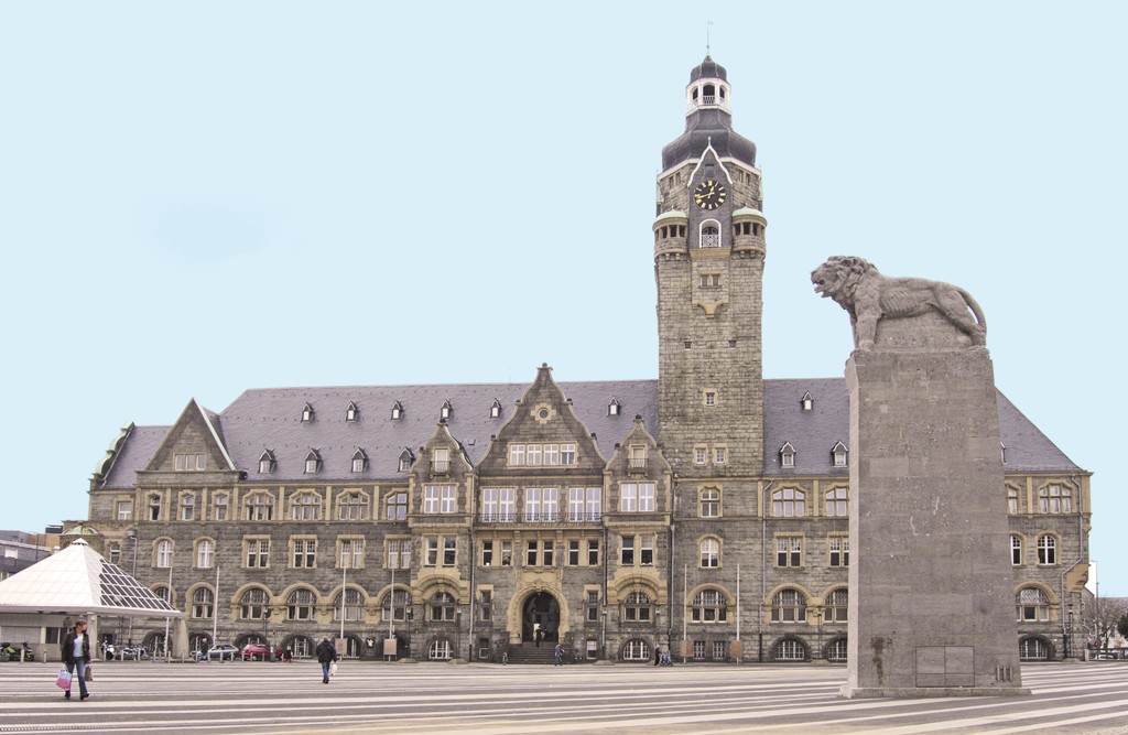
Remscheid () is a city in North Rhine-Westphalia, Germany. It is, after Wuppertal and Solingen, the third-largest municipality in Bergisches Land, being located on the northern edge of the region, on the south side of the Ruhr area. Remscheid had around 109,000 inhabitants in 2015. At the end of 2019 it had 113,703 inhabitants. Geography Remscheid comprises four boroughs, ''Alt-Remscheid'', ''Remscheid-Süd'', ''Lennep'', and Lüttringhausen. Its highest point is the Brodtberg (378 m). History Remscheid was founded in the 12th century, but remained a small village until the 19th century. Early spellings for the city included ''Remissgeid'' (1217), ''Rymscheyd'' (1351), ''Reymscheyd'' (1487) and ''Rembscheid'' (1639). The economic growth of the entire Rhine-Ruhr region led to an increase of the population of Remscheid. Mechanical engineering and toolmaking were the main industries practised within the town. This is carried on today with the Hazet tool company which has two fact ... [...More Info...] [...Related Items...] OR: [Wikipedia] [Google] [Baidu] |
Remscheid
Remscheid () is a List of cities and towns in Germany, city in North Rhine-Westphalia, Germany. It is, after Wuppertal and Solingen, the third-largest municipality in Bergisches Land, being located on the northern edge of the region, on the south side of the Ruhr area. Remscheid had around 109,000 inhabitants in 2015. At the end of 2019 it had 113,703 inhabitants. Geography Remscheid comprises four boroughs, ''Alt-Remscheid'', ''Remscheid-Süd'', ''Lennep'', and Lüttringhausen. Its highest point is the Brodtberg (378 m). History Remscheid was founded in the 12th century, but remained a small village until the 19th century. Early spellings for the city included ''Remissgeid'' (1217), ''Rymscheyd'' (1351), ''Reymscheyd'' (1487) and ''Rembscheid'' (1639). The economic growth of the entire Rhine-Ruhr region led to an increase of the population of Remscheid. Mechanical engineering and toolmaking were the main industries practised within the town. This is carried on today with the H ... [...More Info...] [...Related Items...] OR: [Wikipedia] [Google] [Baidu] |
Olpe, Germany
Olpe is a town situated in the foothills of the Ebbegebirge in North Rhine-Westphalia, roughly 60 km east of Cologne and 20 km northwest of Siegen. It is part of the ''Regierungsbezirk'' of Arnsberg and is the seat of the district of Olpe. Geography Location Olpe lies in the Sauerland on the southern edge of the Ebbegebirge Nature Park. In the town's north lies South Westphalia's biggest reservoir, the Biggesee. Rivers and mountains The highest mountains are: * Engelsberg (589 m) * Rother Stein (583 m) * Feld-Berg (556 m) * Hohe Rhonard (526 m) The inner town is ringed by the following hills: * Imberg * Hatzenberg * Gallenberg * Lindenhardt * Eichhardt * Kimicker Berg * Bratzkopf * Kreuzberg The municipal area also has a few rivers or brooks that all empty into the Biggesee: * Bigge, fed by: * Olpe, itself fed by: * Günse * Felmicke (underground), * Kortemicke (underground), * Ahe Other rivers in the municipal area: * Brachtpe * Neger The Veischedebach do ... [...More Info...] [...Related Items...] OR: [Wikipedia] [Google] [Baidu] |
Gießen
Giessen, spelled Gießen in German (), is a town in the German state (''Bundesland'') of Hesse, capital of both the district of Giessen and the administrative region of Giessen. The population is approximately 90,000, with roughly 37,000 university students. The name comes from ''Giezzen'', as it was first referred to in 1197, which refers to the position of the town between several rivers, lakes and streams. The largest river in Giessen is the Lahn, which divides the town in two parts (west and east), roughly north of Frankfurt am Main. Giessen is also home to the University of Giessen. In 1969, the town hosted the ninth ''Hessentag'' state festival. History Giessen came into being as a moated castle in 1152 built by Count Wilhelm von Gleiberg, although the history of the community in the northeast and in today's suburb called "Wieseck" dates back to 775. The town became part of Hesse-Marburg in 1567, passing to Hesse-Darmstadt in 1604. The University of Giessen was founded i ... [...More Info...] [...Related Items...] OR: [Wikipedia] [Google] [Baidu] |
Dortmund
Dortmund (; Westphalian nds, Düörpm ; la, Tremonia) is the third-largest city in North Rhine-Westphalia after Cologne and Düsseldorf, and the eighth-largest city of Germany, with a population of 588,250 inhabitants as of 2021. It is the largest city (by area and population) of the Ruhr, Germany's largest urban area with some 5.1 million inhabitants, as well as the largest city of Westphalia. On the Emscher and Ruhr rivers (tributaries of the Rhine), it lies in the Rhine-Ruhr Metropolitan Region and is considered the administrative, commercial, and cultural center of the eastern Ruhr. Dortmund is the second-largest city in the Low German dialect area after Hamburg. Founded around 882,Wikimedia Commons: First documentary reference to Dortmund-Bövinghausen from 882, contribution-list of the Werden Abbey (near Essen), North-Rhine-Westphalia, Germany Dortmund became an Imperial Free City. Throughout the 13th to 14th centuries, it was the "chief city" of the Rhine, Westphali ... [...More Info...] [...Related Items...] OR: [Wikipedia] [Google] [Baidu] |
Sauerland
The Sauerland () is a rural, hilly area spreading across most of the south-eastern part of North Rhine-Westphalia, in parts heavily forested and, apart from the major valleys, sparsely inhabited. The Sauerland is the largest tourist region in North Rhine-Westphalia, in particular for mountain biking and cycling, water sports and scenic recreation. The town and Skiliftkarussell Winterberg, Skiliftkarussell of Winterberg in the Hochsauerlandkreis is a major winter sport resort. Etymology The name ''Sauerland'' is first mentioned as ''Suderland'' in an official document from 1266. After 1400 the letter 'd' started to disappear. Therefore, Sauerland = ''southern country'' is the most convincing meaning, opposed to the theory that Sauer is from the German language, German word ''sauer'' meaning ''sour'' (poor "sour" soil). Linguistically, "suder-“ is similar to the Old Saxon ''sûðar'' (southbound). History Before 1800 the western part of the Sauerland was part of the Mark (c ... [...More Info...] [...Related Items...] OR: [Wikipedia] [Google] [Baidu] |
Bundesautobahn 45
is an autobahn in Germany, connecting Dortmund in the west with Aschaffenburg in the southwest. It is colloquially known as the ''Sauerlandlinie'' (Sauerland line) as it runs through the hilly, rural Sauerland region between Hagen and Siegen. The A45 has many bridges to cross valleys, the highest of which is the Sichter Valley bridge (''Talbrücke Sichter'') between Lüdenscheid and Meinerzhagen at 530 metres above mean sea level. It is mostly two lanes each way with frequent climbing lanes between Dortmund-Hafen and the Gambacher Kreuz intersection. In March 2013 30 people were injured in a pile-up on the A45. History During the 1960s and 1970s a southward extension was proposed as the „Odenwald-Neckar-Alb-Autobahn“ (ONAA), to pass through Groß-Umstadt, Michelstadt, Schwaigern, Neckarwestheim, Mundelsheim, Berglen, Remshalden, Lichtenwald and Schlierbach, linking the ONAA to the A 8 near Kirchheim unter Teck, however the project was abandoned for ecological ... [...More Info...] [...Related Items...] OR: [Wikipedia] [Google] [Baidu] |
Autobahn
The (; German plural ) is the federal controlled-access highway system in Germany. The official German term is (abbreviated ''BAB''), which translates as 'federal motorway'. The literal meaning of the word is 'Federal Auto(mobile) Track'. German are widely known for having no federally mandated general speed limit for some classes of vehicles. However, limits are posted and enforced in areas that are urbanised, substandard, accident-prone, or under construction. On speed-unrestricted stretches, an advisory speed limit () of applies. While driving faster is not illegal as such in the absence of a speed limit, it can cause an increased liability in the case of a collision (which mandatory auto insurance has to cover); courts have ruled that an "ideal driver" who is exempt from absolute liability for "inevitable" tort under the law would not exceed . A 2017 report by the Federal Road Research Institute reported that in 2015, 70.4% of the Autobahn network had only the advis ... [...More Info...] [...Related Items...] OR: [Wikipedia] [Google] [Baidu] |
.jpg)


