|
Hoher Stein (Fichtelgebirge)
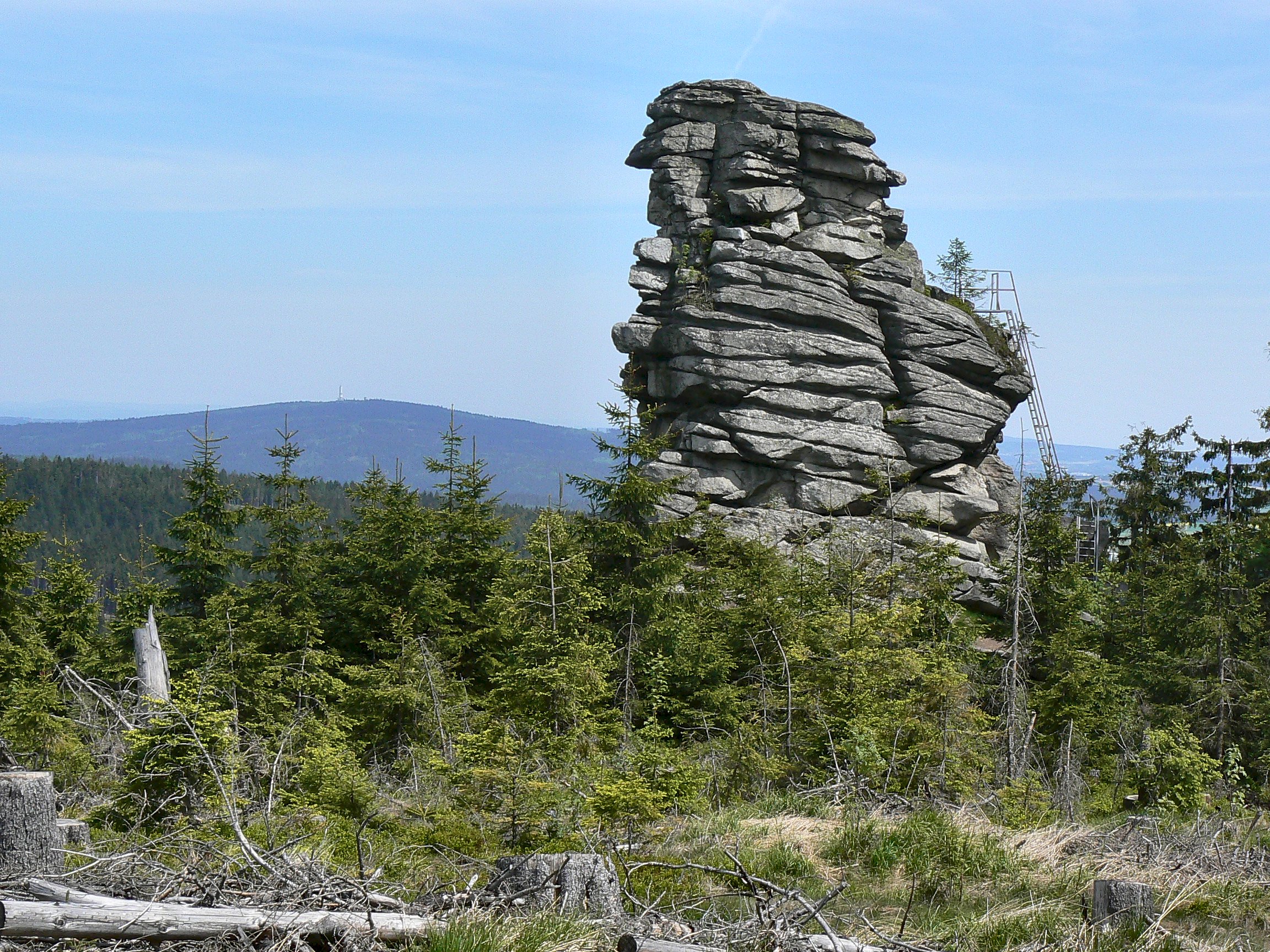
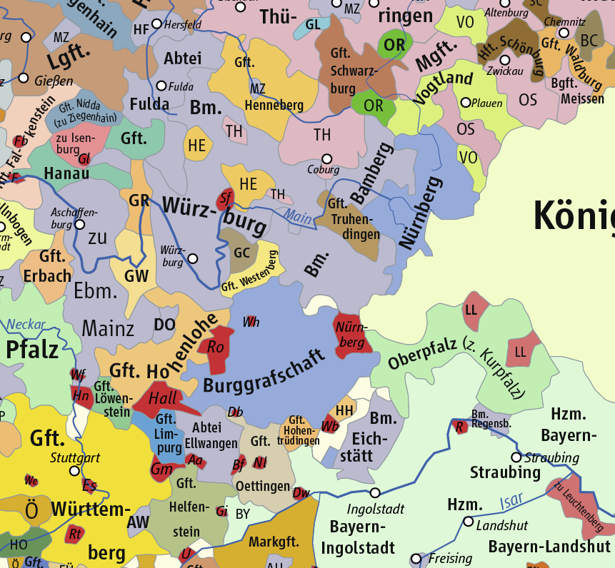
The Hoher Stein is a rock formation at the northeastern foot of the Bergkopf mountain, part of the Waldstein ridge in Germany's Fichtel Mountains. Appearance and location The Hoher Stein rocks are about 25 metres high, their highest point having an elevation of . They are granite rocks exhibiting spheroidal weathering. Iron ladders climb the rocks to a viewing point. The rocks are officially designated as climbing rocks. The Hoher Stein lies west of the town of Kirchenlamitz and northeast of the Großer Waldstein mountain in the forest district of '' Hallersteiner Forst Süd''. Although the Hoher Stein is not far from another rock formation, the Kleiner Waldstein, they are only linked by circuitous routes. Sights in the vicinity are the source of the Lamitz and the Epprechtstein. History as a boundary stone Today the rocks lie on the border between the Upper Franconian counties of Wunsiedel im Fichtelgebirge and Hof. In former times the political boundary between the ... [...More Info...] [...Related Items...] OR: [Wikipedia] [Google] [Baidu] |
Hoher Stein
Hoher Stein may refer to: * Hoher Stein (Fichtel Mountains), a rock formation in Bavaria, Germany *Hoher Stein, a monument in Osterheide Osterheide is an unincorporated area in the district of Heidekreis, in Lower Saxony, Germany. The area has 2,463 inhabitants (as at 31 December 2020). Its administrative seat is the village of Oerbke; other villages are Ostenholz and Wense. The ..., Saxony, Germany * Vysoký kámen (german: Hoher Stein, link=no), a hill in the Czech Republic {{geodis ... [...More Info...] [...Related Items...] OR: [Wikipedia] [Google] [Baidu] |
Lamitz
Lamitz is a river of Bavaria, Germany, whose source lies on the slopes of the Bergkopf mountain. It flows into the Saale The Saale (), also known as the Saxon Saale (german: Sächsische Saale) and Thuringian Saale (german: Thüringische Saale), is a river in Germany and a left-bank tributary of the Elbe. It is not to be confused with the smaller Fränkische Saale, ... in Fattigau. See also * List of rivers of Bavaria References Rivers of Bavaria Rivers of Germany {{Bavaria-river-stub ... [...More Info...] [...Related Items...] OR: [Wikipedia] [Google] [Baidu] |
Fichtelgebirge Club
The Fichtelgebirge Club (german: Fichtelgebirgsverein or ''FGV'') is a large walking club and local heritage society in Bavaria and recognised conservation group with 20,000 members in 55 local groups. As the name says, its main sphere of activity is in the Fichtelgebirge mountains in north Bavaria. Its emblem is the Arctic starflower (the ''Siebenstern''). Address Headquarters: Theresienstraße 2, 95632 Wunsiedel in the Haus des Fichtelgebirgsvereins (near the Marktplatz/Rathaus); Expertise and service centre for hiking, paths, conservation, culture and local history; regional specialist library.; FGV Shop; conference and exhibition rooms. Club aims The aims of the club are the fostering of hiking, training of hiking guides, marking of footpaths, construction and maintenance of rock climbing facilities, observation towers and accommodation facilities, conservation work and support, landscape conservation, support of local culture, monument protection, running the Fichtelgebirge ... [...More Info...] [...Related Items...] OR: [Wikipedia] [Google] [Baidu] |
Hohenzollern
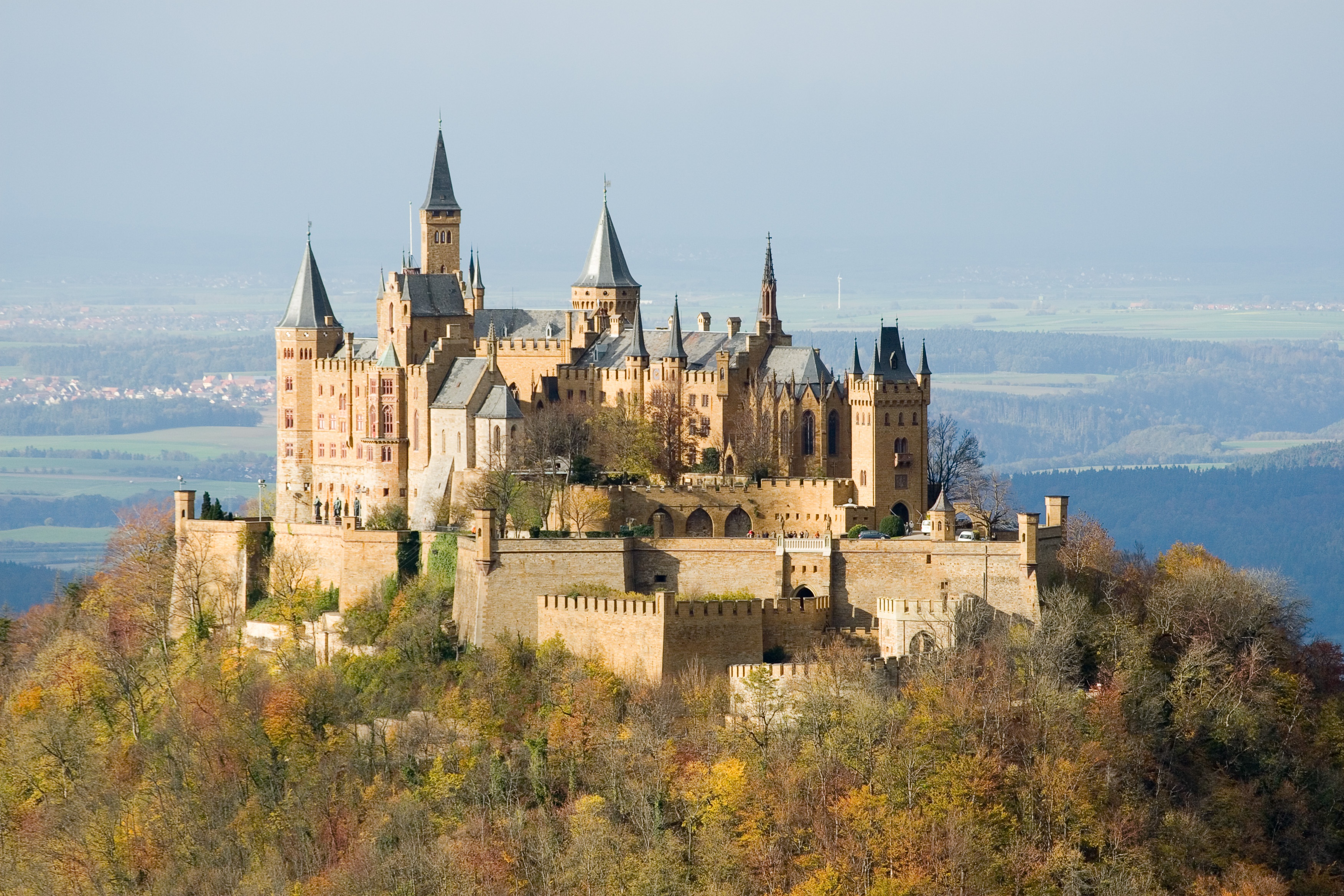
The House of Hohenzollern (, also , german: Haus Hohenzollern, , ro, Casa de Hohenzollern) is a German royal (and from 1871 to 1918, imperial) dynasty whose members were variously princes, electors, kings and emperors of Hohenzollern, Brandenburg, Prussia, the German Empire, and Romania. The family came from the area around the town of Hechingen in Swabia during the late 11th century and took their name from Hohenzollern Castle. The first ancestors of the Hohenzollerns were mentioned in 1061. The Hohenzollern family split into two branches, the Catholic Swabian branch and the Protestant Franconian branch,''Genealogisches Handbuch des Adels, Fürstliche Häuser'' XIX. "Haus Hohenzollern". C.A. Starke Verlag, 2011, pp. 30–33. . which ruled the Burgraviate of Nuremberg and later became the Brandenburg-Prussian branch. The Swabian branch ruled the principalities of Hohenzollern-Hechingen and Hohenzollern-Sigmaringen until 1849, and also ruled Romania from 1866 to 1947. Members ... [...More Info...] [...Related Items...] OR: [Wikipedia] [Google] [Baidu] |
Bishopric Of Regensburg
The Prince-Bishopric of Regensburg (german: link=no, Fürstbistum Regensburg; Hochstift Regensburg) was a small ecclesiastical principality of the Holy Roman Empire located near the Free Imperial City of Regensburg in Bavaria. It was elevated to the Archbishopric of Regensburg in 1803 after the dissolution of the Archbishopric of Mainz. The Prince-Bishopric of Regensburg must not be confused with the Roman Catholic Diocese of Regensburg, which was considerably larger. History The diocese was founded in 739 by Saint Boniface; it was originally subordinate to the archbishop of Salzburg. In the 13th century, the bishop of Regensburg became a prince of the Holy Roman Empire with a seat and vote at the Imperial Diet. As an enclave of the Duchy of Bavaria, the prince-bishopric was not able to expand territorially and remained one of the smallest of the Empire. In the course of the German mediatization of 1803, the prince-bishopric was united with the Free Imperial city of ... [...More Info...] [...Related Items...] OR: [Wikipedia] [Google] [Baidu] |
Prince-Bishopric Of Bamberg
The Prince-Bishopric of Bamberg (german: Hochstift Bamberg) was an ecclesiastical State of the Holy Roman Empire. It goes back to the Roman Catholic Diocese of Bamberg established at the 1007 synod in Frankfurt, at the behest of King Henry II to further expand the spread of Christianity in the Franconian lands. The bishops obtained the status of Imperial immediacy about 1245 and ruled their estates as Prince-bishops until they were subsumed to the Electorate of Bavaria in the course of the German Mediatisation in 1802. State The Bishops of Bamberg received the princely title by Emperor Frederick II of Hohenstaufen before his deposition by Pope Innocent IV in 1245, whereby the diocese became an Imperial state, covering large parts of the current Bavarian region of Franconia ("Main Franconia"). Part of the Franconian Circle (territories grouped together within the Holy Roman Empire for defensive purposes) from 1500 onwards, the Bamberg territory was bordered, among others, ... [...More Info...] [...Related Items...] OR: [Wikipedia] [Google] [Baidu] |
Principality Of Bayreuth
The Principality of Bayreuth (german: Fürstentum Bayreuth) or Margraviate of Brandenburg-Bayreuth (''Markgraftum Brandenburg-Bayreuth'') was an immediate territory of the Holy Roman Empire, ruled by a Franconian branch of the Hohenzollern dynasty. Since Burgrave Frederick VI of Nuremberg was enfeoffed with the Margraviate of Brandenburg in 1415/17, the Hohenzollern princes transferred the margravial title to their Franconian possessions, though the principality never had been a march. Until 1604 they used Plassenburg Castle in Kulmbach as their residence, hence their territory was officially called the Principality of Kulmbach or Margraviate of Brandenburg-Kulmbach until the Empire's dissolution in 1806. Geography The Kulmbach-Bayreuth principality arose from the northern uplands (''Oberland'') of the former Burgraviate of Nuremberg, while the southern lowlands (''Unterland'') formed the Principality of Ansbach. The final border demarcation was settled by the 1541 House Tr ... [...More Info...] [...Related Items...] OR: [Wikipedia] [Google] [Baidu] |
Landkreis Hof
Hof () is a ''Landkreis'' (district) in Bavaria, Germany. It is bounded by (from the south and clockwise) the districts of Wunsiedel, Bayreuth, Kulmbach and Kronach, the states of Thuringia (district of Saale-Orla) and Saxony (district of Vogtlandkreis), and the Czech Republic. The city of Hof is an enclave within the district, as well as being the district's administrative seat. History Following a short regency by Kingdom of Prussia (1791–1810) the region fell to Bavaria in 1810. The district was established in 1852. In the Bavarian communal reforms of 1972 it was merged with parts of the dissolved districts Naila, Münchberg, Kronach and Rehau. Geography The Saxon Saale river originates in the south of the district, on the slopes of the Fichtelgebirge. From here it runs northwards, its valley separating the Fichtelgebirge in the east and the lower Frankenwald View to Döbraberg The Franconian Forest [...More Info...] [...Related Items...] OR: [Wikipedia] [Google] [Baidu] |
Landkreis Wunsiedel Im Fichtelgebirge
Wunsiedel (german: Landkreis Wunsiedel i. Fichtelgebirge) is a ''Landkreis'' (district) in the northeastern part of Bavaria, Germany. Neighbouring districts are (from the south clockwise) Tirschenreuth, Bayreuth, Hof, and to the east the Czech Karlovy Vary Region. Geography The district is located in the mountains of the ''Fichtelgebirge'', with the highest elevation the 1051 m high Schneeberg. The river Ohře (german: Eger) originates in the district. History In the Bavarian communal reforms of 1972 the district was merged with the previously district-free cities Marktredwitz and Selb Selb is a town in the district of Wunsiedel, in Upper Franconia, Bavaria, Germany. It is situated in the Fichtelgebirge, on the border with the Czech Republic, 20 km northwest of Cheb and 23 km southeast of Hof. Selb is well known fo ..., as well as parts of the dissolved district of Rehau. Coat of arms The coat of arms shows an eagle in the bottom left as the symbol of the city ... [...More Info...] [...Related Items...] OR: [Wikipedia] [Google] [Baidu] |
Upper Franconia
Upper Franconia (german: Oberfranken) is a ''Regierungsbezirk'' (administrative 'Regierungs''region 'bezirk'' of the state of Bavaria, southern Germany. It forms part of the historically significant region of Franconia, the others being Middle Franconia and Lower Franconia, which are all now part of the German Federal State of Bayern (''Bavaria''). With more than 200 independent breweries which brew approximately 1000 different types of beer, Upper Franconia has the world's highest brewery-density per capita. A special Franconian beer route (''Fränkische Brauereistraße'') runs through many popular breweries. Geography The administrative region borders on Thuringia (''Thüringen'') to the north, Lower Franconia (''Unterfranken'') to the west, Middle Franconia (''Mittelfranken'') to the south-west, and Upper Palatinate (''Oberpfalz'') to the south-east, Saxony (''Sachsen'') to the north-east and the Czech Republic to the east. History After the founding of the Kingdom of Bava ... [...More Info...] [...Related Items...] OR: [Wikipedia] [Google] [Baidu] |
Epprechtstein
The Epprechtstein is a mountain in the northern Fichtel Mountains in northeast Bavaria, Germany, . It is mineralogically the most interesting mountain in the entire Fichtel range. Around the summit there are about 20 quarries, in three of which Epprechtstein granite is quarried. The others are closed and partially overgrown. Climb The mountain may be climbed from Buchhaus to the north on one of the Fichtelgebirge Club's main hiking trails. Ruins of Epprechtstein Castle On the treeless summit on a long, steep-sided, granite slab stands the ruined castle of Epprechtstein. This is the old tower-like main residence on which a staircase has been built leading to an observation platform. From here there is a panoramic view of the Waldstein ridge, the Großer Kornberg, to Schwarzenbach an der Saale and Oberkotzau as far as Hof, and south to the inner Fichtel Mountains and Kösseine. Two hundred and fifty metres southeast is a service hut belonging to the Kirchenlamitz Mountain Res ... [...More Info...] [...Related Items...] OR: [Wikipedia] [Google] [Baidu] |


