|
Hohensyburg Syburg
The Syberg is a hill in the Ruhr in the southern part of Dortmund, 240 m above Normalnull, sea level (NN), which is part of the Ardey Hills. The Syberg is home to the Sigiburg, the Vincke Tower, a monument to William I, German Emperor, Emperor William I and other points of interest. The family name of the House of Syberg is derived from the Syberg. Geology, mining, nature reserve The Syberg is part of the Ardey Hills, and was formed of sandstone and slate of the Namurian, a stratigraphic unit of the Carboniferous. The sandstone (''Ruhrsandstein'') is of high resistance, and was widely used as building material in the region; some quarry, quarries are yet visible in the area. The slopes of the Ruhr (river), Ruhr and its tributaries were the first locations of coal mining in the Ruhr region. The first documents of coal mining in the Syberg date from 1580. Regular mining ended at the end of the 19th century, but during the Occupation of the Ruhr in 1923 and in the crisis after Wor ... [...More Info...] [...Related Items...] OR: [Wikipedia] [Google] [Baidu] |
Ardey Hills
The Ardey Hills (german: Ardeygebirge or ''Ardey'') are a range of wooded hills, up to , in the territory of the city of Dortmund and the districts of Ennepe-Ruhr-Kreis and Unna in the German state of North Rhine-Westphalia. The hills form part of the eastern Rhenish Massif and, to a lesser extent, to the Berg-Mark Hills (''Bergisch-Märkisches Hügelland''). Geography Location The Ardey Hills, together with the Haarstrang, run from east to west, separating two major natural units: the Westphalian Lowland including the Emscher Depression and Hellwegbörde in the north from the Süder Uplands and lower Sauerland in the south, the Ardey being counted as part of the Süder Uplands and the Haarstrang the Westphalian Lowland. From a topographical perspective, the Ardey Hills are the western foothills of the sparsely wooded and mainly agricultural Haarstrang. However it is different, not only from a cultural landscape point of view, but also geologically (a decisive fac ... [...More Info...] [...Related Items...] OR: [Wikipedia] [Google] [Baidu] |
Pinge
A ''Pinge'' (pronounced "pinger", plural: ''Pingen'') or ''Binge'' ("binger") is the name given in German-speaking Europe to a wedge-, ditch- or funnel-shaped depression in the terrain caused by mining activity. This depression or sink-hole is frequently caused by the collapse of old underground mine workings that are close to the Earth's surface. Unlike natural landforms, a ''Pinge'' is a direct result of human activity. The term has no direct equivalent in English, but may be translated as "mining sink-hole", "mine slump" or, in some cases, as "glory hole". Origin of the word In the original sense of the word, the mining terms ''Pinge'' or ''Binge'' go back to the activity known as ''pingen'' which meant something like "prospecting". An ''aufgepingter'' lode was one near the surface of the ground. The ''Pinge'' was therefore like a primitive, open pit mine. Subsequently, the term was transferred to the funnel-shaped depressions that formed at the surface above filled or co ... [...More Info...] [...Related Items...] OR: [Wikipedia] [Google] [Baidu] |
Hillfort
A hillfort is a type of earthwork used as a fortified refuge or defended settlement, located to exploit a rise in elevation for defensive advantage. They are typically European and of the Bronze Age or Iron Age. Some were used in the post- Roman period. The fortification usually follows the contours of a hill and consists of one or more lines of earthworks, with stockades or defensive walls, and external ditches. Hillforts developed in the Late Bronze and Early Iron Age, roughly the start of the first millennium BC, and were used in many Celtic areas of central and western Europe until the Roman conquest. Nomenclature The spellings "hill fort", "hill-fort" and "hillfort" are all used in the archaeological literature. The ''Monument Type Thesaurus'' published by the Forum on Information Standards in Heritage lists ''hillfort'' as the preferred term. They all refer to an elevated site with one or more ramparts made of earth, stone and/or wood, with an external ditch ... [...More Info...] [...Related Items...] OR: [Wikipedia] [Google] [Baidu] |
Charlemagne
Charlemagne ( , ) or Charles the Great ( la, Carolus Magnus; german: Karl der Große; 2 April 747 – 28 January 814), a member of the Carolingian dynasty, was King of the Franks from 768, King of the Lombards from 774, and the first Emperor of the Romans from 800. Charlemagne succeeded in uniting the majority of western and central Europe and was the first recognized emperor to rule from western Europe after the fall of the Western Roman Empire around three centuries earlier. The expanded Frankish state that Charlemagne founded was the Carolingian Empire. He was canonized by Antipope Paschal III—an act later treated as invalid—and he is now regarded by some as beatified (which is a step on the path to sainthood) in the Catholic Church. Charlemagne was the eldest son of Pepin the Short and Bertrada of Laon. He was born before their canonical marriage. He became king of the Franks in 768 following his father's death, and was initially co-ruler with his brother ... [...More Info...] [...Related Items...] OR: [Wikipedia] [Google] [Baidu] |
Saxon Wars
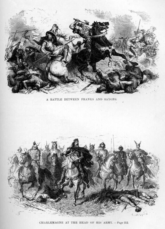
The Saxon Wars were the campaigns and insurrections of the thirty-three years from 772, when Charlemagne first entered Saxony with the intent to conquer, to 804, when the last rebellion of tribesmen was defeated. In all, 18 campaigns were fought, primarily in what is now northern Germany. They resulted in the incorporation of Saxony into the Frankish realm and their forcible conversion from Germanic paganism to Christianity. The Saxons were divided into four subgroups in four regions. Nearest to the ancient Frankish kingdom of Austrasia was Westphalia, and farthest was Eastphalia. In between the two kingdoms was that of Engria (or Engern), and north of the three, at the base of the Jutland peninsula, was Nordalbingia. Despite repeated setbacks, the Saxons resisted steadfastly, returning to raid Charlemagne's domains as soon as he turned his attention elsewhere. Their main leader, Widukind, was a resilient and resourceful opponent, but eventually was defeated and baptized (in ... [...More Info...] [...Related Items...] OR: [Wikipedia] [Google] [Baidu] |
Dortmund Syburg Wilhelmdenkmal Pano Wp
Dortmund (; Westphalian nds, Düörpm ; la, Tremonia) is the third-largest city in North Rhine-Westphalia after Cologne and Düsseldorf, and the eighth-largest city of Germany, with a population of 588,250 inhabitants as of 2021. It is the largest city (by area and population) of the Ruhr, Germany's largest urban area with some 5.1 million inhabitants, as well as the largest city of Westphalia. On the Emscher and Ruhr rivers (tributaries of the Rhine), it lies in the Rhine-Ruhr Metropolitan Region and is considered the administrative, commercial, and cultural center of the eastern Ruhr. Dortmund is the second-largest city in the Low German dialect area after Hamburg. Founded around 882,Wikimedia Commons: First documentary reference to Dortmund-Bövinghausen from 882, contribution-list of the Werden Abbey (near Essen), North-Rhine-Westphalia, Germany Dortmund became an Imperial Free City. Throughout the 13th to 14th centuries, it was the "chief city" of the Rhine, Westphalia ... [...More Info...] [...Related Items...] OR: [Wikipedia] [Google] [Baidu] |
Hohensyburg - Gesamtanlage 2
The Syberg is a hill in the Ruhr in the southern part of Dortmund, 240 m above sea level (NN), which is part of the Ardey Hills. The Syberg is home to the Sigiburg, the Vincke Tower, a monument to Emperor William I and other points of interest. The family name of the House of Syberg is derived from the Syberg. Geology, mining, nature reserve The Syberg is part of the Ardey Hills, and was formed of sandstone and slate of the Namurian, a stratigraphic unit of the Carboniferous. The sandstone (''Ruhrsandstein'') is of high resistance, and was widely used as building material in the region; some quarries are yet visible in the area. The slopes of the Ruhr and its tributaries were the first locations of coal mining in the Ruhr region. The first documents of coal mining in the Syberg date from 1580. Regular mining ended at the end of the 19th century, but during the Occupation of the Ruhr in 1923 and in the crisis after World War II illegal mining took place. Adits and pinges are ... [...More Info...] [...Related Items...] OR: [Wikipedia] [Google] [Baidu] |
Common Wall Lizard
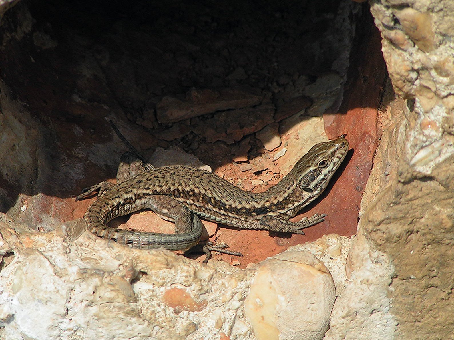
''Podarcis muralis'' (common wall lizard) is a species of lizard with a large distribution in Europe and well-established introduced populations in North America, where it is also called the European wall lizard. It can grow to about in total length. The animal has shown variation in the places it has been introduced to. Fossils have been found in a cave in Greece dating to the early part of the Holocene. Description The common wall lizard is a small, thin lizard whose small scales are highly variable in colour and pattern. Its coloration is generally brownish or greyish, and may occasionally be tinged with green. In some individuals, the row of spots along their backs may form a line, while others may have a reticulated pattern with dark spots on the side and scattered white spots that can be blue in the shoulder region. The tail is brown, grey or rust in colour, and may also have light bars on the sides. The belly region has six rows of larger rectangular scales that are ge ... [...More Info...] [...Related Items...] OR: [Wikipedia] [Google] [Baidu] |
Refugium (population Biology)
Refugium, plural refugia, the Latin for "refuge" or "hideaway", may refer to: * Refugium (fishkeeping), an appendage to a marine, brackish, or freshwater fish tank that shares the same water supply * Refugium (population biology), a location of an isolated or relict population of a once widespread animal or plant species ** Last Glacial Maximum refugia specifically, in anthropology * Refugium Range, a mountain range on Vancouver Island, British Columbia, Canada See also * Refuge (Buddhism) * Refugium Peccatorum {{disambiguation ... [...More Info...] [...Related Items...] OR: [Wikipedia] [Google] [Baidu] |


