|
Hody-Dobrovidka
Hody-Dobrovidka ( uk, Го́ди-Доброві́дка) is a village in Kolomyia Raion of Ivano-Frankivsk Oblast in Western Ukraine. The population of the village is around 967 inhabitants, and local government is administered by Hodo-Dobrovidska village council. It belongs to Piadyky rural hromada, one of the hromadas of Ukraine. Geography The village is in a flat terrain on the altitude of above sea level and area of the village totals is . It is at a distance from the district center Kolomyia and from the regional center of Ivano-Frankivsk. History and Attractions The village was established in 1939 from the two separate villages, Hody and Dobrovidka. The first written record about Dobrovidka dates back to 1451, and Gody village mentioned in 1857. The village has an architectural monument of local importance of Ivano-Frankivsk region. It is the Church of St. Dmitry 1923 (Wooden). The church belongs to the architectural monuments of local importance. There is also the ... [...More Info...] [...Related Items...] OR: [Wikipedia] [Google] [Baidu] |
Kolomyia Raion
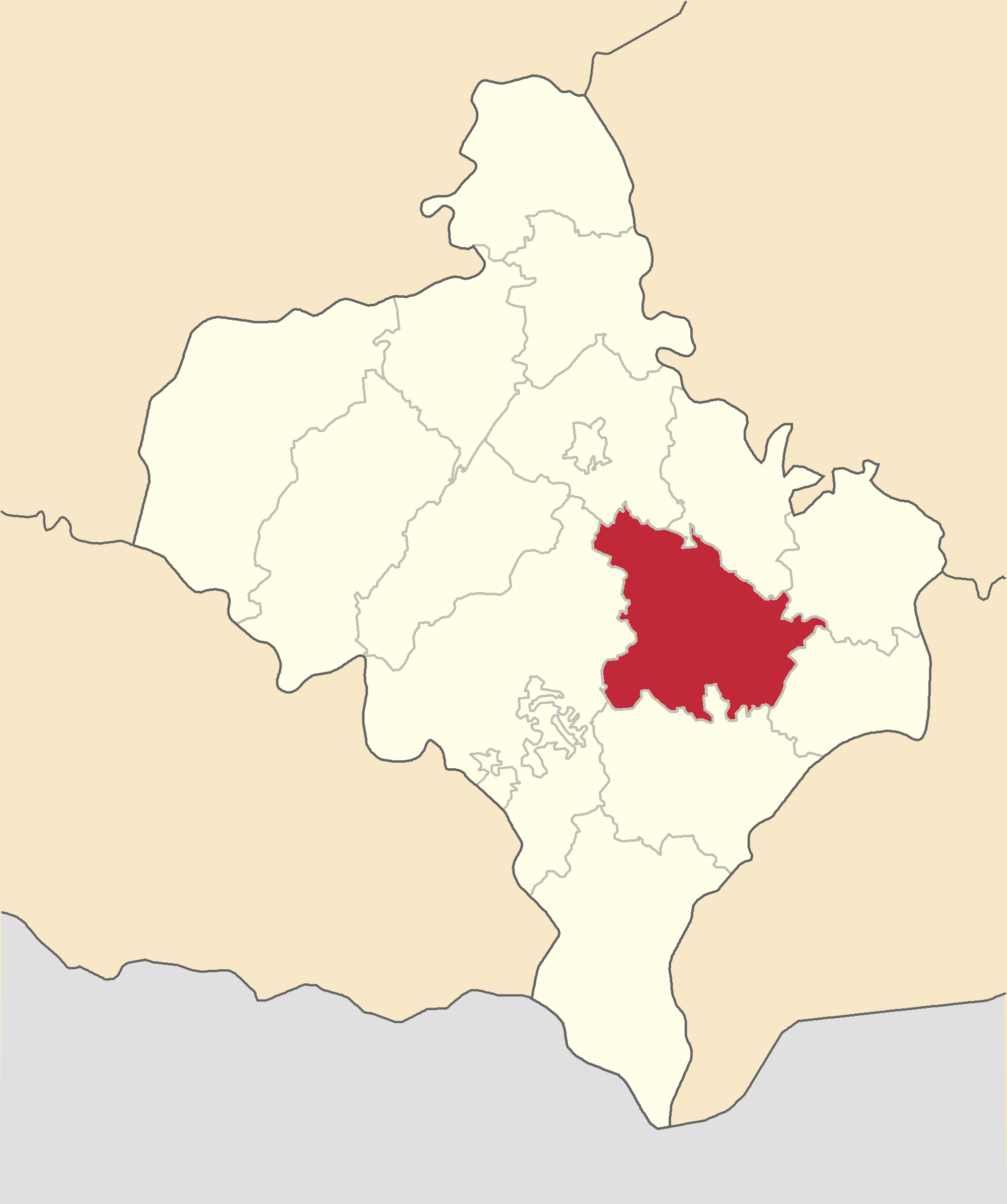
Kolomyia Raion ( uk, Коломи́йський райо́н, translit=Kołomyjśkyj rajon) is a Raions of Ukraine, raion (district) of Ivano-Frankivsk Oblast (Oblast, region). The administrative center of the raion is the city of Kolomyia. Population: . On 18 July 2020, as part of the administrative reform of Ukraine, the number of raions of Ivano-Frankivsk Oblast was reduced to six, and the area of Kolomyia Raion was significantly expanded. Two abolished raions, Horodenka Raion, Horodenka and Sniatyn Raions, as well as the city of Kolomyia, which was previously incorporated as a City of regional significance (Ukraine), city of oblast significance and did not belong to the raion, were merged into Kolomyia Raion. The January 2020 estimate of the raion population was Subdivisions Current After the reform in July 2020, the raion consisted of 13 hromadas: * Chernelytsia settlement hromada with the administration in the urban-type settlement of Chernelytsia, transferred from Horodenk ... [...More Info...] [...Related Items...] OR: [Wikipedia] [Google] [Baidu] |
Oblasts Of Ukraine
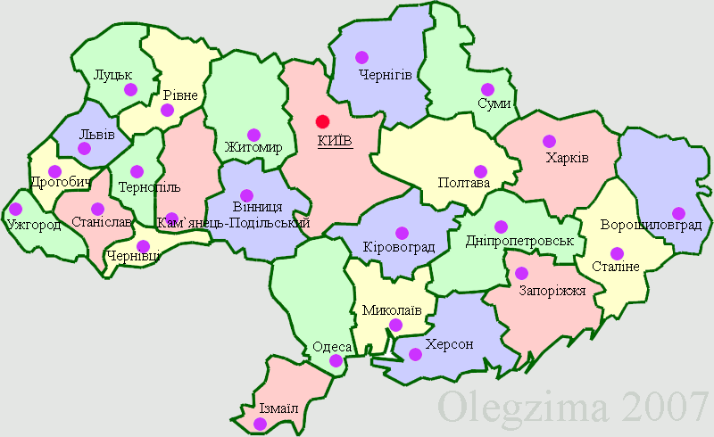
An oblast ( uk, о́бласть; ) in Ukraine, often called a region or province, is the main type of first-level administrative division of the country. Ukraine's territory is divided into 24 oblasts, as well as one autonomous republic, Crimea, and two cities with special status, Kyiv and Sevastopol. Ukraine is a unitary state, thus the oblasts do not have much legal scope of competence other than that which is established in the Ukrainian Constitution and by law. Articles 140–146 of Chapter XI of the constitution deal directly with local authorities and their competency. Oblasts are subdivided into raions (districts), each oblast having from 3 to 10 raions following the July 2020 reform. General characteristics In Ukraine, the term ''oblast'' denotes a primary administrative division. Under the Russian Empire and into the 1920s, Ukraine was divided between several governorates. The term ''oblast'' was introduced in 1932 by Soviet authorities when the Ukrainian SSR was ... [...More Info...] [...Related Items...] OR: [Wikipedia] [Google] [Baidu] |
Raions Of Ukraine
Raions of Ukraine (often translated as "districts"; Ukrainian: ра́йон, tr. ''raion''; plural: райо́ни, tr. ''raiony'') are the second level of administrative division in Ukraine, below the oblast. Raions were created in a 1922 administrative reform of the Soviet Union, to which Ukraine, as the Ukrainian Soviet Socialist Republic, belonged. On 17 July 2020, the Verkhovna Rada (Ukraine's parliament) approved an administrative reform to merge most of the 490 raions, along with the "cities of regional significance", which were previously outside the raions, into just 136 reformed raions. Most tasks of the raions (education, healthcare, sport facilities, culture, and social welfare) were taken over by new hromadas, the subdivisions of raions. [...More Info...] [...Related Items...] OR: [Wikipedia] [Google] [Baidu] |
Flag Of Kolomyisky Raion In Ivano-Frankivsk Oblast
A flag is a piece of fabric (most often rectangular or quadrilateral) with a distinctive design and colours. It is used as a symbol, a signalling device, or for decoration. The term ''flag'' is also used to refer to the graphic design employed, and flags have evolved into a general tool for rudimentary signalling and identification, especially in environments where communication is challenging (such as the maritime environment, where semaphore is used). Many flags fall into groups of similar designs called flag families. The study of flags is known as "vexillology" from the Latin , meaning "flag" or "banner". National flags are patriotic symbols with widely varied interpretations that often include strong military associations because of their original and ongoing use for that purpose. Flags are also used in messaging, advertising, or for decorative purposes. Some military units are called "flags" after their use of flags. A ''flag'' (Arabic: ) is equivalent to a brigade ... [...More Info...] [...Related Items...] OR: [Wikipedia] [Google] [Baidu] |
Postal Code
A postal code (also known locally in various English-speaking countries throughout the world as a postcode, post code, PIN or ZIP Code) is a series of letters or digits or both, sometimes including spaces or punctuation, included in a postal address for the purpose of sorting mail. the Universal Postal Union lists 160 countries which require the use of a postal code. Although postal codes are usually assigned to geographical areas, special codes are sometimes assigned to individual addresses or to institutions that receive large volumes of mail, such as government agencies and large commercial companies. One example is the French CEDEX system. Terms There are a number of synonyms for postal code; some are country-specific; * CAP: The standard term in Italy; CAP is an acronym for ''codice di avviamento postale'' (postal expedition code). * CEP: The standard term in Brazil; CEP is an acronym for ''código de endereçamento postal'' (postal addressing code). * Eircode: Th ... [...More Info...] [...Related Items...] OR: [Wikipedia] [Google] [Baidu] |
Telephone Numbering Plan
A telephone numbering plan is a type of numbering scheme used in telecommunication to assign telephone number A telephone number is a sequence of digits assigned to a landline telephone subscriber station connected to a telephone line or to a wireless electronic telephony device, such as a radio telephone or a mobile telephone, or to other devices f ...s to subscriber telephones or other telephony endpoints. Telephone numbers are the addresses of participants in a telephone network, reachable by a system of destination code routing. Telephone numbering plans are defined in each of the administrative regions of the public switched telephone network (PSTN) and in private telephone networks. For public numbering systems, geographic location typically plays a role in the sequence of numbers assigned to each telephone subscriber. Many numbering plan administrators subdivide their territory of service into geographic regions designated by a prefix, often called an area code or ... [...More Info...] [...Related Items...] OR: [Wikipedia] [Google] [Baidu] |
Ivano-Frankivsk Oblast
Ivano-Frankivsk Oblast ( uk, Іва́но-Франкі́вська о́бласть, translit=Ivano-Frankivska oblast), also referred to as Ivano-Frankivshchyna ( uk, Іва́но-Франкі́вщина), is an administrative divisions of Ukraine, oblast (region) in western Ukraine. Its administrative center is the city of Ivano-Frankivsk. As is the case with most other oblasts of Ukraine this region has the same name as its administrative center – which was renamed by the Ukrainian Soviet Socialist Republic, Soviet Ukrainian authorities after the Ukrainian writer Ivan Franko on 9 November 1962. It has a population of Ivano-Frankivsk Oblast is also known to Ukrainians by a deep-rooted alternative name: ''Prykarpattia'' (although some sources may also consider the southern Lviv Oblast including such cities as Stryi, Truskavets, and Drohobych, as also part of Prykarpattia). Prykarpattia, together with Lviv Oblast, Lviv and Ternopil Oblast, Ternopil regions, was the main body of ... [...More Info...] [...Related Items...] OR: [Wikipedia] [Google] [Baidu] |
Western Ukraine
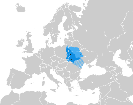
Western Ukraine or West Ukraine ( uk, Західна Україна, Zakhidna Ukraina or , ) is the territory of Ukraine linked to the former Kingdom of Galicia–Volhynia, which was part of the Polish–Lithuanian Commonwealth, the Austrian Empire, Austria-Hungary and the Second Polish Republic, and came fully under the control of the Soviet Union (via the Ukrainian Soviet Socialist Republic) only in 1939, following the Molotov–Ribbentrop Pact. There is no universally accepted definition of the territory's boundaries (see the map, right), but the contemporary Ukrainian administrative regions or Oblasts of Chernivtsi, Ivano-Frankovsk, Lviv, Ternopil and Transcarpathia (which were part of the former Austro-Hungarian Empire) are nearly always included and the Lutsk and Rivne Oblasts (parts of the annexed from Poland during its Third Partition) are usually included. It is less common to include the Khmelnytski and, especially, the Vinnytsia and Zhytomyr Oblasts in this c ... [...More Info...] [...Related Items...] OR: [Wikipedia] [Google] [Baidu] |
Piadyky Rural Hromada
Piadyky ( uk, П'ядики; pl, Piadyki) is a village in Kolomyia Raion, Ivano-Frankivsk Oblast, Ukraine. It is the administrative centre of Piadyky rural hromada. Its population is 3,567 (). History A burial mound in Piadyky dates back to the Bronze Age. It was first mentioned in writing in 1480, as a village under property of a landlord. The village's residents participated in the Khmelnytsky uprising, leading to a complaint by a local landlord to Władysław IV Vasa, King of Poland, over the damages. Piadyky became part of the Austrian Empire after the partitions of Poland, and a local branch of Prosvita operated in the village starting in the late 19th century. In 1939, according to Volodymyr Kubijovyč, Piadyky had a population of 2,460. Of this population, 2,030 were Ukrainians, 290 ''Latynnyky'', 80 Polish people, (including 60 Osadniks), 30 Jews, and 30 Germans. The wooden church in the village, the Church of the Intercession, was first mentioned in 1680, and rebu ... [...More Info...] [...Related Items...] OR: [Wikipedia] [Google] [Baidu] |
Hromada
A hromada ( uk, територіальна громада, lit=territorial community, translit=terytorialna hromada) is a basic unit of administrative division in Ukraine, similar to a municipality. It was established by the Government of Ukraine on 12 June 2020. Similar terms exist in Poland (''gromada'') and in Belarus (''hramada''). The literal translation of this term is "community", similarly to the terms used in western European states, such as Germany ('' Gemeinde''), France (''commune'') and Italy (''comune''). History In history of Ukraine and Belarus, hromadas appeared first as village communities, which gathered their meetings for discussing and resolving current issues. In the 19th century, there were a number of political organizations of the same name, particularly in Belarus. Prior to 2020, the basic units of administrative division in Ukraine were rural councils, settlement councils and city councils, which were often referred to by the generic term ''hromada ... [...More Info...] [...Related Items...] OR: [Wikipedia] [Google] [Baidu] |
Kolomyia
Kolomyia, formerly known as Kolomea ( ua, Коломия, Kolomyja, ; pl, Kołomyja; german: Kolomea; ro, Colomeea; yi, ), is a city located on the Prut River in Ivano-Frankivsk Oblast (province), in western Ukraine. It serves as the administrative centre of Kolomyia Raion (district). The city rests approximately halfway between Ivano-Frankivsk and Chernivtsi, in the centre of the historical region of Pokuttya, with which it shares much of its history. Kolomyia hosts the administration of Kolomyia urban hromada, one of the hromadas of Ukraine. The population is . The city is a notable railroad hub, as well as an industrial centre (textiles, shoes, metallurgical plant, machine works, wood and paper industry). It is a centre of Hutsul culture. Until 1925 the city was the most populous city in the region. History The settlement of Kolomyia was first mentioned by the Hypatian Chronicle [...More Info...] [...Related Items...] OR: [Wikipedia] [Google] [Baidu] |
Ivano-Frankivsk
Ivano-Frankivsk ( uk, Іва́но-Франкі́вськ, translit=Iváno-Frankívśk ), formerly Stanyslaviv ( pl, Stanisławów ; german: Stanislau), is a city located in Western Ukraine. It is the administrative centre of Ivano-Frankivsk Oblast and Ivano-Frankivsk Raion. Ivano-Frankivsk hosts the administration of Ivano-Frankivsk urban hromada. Its population is Built in the mid-17th century as a fortress of the Polish Potocki family, Stanisławów was annexed to the Habsburg Empire during the First Partition of Poland in 1772, after which it became the property of the State within the Austrian Empire. The fortress was slowly transformed into one of the most prominent cities at the foothills of the Carpathian Mountains. After World War I, for several months, it served as a temporary capital of the West Ukrainian People's Republic. Following the Peace of Riga in 1921, Stanisławów became part of the Second Polish Republic. After the Soviet invasion of Poland at the ons ... [...More Info...] [...Related Items...] OR: [Wikipedia] [Google] [Baidu] |


