|
Hillegersberg-Schiebroek
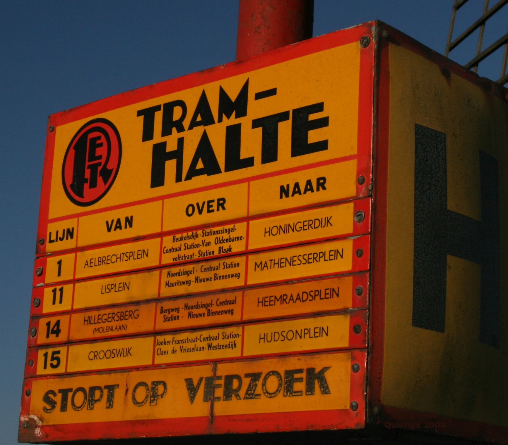
Hillegersberg-Schiebroek is a borough in northern Rotterdam. The borough has (on January 1, 2008) 40,846 inhabitants. Until the annexation by Rotterdam on August 1, 1941, Hillegersberg and Schiebroek were independent communities. In 1947 in Rotterdam, the first elected councils established, in 1948 was the first Hillegersberg-Schiebroek ward council. In 1972, the Regulation on the localities in the city of Rotterdam was adopted. The neighbourhood council of Hillegersberg-Schiebroek was in 1983 converted into a municipal section. Hillegersberg is operated by Rotterdam tram lines 4 and 8 and Schiebroek by tram line 25. The borough is also served by several bus lines from the RET and Qbuzz. Within the municipality Hillegersberg-Schiebroek the Stichting Wijkvervoer Hillegersberg-Schiebroek takes care of cheap transportation for the elderly and other people unable to use own or public transport. This is done under the name De Belbus.http://home.kpn.nl/~f2hbelbus/ Belbus The distri ... [...More Info...] [...Related Items...] OR: [Wikipedia] [Google] [Baidu] |
Hillegersberg
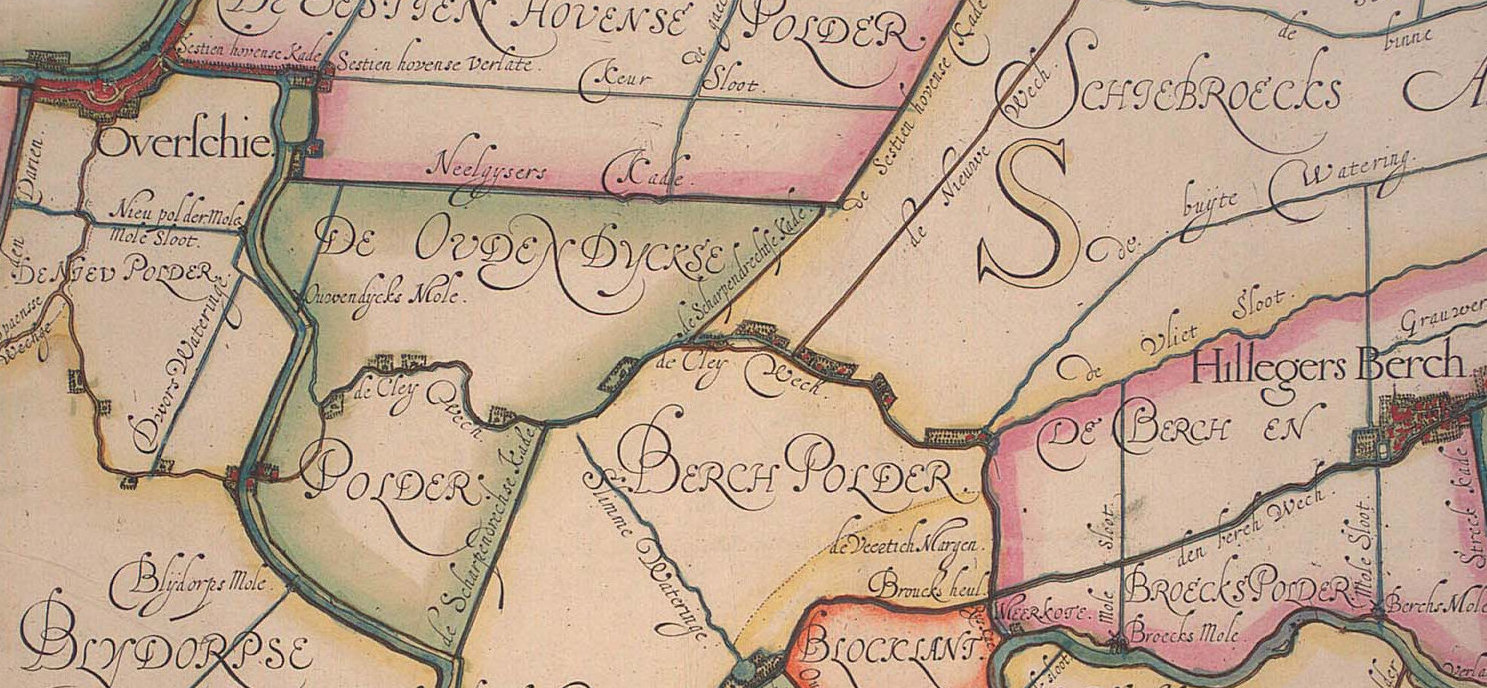
Hillegersberg is a neighbourhood of Rotterdam, Netherlands. Primarily a green residential area with lakes, canals and parks, it was incorporated into the city of Rotterdam in 1941. History Hillegersberg was named after Hildegard van Vlaanderen, wife of Count Dirk II of Holland and West Friesland (920-988). The village was founded on a hill, form by a ridge of sand known locally as a donk or morre. Local flint finds here indicate pre-historic occupation and later discoveries of Roman pottery, medals as well as a bust of Emperor Hadrian show subsequent early activity in the area. According to legend, this ridge was formed by sand dropped from the apron of the mythical giant Hillegonda. She was said to have built her house on this ridge and so Hillegersberg, then known as Hillegonda's mountain, was named. The image of the giant Hillegonda with her torn apron is shown on Hillegersberg's coat of arms. A church and a castle, , were subsequently built on the ridge. The castle w ... [...More Info...] [...Related Items...] OR: [Wikipedia] [Google] [Baidu] |
Rotterdam
Rotterdam ( , , , lit. ''The Dam on the River Rotte'') is the second largest city and municipality in the Netherlands. It is in the province of South Holland, part of the North Sea mouth of the Rhine–Meuse–Scheldt delta, via the ''"New Meuse"'' inland shipping channel, dug to connect to the Meuse first, but now to the Rhine instead. Rotterdam's history goes back to 1270, when a dam was constructed in the Rotte. In 1340, Rotterdam was granted city rights by William IV, Count of Holland. The Rotterdam–The Hague metropolitan area, with a population of approximately 2.7 million, is the 10th-largest in the European Union and the most populous in the country. A major logistic and economic centre, Rotterdam is Europe's largest seaport. In 2020, it had a population of 651,446 and is home to over 180 nationalities. Rotterdam is known for its university, riverside setting, lively cultural life, maritime heritage and modern architecture. The near-complete destruction ... [...More Info...] [...Related Items...] OR: [Wikipedia] [Google] [Baidu] |
110-Morgen
110-Morgen is a neighborhood in Rotterdam, Netherlands Located in Hillegersberg-Schiebroek. The name refers to a polder of the same name from 1772, with a surface area of 110 morgen. The first plans for residential development of the area were presented in 1933. The neighborhood was established after World War II World War II or the Second World War, often abbreviated as WWII or WW2, was a world war that lasted from 1939 to 1945. It involved the vast majority of the world's countries—including all of the great powers—forming two opposing ... as part of the efforts to rebuild Rotterdam. It was renovated around the year 2000. 110-Morgen has a residents organisation. References Neighbourhoods of Rotterdam {{SouthHolland-geo-stub ... [...More Info...] [...Related Items...] OR: [Wikipedia] [Google] [Baidu] |
Kleiwegkwartier
Kleiwegkwartier is a neighbourhood quarter in Rotterdam, Netherlands. It is in the southern part of Hillegersberg with origins dating from the early 1600s. Background The Kleiwegkwartier is located just north of the A20 autoroute and is part of Rotterdam's Hillegersberg-Schiebroek district. The district originally belonged to the municipalities of Hillegersberg and Schiebroek until they were annexed by Rotterdam in 1941. The area now makes part of Rotterdam's Hillegersberg-Zuid district. The area owes its name to the Kleiweg, the main road that runs centrally through its neighbourhood. The Kleiweg originally served as the main connection between Rotterdam and Overschie where it crossed old creek bridges over the Rivers Schie and Rotte. The road's early existence is documented on an area map dated 1611. Over time the road became increasingly lined by farms, houses and businesses—especially with major residential development occurring in the Kleiwegkwartier during the 1930s. ... [...More Info...] [...Related Items...] OR: [Wikipedia] [Google] [Baidu] |
Molenlaankwartier
Molenlaankwartier is a neighborhood of Rotterdam, Netherlands ) , anthem = ( en, "William of Nassau") , image_map = , map_caption = , subdivision_type = Sovereign state , subdivision_name = Kingdom of the Netherlands , established_title = Before independence , established_date = Spanish Netherl .... Neighbourhoods of Rotterdam {{SouthHolland-geo-stub ... [...More Info...] [...Related Items...] OR: [Wikipedia] [Google] [Baidu] |
Terbregge
Terbregge is a neighborhood of Rotterdam, Netherlands ) , anthem = ( en, "William of Nassau") , image_map = , map_caption = , subdivision_type = Sovereign state , subdivision_name = Kingdom of the Netherlands , established_title = Before independence , established_date = Spanish Netherl .... Terbregge has a typical Dutch landscape with windmills, water and cycling routes that lead through the Lage Bergse Bos and the Rotte countryside. The district has a varied living environment. History The current district consists of the former neighborhood of Terbregge, which was built around a bridge over the Rotte in the thirteenth century. The hamlet of 'Terbregge' is known to have existed in 1524. The windmill "De Vier Winden" is located in the old part on the Rotte. The district is now mainly known for the adjacent traffic junction, Terbregseplein, where the A16 motorway leads to the A20 Old Terbregge Oud Terbregge has a village character and is surrounded by water and gr ... [...More Info...] [...Related Items...] OR: [Wikipedia] [Google] [Baidu] |
Schiebroek
Schiebroek is a former village in the province of South Holland, Netherlands. It is now a neighbourhood of Rotterdam, and part of the borough of Hillegersberg-Schiebroek Hillegersberg-Schiebroek is a borough in northern Rotterdam. The borough has (on January 1, 2008) 40,846 inhabitants. Until the annexation by Rotterdam on August 1, 1941, Hillegersberg and Schiebroek were independent communities. In 1947 in Rotter .... Schiebroek was a separate municipality between 1817 and 1941, when it became part of Rotterdam. References {{coord, 51, 58, N, 4, 29, E, display=title, region:NL_type:city_source:GNS-enwiki Former municipalities of South Holland Neighbourhoods of Rotterdam ... [...More Info...] [...Related Items...] OR: [Wikipedia] [Google] [Baidu] |
List Of Sovereign States
The following is a list providing an overview of sovereign states around the world with information on their status and recognition of their sovereignty. The 206 listed states can be divided into three categories based on membership within the United Nations System: 193 UN member states, 2 UN General Assembly non-member observer states, and 11 other states. The ''sovereignty dispute'' column indicates states having undisputed sovereignty (188 states, of which there are 187 UN member states and 1 UN General Assembly non-member observer state), states having disputed sovereignty (16 states, of which there are 6 UN member states, 1 UN General Assembly non-member observer state, and 9 de facto states), and states having a special political status (2 states, both in free association with New Zealand). Compiling a list such as this can be a complicated and controversial process, as there is no definition that is binding on all the members of the community of nations concerni ... [...More Info...] [...Related Items...] OR: [Wikipedia] [Google] [Baidu] |
Netherlands
) , anthem = ( en, "William of Nassau") , image_map = , map_caption = , subdivision_type = Sovereign state , subdivision_name = Kingdom of the Netherlands , established_title = Before independence , established_date = Spanish Netherlands , established_title2 = Act of Abjuration , established_date2 = 26 July 1581 , established_title3 = Peace of Münster , established_date3 = 30 January 1648 , established_title4 = Kingdom established , established_date4 = 16 March 1815 , established_title5 = Liberation Day (Netherlands), Liberation Day , established_date5 = 5 May 1945 , established_title6 = Charter for the Kingdom of the Netherlands, Kingdom Charter , established_date6 = 15 December 1954 , established_title7 = Dissolution of the Netherlands Antilles, Caribbean reorganisation , established_date7 = 10 October 2010 , official_languages = Dutch language, Dutch , languages_type = Regional languages , languages_sub = yes , languages = , languages2_type = Reco ... [...More Info...] [...Related Items...] OR: [Wikipedia] [Google] [Baidu] |
Borough
A borough is an administrative division in various English-speaking countries. In principle, the term ''borough'' designates a self-governing walled town, although in practice, official use of the term varies widely. History In the Middle Ages, boroughs were settlements in England that were granted some self-government; burghs were the Scottish equivalent. In medieval England, boroughs were also entitled to elect members of parliament. The use of the word ''borough'' probably derives from the burghal system of Alfred the Great. Alfred set up a system of defensive strong points (Burhs); in order to maintain these particular settlements, he granted them a degree of autonomy. After the Norman Conquest, when certain towns were granted self-governance, the concept of the burh/borough seems to have been reused to mean a self-governing settlement. The concept of the borough has been used repeatedly (and often differently) throughout the world. Often, a borough is a single town with ... [...More Info...] [...Related Items...] OR: [Wikipedia] [Google] [Baidu] |
Trams In Rotterdam
The Rotterdam tramway network ( nl, Rotterdams tramnet) is a key element of the overall public transport arrangements in Rotterdam, Netherlands. Opened in 1879, the network currently has nine regular tramlines, and three special or seasonal tramlines. It has been operated since 1927 by Rotterdamse Elektrische Tram (RET). The tram network is the city's more extensive public transport system, while the rapid transit Rotterdam Metro is the more utilized system. History The RET has had two predecessor tramway companies, the RTM and the RETM, respectively. The RTM (''Rotterdamsche Tramweg Maatschappij'') was founded in 1878 to operate the first horse-drawn tramway in Rotterdam, which opened in 1879. From then until 1904, the RTM ran both horse trams and steam trams in and around the city, which was then much smaller than today. Apart from the RTM, there were two other, smaller, companies operating tramway networks in and around Rotterdam in the late nineteenth and early twentieth ... [...More Info...] [...Related Items...] OR: [Wikipedia] [Google] [Baidu] |
Rotterdamse Elektrische Tram
Rotterdamse Elektrische Tram (RET; en, Rotterdam Electric Tram) is the main public transport operator in Rotterdam, Netherlands. It started in 1905 when they took over the city tram lines from RTM (Rotterdamsche Tramweg Maatschappij). It currently operates 64 bus lines, 11 tram lines and five metro/ light rail lines in Rotterdam and the surrounding municipalities. RET used to employ the National Tariff System, like other local transport companies in the Netherlands. On 29 January 2009, metro trips switched to using an OV-chipkaart The OV-chipkaart (short for ''openbaar vervoer chipkaart'', meaning ''public transport chipcard'') is a contactless smart card system used for all public transport in the Netherlands. First introduced in the Rotterdam Metro in April 2005, it has s ...; bus and tram trips followed on 11 February 2010. Tram Tramlines Bus Buslines Metro Metrolines External links * Official website {{Authority control Tram transport in the Netherl ... [...More Info...] [...Related Items...] OR: [Wikipedia] [Google] [Baidu] |


