|
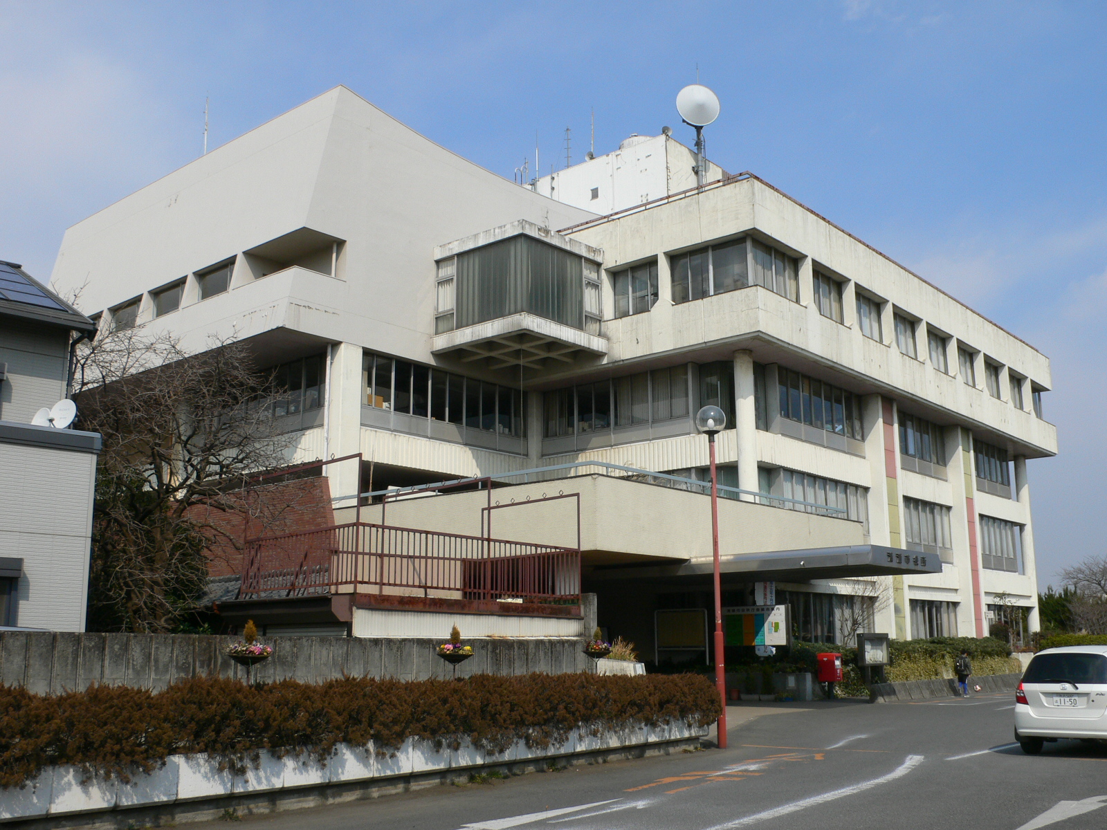
Higashikurume
is a city located in the western portion of Tokyo Metropolis, Japan. , the city had an estimated population of 117,020, and a population density of 9100 persons per km². The total area of the city was . Geography Higashikurume is in the north-center of Tokyo Metropolis, on the Musashino Terrace, approximately 25 kilometers from downtown Tokyo. The Kurome River flows through the western end of the city, and the Ochiai River flows through the center of the city. The land slopes gently from west to east. Surrounding municipalities Tokyo Metropolis * Kiyose * Higashimurayama *Kodaira *Nishitokyo Saitama Prefecture * Niiza Climate Higashikurume has a Humid subtropical climate (Köppen ''Cfa'') characterized by warm summers and cool winters with light to no snowfall. The average annual temperature in Higashikurume is 14.0 °C. The average annual rainfall is 1647 mm with September as the wettest month. The temperatures are highest on average in August, at around 25.7&n ... [...More Info...] [...Related Items...] OR: [Wikipedia] [Google] [Baidu] |
Western Tokyo
Western Tokyo, also known as the , or , in the Tokyo Metropolis consists of 30 ordinary municipalities (Cities of Japan, cities (市 shi), Towns of Japan, towns (町 machi) and one Villages of Japan, village (村 mura)), unlike the eastern part which consists of 23 Special wards of Tokyo, special wards. Before it was transferred to Tokyo in 1893, the Tama area, then also still often referred to as the (referring to the Nishitama District, Kanagawa, West, Kitatama District, Kanagawa, North and Minamitama District, Kanagawa, South Tama counties it consisted of) had formed the Northern part of Kanagawa Prefecture.National Archives of Japan三多摩を東京府に編入/ref> Overview Whereas in the east of Tokyo Metropolis the 23 Special wards of Tokyo, special wards occupy the area that was formerly Tokyo City, the west consists of 30 other ordinary municipalities: Cities of Japan, cities (Nos. 1–26), Towns of Japan, towns (Nos. 27, 28, 30) and a Villages of Japan, village (No. ... [...More Info...] [...Related Items...] OR: [Wikipedia] [Google] [Baidu] |
Kiyose, Tokyo
is a city located in Tokyo Metropolis, Japan. , the city had an estimated population of 74,972 in 36,376 households, and a population density of 7300 persons per km2. The total area of the city was . Geography Kiyose City is roughly in the shape of a wedge, bordered by Saitama Prefecture to the north, east and south and separated from the city of Tokorozawa by the Yanase River. The city has considerable green space, with around 46% of its area remaining rural. Kiyose is located on a flat tableland about 15 km from the northeastern edge of Musashino Plateau. The city measures approximately 6.5 km northeast to southwest and 2 km northwest to southeast, with the west side slightly higher than the east. Average altitude above sea level ranges from 65 meters at Takeoka in the west to 20 meters at Shitajuku in the northeastern side. The city area is mostly diluvial soil except for a small area of alluvial soil by Yanase River, which runs on the edge of the region. S ... [...More Info...] [...Related Items...] OR: [Wikipedia] [Google] [Baidu] |
Tokyo
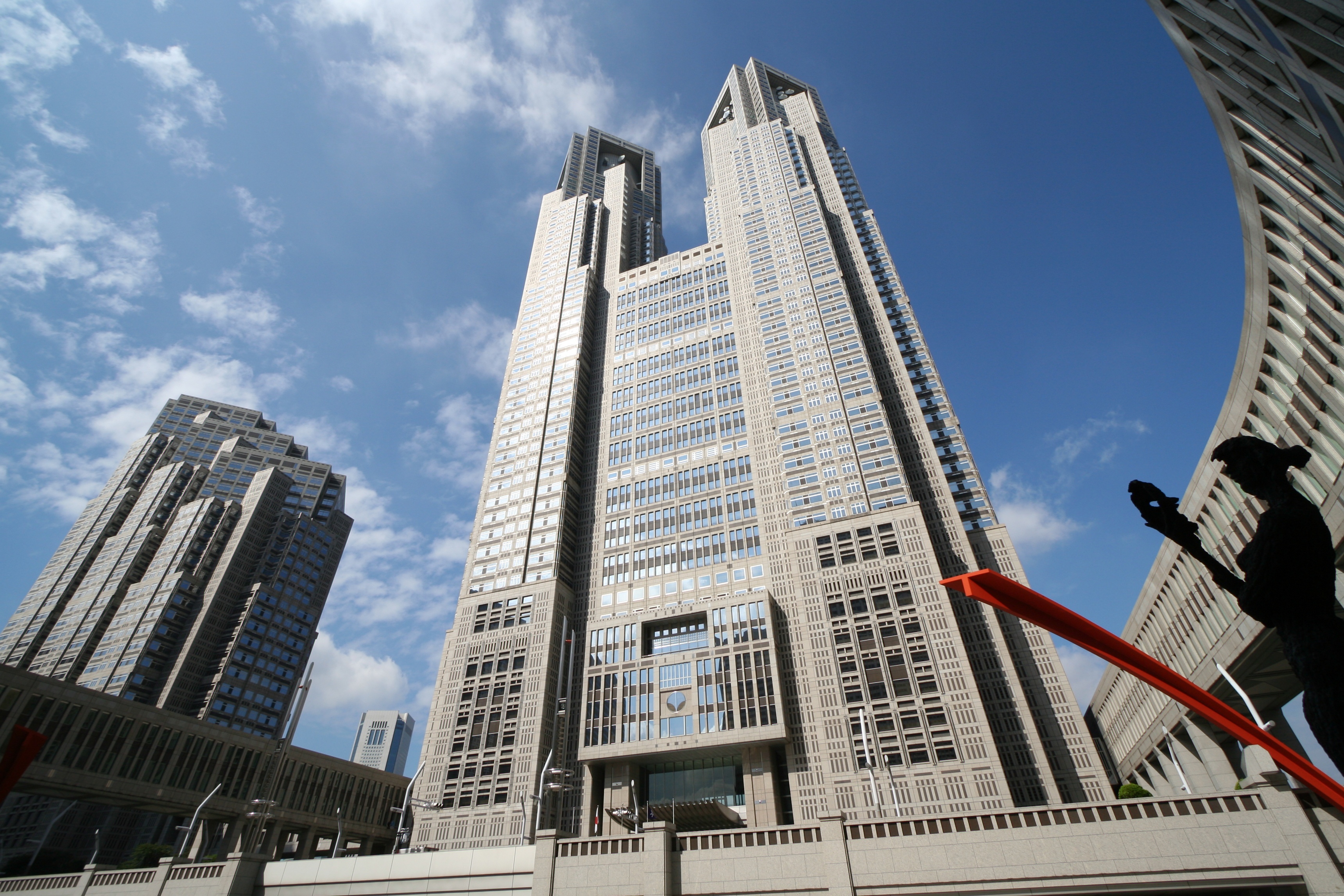
Tokyo (; ja, 東京, , ), officially the Tokyo Metropolis ( ja, 東京都, label=none, ), is the capital and largest city of Japan. Formerly known as Edo, its metropolitan area () is the most populous in the world, with an estimated 37.468 million residents ; the city proper has a population of 13.99 million people. Located at the head of Tokyo Bay, the prefecture forms part of the Kantō region on the central coast of Honshu, Japan's largest island. Tokyo serves as Japan's economic center and is the seat of both the Japanese government and the Emperor of Japan. Originally a fishing village named Edo, the city became politically prominent in 1603, when it became the seat of the Tokugawa shogunate. By the mid-18th century, Edo was one of the most populous cities in the world with a population of over one million people. Following the Meiji Restoration of 1868, the imperial capital in Kyoto was moved to Edo, which was renamed "Tokyo" (). Tokyo was devastate ... [...More Info...] [...Related Items...] OR: [Wikipedia] [Google] [Baidu] |
Tokyo Metropolis
Tokyo (; ja, 東京, , ), officially the Tokyo Metropolis ( ja, 東京都, label=none, ), is the capital and List of cities in Japan, largest city of Japan. Formerly known as Edo, its metropolitan area () is the most populous in the world, with an estimated 37.468 million residents ; the city proper has a population of 13.99 million people. Located at the head of Tokyo Bay, the prefecture forms part of the Kantō region on the central coast of Honshu, Japan's largest island. Tokyo serves as Economy of Japan, Japan's economic center and is the seat of both the Government of Japan, Japanese government and the Emperor of Japan. Originally a fishing village named Edo, the city became politically prominent in 1603, when it became the seat of the Tokugawa shogunate. By the mid-18th century, Edo was one of the most populous cities in the world with a population of over one million people. Following the Meiji Restoration of 1868, the imperial capital in Kyoto was mov ... [...More Info...] [...Related Items...] OR: [Wikipedia] [Google] [Baidu] |
Niiza, Saitama
is a city in Saitama Prefecture, Japan. , the city had an estimated population of 166,208 in 76,639 households and a population density of 7300 persons per km2. The total area of the city is . Geography Niiza is located at the southernmost tip of Saitama Prefecture, and is essentially a suburb of the Tokyo conurbation. The entire city is located on the Musashino Plateau, with the Yanase River running through the western part of the city, and the Kurome River running through the eastern part of the city. Niiza includes the southest point of Saitama Prefecture, which faces Nishitōkyō of Tokyo. Surrounding municipalities Saitama Prefecture * Asaka * Shiki * Tokorozawa * Miyoshi Tokyo Metropolis * Nerima * Kiyose * Nishitokyo * Higashikurume Climate Niiza has a humid subtropical climate (Köppen ''Cfa'') characterized by warm summers and cool winters with light to no snowfall. The average annual temperature in Niiza is 14.9 °C. The average annual rainfall is 1449 mm ... [...More Info...] [...Related Items...] OR: [Wikipedia] [Google] [Baidu] |
Kodaira, Tokyo
is a city located in the western portion of Tokyo Metropolis, Japan. , the city had an estimated population of 195,207 in 93,654 households, and a population density of 9500 persons per km². The total area of the city was . Geography Kodaira is located in the Musashino Terrace near the geographic centre of Tokyo Metropolis. Surrounding municipalities Tokyo Metropolis *Nishitokyo *Tachikawa *Higashimurayama * Higashiiyamato *Higashikurume * Kokubunji *Koganei Climate Kodaira has a Humid subtropical climate (Köppen ''Cfa'') characterized by warm summers and cool winters with light to no snowfall. The average annual temperature in Kodaira is 14.0 °C. The average annual rainfall is 1647 mm with September as the wettest month. The temperatures are highest on average in August, at around 25.5 °C, and lowest in January, at around 2.6 °C. Demographics Per Japanese census data, the population of Kodaira increased rapidly in the 1950s and 1960s. History The ... [...More Info...] [...Related Items...] OR: [Wikipedia] [Google] [Baidu] |
Nishitokyo, Tokyo
() is a city located in the western portion of Tokyo Metropolis, Japan. , the city had an estimated population of 206,047, and a population density of 13,000 persons per km2. The total area of the city is . Geography Nishitokyo is located at the centre of the geological/geographical region known as the Musashino Terrace, and is covered with the Kantō loam formation. The city has a good water supply, owing to rivers running through the city - the Shakujii River, Shirako River, Shin River (tributary of Shirako River) and Tamagawa Josui River. From east to west, the city is about 4.8 km, and from south to north is about 5.6 km. Neighborhoods *former city of Hoya ::Fuji-machi, Hibarigaoka, Higashi-cho, Higashi-fushimi, Hoya-cho, Izumi-cho, Kita-machi, Naka-machi, Sakae-cho, Shimo-hoya, Shin-machi, Sumiyoshi-cho, Yagisawa *former city of Tanashi ::Kitahara-cho, Midori-cho, Minami-cho, Mukodai-cho, Nishihara-cho, Shibakubo-cho, Tanashi-cho, Yato-cho Surrounding munici ... [...More Info...] [...Related Items...] OR: [Wikipedia] [Google] [Baidu] |
Kitatama District, Tokyo
was a district located in the Japanese Prefecture of Kanagawa from 1878 to 1893 and then in the Prefecture of Tokyo until 1970. In 1878, the Meiji government made the first step to introduce modern administrative divisions on the municipal level: The districts (''gun'') were created from the pre-modern districts (''gun'' or ''kōri'') with their towns and villages. The old Tama District of Musashi Province was divided into four parts: Eastern Tama ( Higashitama) became part of Tokyo Prefecture and the three other districts of Northern Tama (Kitatama), Southern Tama ( Minamitama) and Western Tama ( Nishitama) part of Kanagawa Prefecture. In 1889 when the modern cities, towns and villages were incorporated, the communities of Northern Tama were organized into 39 municipalities: the town (initially ''-eki'', became ''machi'' in 1893) of Fuchū where the district government was set up, the towns of Chōfu and Tanashi and 37 villages. Four years later, in 1893, the three Western Tam ... [...More Info...] [...Related Items...] OR: [Wikipedia] [Google] [Baidu] |
Higashimurayama, Tokyo
is a city located in the western portion of Tokyo Metropolis, Japan. , the city had an estimated population of 148,275, and a population density of 8700 persons per km2. The total area of the city is . Geography Higashimurayama is located on the eastern edge of the Sayama Hills, almost in the center of the Musashino Terrace. Most of the city area is flat, except for the northwestern hills. Surrounding municipalities Tokyo Metropolis *Higashikurume * Kiyose * Higashiyamato *Kodaira Saitama Prefecture *Tokorozawa Climate Higashimurayama has a Humid subtropical climate (Köppen ''Cfa'') characterized by warm summers and cool winters with light to no snowfall. The average annual temperature in Higashimurayama is 14.0 °C. The average annual rainfall is 1647 mm with September as the wettest month. The temperatures are highest on average in August, at around 25.7 °C, and lowest in January, at around 2.3 °C. Demographics Per Japanese census data, the population ... [...More Info...] [...Related Items...] OR: [Wikipedia] [Google] [Baidu] |
Saitama Prefecture
is a landlocked prefecture of Japan located in the Kantō region of Honshu. Saitama Prefecture has a population of 7,338,536 (1 January 2020) and has a geographic area of 3,797 km2 (1,466 sq mi). Saitama Prefecture borders Tochigi Prefecture and Gunma Prefecture to the north, Nagano Prefecture to the west, Yamanashi Prefecture to the southwest, Tokyo to the south, Chiba Prefecture to the southeast, and Ibaraki Prefecture to the northeast. Saitama is the capital and largest city of Saitama Prefecture, with other major cities including Kawaguchi, Kawagoe, and Tokorozawa. Saitama Prefecture is part of the Greater Tokyo Area, the most populous metropolitan area in the world, and many of its cities are described as bedroom communities and suburbs of Tokyo with many residents commuting into the city each day. History According to ''Sendai Kuji Hongi'' (''Kujiki''), Chichibu was one of 137 provinces during the reign of Emperor Sujin. Chichibu Province was in western Saitama. ... [...More Info...] [...Related Items...] OR: [Wikipedia] [Google] [Baidu] |
Cities Of Japan
A is a local administrative unit in Japan. Cities are ranked on the same level as and , with the difference that they are not a component of . Like other contemporary administrative units, they are defined by the Local Autonomy Law of 1947. City status Article 8 of the Local Autonomy Law sets the following conditions for a municipality to be designated as a city: *Population must generally be 50,000 or greater (原則として人口5万人以上) *At least 60% of households must be established in a central urban area (中心市街地の戸数が全戸数の6割以上) *At least 60% of households must be employed in commerce, industry or other urban occupations (商工業等の都市的業態に従事する世帯人口が全人口の6割以上) *Any other conditions set by prefectural ordinance must be satisfied (他に当該都道府県の条例で定める要件を満たしていること) The designation is approved by the prefectural governor and the Minister for Internal ... [...More Info...] [...Related Items...] OR: [Wikipedia] [Google] [Baidu] |
Musashi Province
was a province of Japan, which today comprises Tokyo Metropolis, most of Saitama Prefecture and part of Kanagawa Prefecture. It was sometimes called . The province encompassed Kawasaki and Yokohama. Musashi bordered on Kai, Kōzuke, Sagami, Shimōsa, and Shimotsuke Provinces. Musashi was the largest province in the Kantō region. History Musashi had its ancient capital in modern Fuchū, Tokyo, and its provincial temple in what is now Kokubunji, Tokyo. By the Sengoku period, the main city was Edo, which became the dominant city of eastern Japan. Edo Castle was the headquarters of Tokugawa Ieyasu before the Battle of Sekigahara and became the dominant city of Japan during the Edo period, being renamed Tokyo during the Meiji Restoration. ''Hikawa-jinja'' was designated as the chief Shinto shrine (''ichinomiya'') of the province; and there are many branch shrines. The former province gave its name to the battleship of the Second World War. Timeline of important events * ... [...More Info...] [...Related Items...] OR: [Wikipedia] [Google] [Baidu] |


