|
Hereford Mappa Mundi
The Hereford Mappa Mundi is a medieval map of the known world ( la, mappa mundi), of a form deriving from the T and O pattern, dating from c. 1300. Archeological scholars believe the map to have originated from eastern England in either Yorkshire or Lincolnshire before it was transported westward to the Hereford Cathedral in Herefordshire where it has remained ever since. It is displayed at Hereford Cathedral in Hereford, England.Edson, Evelyn (1997) ''Mapping Time and Space: How Medieval Mapmakers Viewed Their World'', The British Library It is the largest medieval map still known to exist. A larger mappa mundi, the Ebstorf map, was destroyed by Allied bombing in 1943, though photographs of it survive. The Hereford Mappa Mundi hung, with little regard, for many years on a wall of a choir aisle in the cathedral. During the troubled times of the Commonwealth the map had been laid beneath the floor of Bishop Audley's Chantry, where it remained secreted for some time. In 185 ... [...More Info...] [...Related Items...] OR: [Wikipedia] [Google] [Baidu] |
Virtual Mappa
Virtual Mappa (VM) (https://sims2.digitalmappa.org/36) is a collaborative digital humanities project that collects, annotates and networks medieval mappa mundi, ''mappamundi'' using the Digital Mappa resource. The project is open access, hosted and published by the Schoenberg Institute for Manuscript Studies at the University of Pennsylvania, and in collaboration with the British Library. The project is currently directed by Martin Foys and Heather Wacha, and continues to grow as new contributors join the project and edit new medieval maps. Maps currently in the project The project currently includes editions of thirteen ''mappamundi'': * Cotton World Map (BL Cotton Tiberius B.v, f. 56v) * Cotton Zonal Map (BL Cotton Tiberius B.v., f. 29r) * Hereford Map (Hereford Cathedral) * Higden Map (BL Royal 14.C IX, ff. 1v–2r) * Higden Map (BL Royal 14.C IX, f. 2v) * Higden Map (CCCC MS 21, f. 9r) * Peterborough Map (BL Harley 3667, f. 8v) * Psalter World Map (BL Add MS 28681, f. 9r) ... [...More Info...] [...Related Items...] OR: [Wikipedia] [Google] [Baidu] |
Sawley Map
The Sawley map, formerly known as the Henry of Mainz map, is the earliest surviving '' mappa mundi'' (world map) made in England. It was made between about 1180 and the early 13th century. The map is the frontispiece of a copy of the ''Imago mundi'' of Honorius of Autun. It is oriented with east (and the Garden of Eden) at the top and the island of Delos at the centre. The map takes up the second page ( folio 1v) of manuscript 66 at Corpus Christi College, Cambridge. The first folio is of thicker vellum than the rest of the manuscript. The manuscript was probably copied at Durham Priory before being given to Sawley Abbey (now in Lancashire) in the early 13th century. The map is oval in shape, with winged figures ( angels, not winds) decorating the four corners of the rectangular page. It measures about . Across the top of the page is a faint ''ex libris'' in Latin: ''Liber s n Marie de Salleia'', 'book of Saint Mary's of Sawley'. The map depicts three continents – Asia, ... [...More Info...] [...Related Items...] OR: [Wikipedia] [Google] [Baidu] |
Psalter World Map
The Psalter World Map or the Map Psalter is a small ''mappa mundi'' from the 13th century, found in a psalter. No other records of psalters found from the middle ages have a mappa mundi. The Psalter mappa mundi was likely used to provide context for the Bible's stories as well as a visual narrative of Christianity. A ''Mappa'' is a noun meaning napkin or cloth and ''mundi'' is an adjective referencing something clean or organized. Mappa mundis were not utilized as maps for travel or geographical education, but as history lessons taught through a visual means. Historian Felicitas Schmieder refers to mappa mundi as "Geographies of Salvation" as they are report the narrative of Christ's interaction with our world. The Psalter mappa mundi is now conserved at the British Library in London. An open-access high-resolution digital image of the map with place and name annotations is included among the thirteen medieval maps of the world edited in the Virtual Mappa project. The Map Psalter ... [...More Info...] [...Related Items...] OR: [Wikipedia] [Google] [Baidu] |
Beatus Of Liébana
Saint Beatus of Liébana ( es, Beato; 730 – c. 800) was a monk, theologian, and geographer from the former Duchy of Cantabria and Kingdom of Asturias, in modern Cantabria, northern Spain, who worked and lived in the Picos de Europa mountains of the region of Liébana. He is best remembered today as the author of the '' Commentary on the Apocalypse''. Biography Beatus was likely born and raised in Liébana, possibly from a poor family. As confessor to Queen Adosinda, wife of Silo of Asturias, and as teacher of Alcuin of York and Etherius of Osma, Beatus exercised wide influence."St. Beatus of Liébana", Christ in the Desert Monastery He is best remembered today as the author of the ''Commentary on the Apocalypse'', written in 776, then revised in ... [...More Info...] [...Related Items...] OR: [Wikipedia] [Google] [Baidu] |
Blemmyes (legendary Creatures)
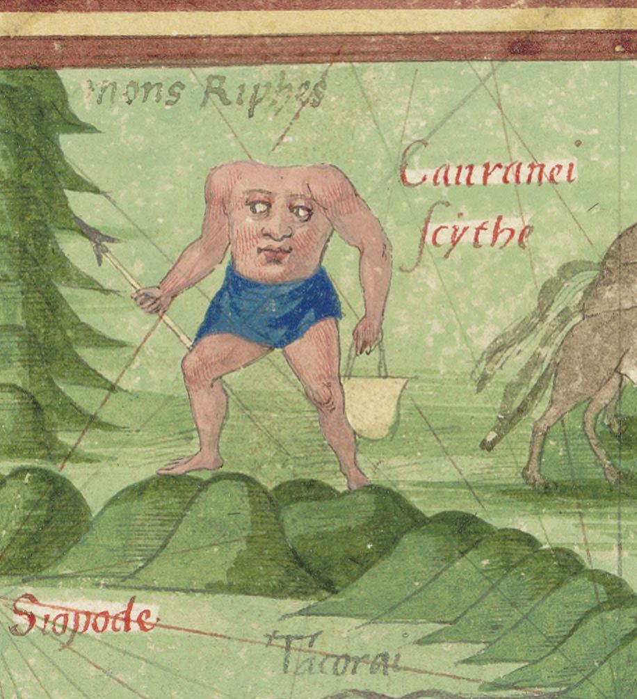
Various species of mythical headless men were rumoured, in antiquity and later, to inhabit remote parts of the world. They are variously known as ''akephaloi'' (Greek ἀκέφαλοι, "headless ones") or Blemmyes ( la, Blemmyae; gr, βλέμμυες) and described as lacking a head, with their facial features on their chest. These were at first described as inhabitants of ancient Libya or the Nile system (Aethiopia). Later traditions confined their habitat to a particular island in the Brisone River, or shifted it to India. Blemmyes are said to occur in two types: with eyes on the chest or with the eyes on the shoulders. Etymology Various etymologies had been proposed for the origins of the name "Blemmyes", and the question is considered unsettled. In antiquity, the actual tribe known as the Blemmyes were said to be named eponymously after King Blemys (Βλέμυς), according to Nonnus's 5th century epic ''Dionysiaca'', but no lore about headlessness is attached to the ... [...More Info...] [...Related Items...] OR: [Wikipedia] [Google] [Baidu] |
Monoceros (legendary Creature)
The monoceros ( el, μονόκερως) is a legendary animal with only one horn related to the unicorn. Mythology It derives from the Greek word μονόκερως (''monokerōs''), a compound word from μόνος (''monos'') which means "only one" / "single" and κέρας (''keras'') (neuter gender), which means " horn". The monoceros was first described in Pliny the Elder's '' Natural History'' as a creature with the body of a horse, the head of a stag (minus the antlers), the feet of an elephant, and the tail of a wild boar. It has one black horn in the middle of its forehead, which is two cubits (about ) in length, and is impossible to capture alive. Cosmas Indicopleustes, in the ''Christian Topography'', writes that he did not see the animal, but he did see brazen figures of it at the palace of the King of Aethiopia and from these figures he was able to draw it. He also mentions that the people speak of it as a terrible beast and invincible, and that all its strength li ... [...More Info...] [...Related Items...] OR: [Wikipedia] [Google] [Baidu] |
Strait Of Gibraltar
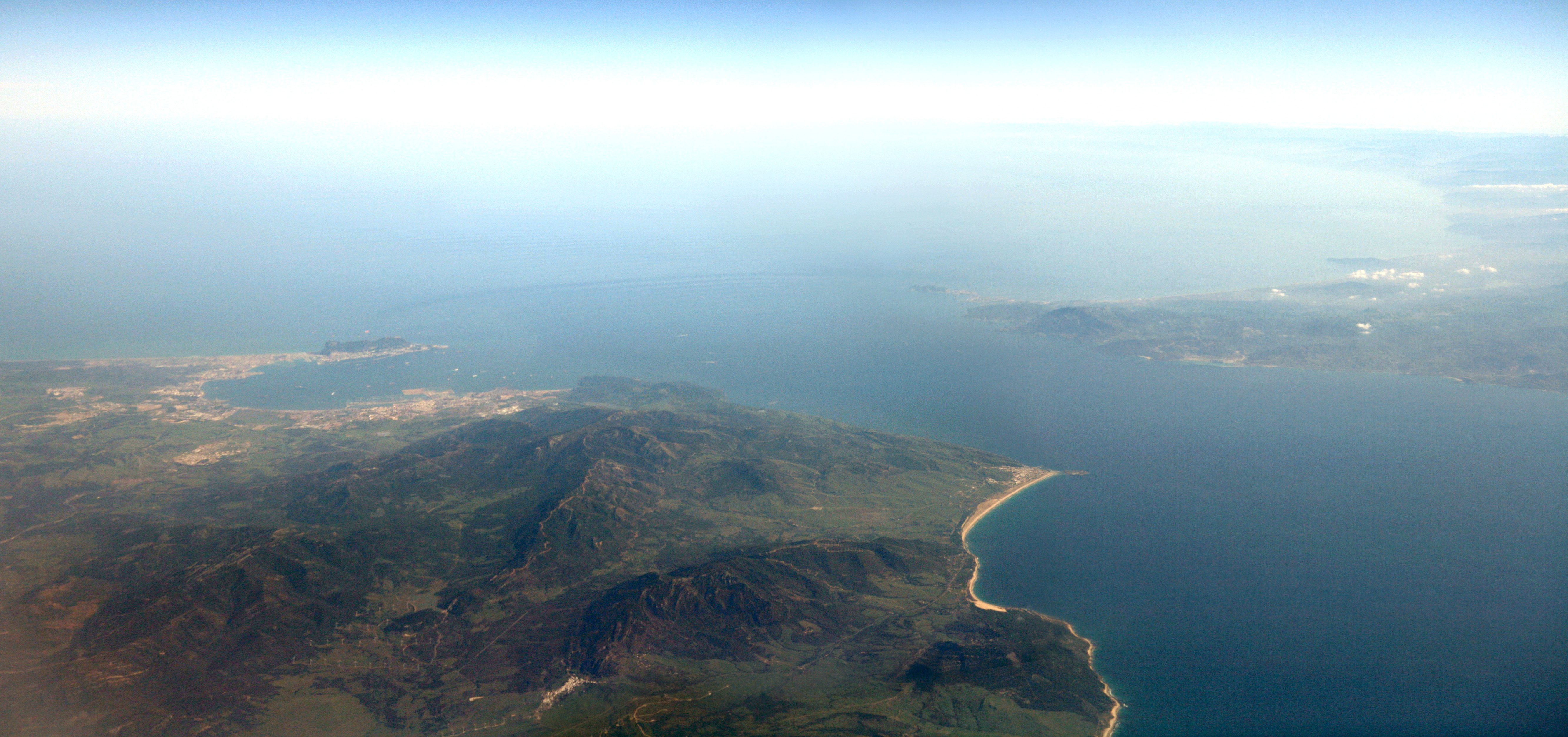
The Strait of Gibraltar ( ar, مضيق جبل طارق, Maḍīq Jabal Ṭāriq; es, Estrecho de Gibraltar, Archaism, Archaic: Pillars of Hercules), also known as the Straits of Gibraltar, is a narrow strait that connects the Atlantic Ocean to the Mediterranean Sea and separates the Iberian Peninsula in Europe from Morocco in Africa. The two continents are separated by of ocean at the Strait's narrowest point between Punta de Tarifa, Point Marroquí in Spain and Point Cires in Morocco. Ferries cross between the two continents every day in as little as 35 minutes. The Strait's depth ranges between which possibly interacted with the lower mean sea level of the last major glaciation 20,000 years ago when the level of the sea is believed to have been lower by . The strait lies in the territorial waters of Morocco, Spain, and the British overseas territory of Gibraltar. Under the United Nations Convention on the Law of the Sea, foreign vessels and aircraft have the freedom of navi ... [...More Info...] [...Related Items...] OR: [Wikipedia] [Google] [Baidu] |
Mediterranean Sea
The Mediterranean Sea is a sea connected to the Atlantic Ocean, surrounded by the Mediterranean Basin and almost completely enclosed by land: on the north by Western and Southern Europe and Anatolia, on the south by North Africa, and on the east by the Levant. The Sea has played a central role in the history of Western civilization. Geological evidence indicates that around 5.9 million years ago, the Mediterranean was cut off from the Atlantic and was partly or completely desiccated over a period of some 600,000 years during the Messinian salinity crisis before being refilled by the Zanclean flood about 5.3 million years ago. The Mediterranean Sea covers an area of about , representing 0.7% of the global ocean surface, but its connection to the Atlantic via the Strait of Gibraltar—the narrow strait that connects the Atlantic Ocean to the Mediterranean Sea and separates the Iberian Peninsula in Europe from Morocco in Africa—is only wide. The Mediterranean ... [...More Info...] [...Related Items...] OR: [Wikipedia] [Google] [Baidu] |
Garden Of Eden
In Abrahamic religions, the Garden of Eden ( he, גַּן־עֵדֶן, ) or Garden of God (, and גַן־אֱלֹהִים ''gan-Elohim''), also called the Terrestrial Paradise, is the Bible, biblical paradise described in Book of Genesis, Genesis 2-3 and Book of Ezekiel, Ezekiel 28 and 31. The location of Eden is described in the Book of Genesis as the source of four tributaries. Various suggestions have been made for its location: at the head of the Persian Gulf, in southern Mesopotamia (now Iraq) where the Tigris and Euphrates rivers run into the sea; and in Armenia. Like the Genesis flood narrative, the Genesis creation narrative and the account of the Tower of Babel, the story of Eden echoes the Ancient Mesopotamian religion, Mesopotamian myth of a king, as a primordial man, who is placed in a divine garden to guard the tree of life. The Hebrew Bible depicts Adam and Eve as walking around the Garden of Eden naked due to their sinlessness. Mentions of Eden are also made in ... [...More Info...] [...Related Items...] OR: [Wikipedia] [Google] [Baidu] |
Jerusalem
Jerusalem (; he, יְרוּשָׁלַיִם ; ar, القُدس ) (combining the Biblical and common usage Arabic names); grc, Ἱερουσαλήμ/Ἰεροσόλυμα, Hierousalḗm/Hierosóluma; hy, Երուսաղեմ, Erusałēm. is a city in Western Asia. Situated on a plateau in the Judaean Mountains between the Mediterranean Sea, Mediterranean and the Dead Sea, it is one of the List of oldest continuously inhabited cities, oldest cities in the world and is considered to be a holy city for the three major Abrahamic religions: Judaism, Christianity, and Islam. Both Israelis and Palestinians claim Jerusalem as their Capital city, capital, as Israel maintains its primary governmental institutions there and the State of Palestine ultimately foresees it as its seat of power. Because of this dispute, Status of Jerusalem, neither claim is widely recognized internationally. Throughout History of Jerusalem, its long history, Jerusalem has been destroyed at least twice, Sie ... [...More Info...] [...Related Items...] OR: [Wikipedia] [Google] [Baidu] |


