|
Hellweg Börde
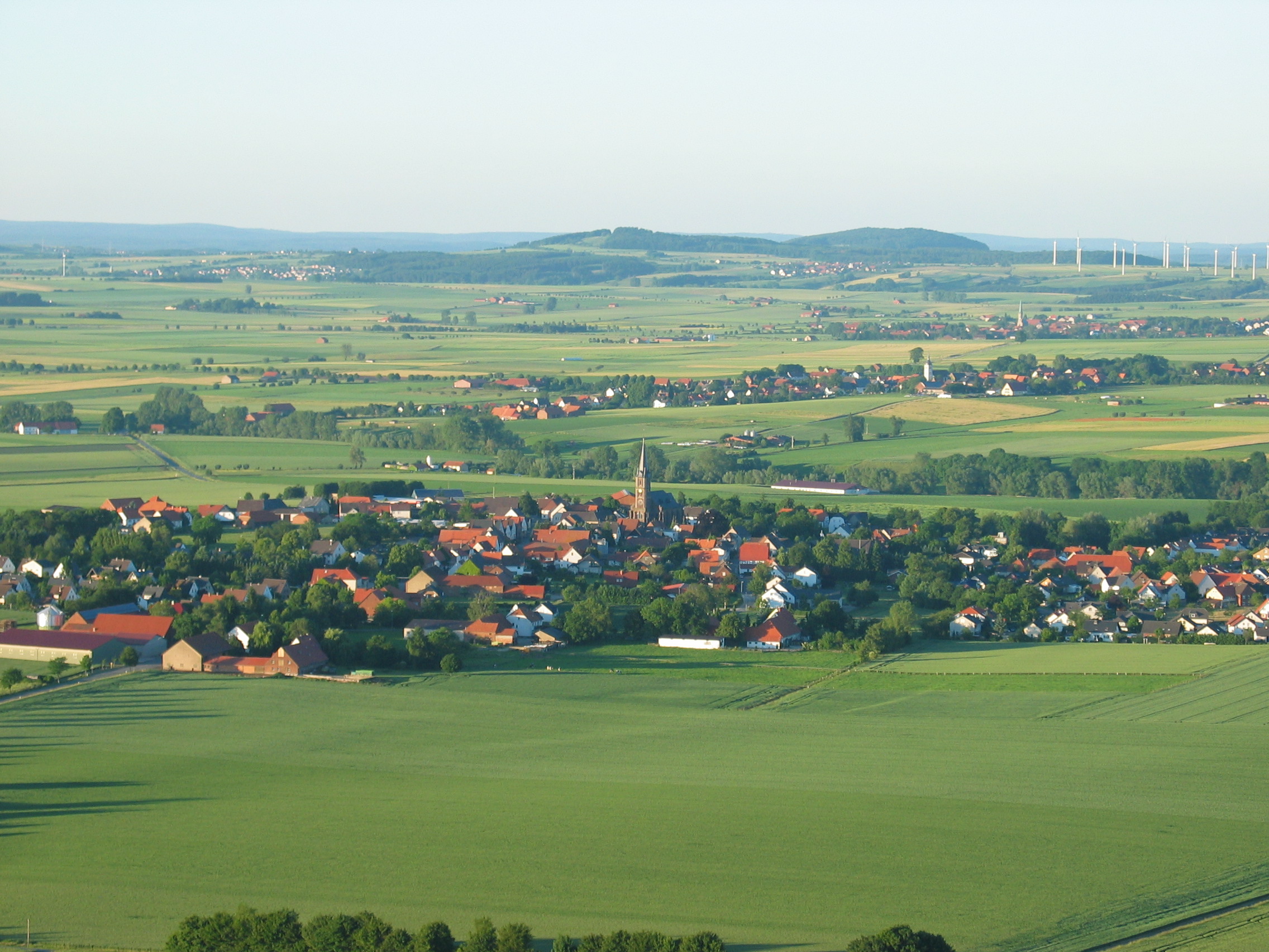
The Hellweg Börde (German: ''Hellwegbörde'') is a ''börde'' landscape and natural region on the southern edge of the Westphalian Lowland in the German state of North Rhine-Westphalia, which embraces the old Hellweg trading route cities and towns of Dortmund, Unna, Werl and Soest extending to Salzkotten and from there in an ever narrower strip to its northeastern tip at Schlangen on the edge of the town of Bad Lippspringe. It is characterised by its heavy deposits of post ice age loess soils. The region can be further divided into the Werl-Unna Börde, Soest Börde and Geseke Börde. In the west the loess soils of the Hellweg Börde continue into the Westenhellweg region. History By the Stone Age (around 4,000 B.C.) grain was already being cultivated here on the fertile, calcareous land. The oldest trace of a neolithic culture was the discovery of pottery from the La Hoguette Culture dating to the middle of the 6th millennium B.C. See also * Geography of Germany * Natura ... [...More Info...] [...Related Items...] OR: [Wikipedia] [Google] [Baidu] |
Börde
A ''börde'' (plural: ''börden'') is a region of highly fertile lowland in North Germany, a "fertile plain". These landscapes often cover great areas and are particularly important for arable farming on account of their rich soils. These regions coincide closely with areas of flat, fertile loess soil and few trees. ''Börden'' are found in Germany, especially in the North German Old Drift region on the northern edges of Central Uplands. The resulting black earth soils are some of the best soils in Germany. Etymology These landscapes are restricted to, or concentrated on, those regions where the Eastphalian and Westphalian dialects are spoken. There are two opposing explanations for the name. According to one, the term is connected with the Old High German word ''giburida'' ("judicial district") or the plattdeutsch word ''bören'' ("to bear"). The ''börde'' in this context is seen as a district in which the inhabitants had to "bear" public charges, i.e. it was effectivel ... [...More Info...] [...Related Items...] OR: [Wikipedia] [Google] [Baidu] |
Loess
Loess (, ; from german: Löss ) is a clastic, predominantly silt-sized sediment that is formed by the accumulation of wind-blown dust. Ten percent of Earth's land area is covered by loess or similar deposits. Loess is a periglacial or aeolian (windborne) sediment, defined as an accumulation of 20% or less of clay and a balance of roughly equal parts sand and silt (with a typical grain size from 20 to 50 micrometers), often loosely cemented by calcium carbonate. It is usually homogeneous and highly porous and is traversed by vertical capillaries that permit the sediment to fracture and form vertical bluffs. Properties Loess is homogeneous, porous, friable, pale yellow or buff, slightly coherent, typically non- stratified and often calcareous. Loess grains are angular, with little polishing or rounding, and composed of crystals of quartz, feldspar, mica and other minerals. Loess can be described as a rich, dust-like soil. Loess deposits may become very thick, more than ... [...More Info...] [...Related Items...] OR: [Wikipedia] [Google] [Baidu] |
Natural Regions Of Germany
This division of Germany into major natural regions takes account primarily of geomorphological, geological, hydrological, and pedological criteria in order to divide the country into large, physical units with a common geographical basis. Political boundaries play no part in this, apart from defining the national border. In addition to a division of Germany by ''natural regions'', the federal authorities have also produced a division by so-called ''landscape areas (Landschaftsräume)'' that is based more on human utilisation of various regions and so has clearly different boundaries. Groundwork by the Federal Institute of Regional Studies (BfL) The natural region classification of Germany, as used today by the Federal Office for Nature Conservation (''Bundesamt für Naturschutz'' or BfN) and by most state institutions, is largely based on the work in producing the Handbook of Natural Region Divisions of Germany between the years 1953 to 1962. This divided the present federal t ... [...More Info...] [...Related Items...] OR: [Wikipedia] [Google] [Baidu] |
Geography Of Germany
Germany (German: ''Deutschland'') is a country in Central Europe, that stretches from the Alps, across the North European Plain to the North Sea and the Baltic Sea. It is the second-most populous country in Europe after Russia, and is seventh-largest country by area in the continent. The area of Germany ranked 63rd and covers , consisting of of land and of waters, smaller than Japan but larger than Republic of the Congo. Elevation ranges from the mountains of the Alps (highest point: the Zugspitze at ) in the south to the shores of the North Sea (Nordsee) in the northwest and the Baltic Sea (Ostsee) in the northeast. Between lie the forested uplands of central Germany and the low-lying lands of northern Germany (lowest point: Neuendorf-Sachsenbande at below sea level), traversed by some of Europe's major rivers such as the Rhine, Danube and Elbe. Germany has the second-most borders of any European country, after Russia. It shares borders with nine countries: Denmark in t ... [...More Info...] [...Related Items...] OR: [Wikipedia] [Google] [Baidu] |
Neolithic
The Neolithic period, or New Stone Age, is an Old World archaeological period and the final division of the Stone Age. It saw the Neolithic Revolution, a wide-ranging set of developments that appear to have arisen independently in several parts of the world. This "Neolithic package" included the introduction of farming, domestication of animals, and change from a hunter-gatherer lifestyle to one of settlement. It began about 12,000 years ago when farming appeared in the Epipalaeolithic Near East, and later in other parts of the world. The Neolithic lasted in the Near East until the transitional period of the Chalcolithic (Copper Age) from about 6,500 years ago (4500 BC), marked by the development of metallurgy, leading up to the Bronze Age and Iron Age. In other places the Neolithic followed the Mesolithic (Middle Stone Age) and then lasted until later. In Ancient Egypt, the Neolithic lasted until the Protodynastic period, 3150 BC.Karin Sowada and Peter Grave. Egypt in th ... [...More Info...] [...Related Items...] OR: [Wikipedia] [Google] [Baidu] |
Stone Age
The Stone Age was a broad prehistoric period during which stone was widely used to make tools with an edge, a point, or a percussion surface. The period lasted for roughly 3.4 million years, and ended between 4,000 BC and 2,000 BC, with the advent of metalworking. Though some simple metalworking of malleable metals, particularly the use of gold and copper for purposes of ornamentation, was known in the Stone Age, it is the melting and smelting of copper that marks the end of the Stone Age. In Western Asia, this occurred by about 3,000 BC, when bronze became widespread. The term Bronze Age is used to describe the period that followed the Stone Age, as well as to describe cultures that had developed techniques and technologies for working copper alloys (bronze: originally copper and arsenic, later copper and tin) into tools, supplanting stone in many uses. Stone Age artifacts that have been discovered include tools used by modern humans, by their predecessor species in the ... [...More Info...] [...Related Items...] OR: [Wikipedia] [Google] [Baidu] |
Westenhellweg
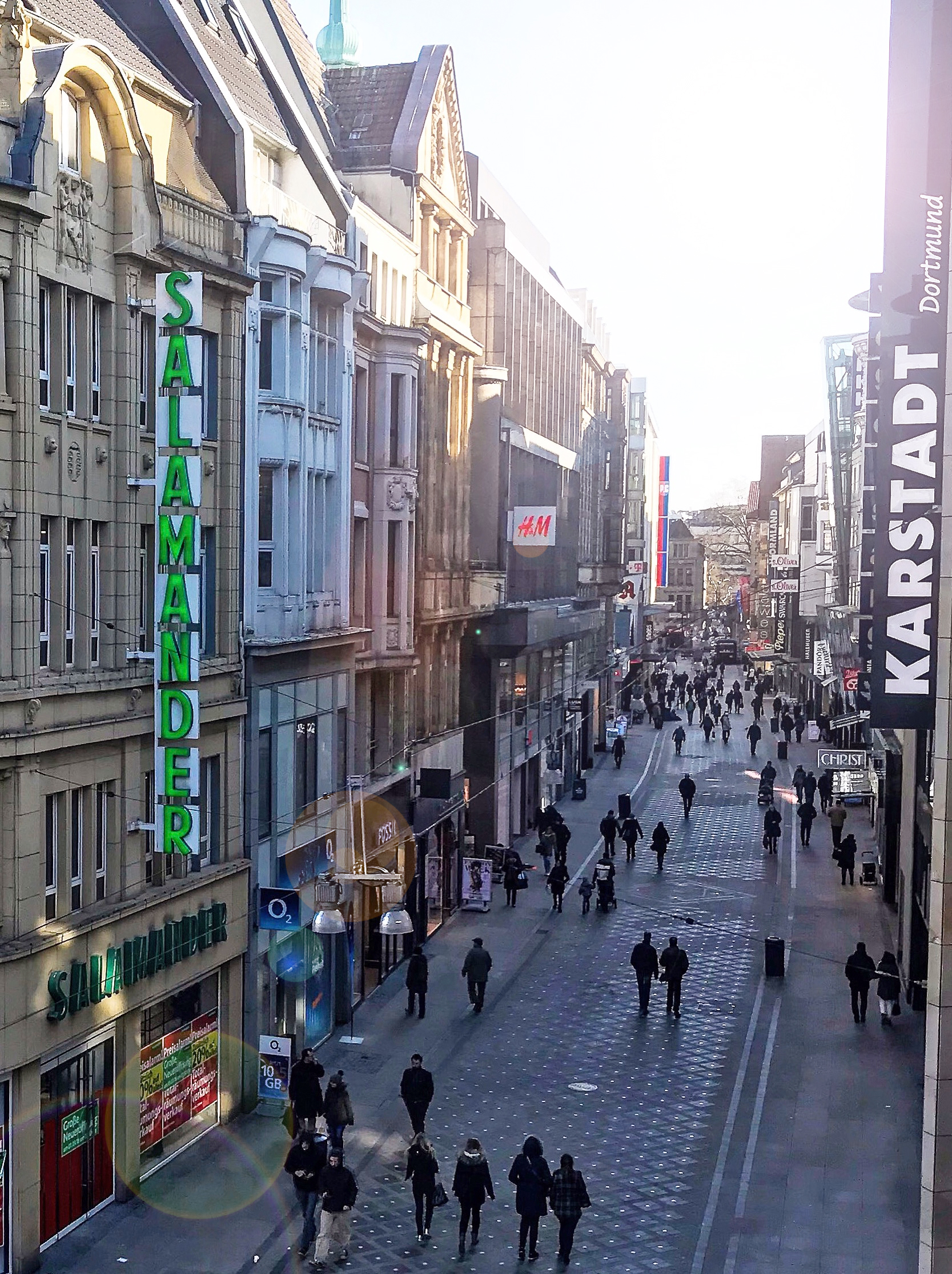
Westenhellweg is the main shopping street in Dortmund, Germany Germany,, officially the Federal Republic of Germany, is a country in Central Europe. It is the second most populous country in Europe after Russia, and the most populous member state of the European Union. Germany is situated betwee .... With nearly 13,000 visitors per hour it was Germany's most frequented shopping street in 2013. References Shopping districts and streets in Germany {{NorthRhineWestphalia-geo-stub ... [...More Info...] [...Related Items...] OR: [Wikipedia] [Google] [Baidu] |
Geseke Börde
''Geseke'' () is a town in the administrative district of Soest, in North Rhine-Westphalia, Germany. Geography Geseke is situated approximately 12 km south-east of Lippstadt and 20 km south-west of Paderborn. The city is located at the Hellweg and B1. Further south in Steinhausen is the motorway that leads to the A44 ( Dortmund- Kassel). In Ahden in Paderborn administrative district is the Paderborn / Lippstadt Airport. The town has his own railway station which lies next to the Edeka and the Aldi market. From Geseke, there's a connection to other cities including Paderborn and Lippstadt. The Ems-Börde-Bahn from the Eurobahn which is part of the Keolis Gruppe runs from Münster via Hamm, Soest, Lippstadt, Geseke to Paderborn and occasionally via Altenbecken, Warburg and Hofgeismar to Kassel-Wilhelmshöhe. In Soest you have an additionally connection to Dortmund via Werl and Unna. The RE1 (Regionalbahn 1) of the Deutsche Bahn ends or starts in Paderborn and ru ... [...More Info...] [...Related Items...] OR: [Wikipedia] [Google] [Baidu] |
Soest Börde
The Soest Börde (german: Soester Börde) is an historical territorial lordship and a cultural landscape in the centre of the German region of Westphalia, between Sauerland in the south and Münsterland in the north. It is known nationally for being a very fertile region thanks to the depth of its loess soils that, it terms of yield are only exceeded in Germany by the Magdeburg Börde. The term "börde" has a twin meaning here. Administratively it refers to a former juridical district and agriculturally to a fertile lowland. Historically-administratively the Soest Börde comprised the former territorial lordship of the town of Soest in the present municipalities of Soest, Bad Sassendorf and Welver. From a natural regional perspective, it belongs to the Hellwegbörden, whose eponymous centre it represents. Within the natural region classification, however, the Soest Börde, is not recognized as a unit. Instead the sub-regions of the ''Soest Upper'' and ''Lower Börde'' are us ... [...More Info...] [...Related Items...] OR: [Wikipedia] [Google] [Baidu] |
Bad Lippspringe
Bad Lippspringe () is a town in the district of Paderborn, in North Rhine-Westphalia, Germany. Geography Bad Lippspringe is situated on the western slope of the Teutoburger Wald, approximately north-east of Paderborn. The river Lippe has its source in Bad Lippspringe, and the town is noted for its powerful river springs, many hospitals and its beautiful state gardening show in 2017. Bad Lippspringe has been twinned with Newbridge, County Kildare ( ga, An Droichead Nua), Ireland since 2008. History Lippspringe is mentioned in chronicles as early as the 9th century, and here in the 13th century the order of the Templars established a stronghold. It received civic rights about 1400. Friedrich Wilhelm Weber was born here in 1817. During the 19th century, the Arminius spring and the Liborius spring, with saline waters of a temperature of , were used both for bathing and drinking in cases of tuberculosis. Further citations: *Dammann, ''Der Kurort Lippspringe'' (Paderborn, 1900); *Kon ... [...More Info...] [...Related Items...] OR: [Wikipedia] [Google] [Baidu] |


