|
Healey Nab
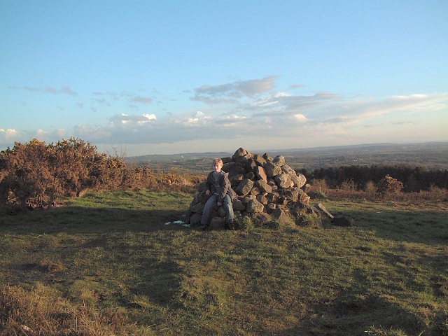
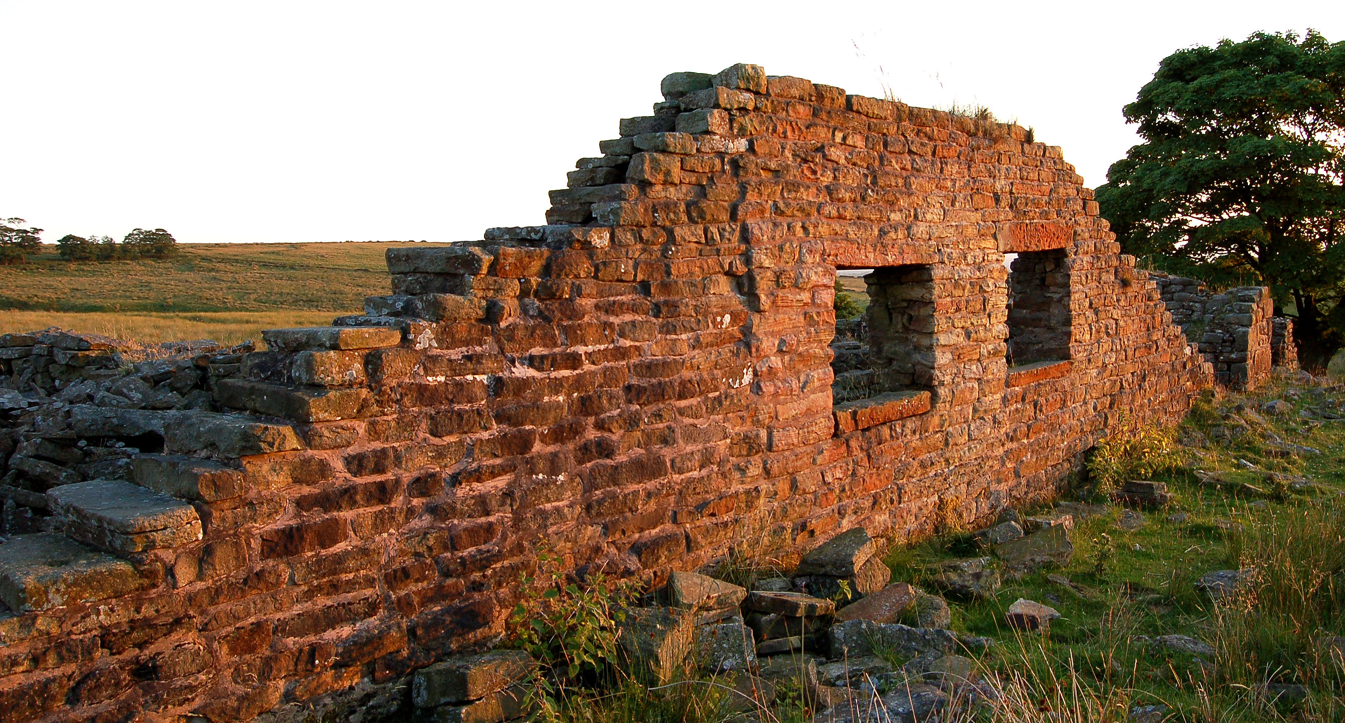
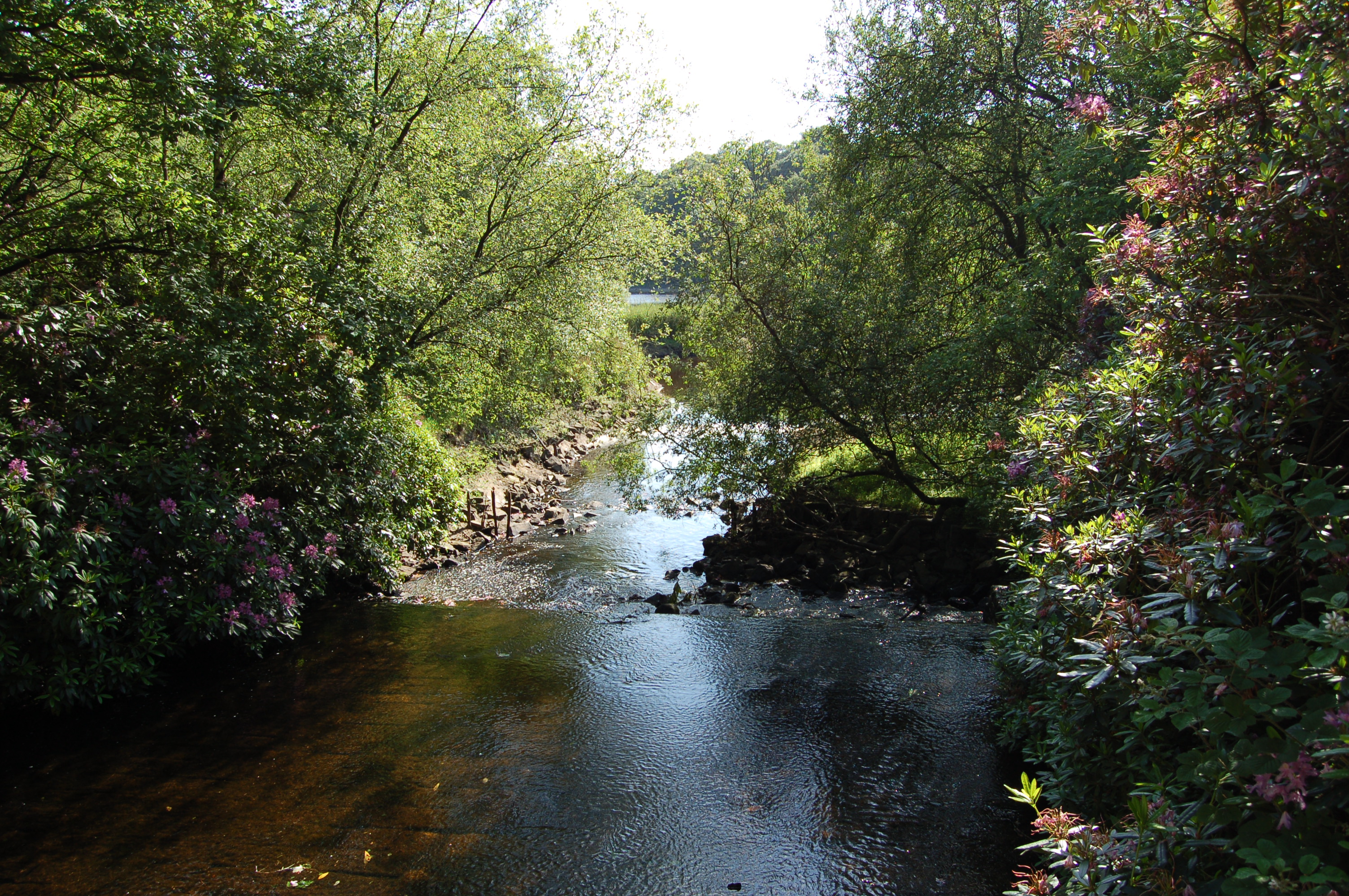
Healey Nab or "The Nab" is an area of countryside owned partly by Lancashire County Council containing rolling hills, moorland, woodland, ponds and streams to the east of Chorley, Lancashire, between the M61 and the West Pennine Moors. To its southeast is Anglezarke Reservoir and to its northeast is White Coppice. The name "Healey Nab" is derived from (high) and (woodland). "Nab" is believed to derive from the Middle-English , meaning promontory or headland. The area is popular with walkers; a network of hiking trails criss-crosses it. It has two small man-made lakes: Bottom Lodge, and Top Lodge, a private fishing lake. They used to be linked to Lower Healey Bleach Works, a finishing works of the town's cotton industry, whose remaining structure has been incorporated into the site's conversion into a small industrial estate. The summit is Grey Heights, and near it is a disused quarry known as Devil's Rock. Its highest point is Grey Heights, at 682 feet, with views of Chorley ... [...More Info...] [...Related Items...] OR: [Wikipedia] [Google] [Baidu] |
Lancashire
Lancashire ( , ; abbreviated Lancs) is the name of a historic county, ceremonial county, and non-metropolitan county in North West England. The boundaries of these three areas differ significantly. The non-metropolitan county of Lancashire was created by the Local Government Act 1972. It is administered by Lancashire County Council, based in Preston, and twelve district councils. Although Lancaster is still considered the county town, Preston is the administrative centre of the non-metropolitan county. The ceremonial county has the same boundaries except that it also includes Blackpool and Blackburn with Darwen, which are unitary authorities. The historic county of Lancashire is larger and includes the cities of Manchester and Liverpool as well as the Furness and Cartmel peninsulas, but excludes Bowland area of the West Riding of Yorkshire transferred to the non-metropolitan county in 1974 History Before the county During Roman times the area was part of th ... [...More Info...] [...Related Items...] OR: [Wikipedia] [Google] [Baidu] |
England
England is a country that is part of the United Kingdom. It shares land borders with Wales to its west and Scotland to its north. The Irish Sea lies northwest and the Celtic Sea to the southwest. It is separated from continental Europe by the North Sea to the east and the English Channel to the south. The country covers five-eighths of the island of Great Britain, which lies in the North Atlantic, and includes over 100 smaller islands, such as the Isles of Scilly and the Isle of Wight. The area now called England was first inhabited by modern humans during the Upper Paleolithic period, but takes its name from the Angles, a Germanic tribe deriving its name from the Anglia peninsula, who settled during the 5th and 6th centuries. England became a unified state in the 10th century and has had a significant cultural and legal impact on the wider world since the Age of Discovery, which began during the 15th century. The English language, the Anglican Church, and Engli ... [...More Info...] [...Related Items...] OR: [Wikipedia] [Google] [Baidu] |
West Pennine Moors
The West Pennine Moors is an area of the Pennines covering approximately of moorland and reservoirs in Lancashire and Greater Manchester, England. It is a Site of Special Scientific Interest. The West Pennine Moors are separated from the main Pennine range by the Irwell Valley to the east. The moorland includes Withnell, Anglezarke and Rivington Moors in the extreme west, Darwen and Turton Moors, Oswaldtwistle Moors and Holcombe Moors. These moors are lower in height than the main spine of the South Pennines. At , the highest point is at Winter Hill. The area is of historical importance with archaeological evidence of human activity from Neolithic times. The area is close to urban areas, the dramatic backdrop to Bolton, Blackburn and Bury and neighbouring towns affording panoramic views across the Lancashire Plain and the Greater Manchester conurbation. The moorland is surrounded by the towns of Bolton, Chorley, Darwen, Horwich, Ramsbottom, Haslingden and Oswaldtwistle. No ... [...More Info...] [...Related Items...] OR: [Wikipedia] [Google] [Baidu] |
Ordnance Survey
Ordnance Survey (OS) is the national mapping agency for Great Britain. The agency's name indicates its original military purpose (see ordnance and surveying), which was to map Scotland in the wake of the Jacobite rising of 1745. There was also a more general and nationwide need in light of the potential threat of invasion during the Napoleonic Wars. Since 1 April 2015 Ordnance Survey has operated as Ordnance Survey Ltd, a government-owned company, 100% in public ownership. The Ordnance Survey Board remains accountable to the Secretary of State for Business, Energy and Industrial Strategy. It was also a member of the Public Data Group. Paper maps for walkers represent only 5% of the company's annual revenue. It produces digital map data, online route planning and sharing services and mobile apps, plus many other location-based products for business, government and consumers. Ordnance Survey mapping is usually classified as either " large-scale" (in other words, more detaile ... [...More Info...] [...Related Items...] OR: [Wikipedia] [Google] [Baidu] |
Lancashire County Council
Lancashire County Council is the upper-tier local authority for the non-metropolitan county of Lancashire, England. It consists of 84 councillors. Since the 2017 election, the council has been under Conservative control. Prior to the 2009 Lancashire County Council election, the county had been under Labour control since 1989. The leader of the council is Conservative councillor Phillippa Williamson, appointed in May 2021, chairing a cabinet of up to eight councillors. The Chief Executive and Director of Resources is Angie Ridgwell who was appointed in January 2018. History The council was established in 1889 under the Local Government Act 1888, covering the administrative county. It was reconstituted under the Local Government Act 1972 with some significant changes to its territory. In 1998 Blackburn with Darwen and Blackpool were both made unitary authorities, making them independent from the county council. One Connect scandal In May 2011 the council's Conservati ... [...More Info...] [...Related Items...] OR: [Wikipedia] [Google] [Baidu] |
Chorley
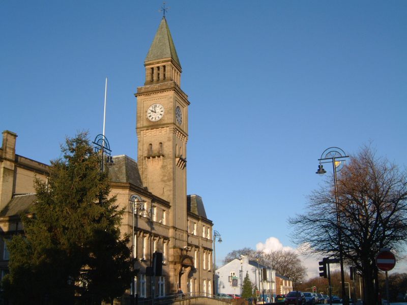
Chorley is a town and the administrative centre of the wider Borough of Chorley in Lancashire, England, north of Wigan, south west of Blackburn, north west of Bolton, south of Preston and north west of Manchester. The town's wealth came principally from the cotton industry. In the 1970s, the skyline was dominated by factory chimneys, but most have now been demolished: remnants of the industrial past include Morrisons chimney and other mill buildings, and the streets of terraced houses for mill workers. Chorley is the home of the Chorley cake. History Toponymy The name ''Chorley'' comes from two Anglo-Saxon words, and , probably meaning "the peasants' clearing". (also or ) is a common element of place-name, meaning a clearing in a woodland; refers to a person of status similar to a freeman or a yeoman. Prehistory There was no known occupation in Chorley until the Middle Ages, though archaeological evidence has shown that the area around the town has been inhabi ... [...More Info...] [...Related Items...] OR: [Wikipedia] [Google] [Baidu] |
M61 Motorway
The M61 is a motorway in North West England between Manchester and Preston, linking the M60 Manchester Orbital Motorway with the M6 Midlands-to-Scotland motorway. It runs from the A580 near Wardley and heads northwest past Bolton, Horwich and Chorley to join the M6 near Bamber Bridge, just north of the junction between the M6 and M65. It runs parallel to the A6, to its northeast, for the entirety of its length, essentially bypassing the towns and villages the A6 runs through between Manchester and Preston. History The Horwich to Worsley section began on Wednesday 1 January 1969, costing £12,434,103, to open by the end of December 1970, built by the Alfred McAlpine and Leonard Fairclough & Son consortium. Services The M61 has one service station: Rivington services (formerly Anderton Services and Bolton West services), located between Junctions 6 and 8 (as Junction 7 was never built). This motorway service area was used in the filming of "The Services", a pilot episode ... [...More Info...] [...Related Items...] OR: [Wikipedia] [Google] [Baidu] |
Anglezarke Reservoir
Anglezarke Reservoir is the largest reservoir in the Rivington chain to the west of Anglezarke in Lancashire, England. Anglezarke Reservoir has three embankments: the Charnock Embankment, the longest, is long and high, the Knowsley Embankment is long and high and the Heapey Embankment is long and high. It is fed by the River Yarrow, which has been diverted from its original course which is now covered by the Knowsley Embankment. It served the city of Liverpool before its current status as a supply mainly for Wigan. The original `Rivington Pike Scheme' was undertaken by Thomas Hawksley between 1850 and 1857 for the Liverpool Corporation Waterworks. The scheme was to construct five reservoirs and a water treatment works at the south end of Lower Rivington with a pipeline to storage reservoirs at Prescot. Water from two higher level reservoirs, Rake Brook and Lower Roddlesworth, was carried south in `The Goit', a channel connecting them to the reservoirs. In November 199 ... [...More Info...] [...Related Items...] OR: [Wikipedia] [Google] [Baidu] |
White Coppice
White Coppice is a hamlet near Chorley, Lancashire, England. It was the most populated part of the township of Anglezarke in the 19th century. Close to the settlement in the early 19th century were quarries and small coal mines. The hamlet lies to the north of Anglezarke Reservoir in the Rivington reservoir chain built to provide water for Liverpool in the mid 19th century. To the south west is a hill known as Healey Nab. White Coppice had a cotton mill at the start of the Industrial Revolution. Its mill lodge provided water for a steam engine, and before that the mill was powered by a waterwheel on the Black Brook. Around 1900 the mill was owned by Alfred Ephraim Eccles, a supporter of the Temperance movement. Notable residents * Walter Haworth was born here on 19 March 1883 and won a Nobel Prize in chemistry. * Sir Henry Tate, 1st Baronet was born on 11 March 1819 in White Coppice. He was an English sugar merchant and philanthropist, noted for establishing the Tate G ... [...More Info...] [...Related Items...] OR: [Wikipedia] [Google] [Baidu] |
Preston, Lancashire
Preston () is a city on the north bank of the River Ribble in Lancashire, England. The city is the administrative centre of the county of Lancashire and the wider City of Preston local government district. Preston and its surrounding district obtained city status in 2002, becoming England's 50th city in the 50th year of Queen Elizabeth II's reign. Preston has a population of 114,300, the City of Preston district 132,000 and the Preston Built-up Area 313,322. The Preston Travel To Work Area, in 2011, had a population of 420,661, compared with 354,000 in the previous census. Preston and its surrounding area have provided evidence of ancient Roman activity, largely in the form of a Roman road that led to a camp at Walton-le-Dale. The Angles established Preston; its name is derived from the Old English meaning "priest's settlement" and in the ''Domesday Book'' is recorded as "Prestune". In the Middle Ages, Preston was a parish and township in the hundred of Amounderness an ... [...More Info...] [...Related Items...] OR: [Wikipedia] [Google] [Baidu] |
Blackpool Tower
Blackpool Tower is a tourist attraction in Blackpool, Lancashire, England, which was opened to the public on 14 May 1894. When it opened, Blackpool Tower was the tallest man made structure in the British Empire. Inspired by the Eiffel Tower in Paris, it is tall and is the 125th-tallest freestanding tower in the world. Blackpool Tower is also the common name for the Tower Buildings, an entertainment complex in a red-brick three-storey block that comprises the tower, Tower Circus, the Tower Ballroom, and roof gardens, which was designated a Grade I listed building in 1973. Background The Blackpool Tower Company was founded by London-based Standard Contract & Debenture Corporation in 1890; it bought an aquarium on Central Promenade with the intention of building a replica Eiffel Tower on the site. John Bickerstaffe, a former mayor of Blackpool, was asked to become chairman of the new company, and its shares went on sale in July 1891. The Standard Corporation kept 30,000 £1 shar ... [...More Info...] [...Related Items...] OR: [Wikipedia] [Google] [Baidu] |


