|
Hawcoat
Hawcoat is an area and electoral ward of Barrow-in-Furness, Cumbria, England. Historically part of Lancashire, it is one of Barrow's most northerly wards and is bordered by Roose, Newbarns, Parkside, Ormsgill and the town of Dalton-in-Furness to the north. The ward itself will be combined with Newbarns ward in April 2023 following formation of the new Westmorland and Furness Local Authority. Geography Hawcoat lies on small hill on the southwest of the Furness Peninsula, rising up from Walney Channel to its west and peaking at 84m. From its peak there are quite extensive views incorporating the Isle of Man, Snowdonia, Blackpool, across Morecambe Bay Ingleborough, the Howgills, and the fells of the Lake District. The small stream of Dane Ghyll rises to the east of the high ground, and flows south and east into Mill Beck at Furness Abbey in the Valley of the Deadly Nightshade, providing a clear eastern boundary to the area. Hawcoat forms the north-eastern part of Barrow-in-Furness ... [...More Info...] [...Related Items...] OR: [Wikipedia] [Google] [Baidu] |
Barrow-in-Furness
Barrow-in-Furness is a port town in Cumbria, England. Historically in Lancashire, it was incorporated as a municipal borough in 1867 and merged with Dalton-in-Furness Urban District in 1974 to form the Borough of Barrow-in-Furness. In 2023 the borough will merge with Eden and South Lakeland districts to form a new unitary authority; Westmorland and Furness. At the tip of the Furness peninsula, close to the Lake District, it is bordered by Morecambe Bay, the Duddon Estuary and the Irish Sea. In 2011, Barrow's population was 56,745, making it the second largest urban area in Cumbria after Carlisle. Natives of Barrow, as well as the local dialect, are known as Barrovian. In the Middle Ages, Barrow was a small hamlet within the parish of Dalton-in-Furness with Furness Abbey, now on the outskirts of the town, controlling the local economy before its dissolution in 1537. The iron prospector Henry Schneider arrived in Furness in 1839 and, with other investors, opened the Furness Railwa ... [...More Info...] [...Related Items...] OR: [Wikipedia] [Google] [Baidu] |
Newbarns
Newbarns is an area and electoral ward of Barrow-in-Furness, Cumbria, England. It is bordered by Hawcoat, Parkside, Risedale and Roose, the local population stood at 5,515 in 2001, decreasing to 5,487 at the 2011 Census. Newbarns covers an area of 2.78 square kilometres and lies east of Abbey Road, encompassing Furness Abbey in its entirety, Barrow Sixth Form College and St. Bernard's Catholic High School. Newbarns is extremely diverse, with the majority of the south of the ward being amongst the 6% to 10% most deprived areas of the country, while north Newbarns contains Croslands Park, Barrow's most expensive street and is within the 25% of least deprived areas nationwide. The ward itself will be combined with Hawcoat ward in April 2023 following formation of the new Westmorland and Furness Local Authority. History The area centred on Hector Street marks the original Newbarns village which pre dates much of Barrow and originally lay within the Parish of Dalton-in-Furness ... [...More Info...] [...Related Items...] OR: [Wikipedia] [Google] [Baidu] |
Abbey Road, Barrow-in-Furness
Abbey Road is the principal north to south arterial road through Barrow-in-Furness, Cumbria, England. Background Abbey Road's name derives from Furness Abbey, a former Cistercian monastery along the route of the road. Beginning at Market Street, in the centre of Dalton-in-Furness, the road runs south and terminates at Hindpool Road, close to the centre of Barrow where the A590 and A5087 merge. Abbey Road predates Barrow itself although it was substantially upgraded to its current appearance during the mid-19th century, when the town was undergoing dramatic growth. The of Abbey Road that runs through Barrow is a tree-lined boulevard with multiple lanes, while the northern section of the road beyond Mill Brow is single lane, winding and more rural in nature. Sites along Abbey Road include Dalton town centre, Furness General Hospital, Barrow Park, Barrow-in-Furness railway station, Barrow town centre and several of Barrow's retail parks. Until 1932, the Barrow-in-Furness Tram ... [...More Info...] [...Related Items...] OR: [Wikipedia] [Google] [Baidu] |
Parkside, Barrow-in-Furness
Parkside is an area and electoral ward of Barrow-in-Furness, Cumbria, England. It is bordered by Hindpool, Ormsgill, Hawcoat, Newbarns and Risedale and had a population of 5,742 in 2001, reducing to 5,584 at the 2011 Census. It is one of the town's most centralised wards and contains Barrow's main park (hence the ward's name), as well as the newly established Furness Academy. Abbey Road - Barrow's principal road runs down the entire western side of Parkside. The majority of housing to the west of Abbey Road is terraced and semi-detached, whilst the eastern side of Parkside is predominantly parkland and fields with the exception of some semi and detached housing. The ward itself will be combined with Ormsgill ward in April 2023 following formation of the new Westmorland and Furness Local Authority. There are a number of place of worship in Parkside including Abbey Road Baptist Church, Spring Mount Christian Fellowship and Trinity Church Centre. Barrow's first synagogue ... [...More Info...] [...Related Items...] OR: [Wikipedia] [Google] [Baidu] |
Cumbria
Cumbria ( ) is a ceremonial and non-metropolitan county in North West England, bordering Scotland. The county and Cumbria County Council, its local government, came into existence in 1974 after the passage of the Local Government Act 1972. Cumbria's county town is Carlisle, in the north of the county. Other major settlements include Barrow-in-Furness, Kendal, Whitehaven and Workington. The administrative county of Cumbria consists of six districts ( Allerdale, Barrow-in-Furness, Carlisle, Copeland, Eden and South Lakeland) and, in 2019, had a population of 500,012. Cumbria is one of the most sparsely populated counties in England, with 73.4 people per km2 (190/sq mi). On 1 April 2023, the administrative county of Cumbria will be abolished and replaced with two new unitary authorities: Westmorland and Furness (Barrow-in-Furness, Eden, South Lakeland) and Cumberland ( Allerdale, Carlisle, Copeland). Cumbria is the third largest ceremonial county in England by area. It i ... [...More Info...] [...Related Items...] OR: [Wikipedia] [Google] [Baidu] |
Barrow-in-Furness (borough)
Barrow-in-Furness is a local government district with borough status in Cumbria, England. It is named after its main town, Barrow-in-Furness. Other settlements include Dalton-in-Furness and Askam-in-Furness. It is the smallest district in the county, but is the most densely populated, with 924 people per square kilometre. The population was 71,980 in 2001, reducing to 69,087 at the 2011 Census. In July 2021 the Ministry of Housing, Communities and Local Government announced that in April 2023, Cumbria will be reorganised into two unitary authorities. Barrow-in-Furness Borough Council is to be abolished and its functions transferred to a new authority, to be known as Westmorland and Furness, which will cover the current districts of Barrow-in-Furness, Eden and South Lakeland. In April 2022 Gareth Davies became the first person to run every single street in the Borough of Barrow-In-Furness. Covering all 1,026 streets over an end to end distance of 201 miles. Background The ar ... [...More Info...] [...Related Items...] OR: [Wikipedia] [Google] [Baidu] |
Furness Peninsula
Furness ( ) is a peninsula and region of Cumbria in northwestern England. Together with the Cartmel Peninsula it forms North Lonsdale, historically an exclave of Lancashire. The Furness Peninsula, also known as Low Furness, is an area of villages, agricultural land and low-lying moorland, with the industrial town of Barrow at its head. The peninsula is bordered by the estuaries of the River Duddon to the west and the River Leven in Morecambe Bay to the east. The wider region of Furness consists of the peninsula and the area known as ''High Furness'', which is a relatively mountainous and sparsely populated part of England, extending inland into the Lake District and containing the Furness Fells. The inland boundary of the region is formed by the rivers Leven, Brathay and Duddon, and the lake of Windermere. Off the southern tip of Furness is Walney Island, long, as well as several smaller islands. The Borough of Barrow-in-Furness, which developed when the Furness iron ind ... [...More Info...] [...Related Items...] OR: [Wikipedia] [Google] [Baidu] |
Ormsgill
Ormsgill is an area and ward of Barrow-in-Furness, Cumbria, England. It is bordered by Hindpool, Parkside, Hawcoat, Roanhead and Walney Channel. The population of the ward in 2001 stood at 5,961 (2,883 male and 3,078 female),increasing to 6,033 at the 2011 Census. Almost three quarters of Ormsgill is greenspace, with the majority of residents living in the densely populated south-east corridor. The western part of the ward is predominantly industrial and includes a large Kimberly-Clark plant and numerous other industrial estates which provide a base for companies including Blyth, BT, Gyrodata, McBride and Oil States International. The ward itself will be combined with Parkside ward in April 2023 following formation of the new Westmorland and Furness Local Authority. Ormsgill is one of the longest settled areas of what is now Barrow. It is home to the town's oldest continuously inhabited building; Ormsgill Farm House dated 1605. The building is Grade II* listed. Other sites of ... [...More Info...] [...Related Items...] OR: [Wikipedia] [Google] [Baidu] |
Howgills
The Howgill Fells are uplands in Northern England between the Lake District and the Yorkshire Dales, lying roughly within a triangle formed by the towns of Sedbergh and Kirkby Stephen and the village of Tebay.The Howgill Fells in Cumbria ''www.visitcumbria.com'' The name Howgill derives from the word ''haugr'' meaning a hill or barrow, plus ''gil'' meaning a narrow valley. Geography The Howgill Fells are bounded by the (and the |
Lake District
The Lake District, also known as the Lakes or Lakeland, is a mountainous region in North West England. A popular holiday destination, it is famous for its lakes, forests, and mountains (or ''fells''), and its associations with William Wordsworth and other Lake Poets and also with Beatrix Potter and John Ruskin. The Lake District National Park was established in 1951 and covers an area of . It was designated a UNESCO World Heritage Site in 2017. The Lake District is today completely within Cumbria, a county and administrative unit created in 1974 by the Local Government Act 1972. However, it was historically divided between three English counties ( Cumberland, Westmorland and Lancashire), sometimes referred to as the Lakes Counties. The three counties met at the Three Shire Stone on Wrynose Pass in the southern fells west of Ambleside. All the land in England higher than above sea level lies within the National Park, including Scafell Pike, the highest mountain in England. ... [...More Info...] [...Related Items...] OR: [Wikipedia] [Google] [Baidu] |
Furness Abbey
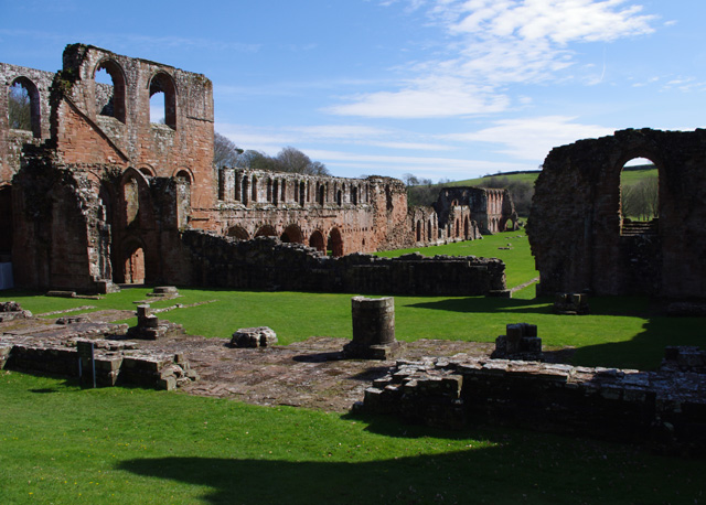
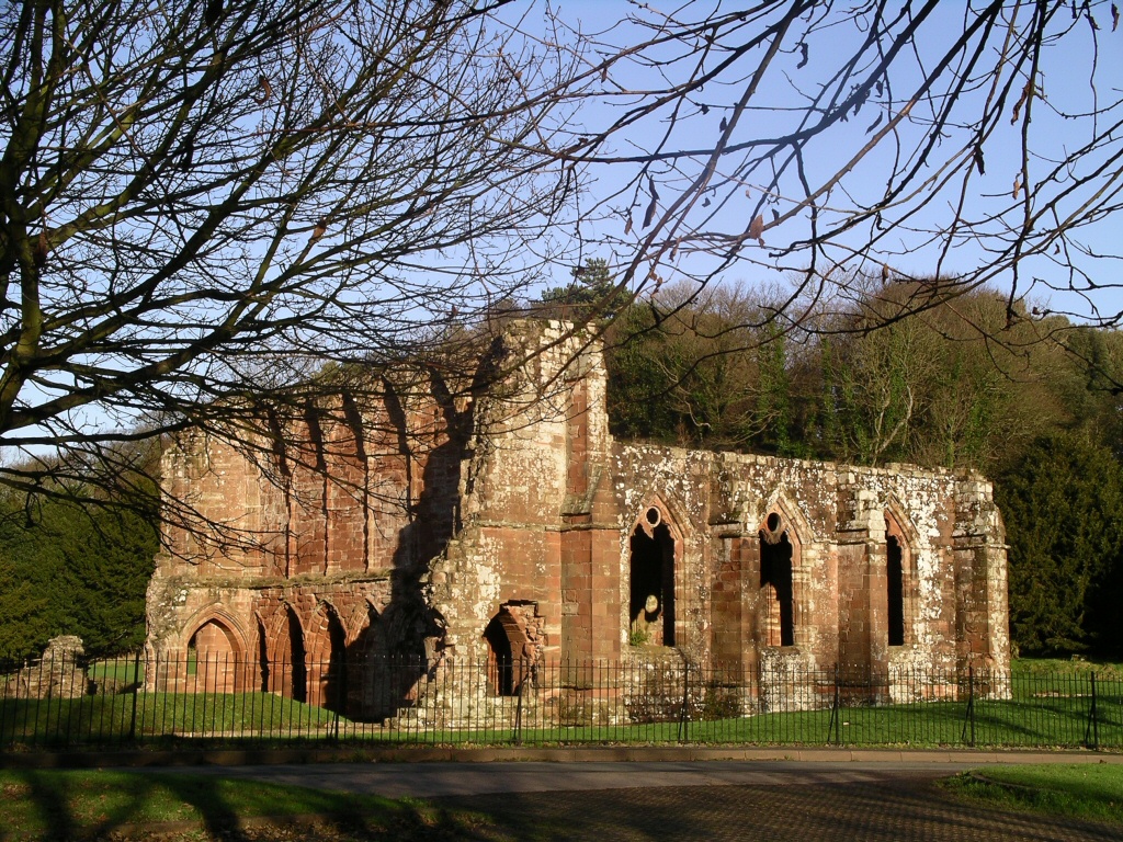
Furness Abbey, or St. Mary of Furness, is a former Catholic monastery located to the north of Barrow-in-Furness, Cumbria, England. The abbey dates back to 1123 and was once the second-wealthiest and most powerful Cistercian monastery in the country, behind Fountains Abbey, prior to its dissolution during the English Reformation.History of the abbey The abbey contains a number of individual Grade I s and is a . History of the abbey Early history [...More Info...] [...Related Items...] OR: [Wikipedia] [Google] [Baidu] |


