|
Having (bay)
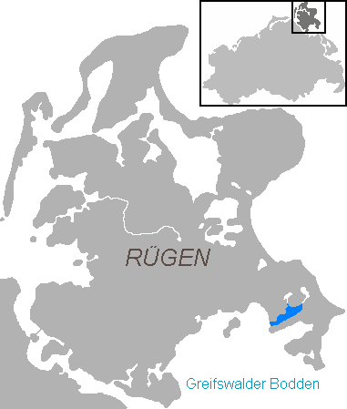
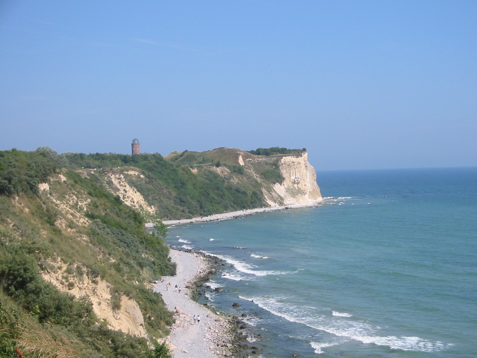
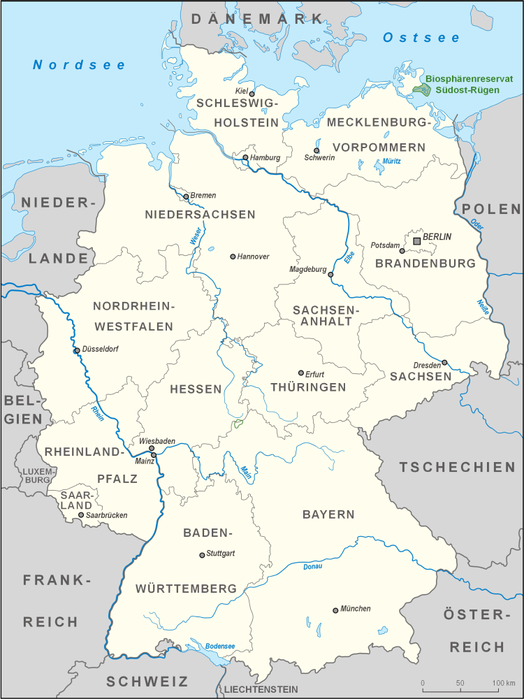
The Having is an inlet in the northeast of the Rügischer Bodden, the northern half of the Bay of Greifswald, which cuts deeply into the peninsula of Mönchgut, the southeastern tip of the German island of Rügen. The inlet is about 5.7 kilometres long, 1.1 kilometres wide and has an area of 7.5 km². It opens towards the southwest onto the Rügische Bodden. The Having is up to eight metres deep. In the south the Having is bounded by the narrow, elongated peninsula of Reddevitzer Höft, in the north by the Granitz. In the north there are two narrow waterways to the lakes of Selliner See and Neuensiener See. The heights around the bay climb to over 30 metres. There are no settlements on the shores of the Having itself. The inlet is part of the Mönchgut Nature Reserve in the Southeast Rügen Biosphere Reserve The Southeast Rügen Biosphere Reserve (german: Biosphärenreservat Südost-Rügen) is a biosphere reserve in the German state of Mecklenburg-Vorpom ... [...More Info...] [...Related Items...] OR: [Wikipedia] [Google] [Baidu] |
Lage Having
Lage may refer to: Places * Lage, Lower Saxony * Lage, North Rhine-Westphalia * Lage, Sulawesi People * Julian Lage (born 1987), American jazz guitarist and composer * Klaus Lage (born 1950), German musician * Natália Lage (born 1978), Brazilian actress. * José María Sánchez Lage, Argentine footballer * Aluizio Lage (1919–1974), Brazilian swimmer * Jorge Enrique Lage Jorge Enrique Lage (Havana, 1979) is a Cuban Cuban may refer to: * Something of, from, or related to Cuba, a country in the Caribbean * Cubans, people from Cuba, or of Cuban descent ** Cuban exile, a person who left Cuba for political reasons, or ... (born 1979), Cuban novelist and short story writer * Olivier Da Lage (born 1957), French journalist {{disamb, geo, surname ... [...More Info...] [...Related Items...] OR: [Wikipedia] [Google] [Baidu] |
Rügischer Bodden
The Rügische Bodden is a bay which is part of a larger stretch of water, the Greifswalder Bodden, bounded on two sides by the German mainland and on a third by the Baltic Sea island of Rügen. It is located southeast of Rügen island between Mönchgut and the Zudar peninsula. At Mönchgut, several headlands project into the ''bodden'': the Reddevitz Höft, the Klein Zicker and the Großer Zicker. The inlet between Rügen and the Reddevitzer Höft is known as Having; between the Reddevitzer Höft and the Großer Zicker lies the inlet of Hagensche Wiek. Other bays are the Schoritzer Wiek, the Selliner See and the Neuensiener See. Its southern boundary would be the line between the headlands of the Zudar and Mönchgut peninsulas. There are harbours in Lauterbach, Baabe and Seedorf. The ''bodden'' is part of the Southeast Rügen Biosphere Reserve. In the northern part of the lagoon, off the village of Lauterbach, lies the island Vilm The Baltic Sea island of Vilm lies in ... [...More Info...] [...Related Items...] OR: [Wikipedia] [Google] [Baidu] |
Bay Of Greifswald
The Bay of Greifswald''Utrata Fachwörterbuch: Geographie - Englisch-Deutsch/Deutsch-Englisch'' by Jürgen Utrata (2014). Retrieved 10 Apr 2014. or Greifswald Bodden (german: Greifswalder Bodden) is a basin in the southwestern , off the shores of in the |
Mönchgut
Mönchgut (''Monk's Estates'' in German) is a peninsula of 29.44 square kilometers with 6600 inhabitants in the southeast of Rügen island in Mecklenburg-Western Pomerania, Germany. It lies just between the Greifswalder Bodden and the rest of the Baltic Sea. Mönchgut contains the districts of Göhren and Thiessow; the peninsula is part of the Mönchgut-Granitz administration area. It is also a part of the Biosphere Reserve of Südost-Rügen. The name translates as ''the monks' estates''. In 1252, Jaromar II, Prince of Rügen sold the area to the Cistercian monks of Eldena Abbey, which was founded by one of his predecessors, Jaromar I, Prince of Rügen in 1199 and by that time also belonged to the Danish Principality of Rügen. To separate the monks' possessions from the rest of the island, a ditch was dug between Baabe and Sellin, known as ''Mönchsgraben'' ("monks' ditch"). Today, a large wooden gate built upon the bridge over the ''Mönchsgraben'' marks the entrance to the ... [...More Info...] [...Related Items...] OR: [Wikipedia] [Google] [Baidu] |
Rügen
Rügen (; la, Rugia, ) is Germany's largest island. It is located off the Pomeranian coast in the Baltic Sea and belongs to the state of Mecklenburg-Western Pomerania. The "gateway" to Rügen island is the Hanseatic city of Stralsund, where it is linked to the mainland by road and railway via the Rügen Bridge and Causeway, two routes crossing the two-kilometre-wide Strelasund, a sound of the Baltic Sea. Rügen has a maximum length of (from north to south), a maximum width of in the south and an area of . The coast is characterized by numerous sandy beaches, lagoons () and open bays (), as well as projecting peninsulas and headlands. In June 2011, UNESCO awarded the status of a World Heritage Site to the Jasmund National Park, famous for its vast stands of beeches and chalk cliffs like King's Chair, the main landmark of Rügen island. The island of Rügen is part of the district of Vorpommern-Rügen, with its county seat in Stralsund. The towns on Rügen are: Bergen, S ... [...More Info...] [...Related Items...] OR: [Wikipedia] [Google] [Baidu] |
Granitz
The Granitz is a wooded ridge in the southeast of Germany's largest island, Rügen, between the Baltic Sea resorts of Binz and Sellin. The woods cover an area of 982 hectares and are designated as a nature reserve. Since 1991 they have been part of the Southeast Rügen Biosphere Reserve. Characteristic of the Granitz are its rich stands of beech and sessile oak and its rolling landscape of push end moraines, which in some ways resemble a mountain landscape. To the north and east the Granitz is bounded by a cliffed coast on the Baltic Sea. In the south it adjoins the Mönchgut region and in the north, the narrow bar of the Schmale Heide. The Black Lake (''Schwarzer See'') lies in the Granitz as do several kettle bogs. A number of non-native stands of conifers are being turned into a near-natural forest. No roads of any description run through the Granitz, but there are many cycle and footpaths. Local transport and access to the area is provided by the Rügen Light Railway ... [...More Info...] [...Related Items...] OR: [Wikipedia] [Google] [Baidu] |
Selliner See (Rügen)
Selliner See (Rügen) is a lake in the Vorpommern-Rügen district in Mecklenburg-Vorpommern, Germany Germany,, officially the Federal Republic of Germany, is a country in Central Europe. It is the second most populous country in Europe after Russia, and the most populous member state of the European Union. Germany is situated betwe .... At an elevation of 0 m, its surface area is Lakes of Mecklenburg-Western Pomerania Bays of Mecklenburg-Western Pomerania Geography of Rügen Bay of Greifswald Sellin {{VorpommernRügen-geo-stub ... [...More Info...] [...Related Items...] OR: [Wikipedia] [Google] [Baidu] |
Mönchgut Nature Reserve
Mönchgut (''Monk's Estates'' in German) is a peninsula of 29.44 square kilometers with 6600 inhabitants in the southeast of Rügen island in Mecklenburg-Western Pomerania, Germany. It lies just between the Greifswalder Bodden and the rest of the Baltic Sea. Mönchgut contains the districts of Göhren and Thiessow; the peninsula is part of the Mönchgut-Granitz administration area. It is also a part of the Biosphere Reserve of Südost-Rügen. The name translates as ''the monks' estates''. In 1252, Jaromar II, Prince of Rügen sold the area to the Cistercian monks of Eldena Abbey, which was founded by one of his predecessors, Jaromar I, Prince of Rügen in 1199 and by that time also belonged to the Danish Principality of Rügen. To separate the monks' possessions from the rest of the island, a ditch was dug between Baabe and Sellin, known as ''Mönchsgraben'' ("monks' ditch"). Today, a large wooden gate built upon the bridge over the ''Mönchsgraben'' marks the entrance to the ... [...More Info...] [...Related Items...] OR: [Wikipedia] [Google] [Baidu] |
Southeast Rügen Biosphere Reserve
The Southeast Rügen Biosphere Reserve (german: Biosphärenreservat Südost-Rügen) is a biosphere reserve in the German state of Mecklenburg-Vorpommern, which covers the southeastern part of the island of Rügen (including Granitz and Mönchgut), the lagoon of Rügischer Bodden between Putbus and Thiessow, the outer coast between Thiessow and Binz and the island of Vilm. In the biosphere reserve all the classic landscape and coastal features of the Mecklenburg-Vorpommern littoral are found within one small area. The land is deeply indented here by the sea. One the one hand, peninsulas and coastal headlands are linked by narrow strips of land, on the other side they are separated by lagoons known as ''boddens'' and open bays called ''Wieken'' locally. There are fine-sanded beaches and rugged cliffed coastlines, at the foot of which are impressive rocky beaches. Broad belts of reed girdle the shores. Beech woods or poor grasslands are found on the sites of terminal moraines and ... [...More Info...] [...Related Items...] OR: [Wikipedia] [Google] [Baidu] |


