|
Havannah Channel
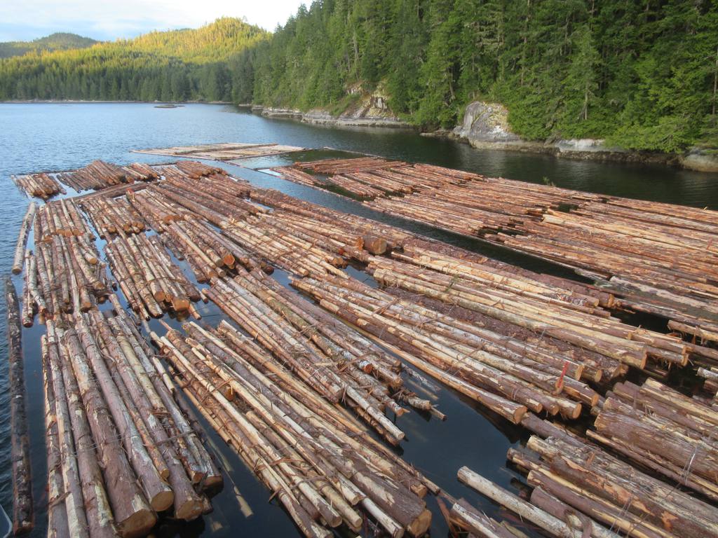
Havannah Channel is a marine passageway in the South Coast region of British Columbia, Canada, leading off of the north side of Johnstone Strait leading to Chatham Channel and Call Inlet, south of East Cracroft Island. Havannah Channel is entered from Johnstone Strait at the Broken Islands. Hull Island is located in the channel, to the southeast of East Cracroft and south of the opening of Call Inlet. Name origin Havannah Channel was named for , which served on the Pacific Station from 1855 to 1859. ''Havannah''s captain was Thomas Harvey, namesake of Port Harvey, which is a bay or port on the north side of the channel formed by the division of the two Cracroft Islands. Indian reserves and villages Etsekin IR No. 1 is on the east shore of Havannah Channel, east of the north end of Hull Island and including three small islands adjacent, and the locality of Matilpi Matilpi is a locality on the Central Coast of British Columbia, Canada, located northeast of Hull Island on the ea ... [...More Info...] [...Related Items...] OR: [Wikipedia] [Google] [Baidu] |
British Columbia Coast
, settlement_type = Region of British Columbia , image_skyline = , nickname = "The Coast" , subdivision_type = Country , subdivision_name = Canada , subdivision_type1 = Province , subdivision_name1 = British Columbia , parts_type = Principal cities , p1 = Vancouver , p2 = Surrey , p3 = Burnaby , p4 = Richmond , p5 = Abbotsford , p6 = Coquitlam , p7 = Delta , p8 = Nanaimo , p9 = Victoria , p10 = Chilliwack , p11 = Maple Ridge , p12 = New Westminster , p13 = Port Coquitlam , p14 = North Vancouver , area_blank1_title = 15 Districts , area_blank1_km2 = 244,778 , area_footnotes = , elevation_max_m = 4019 , elevation_min_m = 0 , elevation_max_footnotes = Mt. ... [...More Info...] [...Related Items...] OR: [Wikipedia] [Google] [Baidu] |
British Columbia
British Columbia (commonly abbreviated as BC) is the westernmost province of Canada, situated between the Pacific Ocean and the Rocky Mountains. It has a diverse geography, with rugged landscapes that include rocky coastlines, sandy beaches, forests, lakes, mountains, inland deserts and grassy plains, and borders the province of Alberta to the east and the Yukon and Northwest Territories to the north. With an estimated population of 5.3million as of 2022, it is Canada's third-most populous province. The capital of British Columbia is Victoria and its largest city is Vancouver. Vancouver is the third-largest metropolitan area in Canada; the 2021 census recorded 2.6million people in Metro Vancouver. The first known human inhabitants of the area settled in British Columbia at least 10,000 years ago. Such groups include the Coast Salish, Tsilhqotʼin, and Haida peoples, among many others. One of the earliest British settlements in the area was Fort Victoria, established ... [...More Info...] [...Related Items...] OR: [Wikipedia] [Google] [Baidu] |
Canada
Canada is a country in North America. Its ten provinces and three territories extend from the Atlantic Ocean to the Pacific Ocean and northward into the Arctic Ocean, covering over , making it the world's second-largest country by total area. Its southern and western border with the United States, stretching , is the world's longest binational land border. Canada's capital is Ottawa, and its three largest metropolitan areas are Toronto, Montreal, and Vancouver. Indigenous peoples have continuously inhabited what is now Canada for thousands of years. Beginning in the 16th century, British and French expeditions explored and later settled along the Atlantic coast. As a consequence of various armed conflicts, France ceded nearly all of its colonies in North America in 1763. In 1867, with the union of three British North American colonies through Confederation, Canada was formed as a federal dominion of four provinces. This began an accretion of provinces an ... [...More Info...] [...Related Items...] OR: [Wikipedia] [Google] [Baidu] |
Johnstone Strait
, image = Pacific Ranges over Johnstone Strait.jpg , image_size = 250px , alt = , caption = Johnstone Strait backdropped by the Vancouver Island Ranges , image_bathymetry = Carte baie Knight.png , alt_bathymetry = , caption_bathymetry = Map of Johnstone Strait (bottom) and the surrounding islands and inlets , location = British Columbia, Canada , group = , coordinates = , type = Channel , etymology = , part_of = , inflow = , rivers = , outflow = , oceans = Pacific Ocean , catchment = , basin_countries = , agency = , designation = , date-built = , engineer = , date-flooded = , length = , width = , area = , depth = , max-depth = , volume = , ... [...More Info...] [...Related Items...] OR: [Wikipedia] [Google] [Baidu] |
Chatham Channel
Chatham Channel is a strait and marine passageway on the coast of British Columbia. It leads from the lower reaches of Knight Inlet to the opening of Call Inlet, separating Minstrel and East Cracroft Islands from the mainland to the east. From the opening of Call Inlet, running south then east around East Cracroft, is Havannah Channel Havannah Channel is a marine passageway in the South Coast region of British Columbia, Canada, leading off of the north side of Johnstone Strait leading to Chatham Channel and Call Inlet, south of East Cracroft Island. Havannah Channel is entered f .... Name origin The channel is presumably named for . References Straits of British Columbia Central Coast of British Columbia {{BritishColumbiaCoast-geo-stub ... [...More Info...] [...Related Items...] OR: [Wikipedia] [Google] [Baidu] |
Call Inlet
Call Inlet is an inlet on the Central Coast region of British Columbia, Canada, located south of the lower reaches of Knight Inlet to the east of East Cracroft Island. Pawala Indian Reserve No. 5 is at the head of the inlet. Chatham Channel connects the outlet of the inlet to Knight Inlet and separates East Cracroft Island from the mainland peninsula on the north side of the inlet. Havannah Channel leads southwest out of the inlet, south and east around East Cracroft and past Hull Island, to Johnstone Strait. Name origin Also named as Call Creek by Captain Pender in his 1865 surveys of the region, when "creek" was a term used for coastal inlets, the inlet was originally named by Commander William Broughton of in 1792 for Sir John Call, 1782–1801, who had distinguished himself with the East India Company The East India Company (EIC) was an English, and later British, joint-stock company founded in 1600 and dissolved in 1874. It was formed to trade in the Indian Oce ... [...More Info...] [...Related Items...] OR: [Wikipedia] [Google] [Baidu] |
East Cracroft Island
East Cracroft Island is an island in the Johnstone Strait region of the Central Coast region of British Columbia, Canada. It is the smaller of the two Cracroft Islands, and at low tide is really one island with its larger neighbour, West Cracroft Island. On the south side of the shallows that form an isthmus between them at low tide is Port Harvey, a short, wide inlet or bay. On its east shore is Keecekiltum Indian Reserve No. 2 (11.7 ha.), which is under the governance of the Tlowitsis Nation of the Kwakwaka'wakw peoples. at . The Cacroft Islands were named for Sophia Cracroft, niece of Sir John Franklin. She visited the British Columbia with Lady Franklin in 1861. Nearby Sophia Island is also named for her. The island is separated from the mainland on its northwest by Chatham Channel, which leads from Knight Inlet to the entrance to Call Inlet to the east. Havannah Passage leads south from the opening of Call Inlet, then west along the Cracroft Islands' south side to Johnst ... [...More Info...] [...Related Items...] OR: [Wikipedia] [Google] [Baidu] |
Broken Islands
The Broken Islands are uninhabited islands in the Arctic Archipelago in Nunavut, Canada located within western Hudson Bay. The closest community is Rankin Inlet Rankin Inlet ( iu, Kangiqliniq; Inuktitut syllabics: ᑲᖏᕿᓂᖅ or ''Kangirliniq'', ᑲᖏᖅᖠᓂᖅ, or ''Kangir&iniq'' meaning ''deep bay/inlet'') is an Inuit hamlet on Kudlulik Peninsula in Nunavut, Canada. It is the largest hamlet and .... Islands of Hudson Bay Uninhabited islands of Kivalliq Region {{KivalliqNU-geo-stub ... [...More Info...] [...Related Items...] OR: [Wikipedia] [Google] [Baidu] |
Hull Island (British Columbia)
Hull Island is an island in the Central Coast region of British Columbia, Canada, located in Havannah Channel to the east of the southern end of East Cracroft Island. Name origin The island was named c.1860 by Captain Richards of the Royal Navy, for Thomas Arthur Hull, ship's master of under Captain Thomas Harvey, namesake of Port Harvey which is just to the west, forming a bay between the two nearly-joined Cracroft Islands. ''Havannah'' served on the Pacific Station from 1855 to 1859. See also *List of islands of British Columbia This is a list of islands of British Columbia. South Coast Vancouver Island *Vancouver Island Gulf of Georgia Gulf Islands =Southern Gulf Islands= *Brethour Island * Cabbage Island * Curlew Island * De Courcy Islands ** Mudge Island **Lin ... References Islands of British Columbia Central Coast of British Columbia {{BritishColumbiaCoast-geo-stub ... [...More Info...] [...Related Items...] OR: [Wikipedia] [Google] [Baidu] |
Pacific Station
The Pacific Station was created in 1837 as one of the geographical military formations into which the Royal Navy divided its worldwide responsibilities. The South America Station was split into the Pacific Station and the South East Coast of America Station. History The British Pacific Squadron was established in 1813 to support British interests along the eastern shores of the Pacific Ocean at Valparaíso, Chile. In 1837, when the South America station was split, this responsibility was passed to the Commander-in-Chief, Pacific. In 1843, Lord George Paulet, George Paulet, captain of , took her out from Valparaíso to Honolulu to demand the islands of the Kingdom of Hawaii for Britain. King Kamehameha III capitulated and signed the islands over to Paulet. In the summer of that year, Rear-Admiral Richard Darton Thomas set out from Valparaíso in to rein Paulet in. On 31 July 1843, Thomas assured the King that the occupation was over and that there was no Paulet Affair (1843) ... [...More Info...] [...Related Items...] OR: [Wikipedia] [Google] [Baidu] |
Port Harvey
Port Harvey is a port on the south side of the Cracroft Islands in the Johnstone Strait region of the Central Coast region of British Columbia, Canada, forming a small bay or inlet south of the shallows that link West Cracroft and East Cracroft Islands. On its east shore is Keecekiltum Indian Reserve No. 2, 11.7 ha., which is under the governance of the Tlowitsis Nation of the Kwakwaka'wakw peoples. at . It was named by Captain Richards for Captain Harvey of . See also *List of Indian reserves in British Columbia The Government of Canada has established at least 316 reserves for First Nation band governments in its westernmost province of British Columbia. The majority of these reserves continue to exist while a number are no longer in existence. See ... References Ports and harbours of British Columbia Central Coast of British Columbia Kwakwaka'wakw Bays of British Columbia {{BritishColumbiaCoast-geo-stub ... [...More Info...] [...Related Items...] OR: [Wikipedia] [Google] [Baidu] |


