|
Hartington Middle Quarter
Hartington Middle Quarter is a civil parish within the Derbyshire Dales district, which is in the county of Derbyshire, England. Formerly a part of Hartington parish, for which it is named, it has a mix of a number of villages and hamlets amongst a mainly rural and undulating landscape, and is wholly within the Peak District National Park. It had a population of 379 residents in 2011. The parish is north west of London, north west of the county city of Derby, and south east of the nearest market town of Buxton. Being on the edge of the county border, it shares a boundary with the parishes of Chelmorton, Flagg, Hartington Town Quarter, Hartington Upper Quarter, Middleton and Smerrill, Monyash in Derbyshire, as well as Hollinsclough, Longnor and Sheen in Staffordshire. Geography Location Hartington Middle Quarter parish is surrounded by the following local locations: * Buxton, Chelmorton and Sterndale Moor to the north * Hartington and Pilsbury to the south * Flagg an ... [...More Info...] [...Related Items...] OR: [Wikipedia] [Google] [Baidu] |
Parkhouse Hill
Parkhouse Hill is a small but distinctive hill in the Peak District National Park of the Hartington Middle Quarter civil parish, in the English county of Derbyshire. It lies on the north side of the River Dove, close to the border with Staffordshire. Geologically, the hill is the remains of an atoll (a 'reef knoll') which is believed to have existed during the Carboniferous period when what is now the Peak District was covered by a tropical sea. Together with its higher but less distinctive neighbour, Chrome Hill, it forms the Chrome and Parkhouse Hills SSSI, cited for their geology and limestone flora. The walk over Chrome Hill and Parkhouse Hill is known as the Dragon's Back ridge. For many years access to Parkhouse Hill was difficult, as there was no right of way to the summit. Access is now possible under the Countryside and Rights of Way Act 2000, as the hill is a designated access area. A double sunset can sometimes be seen against Parkhouse Hill from nearby Glutton Gr ... [...More Info...] [...Related Items...] OR: [Wikipedia] [Google] [Baidu] |
Hartington Upper Quarter
Hartington Upper Quarter is a civil parish in the High Peak district of Derbyshire, England. The civil parish was created following the division of the ancient parish of Hartington into four. The parish had a population of 451 according to the 2001 census reducing to 438 at the 2011 Census. The parish is long and thin, extending from north-west of Buxton, taking in the Errwood Reservoir, to the south-east, and Ann Croft. The parish borders parishes in High Peak and Derbyshire Dales districts, and also some parishes in the Staffordshire Moorlands and Cheshire East Cheshire East is a unitary authority area with Borough status in the United Kingdom, borough status in the ceremonial county of Cheshire, England. The local authority is Cheshire East Council. Towns within the area include Crewe, Macclesfield, Co ... districts. See also * Listed buildings in Hartington Upper Quarter References Civil parishes in Derbyshire {{Derbyshire-geo-stub ... [...More Info...] [...Related Items...] OR: [Wikipedia] [Google] [Baidu] |
Bee Low Limestones
The Bee Low Limestones is a geologic formation in England. It preserves fossils dating back to the Carboniferous period Period may refer to: Common uses * Era, a length or span of time * Full stop (or period), a punctuation mark Arts, entertainment, and media * Period (music), a concept in musical composition * Periodic sentence (or rhetorical period), a concept .... See also * List of fossiliferous stratigraphic units in England References * Carboniferous System of Europe Carboniferous England Limestone formations {{England-stub ... [...More Info...] [...Related Items...] OR: [Wikipedia] [Google] [Baidu] |
High Wheeldon
High Wheeldon is a distinctive dome-shaped hill near the Staffordshire border in Hartington Middle Quarter civil parish, Derbyshire, in the Peak District valley of Upper Dovedale, overlooking the villages of Earl Sterndale, Longnor and Crowdecote. It is close to the more distinctive and more widely known Chrome Hill and Parkhouse Hill. Popular with walkers, and possessing excellent views of the Dove and Manifold valleys, High Wheeldon is in the care of the National Trust, and has been since 1946 when it was presented by Mr F.A. Holmes of Buxton to the Trust as a war memorial. A plaque at the summit commemorates the presentation, stating that the hill was presented 'in honoured memory of the men of Derbyshire and Staffordshire who fell in the Second World War'. Slightly below the summit of the hill is a rock shelter called Fox Hole Cave, which is closed by an iron gate as it has archaeological significance. Items, including Peterborough ware, early Bronze Age pottery, a stone ax ... [...More Info...] [...Related Items...] OR: [Wikipedia] [Google] [Baidu] |
Chrome Hill
Chrome Hill is a limestone reef knoll in Derbyshire, England, in the upper Dove valley beside the border with Staffordshire, within the civil parish of Hartington Middle Quarter. It is adjacent to Parkhouse Hill, another reef knoll. The walk over Chrome Hill and Parkhouse Hill is known as the Dragon's Back ridge. Chrome Hill was declared open access land under the provisions of the Countryside and Rights of Way Act 2000. However, the only access from the north west remains along a concessionary footpath. Chrome Hill contains good exposures of ''Gigantoproductus'' fossils; it is part of a designated Site of Special Scientific Interest which makes it an offence for visitors to remove geological samples. A double sunset can sometimes be seen against Chrome Hill from the southern flank of Parkhouse Hill; and also from nearby Glutton Bridge, on the upper valley of the River Dove, which is more easily accessible. The phenomenon is visible from Glutton Bridge in good weather for ... [...More Info...] [...Related Items...] OR: [Wikipedia] [Google] [Baidu] |
Ashbourne, Derbyshire
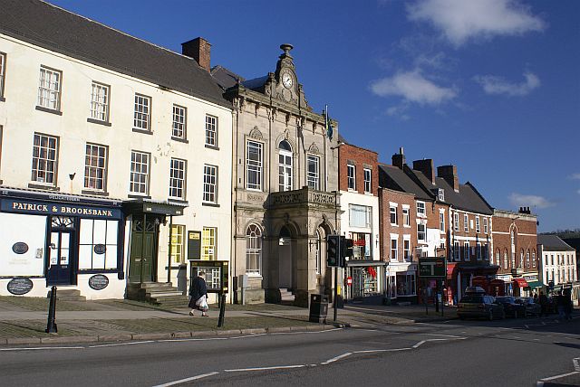
Ashbourne is a market town in the Derbyshire Dales district in Derbyshire, England. Its population was measured at 8,377 in the 2011 census and was estimated to have grown to 9,163 by 2019. It has many historical buildings and independent shops. The town offers a historic annual Shrovetide football match. Its position near the southern edge of the Peak District makes it the closest town to Dovedale, to which Ashbourne is sometimes referred to as the gateway. The town is west of Derby, south-east of Buxton, east of Stoke-on-Trent, south-south-east of Manchester, south-west of Sheffield and north of Lichfield. Nearby towns include Matlock, Uttoxeter, Leek, Cheadle and Bakewell. History The town's name derives from the Old English ''æsc-burna'' meaning "stream with ash trees". Ashbourne was granted a market charter in 1257. In medieval times it was a frequent rest stop for pilgrims walking "St Non's Way" to the shrine of Saint Fremund at Dunstable in Bedfordshire. T ... [...More Info...] [...Related Items...] OR: [Wikipedia] [Google] [Baidu] |
Pilsbury
Pilsbury is a hamlet in the English county of Derbyshire, approximately 2 miles north of Hartington. It is on the side of the valley of the River Dove that, thereabouts, forms the border with the county of Staffordshire. History Pilsbury was mentioned in the Domesday book as belonging to Henry de Ferrers and being worth ten shillings.''Domesday Book: A Complete Translation''. London: Penguin, 2003. p.745 Just to the north of the hamlet is the site of Henry de Ferrers' Pilsbury Castle Pilsbury Castle was a Norman castle in Derbyshire near the present-day village of Pilsbury, overlooking the River Dove. Details Pilsbury Castle occupied an area of high ground approximately overlooking the River Dove, near the village of Pils .... References Hamlets in Derbyshire Towns and villages of the Peak District Derbyshire Dales {{Derbyshire-geo-stub ... [...More Info...] [...Related Items...] OR: [Wikipedia] [Google] [Baidu] |
Ordnance Survey
, nativename_a = , nativename_r = , logo = Ordnance Survey 2015 Logo.svg , logo_width = 240px , logo_caption = , seal = , seal_width = , seal_caption = , picture = , picture_width = , picture_caption = , formed = , preceding1 = , dissolved = , superseding = , jurisdiction = Great BritainThe Ordnance Survey deals only with maps of Great Britain, and, to an extent, the Isle of Man, but not Northern Ireland, which has its own, separate government agency, the Ordnance Survey of Northern Ireland. , headquarters = Southampton, England, UK , region_code = GB , coordinates = , employees = 1,244 , budget = , minister1_name = , minister1_pfo = , chief1_name = Steve Blair , chief1_position = CEO , agency_type = , parent_agency = , child1_agency = , keydocument1 = , website = , footnotes = , map = , map_width = , map_caption = Ordnance Survey (OS) is the national mapping agency for Great Britain. The agency's name indicates its original military purpose (se ... [...More Info...] [...Related Items...] OR: [Wikipedia] [Google] [Baidu] |
Staffordshire
Staffordshire (; postal abbreviation Staffs.) is a landlocked county in the West Midlands region of England. It borders Cheshire to the northwest, Derbyshire and Leicestershire to the east, Warwickshire to the southeast, the West Midlands County and Worcestershire to the south and Shropshire to the west. The largest settlement in Staffordshire is Stoke-on-Trent, which is administered as an independent unitary authority, separately from the rest of the county. Lichfield is a cathedral city. Other major settlements include Stafford, Burton upon Trent, Cannock, Newcastle-under-Lyme, Rugeley, Leek, and Tamworth. Other towns include Stone, Cheadle, Uttoxeter, Hednesford, Brewood, Burntwood/Chasetown, Kidsgrove, Eccleshall, Biddulph and the large villages of Penkridge, Wombourne, Perton, Kinver, Codsall, Tutbury, Alrewas, Barton-under-Needwood, Shenstone, Featherstone, Essington, Stretton and Abbots Bromley. Cannock Chase AONB is within the county as well as parts of the ... [...More Info...] [...Related Items...] OR: [Wikipedia] [Google] [Baidu] |
Sheen, Staffordshire
Sheen is a village and civil parish in north-east Staffordshire, England. The parish is about north to south and about east to west. The eastern boundary is the River Dove (the boundary with Derbyshire), and the western boundary is the River Manifold.A P Baggs, M F Cleverdon, D A Johnston and N J Tringham, "Sheen", in ''A History of the County of Stafford: Volume 7, Leek and the Moorlands, ed. C R J Currie and M W Greenslade (London, 1996), pp. 239-250'' British History Online. Accessed 7 June 2019. There is a north-west to south-east ridge forming Sheen Moor; the village of Sheen, on a road running north–south through the parish, ... [...More Info...] [...Related Items...] OR: [Wikipedia] [Google] [Baidu] |
Longnor, Staffordshire
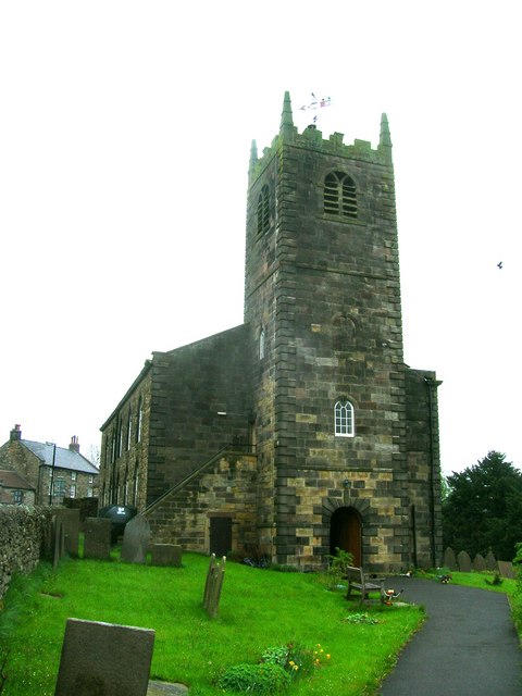
Longnor is a village in the Staffordshire Peak District, England. The settlement dates from early times, the first recorded church building being in the Middle Ages. The village was named Longenalre in the Domesday Book. Located on a major crossroads, Longnor was a significant market town in the 18th century. It lies on the north bank of the River Manifold, on a limestone ridge between the Manifold and the River Dove. Location and geography Longnor is on the B5053 main road from Cheadle to Buxton about south of Buxton. It is at a crossroads with routes to Leek and Macclesfield to the west and Bakewell to the east. West of Longnor are the Staffordshire Moorlands, with a summit at Axe Edge Moor towards the north and Morridge further south. North and east of Longnor is the White Peak section of the Peak District, with the Dove flowing in a steep-sided limestone valley of which the famous Dovedale is a small part. Longnor looks towards the Manifold but lies on the southe ... [...More Info...] [...Related Items...] OR: [Wikipedia] [Google] [Baidu] |


