|
Hamilton Sound
Sir Charles Hamilton Sound, which has been shortened to and is more commonly known as Hamilton Sound, is a body of water on the northeast coast of the island of Newfoundland, between Fogo Island and the mainland to the south, and including (from west to east) Gander Bay, Dog Bay and Rocky Bay. The western half of ''Hamilton Sound'' is dotted with a number of islands, with the largest group being the Indian Islands. At the east end of ''Hamilton Sound'' lie the Wadham Islands. The Gander River is the largest rivers to empty into ''Hamilton Sound'' through Gander Bay. The native peoples of Newfoundland, the Beothuk, is presumed to have used the Gander River to gain access to the rich bird population on the many islands that dot ''Hamilton Sound''. The sound and many of the bays that make up ''Hamilton Sound'', was first frequented by Europeans in the eighteenth century. By the late 1700s the salmon fishery was very well established and operated by Trinity-Poole merchants such a ... [...More Info...] [...Related Items...] OR: [Wikipedia] [Google] [Baidu] |
Sir Charles Hamilton, 2nd Baronet, Of Trebinshun House
Admiral Sir Charles Hamilton, 2nd Baronet KCB (25 May 1767 – 14 September 1849), was a British naval officer and commodore-governor of Newfoundland. Life Hamilton was born the eldest son of John Hamilton, a captain in the Royal Navy who had distinguished himself at the Battle of Quebec in 1775. Charles began his naval career at the age of nine on his father's ship, ''Hector''. He attended the Royal Naval Academy at Portsmouth from 1777 to 1779.O'Byrne He commanded a number of vessels in the Royal Navy and was also a member of the British parliament several times between 1790 and 1812 while still serving in the Royal Navy. He became the 2nd baronet Hamililton of Trebinshun on his father's death in 1784. From 1818 to 1823 he served as resident governor for the colony of Newfoundland. During this period, he oversaw the reconstruction of St. John's following fires in 1818 and 1819. Although he was charged with promoting agriculture, he was soon discouraged by the poor soil ... [...More Info...] [...Related Items...] OR: [Wikipedia] [Google] [Baidu] |
List Of Governors Of Newfoundland And Labrador
The following is a list of the governors, commodore-governors, and lieutenant governors of Newfoundland and Labrador. Though the present day office of the lieutenant governor in Newfoundland and Labrador came into being only upon the province's entry into Canadian Confederation in 1949, the post is a continuation from the first governorship of Newfoundland in 1610. Proprietary governors of Newfoundland, 1610–1728 Governors of Plaisance, 1655–1713 Lieutenant-governors of Placentia, 1713–1770 Commodore-governors of Newfoundland, 1729–1825 The Commodore-Governor was a British Royal Navy official who was commander of the annual fishing convoy which left England each spring to fish off Newfoundland and was charged with protecting the convoys from harm. He was also responsible for various administrative and judicial functions, including assisting the fishing admirals in maintaining law and order and compiling the annual report on the fishery for the English government. ... [...More Info...] [...Related Items...] OR: [Wikipedia] [Google] [Baidu] |
Saltwire Network
SaltWire Network Inc. is a Canadian newspaper publishing company owned by the Dennis-Lever family of Halifax, Nova Scotia, owners of ''The Chronicle Herald''. Saltwire owns 23 daily and weekly newspapers in Atlantic Canada."How SaltWire became the largest media group in Atlantic Canada" , April 13, 2017. The company was formed in 2017 via its purchase of 27 newspapers from . History On April 13, 2017,[...More Info...] [...Related Items...] OR: [Wikipedia] [Google] [Baidu] |
Encyclopedia Of Newfoundland And Labrador
''Encyclopedia of Newfoundland and Labrador'' is an Encyclopedia commissioned by Joey Smallwood to capture the people, places, events and history of the Province of Newfoundland and Labrador. Smallwood's view on the purpose of the encyclopedia was summed up in his remark {{quote, ''Every theme belongs in the Encyclopedia. Every person, every event, every location, every institution, every development, every industry, every intellectual activity, every religious movement in Newfoundland belongs in there.'', Joseph Roberts Smallwood The work took nearly thirteen years to complete and contains 5 volumes containing over 3,900 pages by more than 200 authors. The first volume was printed in 1981 with volume two released in 1984. Smallwood had suffered a stroke two months after volume two was released. The work was suspended until 1987 when the Joseph R. Smallwood Foundation was established with a mandate to complete the five volume encyclopedia. Volume five was published in 1994. Marketi ... [...More Info...] [...Related Items...] OR: [Wikipedia] [Google] [Baidu] |
Change Islands
Change Islands is an outport community in the Canadian province of Newfoundland and Labrador. The community spans two small islands of the same name which lie off the northeast coast of the island of Newfoundland between Notre Dame Bay and the Labrador Sea. The community of Change Islands is located primarily on the larger South Island, today hosting approximately 184 residents, though most of the public buildings are on the North Island. The Newfoundland Pony Refuge is located on Change Islands. Geography The southern and northern Change Islands are separated by a "tickle" (a narrow strait, in Newfoundland English). The South Island is larger, containing more marshes/bogs, and wooded area, the North Island is smaller, mostly barren. It is located in Notre Dame Bay, on the northeast coast of the island of Newfoundland. The community was first established as a series of random settlements around the islands tied to seasonal fishing activity which developed into a cohesive comm ... [...More Info...] [...Related Items...] OR: [Wikipedia] [Google] [Baidu] |
Conception Bay
Conception Bay (CB) is a bay on the southeast coast of Newfoundland, Canada. The population (in 2011) of people living in municipalities (or unincorporated census subdivisions) located along the coast of Conception Bay was 90,490 making it one of the most densely populated areas of the province. Conception Bay is adjacent to the St. John's Metropolitan Area which contains 5 of the 10 largest settlements in the province and is home to over 200,000 people. The smaller communities in Newfoundland may often be referenced by the Bay in which they are located, e.g.: ' Port de Grave, CB'. Geography The bay indents the Avalon Peninsula, opening towards the Atlantic Ocean at its northeast. It is bounded by Cape St. Francis in the south and Split Point near Bay de Verde in the north. It has a maximum depth of 300 metres (980 ft). Conception Bay covers an area of 1295 square kilometres and contains several islands, the three largest being Bell Island, Little Bell Islan ... [...More Info...] [...Related Items...] OR: [Wikipedia] [Google] [Baidu] |
Bonavista Bay
Bonavista Bay (BB) is a large bay located on the northeast coast of the island of Newfoundland in the province of Newfoundland and Labrador in Canada. It opens directly onto the Atlantic Ocean. The bay is demarcated by Cape Freels to the north and Cape Bonavista to the south. Cape Bonavista is also the eastern limit of the Bonavista Peninsula, which forms the bay's southern shore. The topography of the central western shore of the bay is composed of numerous channels and islands. This area also hosts Terra Nova National Park. Containing many densely forested islands, Bonavista Bay is virtually landlocked. With temperatures sometimes reaching -1 °C, it attracts the occasional iceberg. However, due to the dense forestry, the region inside the bay can sometimes be warm enough for lobster cultivation. The smaller communities in Newfoundland may often be referenced by the Bay in which they are located, e.g.: 'Wesleyville, BB'. Fishing communities * Newtown * Wesleyvill ... [...More Info...] [...Related Items...] OR: [Wikipedia] [Google] [Baidu] |
Musgrave Harbour
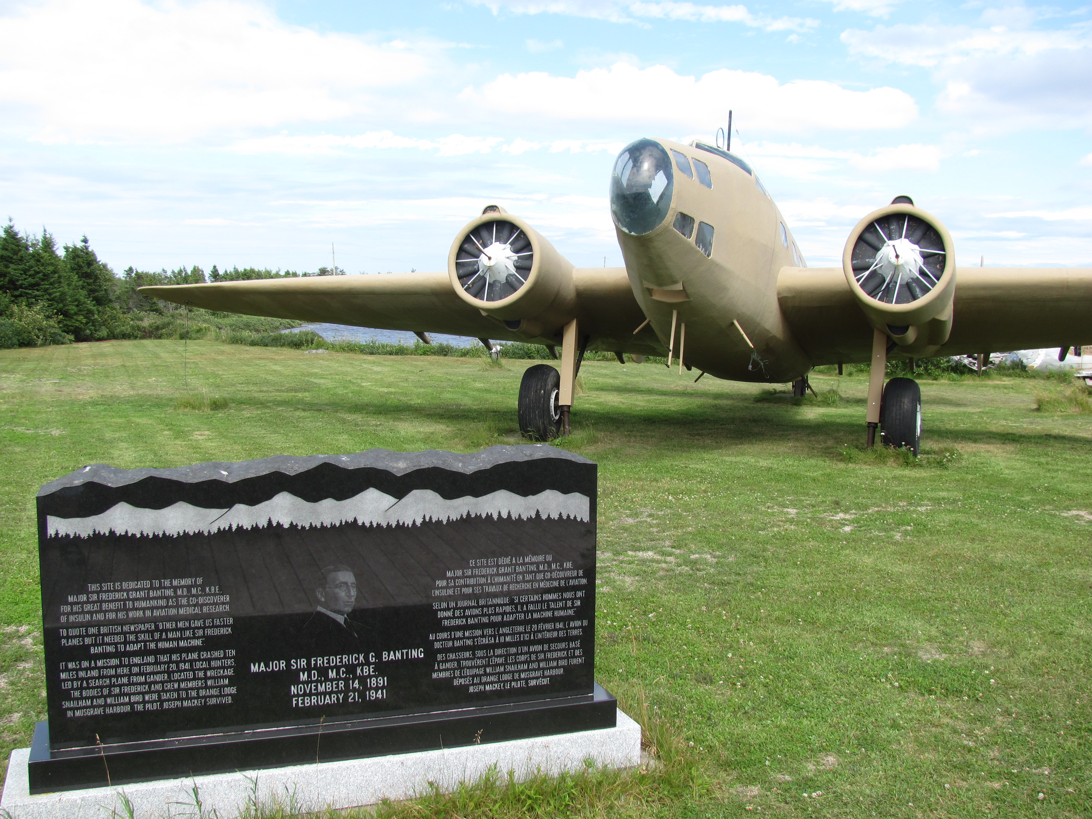
Musgrave Harbour is a town and designated place in the Canadian province of Newfoundland and Labrador. History Musgrave Harbour is a fishing community that was originally named Muddy Hole. The name was changed in 1886 in honor of Governor Anthony Musgrave. It was visited as early as the 18th century by Europeans. For example, George Skeffington from Bonavista was given salmon fishing rights there in 1723. In the 19th century the migratory fishery took place between Musgrave Harbour and Cape Freels and eventually permanent settlement began. The first family to settle in Musgrave Harbour was John Whiteway, of Western Bay, in 1834. The 1836 ''Census'' show Whiteway's family of eleven living in "Muddy Hole" and five people living in nearby Ragged Harbour. Musgrave Harbour was the administrative and religious center of Hamilton Sound by 1900, but due to its poor harbour it failed to be a commercial center. When Tobias Abbott of Doting Cove introduced the gasoline engine in 1909 the ... [...More Info...] [...Related Items...] OR: [Wikipedia] [Google] [Baidu] |
Beothuk
The Beothuk ( or ; also spelled Beothuck) were a group of indigenous people who lived on the island of Newfoundland. Beginning around AD 1500, the Beothuk culture formed. This appeared to be the most recent cultural manifestation of peoples who first migrated from Labrador to present-day Newfoundland around AD 1. The ancestors of this group had three earlier cultural phases, each lasting approximately 500 years. Description The Beothuk lived throughout the island of Newfoundland, mostly in the Notre Dame and Bonavista Bay areas. Estimates vary as to the number of Beothuk at the time of contact with Europeans. Beothuk researcher Ingeborg Marshall has argued that a valid understanding of Beothuk history and culture is directly impacted by how and by whom historical records were created, pointing to the ethnocentric nature of European accounts as inherently unreliable. Scholars of the 19th and early 20th century estimated about 2,000 individuals at the time of European conta ... [...More Info...] [...Related Items...] OR: [Wikipedia] [Google] [Baidu] |
Sound (geography)
In geography, a sound is a smaller body of water typically connected to a larger sea or ocean. There is little consistency in the use of "sound" in English-language place names. It can refer to an inlet, deeper than a bight and wider than a fjord, or a narrow sea or ocean channel between two bodies of land (similar to a strait), or it can refer to the lagoon located between a barrier island and the mainland. Overview A sound is often formed by the seas flooding a river valley. This produces a long inlet where the sloping valley hillsides descend to sea-level and continue beneath the water to form a sloping sea floor. The Marlborough Sounds in New Zealand are good examples of this type of formation. Sometimes a sound is produced by a glacier carving out a valley on a coast then receding, or the sea invading a glacier valley. The glacier produces a sound that often has steep, near vertical sides that extend deep underwater. The sea floor is often flat and deeper at ... [...More Info...] [...Related Items...] OR: [Wikipedia] [Google] [Baidu] |
Gander River
The Gander River is a river in eastern Newfoundland, Canada. It is 110 miles (177 km) long and originates at Partridgeberry Hill, south of Grand Falls-Windsor. The river then flows northeast to Gander Lake and on to Gander Bay on the Atlantic Ocean. See also *List of rivers of Newfoundland and Labrador This is a list of rivers of Newfoundland and Labrador, Canada, divided by watershed. Nearly all watersheds in the province ultimately drain into the Atlantic Ocean. East Coast of Labrador Watersheds between Eclipse River and Groswater Bay in L ... External linksGander River The Columbia Gazetteer of North AmericaGander River Management Association C.N.L.R. 765/96 C.N.L.R. 766/9 ... [...More Info...] [...Related Items...] OR: [Wikipedia] [Google] [Baidu] |


