|
Hamile
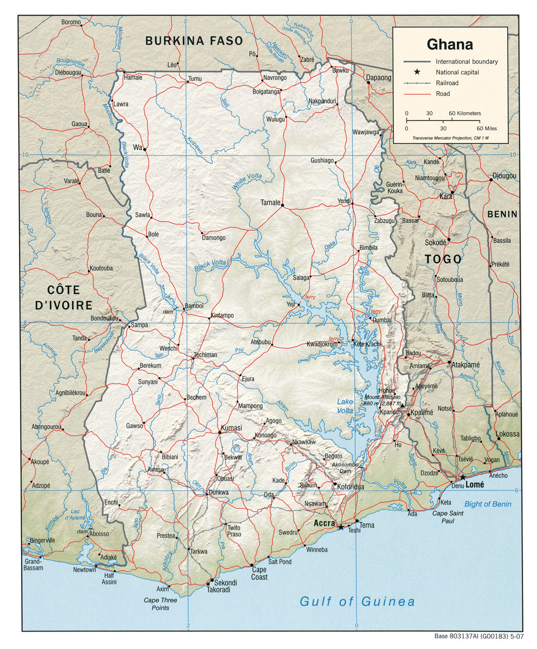
Hamile is a village in the Jirapa/Lambussie district, a district in the far northwestern Upper West Region of north Ghana, close to the border with Burkina Faso Burkina Faso (, ; , ff, 𞤄𞤵𞤪𞤳𞤭𞤲𞤢 𞤊𞤢𞤧𞤮, italic=no) is a landlocked country in West Africa with an area of , bordered by Mali to the northwest, Niger to the northeast, Benin to the southeast, Togo and Ghana to the .... Transport In July 2007, contracts were made for the construction of a railway extension in the village of Hamile. There is a 88.5km highway from Wa-Hamile. Facilities * Hamile Border Post * Hamile Truck Park References {{reflist External links * http://www.hamile.rhade.de/ Partnership-Website with Dorsten-Rhade in Germany Populated places in the Upper West Region ... [...More Info...] [...Related Items...] OR: [Wikipedia] [Google] [Baidu] |
Burkina Faso–Ghana Border
The Burkina Faso–Ghana border is 602 km (374 m) in length and runs from the tripoint with Ivory Coast in the west to the tripoint with Togo in the east. Description The border starts in the west at the tripoint with Ivory Coast on the Black Volta river; the border continues north along this river up to the 11th parallel north. The border then turns east, following this parallel until it reaches the Red Volta (though note that the border is not entirely straight in this sector, as at several points the boundary jogs north or south). The border follows the Red Volta briefly to the south-east, before turning to the north-east via a series of irregular overland lines. It then reaches the White Volta, following this river briefly, and then the Nouhao, before it turns to the south-east in a straight line down to the Togolese tripoint. History Europeans had begun exploring the coast of Ghana (then referred to as the Gold Coast) from the 15th century, and it became the centre of a ... [...More Info...] [...Related Items...] OR: [Wikipedia] [Google] [Baidu] |
Lambussie-Karni District
Lambussie Karni District is one of the eleven districts in Upper West Region, Ghana. Originally it was formerly part of the then-larger Jirapa/Lambussie District Jirapa/Lambussie District is a former district that was located in Upper West Region, Ghana. Originally created as an ordinary district assembly in 1988. However on 29 February 2008, it was split off into two new districts: Jirapa Municipal Dist ... in 1988; until the northern part of the district was later split off to create Lambussie-Karni District on 29 February 2008; thus the remaining part has been renamed as Jirapa District (which it was later elevated to municipal district assembly status on 15 March 2018 to become Jirapa Municipal District). The district assembly is located in the northwest part of Upper West Region and has Lambussie as its capital town. Geography Lambussie-Karni District is located in the north western corner of the Upper West Region of Ghana. It lies approximately between Latitudes 10.250 ... [...More Info...] [...Related Items...] OR: [Wikipedia] [Google] [Baidu] |
2007 In Rail Transport
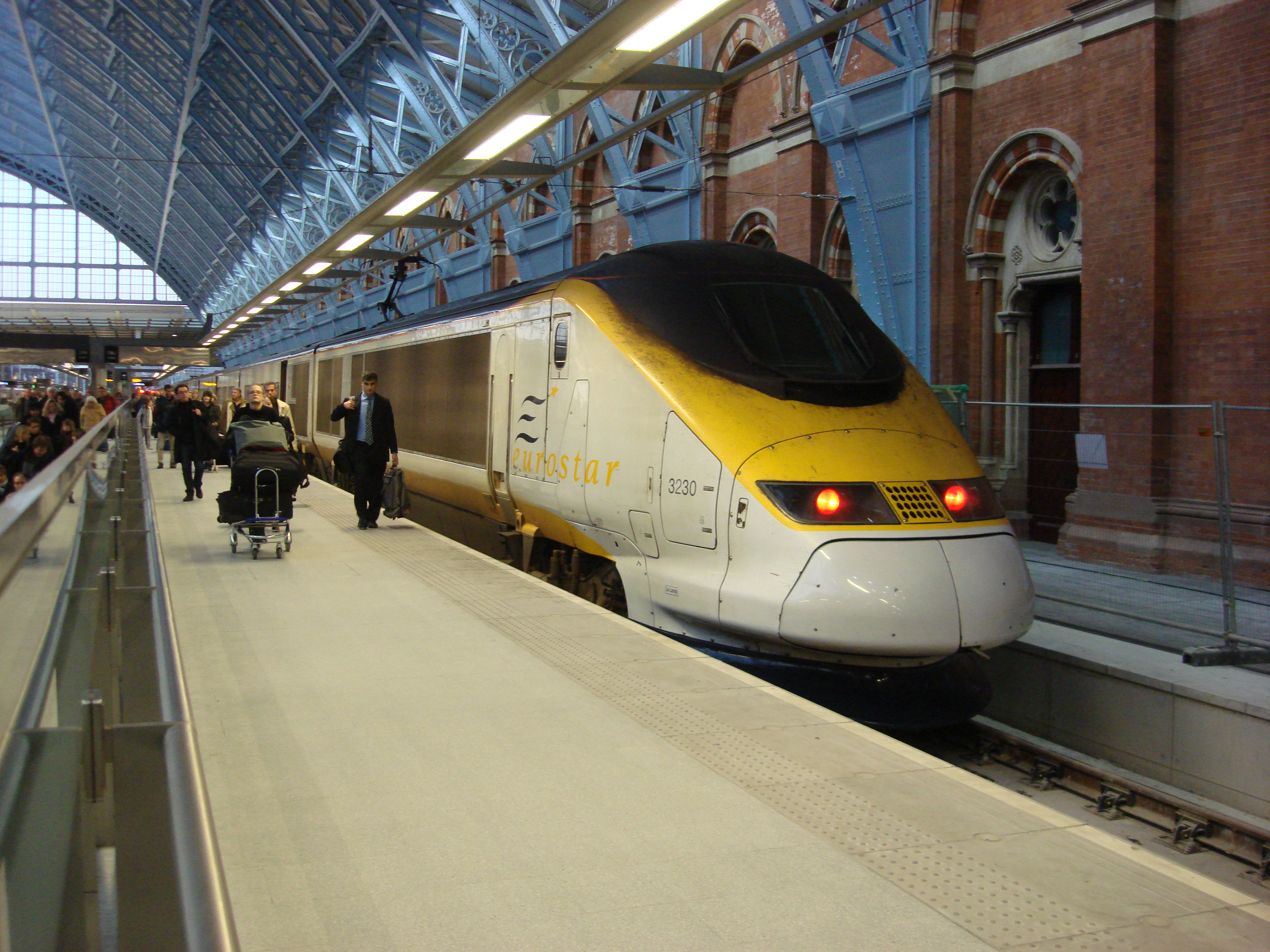
__TOC__ Events January events * January 5 – The first public trains of Taiwan High Speed Rail operate between Taipei and Kaohsiung, a journey, in 1:36 hours. * January 9 – Government of Estonia buys back majority share in Eesti Raudtee, the national rail operator, from private investors. * January 12 – Railway Age Magazine selects Bill Wimmer, Vice President Engineering for Union Pacific Railroad to receive the 2007 award for Railroader of the Year. * January 30 – The suburban rail network of Melbourne, Australia is thrown into chaos as much of the fleet of new Siemens Nexas Electric Multiple Unit trains is withdrawn from service after a number of incidents of brake failure. February events * February 7 – At a meeting in Tbilisi, Georgian President Mikheil Saakashvili, Turkish Prime Minister Recep Tayyip Erdoğan and Azerbaijani President Ilham Aliyev sign an agreement authorizing construction of the new Kars-Tbilisi-Baku railway linking the three nation ... [...More Info...] [...Related Items...] OR: [Wikipedia] [Google] [Baidu] |
Town
A town is a human settlement. Towns are generally larger than villages and smaller than cities, though the criteria to distinguish between them vary considerably in different parts of the world. Origin and use The word "town" shares an origin with the German word , the Dutch word , and the Old Norse . The original Proto-Germanic word, *''tūnan'', is thought to be an early borrowing from Proto-Celtic *''dūnom'' (cf. Old Irish , Welsh ). The original sense of the word in both Germanic and Celtic was that of a fortress or an enclosure. Cognates of ''town'' in many modern Germanic languages designate a fence or a hedge. In English and Dutch, the meaning of the word took on the sense of the space which these fences enclosed, and through which a track must run. In England, a town was a small community that could not afford or was not allowed to build walls or other larger fortifications, and built a palisade or stockade instead. In the Netherlands, this space was a garden, mor ... [...More Info...] [...Related Items...] OR: [Wikipedia] [Google] [Baidu] |
Upper West Region
The Upper West Region of Ghana is located in the north-western corner of Ghana and is bordered by Upper East region to the east, Northern region to the south, and Burkina Faso to the west and north. The Upper West regional capital and largest settlement is Wa. The Upper West was created by the then Head of State, Flight-Lieutenant Jerry Rawlings in 1983 under the Provisional National Defense Council (PNDC) military regime. The area was carved out of the former Upper Region, which is now the Upper East Region. For about thirty-five years, it remained the youngest region of Ghana until 2018 when six more regions were created by the Nana Addo Dankwa Akufo-Addo government; hence increasing the total number of administrative regions in the country to sixteen. Geography and climate Location and size The Upper West Region is one of the 16 regions of Ghana. It is located at the North Western corner of Ghana with latitude 9.8°- 11.O° North and longitude 1.6°- 3.0 West, bounded to Burk ... [...More Info...] [...Related Items...] OR: [Wikipedia] [Google] [Baidu] |
Greenwich Mean Time
Greenwich Mean Time (GMT) is the Local mean time, mean solar time at the Royal Observatory, Greenwich, Royal Observatory in Greenwich, London, counted from midnight. At different times in the past, it has been calculated in different ways, including being calculated from noon; as a consequence, it cannot be used to specify a particular time unless a context is given. The term 'GMT' is also used as Western European Time, one of the names for the time zone UTC+00:00 and, in UK law, is the basis for civil time in the United Kingdom. English speakers often use GMT as a synonym for Coordinated Universal Time (UTC). For navigation, it is considered equivalent to UT1 (the modern form of mean solar time at 0° longitude); but this meaning can differ from UTC by up to 0.9s. The term GMT should thus not be used for purposes that require precision. Because of Earth's uneven angular velocity in its elliptical orbit and its axial tilt, noon (12:00:00) GMT is rarely the exact moment the S ... [...More Info...] [...Related Items...] OR: [Wikipedia] [Google] [Baidu] |
Jirapa/Lambussie District
Jirapa/Lambussie District is a former district that was located in Upper West Region, Ghana. Originally created as an ordinary district assembly in 1988. However on 29 February 2008, it was split off into two new districts: Jirapa Municipal District (which it was elevated to municipal district assembly status on 15 March 2018; capital: Jirapa, Ghana, Jirapa) and Lambussie-Karni District (capital: Lambussie). The district assembly was located in the northwest part of Upper West Region and had Jirapa as its capital town. Geography Jirapa/Lambussie District lies in the northwestern corner of the Upper West Region of Ghana. It shares boundaries to the south with Nadowli District, to the east with Sissala East District, and to the west with Lawra District. Economy About eighty percent of the population are engaged in agriculture and other related activities. The major crops are millet, maize, cotton and Bambara groundnut, groundnuts. Pastoral farming, Livestock farming is practiced th ... [...More Info...] [...Related Items...] OR: [Wikipedia] [Google] [Baidu] |
Ghana
Ghana (; tw, Gaana, ee, Gana), officially the Republic of Ghana, is a country in West Africa. It abuts the Gulf of Guinea and the Atlantic Ocean to the south, sharing borders with Ivory Coast in the west, Burkina Faso in the north, and Togo in the east.Jackson, John G. (2001) ''Introduction to African Civilizations'', Citadel Press, p. 201, . Ghana covers an area of , spanning diverse biomes that range from coastal savannas to tropical rainforests. With nearly 31 million inhabitants (according to 2021 census), Ghana is the List of African countries by population, second-most populous country in West Africa, after Nigeria. The capital and List of cities in Ghana, largest city is Accra; other major cities are Kumasi, Tamale, Ghana, Tamale, and Sekondi-Takoradi. The first permanent state in present-day Ghana was the Bono state of the 11th century. Numerous kingdoms and empires emerged over the centuries, of which the most powerful were the Kingdom of Dagbon in the north and ... [...More Info...] [...Related Items...] OR: [Wikipedia] [Google] [Baidu] |
Burkina Faso
Burkina Faso (, ; , ff, 𞤄𞤵𞤪𞤳𞤭𞤲𞤢 𞤊𞤢𞤧𞤮, italic=no) is a landlocked country in West Africa with an area of , bordered by Mali to the northwest, Niger to the northeast, Benin to the southeast, Togo and Ghana to the south, and the Ivory Coast to the southwest. It has a population of 20,321,378. Previously called Republic of Upper Volta (1958–1984), it was renamed Burkina Faso by President Thomas Sankara. Its citizens are known as ''Burkinabè'' ( ), and its capital and largest city is Ouagadougou. The largest ethnic group in Burkina Faso is the Mossi people, who settled the area in the 11th and 13th centuries. They established powerful kingdoms such as the Ouagadougou, Tenkodogo, and Yatenga. In 1896, it was colonized by the French as part of French West Africa; in 1958, Upper Volta became a self-governing colony within the French Community. In 1960, it gained full independence with Maurice Yaméogo as president. Throughout the decades post in ... [...More Info...] [...Related Items...] OR: [Wikipedia] [Google] [Baidu] |
Rail Transport In Ghana
The railway system in Ghana has historically been confined to the plains south of the barrier range of mountains north of the city of Kumasi. However, the narrow gauge railway, totalling 1,300 kilometres, is undergoing major rehabilitation and inroads to the interior are now being made. In Ghana, most of the lines are single tracked, and in 1997 it was estimated that 32 kilometres were double tracked. There are no rail links of the main system with adjoining countries. However, the Lomé—Aflao line of the Togo rail system is partly located in Ghana. There are also plans to extend the Kumasi-Takoradi railway to Paga, by the Burkina Faso border, plus a branch from Tamale to Yendi. On 31 August 2022, an agreement was announced to upgrade the 299 km Western Railway to , to be operated by Ghana Railway Co and Thelo DB will as rail manager for the US$3·2bn project. Time line Inverse order. 2020 Several SGR are under construction, including * a line from Tema, via Ho and ... [...More Info...] [...Related Items...] OR: [Wikipedia] [Google] [Baidu] |


.jpg)

