|
Halali Airport
Halali Airport is an airport serving the resort of Halali, in the Oshikoto Region of Namibia. The resort is near some of the waterholes of the Etosha National Park, and has elevated viewing platforms for observing native wildlife like elephants, rhinoceros, and leopards. See also * * *List of airports in Namibia *Transport in Namibia This article deals with the system of transport in Namibia, both public and private. General History The beginnings of organised travel and transport routes in the territory of South West Africa, today Namibia, have not yet been established. This ... References External linksOurAirports - Halali Airports in Namibia {{Namibia-airport-stub ... [...More Info...] [...Related Items...] OR: [Wikipedia] [Google] [Baidu] |
Oshikoto Region
Oshikoto is one of the fourteen regions of Namibia, named after Lake Otjikoto. Its capital is Omuthiya. The city of Tsumeb, Otjikoto's capital until 2008, and the towns of Omuthiya and Oniipa are also situated in this region. , Oshikoto had 112,170 registered voters. Geography Oshikoto Region is named after Lake Otjikoto near its former capital Tsumeb. Oshikoto is one of only three regions without either a shoreline or a foreign border. It borders the following regions: *Ohangwena - north *Kavango West - east *Otjozondjupa - southeast * Kunene - southwest *Oshana - west Demographics The region's population has grown significantly over recent years, partly as a result of redistribution within the Oshiwambo-speaking area. Apart from Tsumeb and Oniipa, people have settled in a corridor along the trunk road, sometimes forming quite dense concentrations. Economy and infrastructure The northern part of the region is crop agriculture, whereas the main economic activities in the s ... [...More Info...] [...Related Items...] OR: [Wikipedia] [Google] [Baidu] |
Namibia
Namibia (, ), officially the Republic of Namibia, is a country in Southern Africa. Its western border is the Atlantic Ocean. It shares land borders with Zambia and Angola to the north, Botswana to the east and South Africa to the south and east. Although Kazungula, it does not border Zimbabwe, less than 200 metres (660 feet) of the Botswanan right bank of the Zambezi, Zambezi River separates the two countries. Namibia gained independence from South Africa on 21 March 1990, following the Namibian War of Independence. Its capital and largest city is Windhoek. Namibia is a member state of the United Nations (UN), the Southern African Development Community (SADC), the African Union (AU) and the Commonwealth of Nations. The driest country in sub-Saharan Africa, Namibia has been inhabited since pre-historic times by the San people, San, Damara people, Damara and Nama people. Around the 14th century, immigration, immigrating Bantu peoples arrived as part of the Bantu expansion. Since ... [...More Info...] [...Related Items...] OR: [Wikipedia] [Google] [Baidu] |
Etosha National Park
Etosha National Park is a national park in northwestern Namibia and one of the largest national parks in Africa. It was proclaimed a game reserve in March 1907 in Ordinance 88 by the Governor of German South West Africa, Friedrich von Lindequist. It was designated as ''Wildschutzgebiet'' in 1958, and was elevated to the status of a national park in 1967 by an act of parliament of the Republic of South Africa. It spans an area of and gets its name from the large Etosha pan which is almost entirely within the park. With an area of , the Etosha pan covers 23% of the total area of the national park. The area is home to hundreds of species of mammals, birds and reptiles, including several threatened and endangered species such as the black rhinoceros. The park is located in the Kunene region and shares boundaries with the regions of Oshana, Oshikoto and Otjozondjupa. History Areas north of the Etosha pan were inhabited by Ovambo people, while various Otjiherero-speaking groups ... [...More Info...] [...Related Items...] OR: [Wikipedia] [Google] [Baidu] |
List Of Airports In Namibia ...
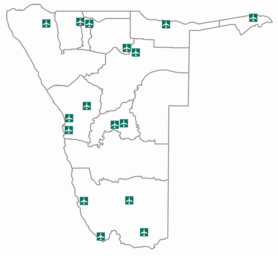
This is a list of airports in Namibia, sorted by location. List of airports Airport names shown in bold indicate the airport has scheduled service on commercial airlines. See also * Transport in Namibia * List of airports by ICAO code: F#FY – Namibia * Wikipedia: WikiProject Aviation/Airline destination lists: Africa#Namibia References * * External links Namibia Airports CompanyGreat Circle Mapper {{Africa in topic, List of airports in Namibia Airports Airports Namibia Namibia (, ), officially the Republic of Namibia, is a country in Southern Africa. Its western border is the Atlantic Ocean. It shares land borders with Zambia and Angola to the north, Botswana to the east and South Africa to the south and ea ... [...More Info...] [...Related Items...] OR: [Wikipedia] [Google] [Baidu] |
Transport In Namibia
This article deals with the system of transport in Namibia, both public and private. General History The beginnings of organised travel and transport routes in the territory of South West Africa, today Namibia, have not yet been established. This is due to the lack of any written records relating to roads prior to the twilight of the 19th century. Archaeological work has dated one stretch of road in the south-western Brandberg Massif to 1250 AD. Although no other such early examples have been found, it is certain that this road was not the only one of its kind. The first permanent road, established for ox wagons, was built at the initiative of Heinrich Schmelen, Rhenish missionary in Bethanie in the early 19th century. It led from Bethanie to Angra Pequeña, today the town of Lüderitz, and was intended to serve the natural harbour there in order to become independent of the Cape Colony. Road Namibia's road network is regarded as one of the best on the continent; road con ... [...More Info...] [...Related Items...] OR: [Wikipedia] [Google] [Baidu] |


