|
HMS Racoon (1808)
HMS ''Racoon'', sometimes spelled HMS ''Raccoon'', was an 18-gun ship sloop of the of the Royal Navy. She was built by John Preston, of Great Yarmouth, and launched on 30 March 1808. She sailed as far as Fort Astoria on the Columbia River. She became a hospital ship in 1819 and finally was sold in 1838. Service Her first commander was Commander James Welsh, under whom she was sent to operate off the African coast. He sailed her to Jamaica on 16 June 1809, but died there in November. His replacement was Commander William Black. She returned to Portsmouth in 1812. On 14 January 1813 ''Racoon'' captured ''Hope'', which the enemy recaptured. Still, a £25,000 insurance payment was payable to ''Racoon''. ''Racoon'' sailed from Rio de Janeiro on 6 July 1813 in company with , , and sailing around Cape Horn to the Juan Fernandez Islands. The Royal Navy had been under pressure from the Montreal-based North West Company, who were agitating for them to capture the base of their ri ... [...More Info...] [...Related Items...] OR: [Wikipedia] [Google] [Baidu] |
Naval Ensign Of The United Kingdom
The White Ensign, at one time called the St George's Ensign due to the simultaneous existence of a cross-less version of the flag, is an ensign worn on British Royal Navy ships and shore establishments. It consists of a red St George's Cross on a white field, identical to the flag of England except with the Union Flag in the upper canton. The White Ensign is also worn by yachts of members of the Royal Yacht Squadron and by ships of Trinity House escorting the reigning monarch. In addition to the United Kingdom, several other nations have variants of the White Ensign with their own national flags in the canton, with the St George's Cross sometimes being replaced by a naval badge omitting the cross altogether. Yachts of the Royal Irish Yacht Club wear a white ensign with an Irish tricolour in the first quadrant and defaced by the crowned harp from the Heraldic Badge of Ireland. The Flag of the British Antarctic Territory and the Commissioners' flag of the Northern Lighthouse Bo ... [...More Info...] [...Related Items...] OR: [Wikipedia] [Google] [Baidu] |
Pacific Fur Company
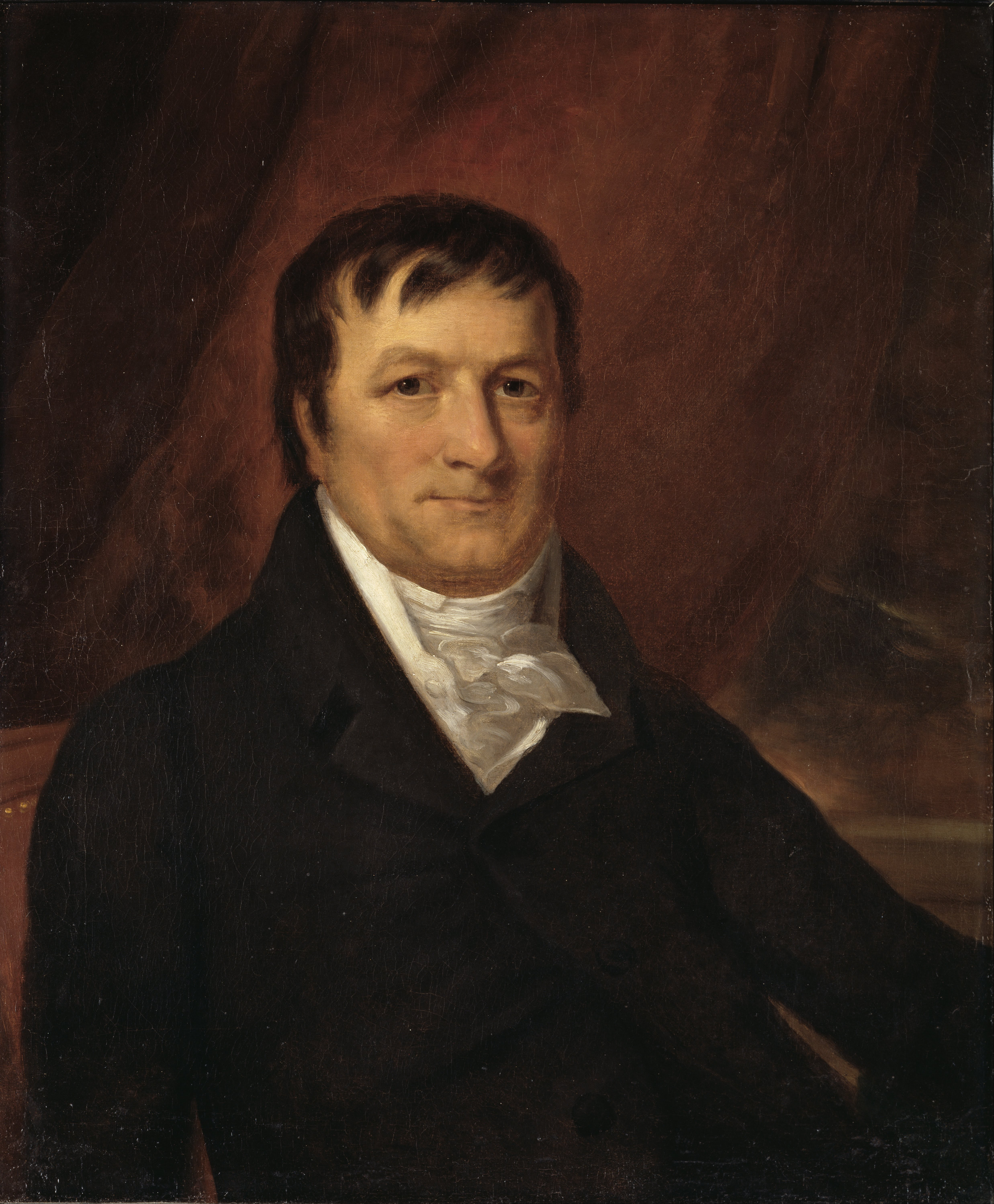
The Pacific Fur Company (PFC) was an American fur trade venture wholly owned and funded by John Jacob Astor that functioned from 1810 to 1813. It was based in the Pacific Northwest, an area contested over the decades between the United Kingdom of Great Britain and Ireland, the Spanish Empire, the United States of America and the Russian Empire. Management, clerks and fur trappers were sent both by land and by sea to the Pacific Coast in the Autumn of 1810. The base of operations was constructed at the mouth of the Columbia River in 1811, Fort Astoria (present-day Astoria, Oregon). The destruction of the company vessel the '' Tonquin'' later that year off the shore of Vancouver Island took with it the majority of the annual trading goods. Commercial competition with the British-Canadian North West Company began soon after the foundation of Fort Astoria. The Canadian competitors maintained several stations in the interior, primarily Spokane House, Kootanae House and Saleesh House ... [...More Info...] [...Related Items...] OR: [Wikipedia] [Google] [Baidu] |
Hospital Ship
A hospital ship is a ship designated for primary function as a floating medical treatment facility or hospital. Most are operated by the military forces (mostly navies) of various countries, as they are intended to be used in or near war zones. In the 19th century, redundant warships were used as moored hospitals for seamen. The Second Geneva Convention prohibits military attacks on hospital ships that meet specified requirements, though belligerent forces have right of inspection and may take patients, but not staff, as prisoners of war. History Early examples Hospital ships possibly existed in ancient times. The Athenian Navy had a ship named ''Therapia'', and the Roman Navy had a ship named ''Aesculapius'', their names indicating that they may have been hospital ships. The earliest British hospital ship may have been the vessel ''Goodwill'', which accompanied a Royal Navy squadron in the Mediterranean in 1608 and was used to house the sick sent aboard from other ships. ... [...More Info...] [...Related Items...] OR: [Wikipedia] [Google] [Baidu] |
Sixth Rate
In the rating system of the Royal Navy used to categorise sailing warships, a sixth-rate was the designation for small warships mounting between 20 and 28 carriage-mounted guns on a single deck, sometimes with smaller guns on the upper works and sometimes without. It thus encompassed ships with up to 30 guns in all. In the first half of the 18th century the main battery guns were 6-pounders, but by mid-century these were supplanted by 9-pounders. 28-gun sixth rates were classed as frigates, those smaller as 'post ships', indicating that they were still commanded by a full ('post') captain, as opposed to sloops of 18 guns and less under commanders. Rating Sixth-rate ships typically had a crew of about 150–240 men, and measured between 450 and 550 tons. A 28-gun ship would have about 19 officers; commissioned officers would include the captain, and two lieutenants; warrant officers would include the master, ship's surgeon, and purser. The other quarterdeck officers were the c ... [...More Info...] [...Related Items...] OR: [Wikipedia] [Google] [Baidu] |
Cape Of Good Hope
The Cape of Good Hope ( af, Kaap die Goeie Hoop ) ;''Kaap'' in isolation: pt, Cabo da Boa Esperança is a rocky headland on the Atlantic coast of the Cape Peninsula in South Africa. A common misconception is that the Cape of Good Hope is the southern tip of Africa, based on the misbelief that the Cape was the dividing point between the Atlantic and Indian oceans, and have nothing to do with north or south. In fact, by looking at a map, the southernmost point of Africa is Cape Agulhas about to the east-southeast. The currents of the two oceans meet at the point where the warm-water Agulhas current meets the cold-water Benguela current and turns back on itself. That oceanic meeting point fluctuates between Cape Agulhas and Cape Point (about east of the Cape of Good Hope). When following the western side of the African coastline from the equator, however, the Cape of Good Hope marks the point where a ship begins to travel more eastward than southward. Thus, the first mode ... [...More Info...] [...Related Items...] OR: [Wikipedia] [Google] [Baidu] |
James Mangles (Royal Navy)
James Mangles (1786 – 18 November 1867) was an officer of the Royal Navy, naturalist, horticulturalist and writer. He served during the French Revolutionary and Napoleonic Wars, rising to the rank of captain. In the post-war period, with his brothers Robert and George, who shared his interests in horticulture, botany and plant collection, James was actively involved in the botanical, horticultural and commercial life of early colonial Western Australia. Life Mangles was the son of John Mangles (1760–1837), brother of James Mangles (1762–1838), the Member of Parliament. He entered the navy in March 1800, on board the frigate , with Captain Ross Donnelly, whom in 1801 he followed to . After active service on the coast of France, at the reduction of the Cape of Good Hope, and at the British invasions of the Río de la Plata, he was, on 24 September 1806, promoted to be lieutenant of , in which, in February 1809, he was present at the reduction of Martinique. In 1811 Mangles ... [...More Info...] [...Related Items...] OR: [Wikipedia] [Google] [Baidu] |
Pernambuco
Pernambuco () is a state of Brazil, located in the Northeast region of the country. With an estimated population of 9.6 million people as of 2020, making it seventh-most populous state of Brazil and with around 98,148 km², being the 19th-largest in area among federative units of the country, it is the sixth-most densely populated with around 89 people per km². Its capital and largest city, Recife, is one of the most important economic and urban hubs in the country. Based on 2019 estimates, the Recife Metropolitan Region is seventh-most populous in the country, and the second-largest in northeastern Brazil. In 2015, the state had 4.6% of the national population and produced 2.8% of the national gross domestic product (GDP). The contemporary state inherits its name from the Captaincy of Pernambuco, established in 1534. The region was originally inhabited by Tupi-Guarani-speaking peoples. European colonization began in the 16th century, under mostly Portuguese rule in ... [...More Info...] [...Related Items...] OR: [Wikipedia] [Google] [Baidu] |
Lima
Lima ( ; ), originally founded as Ciudad de Los Reyes (City of The Kings) is the capital and the largest city of Peru. It is located in the valleys of the Chillón River, Chillón, Rímac River, Rímac and Lurín Rivers, in the desert zone of the central coastal part of the country, overlooking the Pacific Ocean. Together with the seaside city of Callao, it forms a contiguous urban area known as the Lima Metropolitan Area. With a population of more than 9.7 million in its urban area and more than 10.7 million in its metropolitan area, Lima is one of the largest cities in the Americas. Lima was named by natives in the agricultural region known by native Peruvians as ''Limaq''. It became the capital and most important city in the Viceroyalty of Peru. Following the Peruvian War of Independence, it became the capital of the Republic of Peru (República del Perú). Around one-third of the national population now lives in its Lima Metropolitan Area, metropolitan area. The city of Li ... [...More Info...] [...Related Items...] OR: [Wikipedia] [Google] [Baidu] |
Tiburon, California
Tiburon (; es, Tiburón, ) is an incorporated town in Marin County, California. It is located on the Tiburon Peninsula, which reaches south into the San Francisco Bay. It shares a ZIP code with the smaller incorporated city of Belvedere (formerly a separate island), which occupies the southwest part of the peninsula and is contiguous with Tiburon. Tiburon is bordered by Corte Madera to the north and Mill Valley to the west, but is otherwise mostly surrounded by the bay. Besides Belvedere and Tiburon, much of the peninsula is unincorporated, including portions of the north side and the communities of Strawberry and Paradise Cay. The population of Tiburon was 9,146 at the 2020 census and has 6,600 registered voters. Belvedere and Tiburon share a post office, library and recreation agency. The city's name derives from the Spanish word ''tiburón'', which means "shark". The name was first given to the peninsula on which the city is situated, and probably inspired by the prevale ... [...More Info...] [...Related Items...] OR: [Wikipedia] [Google] [Baidu] |
Raccoon Strait
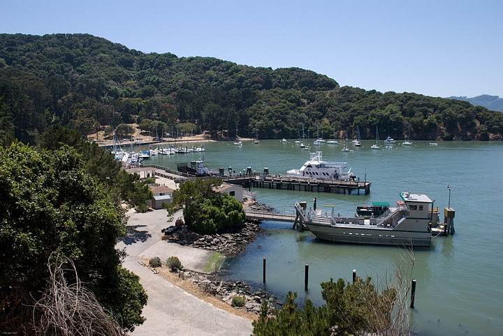
The Raccoon Strait is a waterway of the San Francisco Bay between Angel Island and the Tiburon Peninsula, mainland Marin County, California, United States. During the ice ages, when sea levels were considerably lower and San Francisco Bay was a grassy valley, the combined Sacramento-San Joaquin river flowed through what is now Raccoon Strait before flowing through the canyon at the Golden Gate. History From Angel Island California State Park in San Francisco Bay. Ref. California State Parks Angel Island. In 1814, the British 26-gun sloop of war, , was damaged off the coast of Oregon, but stayed afloat to reach San Francisco Bay. From March 13 to 19th, the ship was repaired on the beach at Ayala Cove on the Northern portion of Angel Island, at the location of the present day ferry boat dock. This event gave the name to the deep-water channel between Tiburon and Angel Island. It is unclear whether the ship was engaged in the War of 1812 or, more likely, protecting British and Canadi ... [...More Info...] [...Related Items...] OR: [Wikipedia] [Google] [Baidu] |
Angel Island (California)
Angel Island is an island in San Francisco Bay. The entire island is included within Angel Island State Park, administered by California State Parks. The island, a California Historical Landmark, has been used by humans for a variety of purposes, including seasonal hunting and gathering by indigenous peoples, water and timber supply for European ships, ranching by Mexicans, United States military installations, a United States Public Health Service Quarantine Station, and a U.S. Bureau of Immigration inspection and detention facility. The Angel Island Immigration Station, on the northeast corner of the island, which has been designated a National Historic Landmark, was where officials detained, inspected, and examined approximately one million immigrants, who primarily came from Asia. Under the Chinese Exclusion Act of 1882, the first United States law to restrict a group of immigrants based on their race, nationality, and class, all arriving Chinese immigrants were to be examined ... [...More Info...] [...Related Items...] OR: [Wikipedia] [Google] [Baidu] |
Hawaiian Islands
The Hawaiian Islands ( haw, Nā Mokupuni o Hawai‘i) are an archipelago of eight major islands, several atolls, and numerous smaller islets in the North Pacific Ocean, extending some from the island of Hawaii in the south to northernmost Kure Atoll. Formerly the group was known to Europeans and Americans as the Sandwich Islands, a name that James Cook chose in honor of the 4th Earl of Sandwich, the then First Lord of the Admiralty. Cook came across the islands by chance when crossing the Pacific Ocean on his Third Voyage in 1778, on board HMS ''Resolution''; he was later killed on the islands on a return visit. The contemporary name of the islands, dating from the 1840s, is derived from the name of the largest island, Hawaii Island. Hawaii sits on the Pacific Plate and is the only U.S. state that is not geographically connected to North America. It is part of the Polynesia subregion of Oceania. The state of Hawaii occupies the archipelago almost in its entirety (includin ... [...More Info...] [...Related Items...] OR: [Wikipedia] [Google] [Baidu] |


.jpg)


%2C_Guamán_Poma%2C_1616.jpg)

