|
Gussage
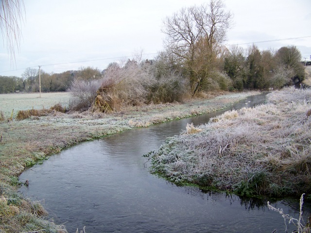
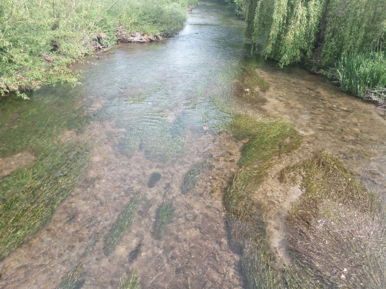
Gussage is a series of three villages in north Dorset, England, situated along the Gussage Stream, a tributary of the River Allen on Cranborne Chase, north east of Blandford Forum and north of Wimborne. The stream runs through all three parishes: Gussage All Saints, population 192, Gussage St Michael, pop. 219 (in 2001) and Gussage St Andrew Gussage is a series of three villages in north Dorset, England, situated along the Gussage Stream, a tributary of the River Allen on Cranborne Chase, north east of Blandford Forum and north of Wimborne. The stream runs through all three parish ..., population unknown, but smaller than the other two villages. External links Census data Villages in Dorset {{Dorset-geo-stub ... [...More Info...] [...Related Items...] OR: [Wikipedia] [Google] [Baidu] |
Gussage All Saints
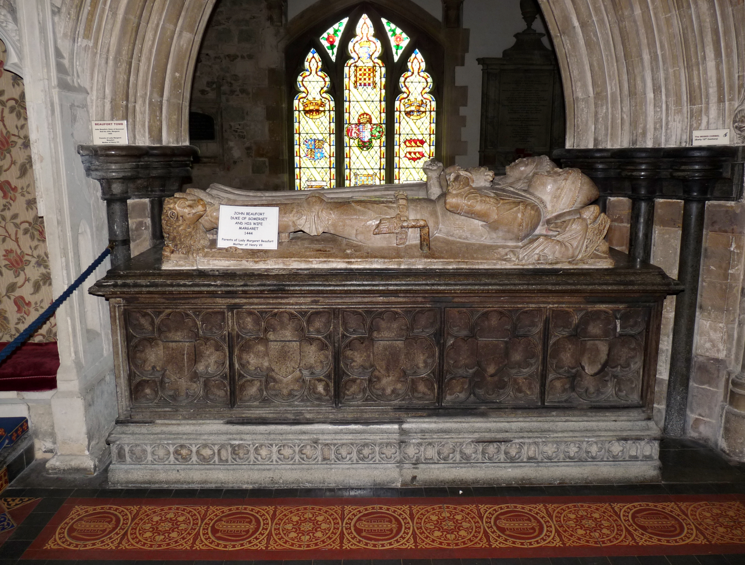
Gussage All Saints is a village and parish in the county of Dorset in southern England. It nestles within the East Dorset administrative district of the county, about 8 miles north-east of the town of Blandford Forum. It is sited by the side of a small stream in a shallow valley on the lower dip slope of Cranborne Chase. Ackling Dyke, a disused Ancient Rome, Roman road, crosses the valley to the northwest, and forms the parish boundary at that point. The village church dates mostly from the early 14th century.Gant, R., ''Dorset Villages'', Hale, 1980, p35 Since 2001 The Ecclesiastical Parish of Gussage All Saints has been one of ten Ecclesiastical Parishes which form ‘The Chase Benefice’ under its first incumbent the Reverend Dr Michael Foster. The other Parishes are Gussage St Michael, Farnham, Dorset, Farnham, Chettle, Tarrant Gunville, Tarrant Hinton, Tarrant Monkton, Tarrant Rushton, Tarrant Keyneston, and Tollard Royal in Wiltshire. To the south of the village lies an Iro ... [...More Info...] [...Related Items...] OR: [Wikipedia] [Google] [Baidu] |
Gussage St Michael
Gussage Saint Michael is a small village in East Dorset, in the south of England. At the United Kingdom Census 2001, 2001 census, the village had a population of 219. Gussage St Michael is tucked off the main A354 road, A354 as it runs through the Cranborne Chase, ten miles from Blandford Forum and fourteen miles from Salisbury. The village has no local shops, with the nearest store being in Cranborne, some away. The nearest public house is the Drovers Inn, a mile down a country lane in the sister village of Gussage All Saints. See also *Gussage References External links Villages in Dorset {{dorset-geo-stub ... [...More Info...] [...Related Items...] OR: [Wikipedia] [Google] [Baidu] |
Gussage St Andrew
Gussage is a series of three villages in north Dorset, England, situated along the Gussage Stream, a tributary of the River Allen, Dorset, River Allen on Cranborne Chase, north east of Blandford Forum and north of Wimborne. The stream runs through all three parishes: Gussage All Saints, population 192, Gussage St Michael, pop. 219 (in 2001) and Gussage St Andrew, population unknown, but smaller than the other two villages. External links Census data Villages in Dorset {{Dorset-geo-stub ... [...More Info...] [...Related Items...] OR: [Wikipedia] [Google] [Baidu] |
River Allen, Dorset
The River Allen is a river in the county of Dorset in South West England. It flows for and has its confluence with the River Stour in Wimborne Minster. It has two main tributaries, the Gussage Stream and the Crichel Stream. Route The River Allen starts at Wyke Farm as a winterbourne and flows down to Monkton Up Wimborne and then tracks its way to the Watercress farm, follows down to Honeybrook Farm, to a mill and then to Canford Bridge in Wimborne Minster that is the mouth of the river. The river is known as a classic chalkstream which supports a good fishery for trout and used to support a good salmonid population. A large amount of the river banks are privately owned by two estates including the Shaftsebury Estate at the source. Watermills There have been a number of corn mills on the river, Loverley Mill at Crichel survives as a Grade II listed building. Originally using two wheels, they were replaced in the early 20th century by a water turbine driving a pump to supply w ... [...More Info...] [...Related Items...] OR: [Wikipedia] [Google] [Baidu] |
Dorset
Dorset ( ; archaically: Dorsetshire , ) is a county in South West England on the English Channel coast. The ceremonial county comprises the unitary authority areas of Bournemouth, Christchurch and Poole and Dorset (unitary authority), Dorset. Covering an area of , Dorset borders Devon to the west, Somerset to the north-west, Wiltshire to the north-east, and Hampshire to the east. The county town is Dorchester, Dorset, Dorchester, in the south. After the Local Government Act 1972, reorganisation of local government in 1974, the county border was extended eastward to incorporate the Hampshire towns of Bournemouth and Christchurch. Around half of the population lives in the South East Dorset conurbation, while the rest of the county is largely rural with a low population density. The county has a long history of human settlement stretching back to the Neolithic era. The Roman conquest of Britain, Romans conquered Dorset's indigenous Durotriges, Celtic tribe, and during the Ear ... [...More Info...] [...Related Items...] OR: [Wikipedia] [Google] [Baidu] |
England
England is a country that is part of the United Kingdom. It shares land borders with Wales to its west and Scotland to its north. The Irish Sea lies northwest and the Celtic Sea to the southwest. It is separated from continental Europe by the North Sea to the east and the English Channel to the south. The country covers five-eighths of the island of Great Britain, which lies in the North Atlantic, and includes over 100 smaller islands, such as the Isles of Scilly and the Isle of Wight. The area now called England was first inhabited by modern humans during the Upper Paleolithic period, but takes its name from the Angles, a Germanic tribe deriving its name from the Anglia peninsula, who settled during the 5th and 6th centuries. England became a unified state in the 10th century and has had a significant cultural and legal impact on the wider world since the Age of Discovery, which began during the 15th century. The English language, the Anglican Church, and Engli ... [...More Info...] [...Related Items...] OR: [Wikipedia] [Google] [Baidu] |
Cranborne Chase
Cranborne Chase () is an area of central southern England, straddling the counties Dorset, Hampshire and Wiltshire. It is part of the Cranborne Chase and West Wiltshire Downs Area of Outstanding Natural Beauty (AONB). The area is dominated by, and often considered to be synonymous with, a chalk downland plateau. Part of the English Chalk Formation, it is adjacent to Salisbury Plain and the West Wiltshire Downs in the north, and the Dorset Downs to the south west. The highest point is Win Green Down, in Wiltshire, at . Historically a medieval hunting forest, the area is also noted for its Neolithic and Bronze age archaeology and its rural agricultural character. Definitions As an informally defined region, the boundaries of Cranborne Chase vary depending on usage. When defined as the chalk plateau, it is clearly bounded by escarpments which face the valleys of the Blackmore Vale to the west, the Vale of Wardour to the north, and the Hampshire Avon to the east. To the south th ... [...More Info...] [...Related Items...] OR: [Wikipedia] [Google] [Baidu] |
Blandford Forum
Blandford Forum ( ), commonly Blandford, is a market town in Dorset, England, sited by the River Stour, Dorset, River Stour about northwest of Poole. It was the administrative headquarters of North Dorset District until April 2019, when this was abolished and its area incorporated into the new Dorset (unitary authority), Dorset unitary authority. Blandford is notable for its Georgian architecture, the result of rebuilding after the majority of the town was destroyed by a fire in 1731. The rebuilding work was assisted by an Act of Parliament and a donation by George II of Great Britain, George II, and the rebuilt town centre—to designs by local architects Bastard brothers, John and William Bastard—has survived to the present day largely intact. Blandford Camp, a military base, is sited on the hills north-east of the town. It is the base of the Royal Corps of Signals, the communications wing of the British Army, and the site of the Royal Signals Museum. Dorset County Coun ... [...More Info...] [...Related Items...] OR: [Wikipedia] [Google] [Baidu] |
Wimborne
Wimborne Minster (often referred to as Wimborne, ) is a market town in Dorset in South West England, and the name of the Church of England church in that town. It lies at the confluence of the River Stour and the River Allen, north of Poole, on the Dorset Heaths, and is part of the South East Dorset conurbation. According to Office for National Statistics data the population of the Wimborne Minster built-up area was 15,552. Governance The town and its administrative area are served by eleven councillors plus one from the nearby ward of Cranfield. The electoral ward of Wimborne Minster is slightly bigger than the parish, with a 2011 population of 7,014. Wimborne Minster is part of the Mid Dorset and North Poole parliamentary constituency. Buildings and architecture Wimborne has one of the foremost collections of 15th-, 16th- and 17th-century buildings in Dorset. Local planning has restricted the construction of new buildings in areas such as the Cornmarket and the High S ... [...More Info...] [...Related Items...] OR: [Wikipedia] [Google] [Baidu] |
Parish
A parish is a territorial entity in many Christian denominations, constituting a division within a diocese. A parish is under the pastoral care and clerical jurisdiction of a priest, often termed a parish priest, who might be assisted by one or more curates, and who operates from a parish church. Historically, a parish often covered the same geographical area as a manor. Its association with the parish church remains paramount. By extension the term ''parish'' refers not only to the territorial entity but to the people of its community or congregation as well as to church property within it. In England this church property was technically in ownership of the parish priest ''ex-officio'', vested in him on his institution to that parish. Etymology and use First attested in English in the late, 13th century, the word ''parish'' comes from the Old French ''paroisse'', in turn from la, paroecia, the latinisation of the grc, παροικία, paroikia, "sojourning in a foreign ... [...More Info...] [...Related Items...] OR: [Wikipedia] [Google] [Baidu] |
Population
Population typically refers to the number of people in a single area, whether it be a city or town, region, country, continent, or the world. Governments typically quantify the size of the resident population within their jurisdiction using a census, a process of collecting, analysing, compiling, and publishing data regarding a population. Perspectives of various disciplines Social sciences In sociology and population geography, population refers to a group of human beings with some predefined criterion in common, such as location, race, ethnicity, nationality, or religion. Demography is a social science which entails the statistical study of populations. Ecology In ecology, a population is a group of organisms of the same species who inhabit the same particular geographical area and are capable of interbreeding. The area of a sexual population is the area where inter-breeding is possible between any pair within the area and more probable than cross-breeding with in ... [...More Info...] [...Related Items...] OR: [Wikipedia] [Google] [Baidu] |


