|
Greenhills, San Juan
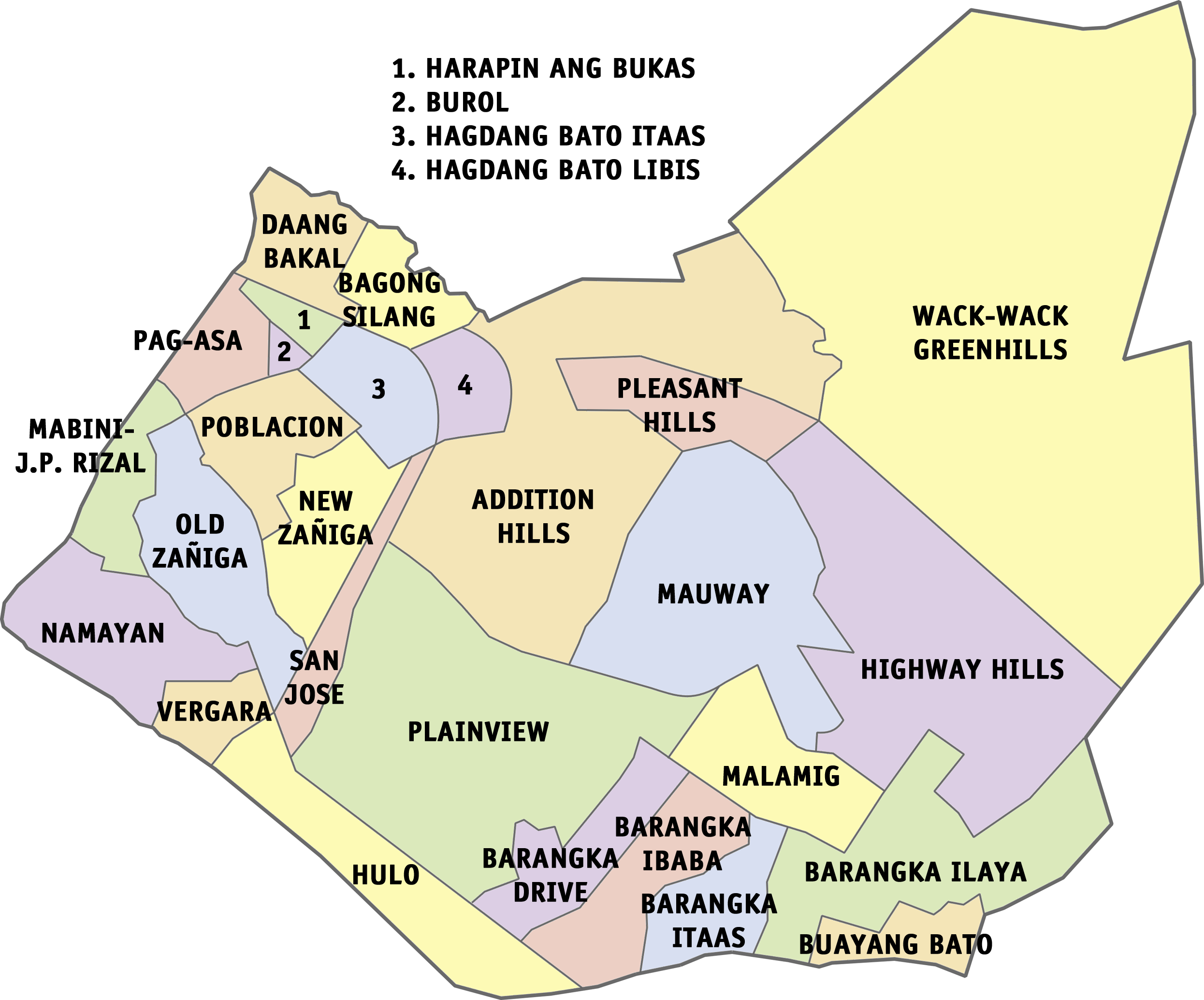
Greenhills is an administrative division in eastern Metro Manila, the Philippines. It is an urban barangay in San Juan and is the largest barangay in the city, covering a total area of that spans over a third of San Juan City's total land area. Centered on the Greenhills Shopping Center and its adjacent commercial establishments and gated communities, the barangay of Greenhills is considered as a major commercial center of the city and of Metro Manila at large. The area was initially part of the ''Hacienda de Mandaluyon'' (Mandaluyong Estate), the estate holdings of the Augustinian Order. The land was later on sold to businessmen Don Francisco Ortigas and Phil Whitaker, who founded Ortigas & Company, which developed the area into multiple residential subdivisions and its centerpiece shopping center, to which it is known for today. History Mandaluyong Estate During the Spanish colonial era, the area that would become known as Greenhills was part of the ''Hacienda de Mandaloyon ... [...More Info...] [...Related Items...] OR: [Wikipedia] [Google] [Baidu] |
Philippines
The Philippines (; fil, Pilipinas, links=no), officially the Republic of the Philippines ( fil, Republika ng Pilipinas, links=no), * bik, Republika kan Filipinas * ceb, Republika sa Pilipinas * cbk, República de Filipinas * hil, Republika sang Filipinas * ibg, Republika nat Filipinas * ilo, Republika ti Filipinas * ivv, Republika nu Filipinas * pam, Republika ning Filipinas * krj, Republika kang Pilipinas * mdh, Republika nu Pilipinas * mrw, Republika a Pilipinas * pag, Republika na Filipinas * xsb, Republika nin Pilipinas * sgd, Republika nan Pilipinas * tgl, Republika ng Pilipinas * tsg, Republika sin Pilipinas * war, Republika han Pilipinas * yka, Republika si Pilipinas In the recognized optional languages of the Philippines: * es, República de las Filipinas * ar, جمهورية الفلبين, Jumhūriyyat al-Filibbīn is an archipelagic country in Southeast Asia. It is situated in the western Pacific Ocean and consists of around 7,641 islands t ... [...More Info...] [...Related Items...] OR: [Wikipedia] [Google] [Baidu] |
History Of The Philippines (1898–1946)
The history of the Philippines from 1898 to 1946 began with the outbreak of the Spanish–American War in April 1898, when the Philippines was still a colony of the Spanish East Indies, and concluded when the United States formally recognized the independence of the Republic of the Philippines on July 4, 1946. With the signing of the Treaty of Paris on December 10, 1898, Spain ceded the Philippines to the United States. The interim U.S. military government of the Philippine Islands experienced a period of great political turbulence, characterized by the Philippine–American War. Beginning in 1906, the military government was replaced by a civilian government—the Insular Government of the Philippine Islands—with William Howard Taft serving as its first governor-general. A series of insurgent governments that lacked significant international and diplomatic recognition also existed between 1898 and 1904. Following the passage of the Philippine Independence Act in 1934 ... [...More Info...] [...Related Items...] OR: [Wikipedia] [Google] [Baidu] |
Cold War
The Cold War is a term commonly used to refer to a period of geopolitical tension between the United States and the Soviet Union and their respective allies, the Western Bloc and the Eastern Bloc. The term '' cold war'' is used because there was no large-scale fighting directly between the two superpowers, but they each supported major regional conflicts known as proxy wars. The conflict was based around the ideological and geopolitical struggle for global influence by these two superpowers, following their temporary alliance and victory against Nazi Germany and Imperial Japan in 1945. Aside from the nuclear arsenal development and conventional military deployment, the struggle for dominance was expressed via indirect means such as psychological warfare, propaganda campaigns, espionage, far-reaching embargoes, rivalry at sports events, and technological competitions such as the Space Race. The Western Bloc was led by the United States as well as a number of other First W ... [...More Info...] [...Related Items...] OR: [Wikipedia] [Google] [Baidu] |
Weapon Of Mass Destruction
A weapon of mass destruction (WMD) is a chemical, biological, radiological, nuclear, or any other weapon that can kill and bring significant harm to numerous individuals or cause great damage to artificial structures (e.g., buildings), natural structures (e.g., mountains), or the biosphere. The scope and usage of the term has evolved and been disputed, often signifying more politically than technically. Originally coined in reference to aerial bombing with chemical explosives during World War II, it has later come to refer to large-scale weaponry of warfare-related technologies, such as chemical, biological, radiological, or nuclear warfare. Early uses of this term The first use of the term "weapon of mass destruction" on record is by Cosmo Gordon Lang, Archbishop of Canterbury, in 1937 in reference to the aerial bombing of Guernica, Spain: At the time, nuclear weapons had not been developed. Japan conducted research on biological weapons (see Unit 731), and chemical w ... [...More Info...] [...Related Items...] OR: [Wikipedia] [Google] [Baidu] |
Planned Community
A planned community, planned city, planned town, or planned settlement is any community that was carefully planned from its inception and is typically constructed on previously undeveloped land. This contrasts with settlements that evolve in a more ''ad hoc'' and organic fashion. The term ''new town'' refers to planned communities of the new towns movement in particular, mainly in the United Kingdom. It was also common in the European colonization of the Americas to build according to a plan either on fresh ground or on the ruins of earlier Native American villages. Planned capitals A planned capital is a city specially planned, designed and built to be a capital. Several of the world's national capitals are planned capitals, including Canberra in Australia, Brasília in Brazil, Belmopan in Belize, New Delhi in India, Abuja in Nigeria, Islamabad in Pakistan, Naypyidaw in Myanmar (Burma) and Washington, D.C. in the United States, and the modern parts of Astana in Kaza ... [...More Info...] [...Related Items...] OR: [Wikipedia] [Google] [Baidu] |
Resettlement Administration
The Resettlement Administration (RA) was a New Deal U.S. federal agency created May 1, 1935. It relocated struggling urban and rural families to communities planned by the federal government. On September 1, 1937, it was succeeded by the Farm Security Administration. History The RA was the brainchild of Rexford G. Tugwell, an economics professor at Columbia University who became an advisor to Franklin D. Roosevelt during the latter's successful campaign for the presidency in 1932 and then held positions in the United States Department of Agriculture. Roosevelt established the RA under Executive Order 7027, as one of the New Deal's " alphabet agencies", and Tugwell became its head. The divisions of the new organization included Rural Rehabilitation, Rural Resettlement, Land Utilization, and Suburban Resettlement. Roosevelt transferred the Federal Emergency Relief Administration land program to the Resettlement Administration under Executive Order 7028 on May 1, 1935. However, ... [...More Info...] [...Related Items...] OR: [Wikipedia] [Google] [Baidu] |
EDSA
Epifanio de los Santos Avenue, commonly referred to by its acronym EDSA, is a limited-access circumferential highway around Manila, the capital city of the Philippines. It passes through 6 of Metro Manila's 17 local government units or cities, namely, from north to south, Caloocan, Quezon City, San Juan, Metro Manila, San Juan, Mandaluyong, Makati, and Pasay. Named after academic Epifanio de los Santos, the road links the North Luzon Expressway at the Balintawak Interchange in the north to the South Luzon Expressway at the Magallanes Interchange in the south, as well as the major financial districts of Makati Central Business District, Ortigas Center, and Araneta City. It is the longest and the most congested highway in the metropolis, stretching some . Structure The entire avenue forms part of Circumferential Road 4 (C-4) of Metro Manila's arterial road network, National Route 1 (N1) of the Philippine highway network and Asian Highway 26 (AH26) of the Asian Highway Network, ... [...More Info...] [...Related Items...] OR: [Wikipedia] [Google] [Baidu] |
Makati
Makati ( ), officially the City of Makati ( fil, Lungsod ng Makati), is a 1st class highly urbanized city in the National Capital Region of the Philippines. Makati is the financial center of the Philippines; it has the highest concentration of multinational and local corporations in the country. Major banks, corporations, department stores as well as foreign embassies are based in Makati. The biggest trading floor of the Philippine Stock Exchange used to be situated along the city's Ayala Avenue, before the stock exchange moved their headquarters to the Bonifacio Global City in Taguig. Makati is also known for being a major cultural and entertainment hub in Metro Manila. According to the 2020 census, it has a population of 629,616 people making it as the 17th most populous city in the country and ranked as the 41st most densely populated city in the world with 19,336 inhabitants per square kilometer. Although its population is just above half a million, the daytime populat ... [...More Info...] [...Related Items...] OR: [Wikipedia] [Google] [Baidu] |
Philam, Quezon City
Philam, also known as Philam Homes, Philamlife Homes or Phil-Am, is an administrative division in eastern Metro Manila, the Philippines. It is an urban barangay located in the first legislative district of Quezon City, consisting entirely of the Philam private subdivision and gated community. It is bounded by EDSA to the northeast, West Avenue on the northwest, and the Anaran Creek to the south. It shares a boundary with barangays Bagong Pag-Asa to the northeast, Bungad to the northwest, Paltok to the southwest, and West Triangle to the south. History On July 17, 1948, president Elpidio Quirino signed Republic Act No. 333, designating Quezon City as the new capital of the Philippines. The following year, the 1949 Master Plan for Quezon City was published to serve as the foremost guideline in transforming the city as a “a real Filipino metropolis” and a “showplace of the nation.” Although aspects of the 1949 Master Plan were not fully implemented, a portion of the W ... [...More Info...] [...Related Items...] OR: [Wikipedia] [Google] [Baidu] |
Manila
Manila ( , ; fil, Maynila, ), officially the City of Manila ( fil, Lungsod ng Maynila, ), is the capital of the Philippines, and its second-most populous city. It is highly urbanized and, as of 2019, was the world's most densely populated city proper. Manila is considered to be a global city and rated as an Alpha – City by Globalization and World Cities Research Network (GaWC). It was the first chartered city in the country, designated as such by the Philippine Commission Act 183 of July 31, 1901. It became autonomous with the passage of Republic Act No. 409, "The Revised Charter of the City of Manila", on June 18, 1949. Manila is considered to be part of the world's original set of global cities because its commercial networks were the first to extend across the Pacific Ocean and connect Asia with the Spanish Americas through the galleon trade; when this was accomplished, it marked the first time in world history that an uninterrupted chain of trade routes circling ... [...More Info...] [...Related Items...] OR: [Wikipedia] [Google] [Baidu] |
Wack-Wack Greenhills, Mandaluyong
Mandaluyong, officially the City of Mandaluyong ( fil, Lungsod ng Mandaluyong), is a first class Cities of the Philippines#Legal classification, highly urbanized city in the Metro Manila, National Capital Region of the Philippines. According to the 2020 census, it has a population of 425,758 people. Located directly east of Manila, Mandaluyong was originally a barrio of Santa Ana, Manila, Santa Ana de Sapa (now a district of Manila) called San Felipe Neri. It separated and became its own town in 1841, and later acquired the name Mandaluyong in 1931 during the History of the Philippines (1898–1946), American occupation. In 1994, it became the first municipality of Metro Manila to become a city since the metropolis' establishment in 1975. At present, it is known for the Ortigas Center, a commercial and business center that it also shares with the city of Pasig. Notable institutions and establishments in the city include the Asian Development Bank, the headquarters of Banco de O ... [...More Info...] [...Related Items...] OR: [Wikipedia] [Google] [Baidu] |
Capitol Commons
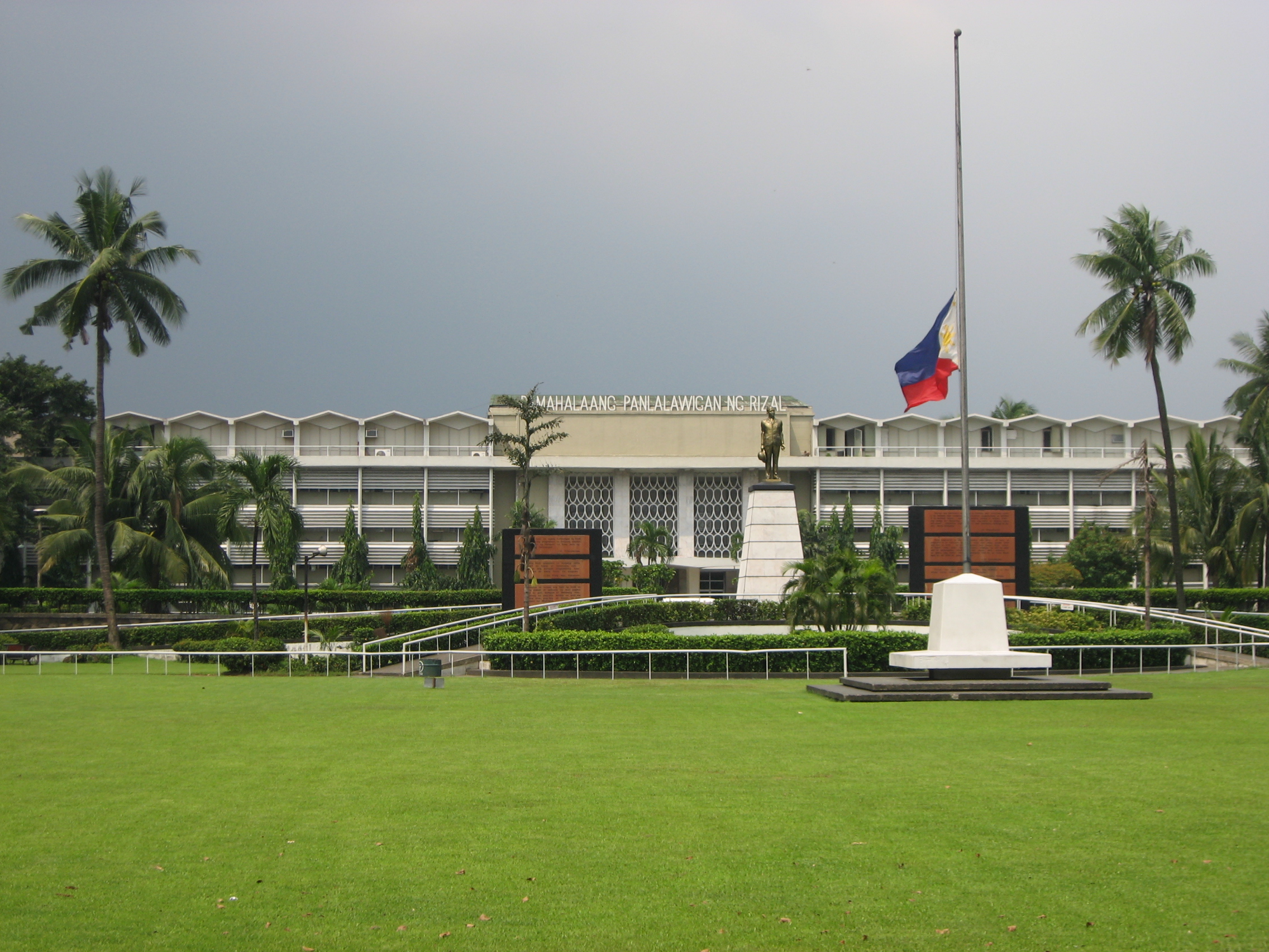
Capitol Commons is a mixed-use development in Oranbo, Pasig, Metro Manila, Philippines. It is a redevelopment of the former Rizal Provincial Capitol complex located in the village of Oranbo adjacent to the Ortigas Center financial district. The site being developed by Ortigas & Company Limited Partnership, the same developer behind Ortigas Center, features Pasig's first high-end shopping center called ''Estancia at Capitol Commons''. Once completed, the P25-billion mixed-use commercial, residential and office development will have of retail space, of office space for knowledge process outsourcing (KPO) companies, and of residential units. The development is also home to the Capitol Commons Park, which takes up fifty percent of the development. Location Capitol Commons is situated in the southern portion of the barangay of Oranbo in the western part of Pasig just north of the village of Kapitolyo (named after the former provincial capitol). It is an eastern extension of Ortiga ... [...More Info...] [...Related Items...] OR: [Wikipedia] [Google] [Baidu] |


.png)


