|
Goaribari Island
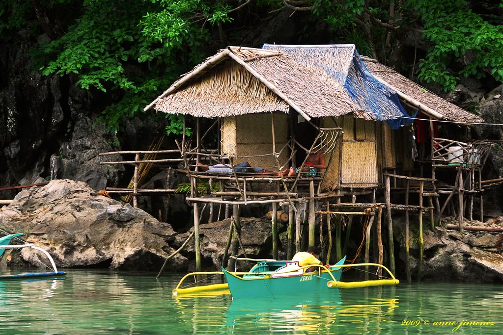
Goaribari is an island in southern Papua New Guinea. It is located in Gulf Province within the Gulf of Papua. During high tides, parts of the island are inundated. The vegetation is thick rainforest. Headhunting was evidenced by the discovery of thousands of skulls in village houses and the longhouse in the early 20th century. In 1901, two ministers and ten missionary students were murdered and cannibalized by island natives. Geography Goaribari Island measures about in east–west direction. Risk Point is the eastern extreme and southward of it there is a sand bank, nearly dry at low water, which extends nearly off the southeast side of the island. The island is covered with tall mangroves. The island is a formation at the delta of the Kikori and Omati Rivers. Its highest point is about above sea level; it consists of mud formation, sedimentary in nature. During very high tides (king tides during storm events), parts of the island become inundated. This has caused some deltai ... [...More Info...] [...Related Items...] OR: [Wikipedia] [Google] [Baidu] |
Kerewo
Kerewo is a Papuan language of southern Papua New Guinea Papua New Guinea (abbreviated PNG; , ; tpi, Papua Niugini; ho, Papua Niu Gini), officially the Independent State of Papua New Guinea ( tpi, Independen Stet bilong Papua Niugini; ho, Independen Stet bilong Papua Niu Gini), is a country i .... Some portions of the Bible were translated into Kerewo. The Gospels of Matthew, Mark, Luke and JOhn and the Epistles of Ephesians, Philippians and 1 John were translated as "Nouri buka nou'a airoa" and published in the Goaribari dialect of Kerewo in 1941. References Kiwaian languages Languages of Gulf Province {{PapuaNewGuinea-stub ... [...More Info...] [...Related Items...] OR: [Wikipedia] [Google] [Baidu] |
Spring Tide
Tides are the rise and fall of sea levels caused by the combined effects of the gravitational forces exerted by the Moon (and to a much lesser extent, the Sun) and are also caused by the Earth and Moon orbiting one another. Tide tables can be used for any given locale to find the predicted times and amplitude (or " tidal range"). The predictions are influenced by many factors including the alignment of the Sun and Moon, the phase and amplitude of the tide (pattern of tides in the deep ocean), the amphidromic systems of the oceans, and the shape of the coastline and near-shore bathymetry (see '' Timing''). They are however only predictions, the actual time and height of the tide is affected by wind and atmospheric pressure. Many shorelines experience semi-diurnal tides—two nearly equal high and low tides each day. Other locations have a diurnal tide—one high and low tide each day. A "mixed tide"—two uneven magnitude tides a day—is a third regular category. Tide ... [...More Info...] [...Related Items...] OR: [Wikipedia] [Google] [Baidu] |
Headhunting In New Guinea
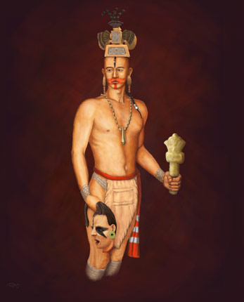
Headhunting is the practice of hunting a human and collecting the severed head after killing the victim, although sometimes more portable body parts (such as ear, nose or scalp) are taken instead as trophies. Headhunting was practiced in historic times in parts of Europe, East Asia, Oceania, Southeast Asia, South Asia, Mesoamerica, West and Central Africa. The headhunting practice has been the subject of intense study within the anthropological community, where scholars try to assess and interpret its social roles, functions, and motivations. Anthropological writings explore themes in headhunting that include mortification of the rival, ritual violence, cosmological balance, the display of manhood, cannibalism, dominance over the body and soul of his enemies in life and afterlife, as a trophy and proof of killing (achievement in hunting), show of greatness, prestige by taking on a rival's spirit and power, and as a means of securing the services of the victim as a slave ... [...More Info...] [...Related Items...] OR: [Wikipedia] [Google] [Baidu] |
Islands Of Papua New Guinea
An island (or isle) is an isolated piece of habitat that is surrounded by a dramatically different habitat, such as water. Very small islands such as emergent land features on atolls can be called islets, skerries, cays or keys. An island in a river or a lake island may be called an eyot or ait, and a small island off the coast may be called a holm. Sedimentary islands in the Ganges delta are called chars. A grouping of geographically or geologically related islands, such as the Philippines, is referred to as an archipelago. There are two main types of islands in the sea: continental and oceanic. There are also artificial islands, which are man-made. Etymology The word ''island'' derives from Middle English ''iland'', from Old English ''igland'' (from ''ig'' or ''ieg'', similarly meaning 'island' when used independently, and -land carrying its contemporary meaning; cf. Dutch ''eiland'' ("island"), German ''Eiland'' ("small island")). However, the spelling of the w ... [...More Info...] [...Related Items...] OR: [Wikipedia] [Google] [Baidu] |
Kikori District
Kikori District is a district of the Gulf Province of Papua New Guinea. Its capital is Kikori Kikori is a small town in the Gulf Province of Papua New Guinea. Kikori lies in the delta of the Kikori River at the head of the Gulf of Papua. This area is particularly biologically rich with a diversity of ecosystems and densely forested, wit .... at statoids.com References Districts of Papua New Guinea Gulf Province {{GulfProvince-geo-stub ...[...More Info...] [...Related Items...] OR: [Wikipedia] [Google] [Baidu] |
Coconut
The coconut tree (''Cocos nucifera'') is a member of the palm tree family (Arecaceae) and the only living species of the genus ''Cocos''. The term "coconut" (or the archaic "cocoanut") can refer to the whole coconut palm, the seed, or the fruit, which botanically is a drupe, not a nut. The name comes from the old Portuguese word '' coco'', meaning "head" or "skull", after the three indentations on the coconut shell that resemble facial features. They are ubiquitous in coastal tropical regions and are a cultural icon of the tropics. The coconut tree provides food, fuel, cosmetics, folk medicine and building materials, among many other uses. The inner flesh of the mature seed, as well as the coconut milk extracted from it, form a regular part of the diets of many people in the tropics and subtropics. Coconuts are distinct from other fruits because their endosperm contains a large quantity of clear liquid, called ''coconut water'' or ''coconut juice''. Mature, ripe coconuts ... [...More Info...] [...Related Items...] OR: [Wikipedia] [Google] [Baidu] |
Nypa Fruticans
''Nypa fruticans'', commonly known as the nipa palm (or simply nipa, from ms, nipah) or mangrove palm, is a species of palm native to the coastlines and estuarine habitats of the Indian and Pacific Oceans. It is the only palm considered adapted to the mangrove biome. The genus ''Nypa'' and the subfamily Nypoideae are monotypic taxa because this species is their only member. Description Unlike most palms, the nipa palm's trunk grows beneath the ground; only the leaves and flower stalk grow upwards above the surface. The leaves extend up to in height. The flowers are a globular inflorescence of female flowers at the tip with catkin-like red or yellow male flowers on the lower branches. The flower produces woody nuts arranged in a globular cluster up to across on a single stalk. The ripe nuts separate from the ball and float away on the tide, occasionally germinating while still water-borne. Fossil record While only one species of ''Nypa'' now exists, ''N. fruticans'' ... [...More Info...] [...Related Items...] OR: [Wikipedia] [Google] [Baidu] |
Croton (plant)
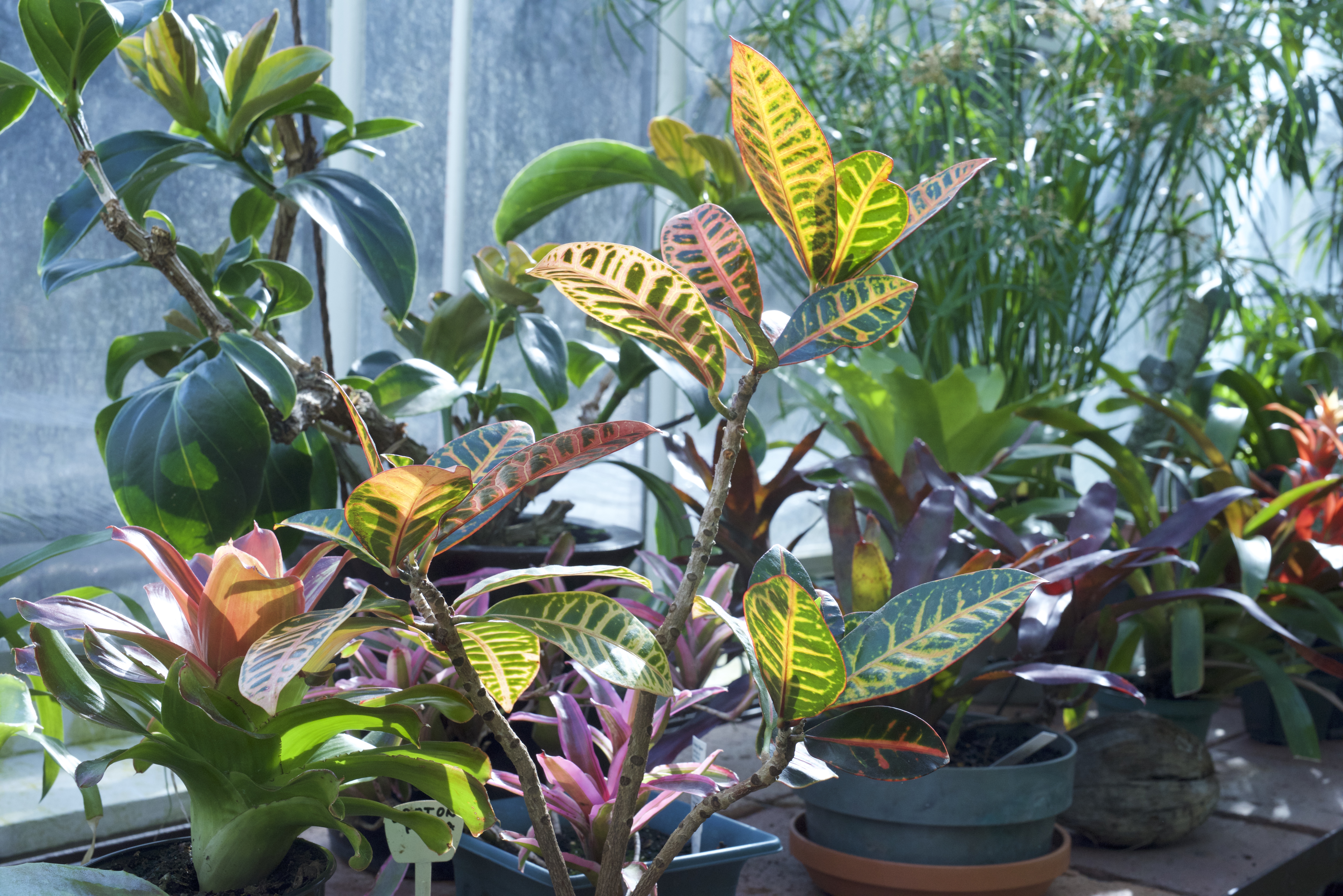
''Croton'' is an extensive flowering plant genus in the spurge family, Euphorbiaceae. The plants of this genus were described and introduced to Europeans by Georg Eberhard Rumphius. The common names for this genus are rushfoil and croton, but the latter also refers to '' Codiaeum variegatum''. The generic name comes from the Greek ('), which means "tick" and refers to the shape of the seeds of certain species. Description ''Croton'' is a diverse and complex taxonomic group of plants ranging from herbs and shrubs to trees. A well-known member of this genus is ''Croton tiglium'', a shrub native to Southeast Asia. It was first mentioned in European literature by Cristóbal Acosta in 1578 as lignum pavanae. The oil, used in herbal medicine as a violent purgative, is extracted from its seeds. Currently, it is considered unsafe and it is no longer listed in the pharmacopeias of many countries. Taxonomy Uses Traditional uses ''C. tiglium'' oil has been used in traditional Chi ... [...More Info...] [...Related Items...] OR: [Wikipedia] [Google] [Baidu] |
Dracaena (plant)
''Dracaena'' () is a genus of about 120 species of trees and succulent shrubs. The formerly accepted genera ''Pleomele'' and '' Sansevieria'' are now included in ''Dracaena''. In the APG IV classification system, it is placed in the family Asparagaceae, subfamily Nolinoideae (formerly the family Ruscaceae). It has also formerly been separated (sometimes with ''Cordyline'') into the family Dracaenaceae or placed in the Agavaceae (now Agavoideae). The name ''dracaena'' is derived from the romanized form of the Ancient Greek – ''drakaina'', "female dragon". The majority of the species are native to Africa, southern Asia through to northern Australia, with two species in tropical Central America. Description Species of ''Dracaena'' have a secondary thickening meristem in their trunk, termed Dracaenoid thickening by some authors, which is quite different from the thickening meristem found in dicotyledonous plants. This characteristic is shared with members of the Agavoideae ... [...More Info...] [...Related Items...] OR: [Wikipedia] [Google] [Baidu] |
Melo (gastropod)
''Melo'' is a genus of extremely large sea snails, marine gastropod molluscs in the family Volutidae, the volutes. Because of their huge ovate shells, these snails are often known as "bailers" (the shells were sometimes used for bailing out canoes) or "melons" (because the shell resembles that fruit). Species in this genus sometimes produce large pearls. The image in the taxobox shows a group of these pearls with a shell of the species '' Melo melo''. Species Species in the genus ''Melo'' include: * '' Melo aethiopica'' (Linnaeus, 1758) Crowned baler * ''Melo amphora'', (Lightfoot, 1786) Giant baler * '' Melo ashmorensis'' Morrison, 2005 * '' Melo diadema'' * '' Melo broderipii'' (Griffith, E. & E. Pidgeon, 1834) * '' Melo georginae'' (Griffith, E. & E. Pidgeon, 1834) * '' Melo melo'' (Lightfoot, 1786) Indian volute * '' Melo miltonis'' (Griffith, E. & E. Pidgeon, 1834) Milton's melon or Southern bailer * '' Melo nautica'' (Lamarck Jean-Baptiste Pierre Antoine ... [...More Info...] [...Related Items...] OR: [Wikipedia] [Google] [Baidu] |
Fly River
The Fly River is the third longest river in the island of New Guinea, after the Sepik River and Mamberamo River, with a total length of and the largest by volume of discharge in Oceania, the largest in the world without a single dam in its catchment, and overall the 20th-largest primary river in the world by discharge volume. It is located in the southwest of Papua New Guinea and Papua Province of Indonesia. It rises in the Victor Emanuel Range arm of the Star Mountains, and crosses the south-western lowlands before flowing into the Gulf of Papua in a large delta. The Fly-Strickland River system has a total length of making it the longest river system of an island in the world, including Strickland River is the longest and largest tributary of Fly River, making it the farthest distance source of the Fly River. Description The Fly flows mostly through the Western Province of Papua New Guinea and for a small stretch, it forms the international boundary with western New ... [...More Info...] [...Related Items...] OR: [Wikipedia] [Google] [Baidu] |


