|
Glensanda
Glensanda (Old Norse, the glen of the sandy river) was a Viking settlement at the mouth of Glen Sanda on the Morvern peninsula within south west Lochaber, overlooking the island of Lismore and Loch Linnhe in the western Highlands of Scotland. Glensanda Castle (''Caisteal Na Gruagaich (Maiden's Castle)''; overlooks the mouth of the Glensanda River which tumbles down 400 metres along its course from 'Caol Bheinn' into Loch Linnhe. The castle was the main base of the Macleans of Kingairloch (Kingerloch) since the 15th century, but the population fell from 500 to zero after 1812 when they emigrated to Pictou, Nova Scotia. The remoteness of the Glensanda settlement is such that there are no road, rail, or marked footway links across the granite mountain, moor, heather and peat bog of the private Glensanda estate. The only practical access is by boat from the shores of Loch Linnhe. Since 1982 the Glensanda Estate has been the home of the Glensanda Superquarry created by Foster ... [...More Info...] [...Related Items...] OR: [Wikipedia] [Google] [Baidu] |
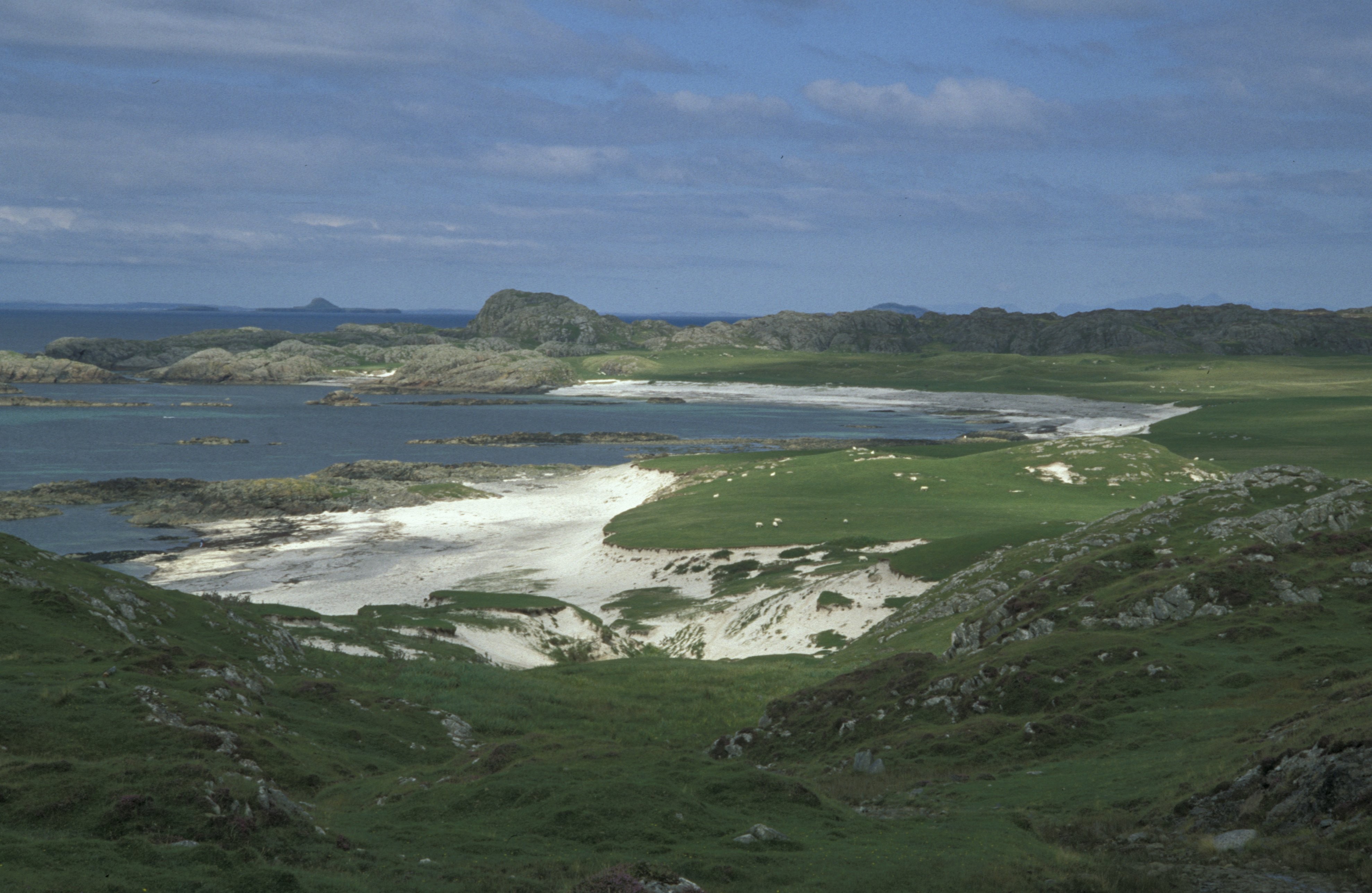
Glensanda From Glas Dhruim On Lismore - Geograph
Glensanda (Old Norse, the glen of the sandy river) was a Viking settlement at the mouth of Glen Sanda on the Morvern, Morvern peninsula within south west Lochaber, overlooking the island of Lismore, Scotland, Lismore and Loch Linnhe in the western Highlands of Scotland. Glensanda Castle (''Caisteal Na Gruagaich (Maiden's Castle)''; overlooks the mouth of the Glensanda River which tumbles down 400 metres along its course from 'Caol Bheinn' into Loch Linnhe. The castle was the main base of the Clan Maclean, Macleans of Kingairloch (Kingerloch) since the 15th century, but the population fell from 500 to zero after 1812 when they emigrated to Pictou, Nova Scotia. The remoteness of the Glensanda settlement is such that there are no road, rail, or marked footway links across the granite mountain, moor, heather and peat bog of the private Glensanda estate. The only practical access is by boat from the shores of Loch Linnhe. Since 1982 the Glensanda Estate has been the home of the ... [...More Info...] [...Related Items...] OR: [Wikipedia] [Google] [Baidu] |
Foster Yeoman
Foster Yeoman Limited, based near Frome, Somerset, England, was one of Europe's largest independent quarrying and asphalt companies. It was sold to Aggregate Industries in 2006. History The company was founded by Foster Yeoman, from Hartlepool, at Dulcote, near Wells, in 1923. He was a former ship owner and had worked in the iron and steel business. Yeoman had served in the First World War and went into quarrying to provide employment for ex-soldiers. Between the wars Foster Yeoman Limited supplied contractors and local authorities in the South of England, reaching an early peak of prosperity in the 1930s. During the Second World War, the firm supplied materials for the construction of airfields. Most stone was sent away by rail as it is today. After the war, with Foster Yeoman ailing, business declined and the company came full circle, returning to the ┬Ż20,000 turnover it had enjoyed in 1923. In 1949, Foster died and his son, John Foster Yeoman, became a managing director at ... [...More Info...] [...Related Items...] OR: [Wikipedia] [Google] [Baidu] |
Aggregate Industries
Aggregate Industries, a member of the Holcim Group, is a company based in the United Kingdom with headquarters at Bardon Hill, Coalville, Leicestershire. Aggregate Industries manufactures and supplies a range of heavy building materials, primarily aggregates such as stone, asphalt and concrete, to the construction industry and other business sectors. Aggregate Industries also manufactures and imports cement, and provides a range of aggregate-associated goods and services, these include the manufacture of masonry and reconstructed stone items for construction industry and domestic applications, the manufacture of pre-cast concrete items, the supply of ready mixed concrete, design and project management consulting, and resurfacing contracting services. Aggregate Industries operates more than 60 quarries in the UK and has several bases throughout mainland Europe and Scandinavia. Its clients operate in a range of services including construction, aviation, education, horticulture, r ... [...More Info...] [...Related Items...] OR: [Wikipedia] [Google] [Baidu] |
Ardgour
Ardgour () (, meaning ''Height of the goats'') is an area of the Scottish Highlands on the western shore of Loch Linnhe. It lies north of the district of Morvern and east of the district of Sunart. Administratively it is now part of the ward management area of Lochaber, in Highland council area. It forms part of the traditional shire and current registration county of Argyll. The modern term Ardgour, together with Kingairloch, is applied to a large area of countryside around the village, from the Glensanda Superquarry, Kingairloch and Kilmalieu in the south and west (bordering Morvern and Sunart districts), up to Conaglen, Stroncreggan, Treslaig, Camasnagaul, Achaphubuil, Blaich, Duisky, Garvan and Drumfin in the north (bordering Glenfinnan). Until 1829 Ardgour was part of Kilmallie Parish - the largest in Scotland - at which time a Quoad Sacra Parish (QSP) - 'Ballachulish & Corran of Ardgour' - was formed, together with Ballachulish, in Inverness-shire across ... [...More Info...] [...Related Items...] OR: [Wikipedia] [Google] [Baidu] |
Pictou
Pictou ( ; Canadian Gaelic: ''Baile Phiogto'') is a town in Pictou County, in the Canadian province of Nova Scotia. Located on the north shore of Pictou Harbour, the town is approximately 10 km (6 miles) north of the larger town of New Glasgow. Once an active shipping port and the shire town of the county, today Pictou is primarily a local service centre for surrounding rural communities and the primary tourist destination in this region of Nova Scotia. The name Pictou derives from the Mi'kmaq name , meaning "explosive place", a reference to the river of pitch that was found in the area, or perhaps from methane bubbling up from coal seams below the harbour. History Pictou Town had been the location of an annual Mi'kmaq summer coastal community prior to European settlement. Pictou was part of the Epekwitk aq Piktuk Mi'kmaq District, which included present-day Prince Edward Island and Pictou. Pictou Town was a receiving point for many Scottish immigrants moving to a new ... [...More Info...] [...Related Items...] OR: [Wikipedia] [Google] [Baidu] |
Morvern
Morvern, historically also spelt Morven, is a peninsula and traditional district in the Highlands, on the west coast of Scotland. It lies south of the districts of Ardgour and Sunart, and is bounded on the north by Loch Sunart and Glen Tarbert, on the south east by Loch Linnhe and on the south west by the Sound of Mull. The name is derived from the Gaelic ''A' Mhorbhairne'' (the Sea-Gap). The highest point is the summit of the Corbett Creach Bheinn which reaches in elevation. Administratively Morvern is now part of the ward management area of Lochaber, in Highland council area. It forms part of the traditional shire and current registration county of Argyll. Morvern is approximately in area, with a current population of about 320. Prehistory and archaeology In 2010, forestry planting by the then Forestry Commission Scotland let to the discovery of a Mesolithic stone tool scatter. Subsequent archaeology excavations also found evidence that people in the Bronze Age also ... [...More Info...] [...Related Items...] OR: [Wikipedia] [Google] [Baidu] |
William J
William is a male given name of Germanic origin.Hanks, Hardcastle and Hodges, ''Oxford Dictionary of First Names'', Oxford University Press, 2nd edition, , p. 276. It became very popular in the English language after the Norman conquest of England in 1066,All Things William"Meaning & Origin of the Name"/ref> and remained so throughout the Middle Ages and into the modern era. It is sometimes abbreviated "Wm." Shortened familiar versions in English include Will, Wills, Willy, Willie, Bill, and Billy. A common Irish form is Liam. Scottish diminutives include Wull, Willie or Wullie (as in Oor Wullie or the play ''Douglas''). Female forms are Willa, Willemina, Wilma and Wilhelmina. Etymology William is related to the given name ''Wilhelm'' (cf. Proto-Germanic ßÜ╣ßøüßøÜßøāßÜ©ßÜ║ßø¢ßøÜßøŚßÜ©ßøē, ''*Wiljahelmaz'' > German ''Wilhelm'' and Old Norse ßÜóßøüßøÜßøŗßøģßÜ╝ßøģßøÜßøśßøģßøŗ, ''Vilhj├Īlmr''). By regular sound changes, the native, inherited English form of the name shoul ... [...More Info...] [...Related Items...] OR: [Wikipedia] [Google] [Baidu] |
River Sanda And Footpath To Ardtornish - Geograph
A river is a natural flowing watercourse, usually freshwater, flowing towards an ocean, sea The sea, connected as the world ocean or simply the ocean, is the body of salty water that covers approximately 71% of the Earth's surface. The word sea is also used to denote second-order sections of the sea, such as the Mediterranean Sea, ..., lake or another river. In some cases, a river flows into the ground and becomes dry at the end of its course without reaching another body of water. Small rivers can be referred to using names such as Stream#Creek, creek, Stream#Brook, brook, rivulet, and rill. There are no official definitions for the generic term river as applied to Geographical feature, geographic features, although in some countries or communities a stream is defined by its size. Many names for small rivers are specific to geographic location; examples are "run" in some parts of the United States, "Burn (landform), burn" in Scotland and northeast England, and "bec ... [...More Info...] [...Related Items...] OR: [Wikipedia] [Google] [Baidu] |
D├Īl Riata
D├Īl Riata or D├Īl Riada (also Dalriada) () was a Gaelic kingdom that encompassed the western seaboard of Scotland and north-eastern Ireland, on each side of the North Channel. At its height in the 6th and 7th centuries, it covered what is now Argyll ("Coast of the Gaels") in Scotland and part of County Antrim in Northern Ireland.Clancy, Thomas Owen, "Philosopher King: Nechtan mac Der Ilei," SHR 83 (2004): 135ŌĆō149 After a period of expansion, D├Īl Riata eventually became associated with the Gaelic Kingdom of Alba.Oxford Companion to Scottish History pp. 161ŌĆō162, edited by Michael Lynch, Oxford University Press. . In Argyll, it consisted of four main kindreds, each with their own chief: Cen├®l nGabr├Īin (based in Kintyre), Cen├®l n├ōengusa (based on Islay), Cen├®l Loairn (who gave their name to the district of Lorn) and Cen├®l Comgaill (who gave their name to Cowal). The hillfort of Dunadd is believed to have been its capital. Other royal forts included Dunollie, Dunaver ... [...More Info...] [...Related Items...] OR: [Wikipedia] [Google] [Baidu] |
Gaels
The Gaels ( ; ga, Na Gaeil ; gd, Na G├Āidheil ; gv, Ny Gaeil ) are an ethnolinguistic group native to Ireland, Scotland and the Isle of Man in the British Isles. They are associated with the Gaelic languages: a branch of the Celtic languages comprising Irish, Manx and Scottish Gaelic. Gaelic language and culture originated in Ireland, extending to D├Īl Riata in western Scotland. In antiquity, the Gaels traded with the Roman Empire and also raided Roman Britain. In the Middle Ages, Gaelic culture became dominant throughout the rest of Scotland and the Isle of Man. There was also some Gaelic settlement in Wales, as well as cultural influence through Celtic Christianity. In the Viking Age, small numbers of Vikings raided and settled in Gaelic lands, becoming the Norse-Gaels. In the 9th century, D├Īl Riata and Pictland merged to form the Gaelic Kingdom of Alba. Meanwhile, Gaelic Ireland was made up of several kingdoms, with a High King often claiming lordship over ... [...More Info...] [...Related Items...] OR: [Wikipedia] [Google] [Baidu] |
Corran Ferry
The Corran Ferry crosses Loch Linnhe at the Corran Narrows, south of Fort William, Scotland. Description Operated by Highland Council, the Corran Ferry is one of few remaining scheduled mainland vehicle ferries in Scotland. The route crosses Loch Linnhe from Nether Lochaber to Ardgour, at the Corran Narrows, south of Fort William. It was noted for the unusual sign "This is not the Ballachulish Ferry", placed there to avoid confusion with the nearby ferry at Ballachulish which crossed Loch Leven until being replaced by the Ballachulish Bridge in early 1976. The route lies on one of the ancient drove routes from the Hebrides to the cattle markets in Central Scotland. Today, the ferry is a crucial link between the main A82 road (serving Inverness, Fort William, and Glasgow) with the otherwise extremely remote Morvern and Ardnamurchan peninsulas. Use of the ferry saves over an hour from the land route between Ardgour and Corran (which would involve use of the A861 and the A ... [...More Info...] [...Related Items...] OR: [Wikipedia] [Google] [Baidu] |
Iona
Iona (; gd, ├ī Chaluim Chille (IPA: łi╦É╦łxa╔½╠¬╔»im╦ł├¦i╩Ä╔Ö, sometimes simply ''├ī''; sco, Iona) is a small island in the Inner Hebrides, off the Ross of Mull on the western coast of Scotland. It is mainly known for Iona Abbey, though there are other buildings on the island. Iona Abbey was a centre of Gaelic monasticism for three centuries and is today known for its relative tranquility and natural environment. It is a tourist destination and a place for spiritual retreats. Its modern Scottish Gaelic name means "Iona of (Saint) Columba" (formerly anglicised as "Icolmkill"). In 2019, the island's estimated population was 120. Residents engage in farming, using traditional methods. Other occupations include crofting and tourism-related work; some craftsmen make goods for sale locally, such as pottery, tapestries, jewellery and knitted goods. In March 1980, the Hugh Fraser Foundation donated much of the main island (and its off-lying islands) to the current owner, the National ... [...More Info...] [...Related Items...] OR: [Wikipedia] [Google] [Baidu] |


