|
Gleadless Valley (ward)
Gleadless Valley ward—which includes the districts of Gleadless Valley (Hemsworth, Herdings), Heeley, Lowfield, and Meersbrook—is one of the 28 electoral wards in City of Sheffield, England. It is located in the southern part of the city and covers an area of 4.5 km2. The population of this ward in 2011 was 21,089 people in 9,516 households. It is one of the five wards that form the Sheffield Heeley parliamentary constituency in the House of Commons. Gleadless Valley actually describes the valley that separates Hemsworth from Herdings, and is a broad area that covers several housing estates: Hemsworth, Herdings and Rollestone. Gleadless Valley is bordered by Gleadless and Norton. Districts of Gleadless Valley ward Heeley Heeley () is a former village now a suburb in the south of the City of Sheffield, England. The village has existed at least since 1343, its name deriving from 'Heah Leah', meaning a high, woodland clearing. Originally Heeley was divided in ... [...More Info...] [...Related Items...] OR: [Wikipedia] [Google] [Baidu] |
Sheffield
Sheffield is a city status in the United Kingdom, city in South Yorkshire, England, whose name derives from the River Sheaf which runs through it. The city serves as the administrative centre of the City of Sheffield. It is Historic counties of England, historically part of the West Riding of Yorkshire and some of its southern suburbs were transferred from Derbyshire to the city council. It is the largest settlement in South Yorkshire. The city is in the eastern foothills of the Pennines and the valleys of the River Don, Yorkshire, River Don with its four tributaries: the River Loxley, Loxley, the Porter Brook, the River Rivelin, Rivelin and the River Sheaf, Sheaf. Sixty-one per cent of Sheffield's entire area is green space and a third of the city lies within the Peak District national park. There are more than 250 parks, woodlands and gardens in the city, which is estimated to contain around 4.5 million trees. The city is south of Leeds, east of Manchester, and north ... [...More Info...] [...Related Items...] OR: [Wikipedia] [Google] [Baidu] |
Midland Main Line
The Midland Main Line is a major railway line in England from London to Nottingham and Sheffield in the Midlands. It comprises the lines from London's St Pancras station via Leicester, Derby/Nottingham and Chesterfield in the East Midlands. Express passenger services on the line are operated by East Midlands Railway. The line is electrified between St Pancras and Corby and the section south of Bedford forms the northern half of the Thameslink network, with a semi-fast service to Brighton and other suburban services. A northern part of the route, between Derby and Chesterfield, also forms part of the Cross Country Route operated by CrossCountry. Tracks from Nottingham to Leeds via Barnsley and Sheffield are shared with Northern. East Midlands Railway also operates regional and local services using parts of the line. The Midland Main Line is to receive a major upgrade of new digital signalling and full line electrification from London to Sheffield. HS2 is to branch onto th ... [...More Info...] [...Related Items...] OR: [Wikipedia] [Google] [Baidu] |
Walkley
Walkley is a suburb of Sheffield, England, west of Burngreave, south of Hillsborough and north-east of Crookes. The area consists mainly of Victorian stone-fronted terraced housing and has a relatively high student population. It also has a number of independent shops and cafes. History The origin of the name Walkley comes from the Old English language with the original name being "Walcas Leah", meaning Walca's forest clearing.J. Edward Vickers, ''The Ancient Suburbs of Sheffield'', p.24 (1971) The early Anglo-Saxon village consisted of a few structures, mainly farm buildings and workmen's cottages. Most of the area was thick woodland with the few open quarters such as Crookesmoor and Bell Hagg Common being used for grazing cattle. Walkley was mentioned in several documents in the centuries after the Norman Conquest, in 1554 it was described as having several cottages and smallholdings worked by tenants of the Lord of the Manor of Sheffield. By this time the population of W ... [...More Info...] [...Related Items...] OR: [Wikipedia] [Google] [Baidu] |
Guild Of St George
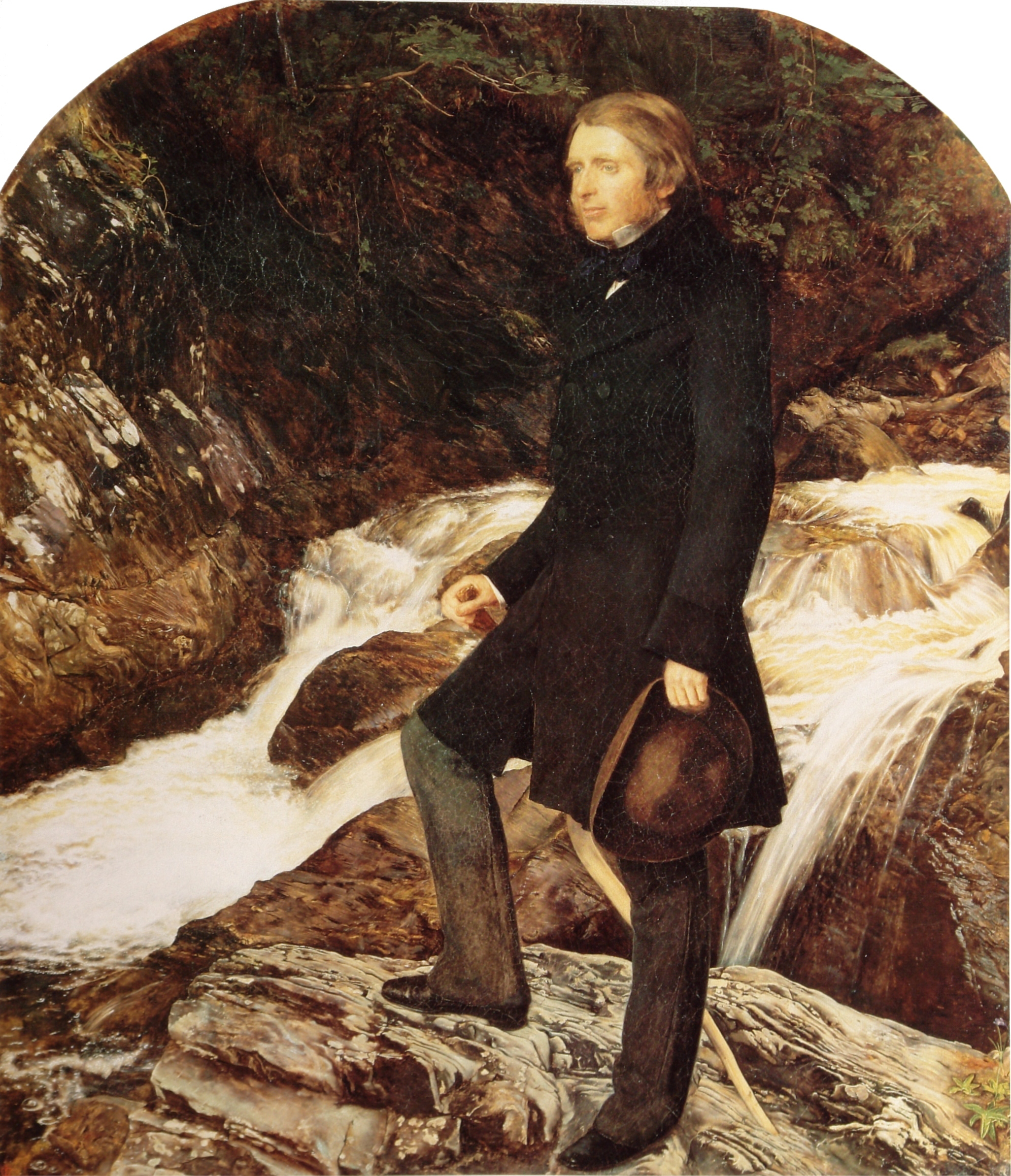
The Guild of St George is a charitable Education Trust, based in England but with a worldwide membership, which tries to uphold the values and put into practice the ideas of its founder, John Ruskin (1819–1900). History Ruskin, a Victorian polymath, established the Guild in the 1870s. Founded as St George's Company in 1871, it adopted its current name and constitution in 1878. Ruskin, the most influential art critic of his day, had turned increasingly to social concerns from the 1850s. His highly influential critique of Victorian political economy, ''Unto This Last'', was serialised in 1860, and published with an additional preface in book-form in 1862. In lectures, letters and other published writings, he used his considerable rhetorical skills to denounce modern, industrial capitalism, and the theorists and politicians who served it. He considered that the ugliness, pollution and poverty it caused were undermining the nation. His deeply felt moral conviction that human soc ... [...More Info...] [...Related Items...] OR: [Wikipedia] [Google] [Baidu] |
John Ruskin
John Ruskin (8 February 1819 20 January 1900) was an English writer, philosopher, art critic and polymath of the Victorian era. He wrote on subjects as varied as geology, architecture, myth, ornithology, literature, education, botany and political economy. Ruskin's writing styles and literary forms were equally varied. He wrote essays and treatises, poetry and lectures, travel guides and manuals, letters and even a fairy tale. He also made detailed sketches and paintings of rocks, plants, birds, landscapes, architectural structures and ornamentation. The elaborate style that characterised his earliest writing on art gave way in time to plainer language designed to communicate his ideas more effectively. In all of his writing, he emphasised the connections between nature, art and society. Ruskin was hugely influential in the latter half of the 19th century and up to the First World War. After a period of relative decline, his reputation has steadily improved since the 1960s wi ... [...More Info...] [...Related Items...] OR: [Wikipedia] [Google] [Baidu] |
Benjamin Roebuck
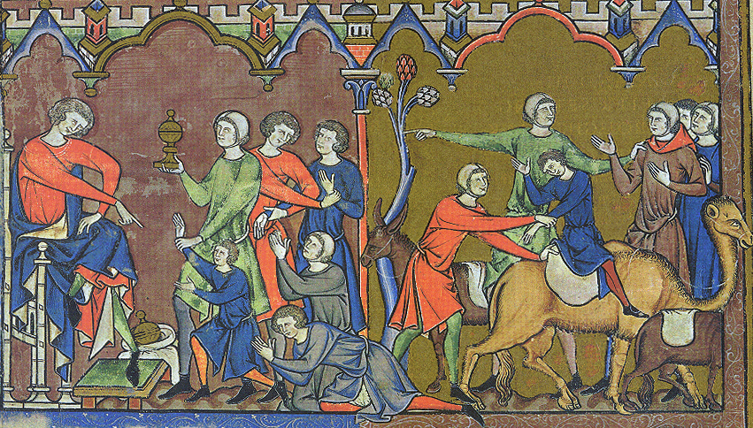
Benjamin ( he, ''Bīnyāmīn''; "Son of (the) right") blue letter bible: https://www.blueletterbible.org/lexicon/h3225/kjv/wlc/0-1/ H3225 - yāmîn - Strong's Hebrew Lexicon (kjv) was the last of the two sons of Jacob and Rachel (Jacob's thirteenth child and twelfth and youngest son) in Jewish, Christian and Islamic tradition. He was also the progenitor of the Israelite Tribe of Benjamin. Unlike Rachel's first son, Joseph, Benjamin was born in Canaan according to biblical narrative. In the Samaritan Pentateuch, Benjamin's name appears as "Binyamēm" ( Samaritan Hebrew: , "son of days"). In the Quran, Benjamin is referred to as a righteous young child, who remained with Jacob when the older brothers plotted against Joseph. Later rabbinic traditions name him as one of four ancient Israelites who died without sin, the other three being Chileab, Jesse and Amram. Name The name is first mentioned in letters from King Sîn-kāšid of Uruk (1801–1771 BC), who called himself “K ... [...More Info...] [...Related Items...] OR: [Wikipedia] [Google] [Baidu] |
Bishops' House, Sheffield
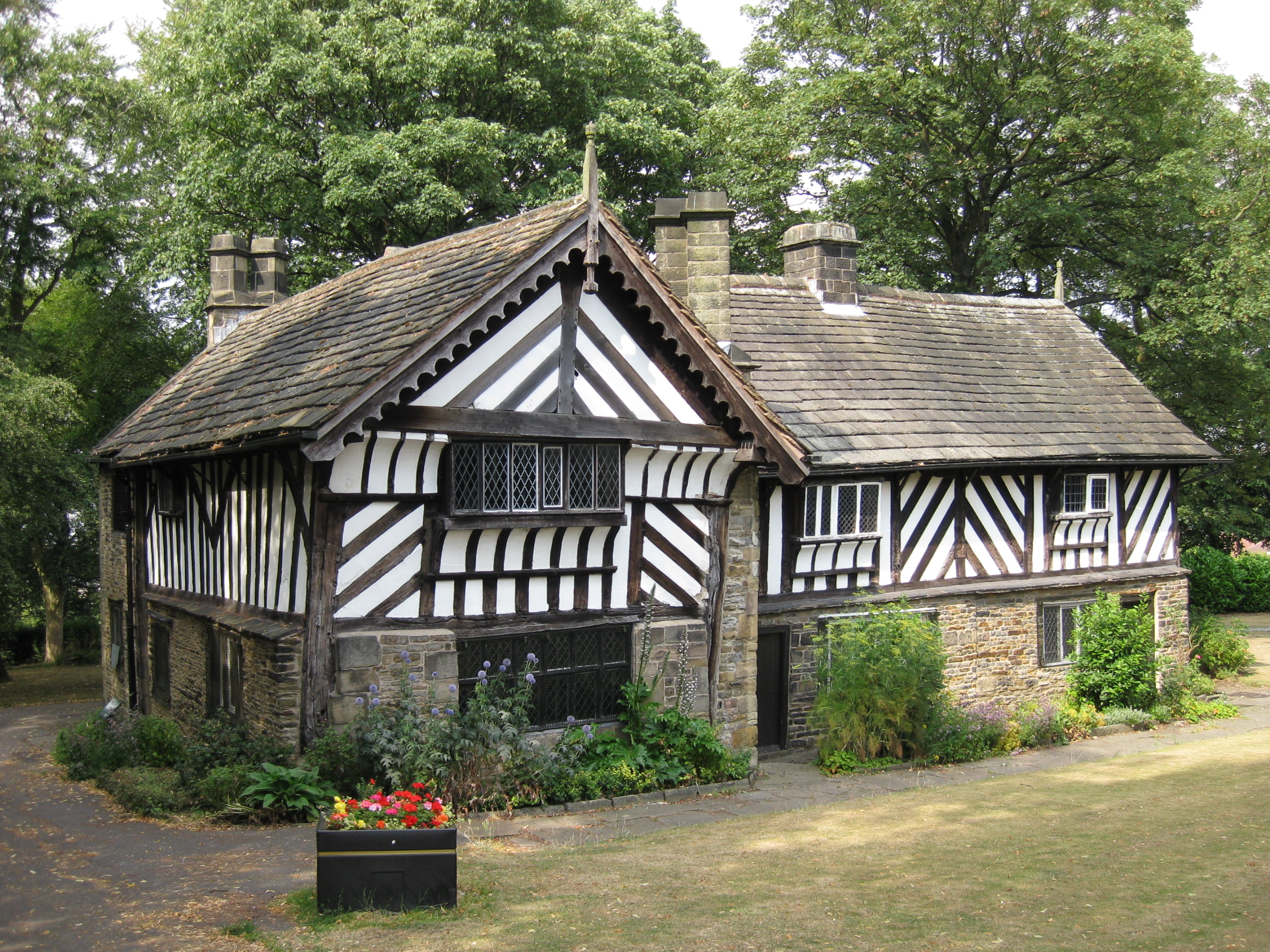
Bishops' House is a Timber framing, half-timbered house in the Norton Lees district of the Sheffield, City of Sheffield, England. It was built and is located on the southern tip of Meersbrook Park. It is one of the three surviving timber-framed houses in the city (the others being the Old Queen's Head and Broom Hall). It is known as Bishops' House because it was said to have been built for two brothers, John Blyth (bishop), John and Geoffrey Blythe, both of whom became Bishops. There is, however, no evidence that they ever lived in this house—the first known resident is William Blythe, a farmer and scythe manufacturer, who was living here in 1627. Samuel Blyth was the last of the family to live in the house, dying in 1753, after which his sons sold the house to a William Shore. The Blyth family subsequently moved to Birmingham.Blyth, E.L.I. 1893, The family of Blythe or Blyth of Norton and Birchet Notable descendants were Benjamin Blyth, Sir Arthur Blyth and Benjamin Blyth ... [...More Info...] [...Related Items...] OR: [Wikipedia] [Google] [Baidu] |
Mercia
la, Merciorum regnum , conventional_long_name=Kingdom of Mercia , common_name=Mercia , status=Kingdom , status_text=Independent kingdom (527–879)Client state of Wessex () , life_span=527–918 , era=Heptarchy , event_start= , date_start= , year_start=527 , event_end= , date_end= , year_end=918 , event1= , date_event1= , event2= , date_event2= , event3= , date_event3= , event4= , date_event4= , p1=Sub-Roman Britain , flag_p1=Vexilloid of the Roman Empire.svg , border_p1=no , p2=Hwicce , flag_p2= , p3=Kingdom of Lindsey , flag_p3= , p4=Kingdom of Northumbria , flag_p4= , s1=Kingdom of England , flag_s1=Flag of Wessex.svg , border_s1=no , s2= , flag_s2= , image_flag= , image_map=Mercian Supremacy x 4 alt.png , image_map_caption=The Kingdom of Mercia (thick line) and the kingdom's extent during the Mercian Supremacy (green shading) , national_motto= , national_anthem= , common_languages=Old English *Mercian dialect British Latin , currency=Sceat Penny , religion=PaganismChristia ... [...More Info...] [...Related Items...] OR: [Wikipedia] [Google] [Baidu] |
Northumbria
la, Regnum Northanhymbrorum , conventional_long_name = Kingdom of Northumbria , common_name = Northumbria , status = State , status_text = Unified Anglian kingdom (before 876)North: Anglian kingdom (after 876)South: Danish kingdom (876–914)South: Norwegian kingdom (after 914) , life_span = 654–954 , flag_type = Oswald's Stripes, the provincial flag of Northumbria and red was previously purple , image_coat = , image_map = Map_of_the_Kingdom_of_Northumbria_around_700_AD.svg , image_map_size = 250 , image_map_caption = Northumbria around 700 AD , image_map2 = , image_map2_size = , image_map2_caption = , government_type = Monarchy , year_start = 653 , year_end = 954 , event_end = South is annexed by Kingdom of England , event1 = South is annexed by the Danelaw , date_even ... [...More Info...] [...Related Items...] OR: [Wikipedia] [Google] [Baidu] |
Anglo-Saxon England
Anglo-Saxon England or Early Medieval England, existing from the 5th to the 11th centuries from the end of Roman Britain until the Norman conquest in 1066, consisted of various Anglo-Saxon kingdoms until 927, when it was united as the Kingdom of England by King Æthelstan (r. 927–939). It became part of the short-lived North Sea Empire of Cnut the Great, a personal union between England, Denmark and Norway in the 11th century. The Anglo-Saxons migrated to England from mainland northwestern Europe after the Roman Empire abandoned Britain at the beginning of the fifth century. Anglo-Saxon history thus begins during the period of sub-Roman Britain following the end of Roman control, and traces the establishment of Anglo-Saxon kingdoms in the 5th and 6th centuries (conventionally identified as seven main kingdoms: Northumbria, Mercia, East Anglia, Essex, Kent, Sussex, and Wessex); their Christianisation during the 7th century; the threat of Viking invasions and Danish settle ... [...More Info...] [...Related Items...] OR: [Wikipedia] [Google] [Baidu] |
River Sheaf
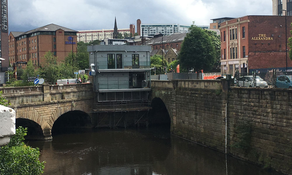
The River Sheaf in Sheffield, South Yorkshire, England, flows northwards, past Dore, through Abbeydale and north of Heeley. It then passes into a culvert, through which it flows under the centre of Sheffield before joining the River Don. This lower section of the River Sheaf, together with the River Don between the Blonk Street and Lady's Bridges, formed two sides of the boundary of Sheffield Castle. The main tributaries of the Sheaf are the Porter Brook, which joins it beneath Sheffield Midland station, and the Meers Brook. The river has been polluted upstream through centuries of industrial activity, including iron and steel working, and is only slowly recovering. The river used to provide the power for metal works such as the Grade I-listed Abbeydale Industrial Hamlet. A River Sheaf Walk has been developed which follows the river from Granville Square out to Millhouses Park and beyond to the Peak District. Name Until the 17th century the name ''Sheaf'' was written as ... [...More Info...] [...Related Items...] OR: [Wikipedia] [Google] [Baidu] |
Meersbrook House
Meersbrook () is a suburban district in the south-west of Sheffield, England bordered by Nether Edge to the west, Norton Lees to the south, Heeley to the north and the Meersbrook allotment site (the largest allotment site in Europe) to the east. Until 1950 it was part of the Sheffield Ecclesall constituency and now forms part of the Sheffield Heeley constituency. The district falls within the Gleadless Valley ward of the city. The name comes from the stream, the Meers Brook, a tributary of the River Sheaf which means 'boundary brook' and in ancient times this, along with the River Sheaf formed the boundary between the Anglo-Saxon kingdoms of Northumbria and Mercia. It remained as the boundary between Yorkshire and Derbyshire into the 20th century. Meersbrook itself was once several small communities which have given many roads their names; Rush Dale, Carfield & Cliffe Field and in 1857 was known as Mears Brook. Due to its proximity to the city centre and a thriving independen ... [...More Info...] [...Related Items...] OR: [Wikipedia] [Google] [Baidu] |


