|
Georgioupoli
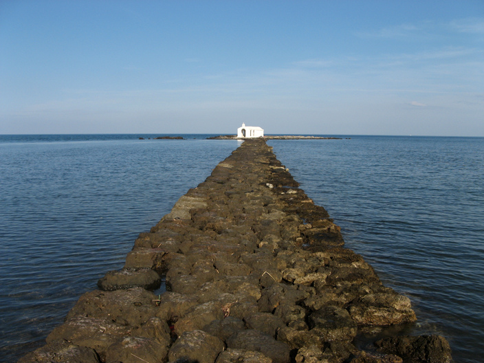
Georgioupoli ( el, Γεωργιούπολη) is a resort village and former municipality in the Chania regional unit, Crete, Greece. Since the 2011 local government reform it is part of the municipality Apokoronas, of which it is a municipal unit. The municipal unit has an area of . It is located east of Chania, about west of Rethymno and about west of Heraklio. It was named after Prince George of Greece, high commissioner of the island in the last years of Ottoman occupation. Geography Georgioupolis is found at the apex of Almiros Bay on the Sea of Crete, with Cape Drapano and its rocky coast to the north and the long sandy beaches towards Rethimno in the east, just away. Three rivers meet the sea at the village; the largest, Almiros, creates a small harbour for fishing and tourist boats. The entrance to the village on the old road from Vrisses is a long avenue of eucalyptus trees. Formerly a small fishing village, Georgioupolis is very much a tourist town now, with many ... [...More Info...] [...Related Items...] OR: [Wikipedia] [Google] [Baidu] |
Chania (regional Unit)
Chania ( el, Περιφερειακή ενότητα Χανίων) is one of the four regional units of Greece, regional units of Crete; it covers the westernmost quarter of the island. Its capital is the city of Chania. Chania borders only one other regional unit: that of Rethymno (regional unit), Rethymno to the east. The western part of Crete is bounded to the north by the Sea of Crete, Cretan Sea, and to the west and south by the Mediterranean Sea. The regional unit also includes the southernmost island of Europe, Gavdos. Geography Chania regional unit, often informally termed 'Western Crete', is a part of the island which includes the districts of Apokoronas, Sfakia, and Selino in the far South West corner. Other towns in the Chania prefecture include Sfakia#Hora Sfakion, Hora Sfakion, Kastelli-Kissamos, Kissamos, Palaiochora, Maleme, Vryses, Vamos, Georgioupolis and Kalives. The natural park of Samariá Gorge, a tourist attraction and a refuge for the rare Cretan wild goat ... [...More Info...] [...Related Items...] OR: [Wikipedia] [Google] [Baidu] |
Apokoronas
Apokoronas ( el, Αποκόρωνας) is a municipality and a former province (επαρχία) in the Chania regional unit, north-west Crete, Greece. It is situated on the north coast of Crete, to the east of Chania itself. The seat of the municipality is the village Vryses. The municipality has an area of . Geography Apokoronas extends from the foothills of the White Mountains north to the coast, in a wide plain with rolling hills. To the east, Cape Drapanon rises above the plain and extends out into the Sea of Crete. The area is very green and fertile, unusual for rocky Crete. The Kiliaris river, known in antiquity as 'Pyknos', runs through the region. Robert Pashley suggested that the name 'Apokoronas' came from the ancient city of Ippokoronas or Ippokoronion, also cited by Strabo. This city may have been located near modern Nipos, or on the site of the Venetian fortress, Castel Apicorono, on an outcrop between Kalyves and Almyrida. The major towns of Apokoronas are Va ... [...More Info...] [...Related Items...] OR: [Wikipedia] [Google] [Baidu] |
Kournas
Kournas is a mountainous village of Municipality of Apokoronas, Chania, on the Greek island of Crete. It has a population of 500 citizens. It is located at 200 meters altitude and south-east of the mountain named Dafnomadara (1680 meters). Kournas is a fairly large village perched on a hill overlooking Lake Kournas. It was in the former Georgioupoli municipality, not far from the town of the same name. A working village which has seen less depopulation than some of its neighbours, Kournas is known for its pottery and many popular taverns. The taverna's seats are largely in the road - it is popular for its specialties of 'kokoretsi Kokoretsi or kokoreç is a dish of the Balkans and Anatolia (Asia Minor), consisting of lamb or goat intestines wrapped around seasoned offal, including sweetbreads, hearts, lungs, or kidneys, and typically grilled; a variant consists of chopp ...' (grilled offal) and 'galaktoboureko' (custard and orange tart). Populated places in Chania (re ... [...More Info...] [...Related Items...] OR: [Wikipedia] [Google] [Baidu] |
Vamos
Vamos (Greek: Βάμος) is a small town and former municipality in the Chania regional unit, Crete, Greece. Since the 2011 local government reform "Kallikratis" it is a municipal unit, part of the municipality of Apokoronas, serving as its historical capital. It is situated on a small hill at an altitude of above sea level, about from Chania. In Vamos, one can find several restaurants, snack bars and shops in the village, as well as many public services, such as a fully equipped health center, schools, police station and the regional court for the regions of Apokoronas and Sfakia. The village is said to have been founded by Arab invaders during the 8th century, which sought refuge in Crete after being expelled from Andalusia. The first official record of the name (Vamo/Vamu) is found on a map of 1577 made by Francesco Barozzi, and according to the Venetian census of 1583 it had 271 inhabitants. The village followed the fate of the rest of Western Crete when the Ottomans inva ... [...More Info...] [...Related Items...] OR: [Wikipedia] [Google] [Baidu] |
Amphimalla
Amphimalla (Greek: , Strabo p. 475; Plin. iv. 20) or Amphimalion (Greek: , Steph. B. ''s. v.''), was an ancient town on the north coast of Crete, Greece, situated on the bay named after it ( Ptol. iii. 17. § 7), which corresponds, according to some, to the Almyros Bay (Armiro), and, according to others, to Suda Bay. The site of Amphimalla has not been located with precision; although the editors of the Barrington Atlas of the Greek and Roman World choose the Bay of Almyros, and place Amphimalla at its extreme southwest corner approximately on the site of the modern town of Georgioupoli, in Chania regional unit. References * *Richard Talbert, Barrington Atlas of the Greek and Roman World The ''Barrington Atlas of the Greek and Roman World'' is a large-format English language atlas of ancient Europe, Asia, and North Africa, edited by Richard Talbert, Richard J. A. Talbert. The time period depicted is roughly from Archaic Greece, ..., (), p. 60. Ancient Greek ... [...More Info...] [...Related Items...] OR: [Wikipedia] [Google] [Baidu] |
Prince George Of Greece
Prince George of Greece and Denmark ( el, Γεώργιος; 24 June 1869 – 25 November 1957) was the second son and child of George I of Greece and Olga Konstantinovna of Russia, and is remembered chiefly for having once saved the life of his cousin the future Emperor of Russia, Nicholas II in 1891 during their visit to Japan together. He served as high commissioner of the Cretan State during its transition towards independence from Ottoman rule and union with Greece. Youth From 1883, George lived at Bernstorff Palace near Copenhagen with Prince Valdemar of Denmark, his father's younger brother. The queen had taken the boy to Denmark to enlist him in the Danish royal navy and consigned him to the care of Valdemar, who was an admiral in the Danish fleet. Feeling abandoned by his father on this occasion, George would later describe to his fiancée the profound attachment he developed for his uncle from that day forward. In 1891, George accompanied his cousin the Tsesarevich ... [...More Info...] [...Related Items...] OR: [Wikipedia] [Google] [Baidu] |
Kärdla
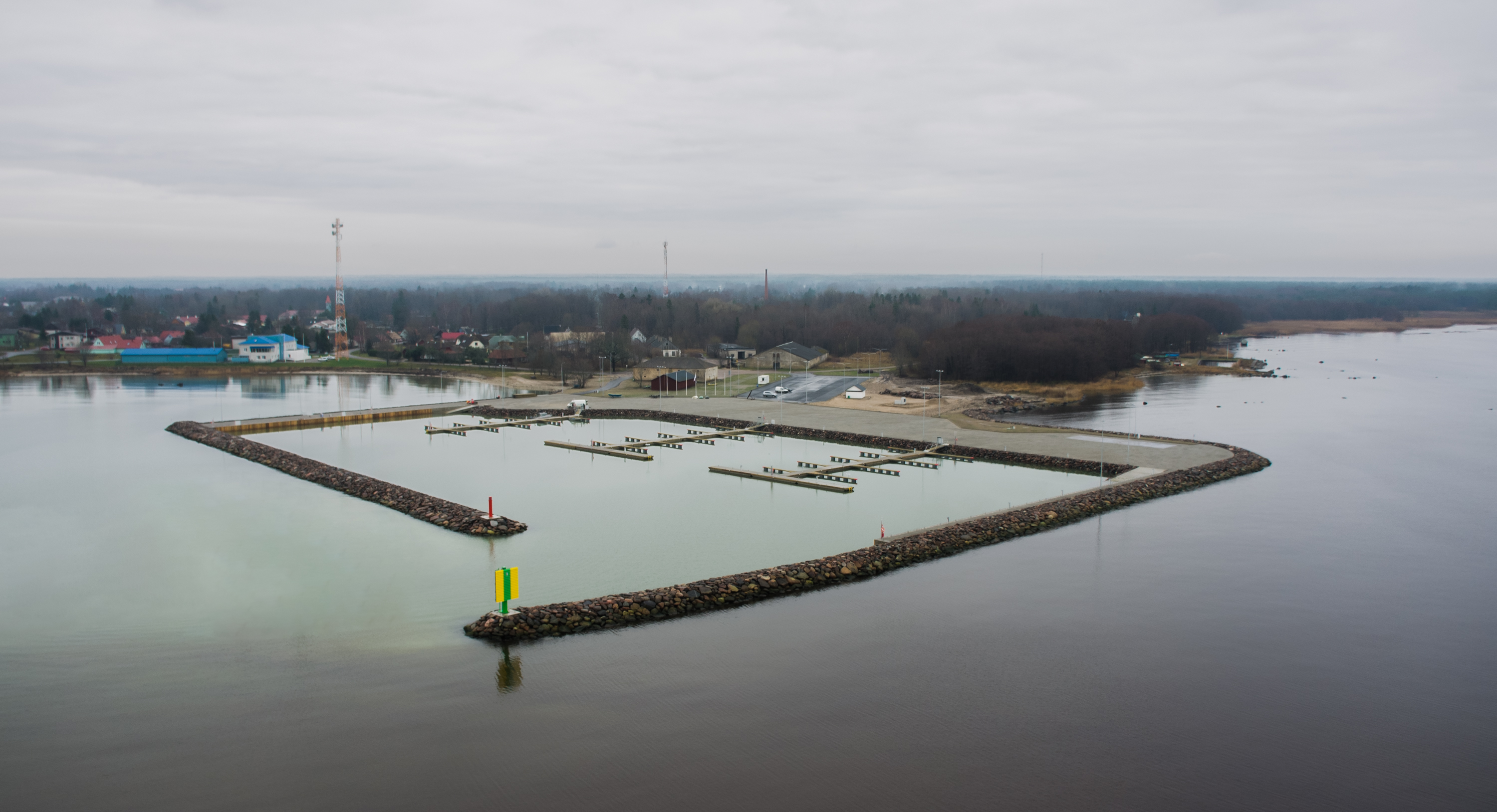
Kärdla (; sv, ; german: Kertel) is the only town on the island of Hiiumaa, Estonia. It is the capital of Hiiu County and the administrative center of Hiiumaa Parish. Geography Kärdla is located on the northeastern coast of Hiiumaa, by the Tareste Bay; to the southeast of the town lies the 455 million year old Kärdla meteorite crater. Several small rivers flow through the town. There are also artesian wells in Kärdla. The Swedish name ''Kärrdal'' means "marsh valley"; the town is located in a lowlands valley. History Kärdla was first mentioned in 1564 as a village inhabited by Swedes. Its growth was greatly influenced by the cloth factory founded in 1830. A port was built in 1849. Both the port and the factory were destroyed in World War II. Kärdla officially became a borough in 1920, and a town in 1938. In 2013 the town was merged with Kõrgessaare Parish to establish Hiiumaa Parish, therefore Kärdla lost its municipality status. Population Transport Road transp ... [...More Info...] [...Related Items...] OR: [Wikipedia] [Google] [Baidu] |
List Of Settlements In The Chania Regional Unit
This is a list of settlements in the Chania regional unit, Greece. * Afrata * Agia Marina * Agia Roumeli * Agia * Agia Eirini * Agios Ioannis * Alikampos * Alikianos * Amygdalokefali * Anopoli * Anoskeli * Aptera * Armenoi * Aroni * Asfendos * Asi Gonia * Askyfou * Chairethiana * Chania * Chora Sfakion * Chordaki * Chrysavgi * Daratsos * Deliana * Drakona * Drakona * Drapanias * Elos * Emprosneros * Epanochori * Episkopi * Faleliana * Fournes * Fres * Fylaki * Galatas * Gavalochori * Georgioupoli * Gerani * Glossa * Gramvousa * Impros * Kaina * Kakodiki * Kakopetros * Kalamitsi * Kalamitsi * Kalathenes * Kallergiana * Kaloudiana * Kalydonia * Kalyves * Kamisiana * Kampanos * Kampoi * Kampos * Kandanos * Karanos * Kares, Apokoronas * Kares, Platanias * Kastellos * Kefalas * Kefali * Kissamos * Kokkino Chorio * Kolymvari * Kontomari * Kontopoula * Koufos * Koukounara * Koulkouthiana * Kounoupidiana * Kournas * Kypari ... [...More Info...] [...Related Items...] OR: [Wikipedia] [Google] [Baidu] |
Hiiumaa
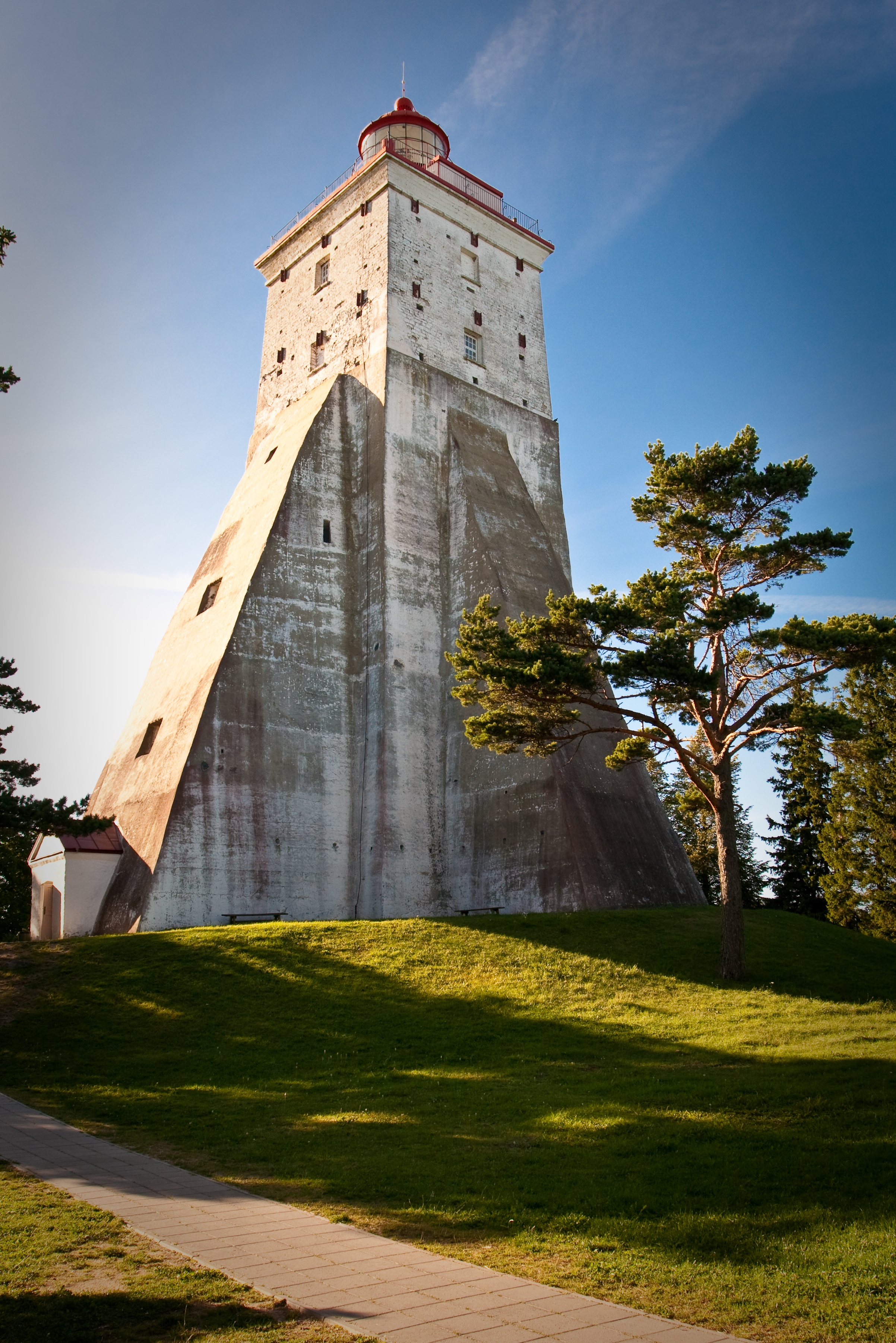
Hiiumaa (, ) is the second largest island in Estonia and is part of the West Estonian archipelago, in the Baltic Sea. It has an area of 989 km2 and is 22 km from the Estonian mainland. Its largest town is Kärdla. It is located within Hiiu County. Names Hiiumaa is the main island of Hiiu County, called or in Estonian. The Swedish and German name of the island is or ('Day' island) and in Danish. In modern Finnish, it is called , literally 'Hiisi's Land'. In Russian it is known as (). In Old Gutnish, it was ('day isthmus'), from which the local North Germanic name is derived. History Prehistory Hiiumaa emerged from the Baltic Sea 8500 years ago due to isostatic uplift after the retreat of the ice cap. Mesolithic settlements are found on the island's Kõpu Peninsula from about 5500 BC. These settlements seem to be related mostly to seal hunting and extend into the earliest Neolithic. As Hiiumaa is constantly uplifting the local sea level was 20 m higher ... [...More Info...] [...Related Items...] OR: [Wikipedia] [Google] [Baidu] |
Estonia
Estonia, formally the Republic of Estonia, is a country by the Baltic Sea in Northern Europe. It is bordered to the north by the Gulf of Finland across from Finland, to the west by the sea across from Sweden, to the south by Latvia, and to the east by Lake Peipus and Russia. The territory of Estonia consists of the mainland, the larger islands of Saaremaa and Hiiumaa, and over 2,200 other islands and islets on the eastern coast of the Baltic Sea, covering a total area of . The capital city Tallinn and Tartu are the two largest urban areas of the country. The Estonian language is the autochthonous and the official language of Estonia; it is the first language of the majority of its population, as well as the world's second most spoken Finnic language. The land of what is now modern Estonia has been inhabited by '' Homo sapiens'' since at least 9,000 BC. The medieval indigenous population of Estonia was one of the last " pagan" civilisations in Europe to adopt Ch ... [...More Info...] [...Related Items...] OR: [Wikipedia] [Google] [Baidu] |
Twin Towns And Sister Cities
A sister city or a twin town relationship is a form of legal or social agreement between two geographically and politically distinct localities for the purpose of promoting cultural and commercial ties. While there are early examples of international links between municipalities akin to what are known as sister cities or twin towns today dating back to the 9th century, the modern concept was first established and adopted worldwide during World War II. Origins of the modern concept The modern concept of town twinning has its roots in the Second World War. More specifically, it was inspired by the bombing of Coventry on 14 November 1940, known as the Coventry Blitz. First conceived by the then Mayor of Coventry, Alfred Robert Grindlay, culminating in his renowned telegram to the people of Stalingrad (now Volgograd) in 1942, the idea emerged as a way of establishing solidarity links between cities in allied countries that went through similar devastating events. The comradeship ... [...More Info...] [...Related Items...] OR: [Wikipedia] [Google] [Baidu] |


.jpg)