|
Gee Cross
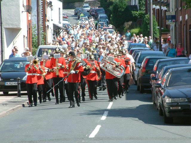
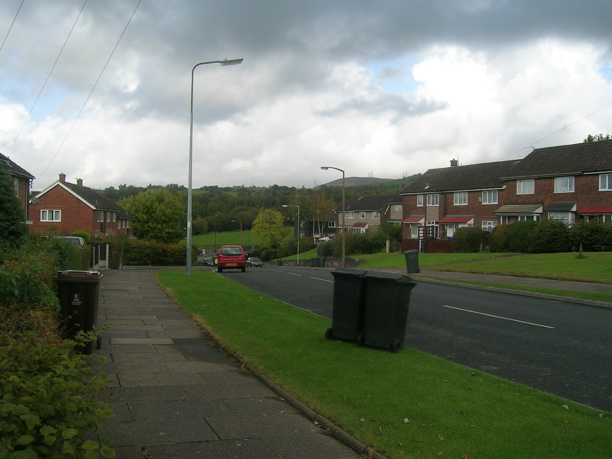
Gee Cross is a village and suburb of Hyde within Tameside Metropolitan Borough, in Greater Manchester, England. History Gee Cross village centre dates back to the times of the Domesday Book. Originally, Gee Cross was the larger village in the immediate area; however, Hyde grew during the Industrial Revolution and is now the major town, having merged into the north of Gee Cross. The village contains modern day Hyde's first place of Christian worship, Hyde Chapel, built in 1708. This would serve as the main church in the area for over a century until St George's Church was built in the centre of Hyde in 1832. Historically, the village, latterly as part of the borough of Hyde, was a part of Cheshire until the creation of Greater Manchester in 1974. The village has neither statutory boundaries nor civil parish status. Tradition would dictate that the northern boundary is at a location known as the ''Big Tree'', just past Lilly Street, which now commemorates those that lost thei ... [...More Info...] [...Related Items...] OR: [Wikipedia] [Google] [Baidu] |
Tameside
The Metropolitan Borough of Tameside is a metropolitan borough of Greater Manchester in England. It is named after the River Tame, Greater Manchester, River Tame, which flows through the borough, and includes the towns of Ashton-under-Lyne, Audenshaw, Denton, Greater Manchester, Denton, Droylsden, Dukinfield, Hyde, Greater Manchester, Hyde, Mossley and Stalybridge. Its western border is approximately east of Manchester city centre. Tameside is bordered by the metropolitan boroughs of Metropolitan Borough of Stockport, Stockport and Metropolitan Borough of Oldham, Oldham to the south and north respectively, the city of Manchester to the west and the borough of High Peak, Derbyshire, High Peak in Derbyshire to the east across Longdendale. the overall population was 219,324. It is also the 8th-most populous borough of Greater Manchester by population. The history of the area extends back to the Stone Age. There are over 300 listed buildings in Tameside and three Scheduled Ancien ... [...More Info...] [...Related Items...] OR: [Wikipedia] [Google] [Baidu] |
Pennines
The Pennines (), also known as the Pennine Chain or Pennine Hills, are a range of uplands running between three regions of Northern England: North West England on the west, North East England and Yorkshire and the Humber on the east. Commonly described as the "backbone of England", the range stretches northwards from the Peak District at the southern end, through the South Pennines, Yorkshire Dales and North Pennines to the Tyne Gap, which separates the range from the Border Moors and Cheviot Hills across the Anglo-Scottish border, although some definitions include them. South of the Aire Gap is a western spur into east Lancashire, comprising the Rossendale Fells, West Pennine Moors and the Bowland Fells in North Lancashire. The Howgill Fells and Orton Fells in Cumbria are sometimes considered to be Pennine spurs to the west of the range. The Pennines are an important water catchment area with numerous reservoirs in the head streams of the river valleys. The North Pennin ... [...More Info...] [...Related Items...] OR: [Wikipedia] [Google] [Baidu] |
Post Office Ltd
gd, Oifis a' Phuist kw, Sodhva an Post ga, An Post Ríoga , logo = Post Office Logo.svg , type = State-owned private company limited by shares , genre = , predecessor = General Post Office , foundation = 1987 , founder = , location_city = London , location_country = England , location = , origins = , key_people = , area_served = United Kingdom , industry = Postal service , products = , services = , revenue = £957 million , revenue_year = 2021 , operating_income = , operating_income_year = , net_income = £35 million , net_income_year = 2021 , num_employees = 5,020 , divisions = , subsid = , parent = , owner = , caption = , homepage = , dissolved = , footnotes = Post Office Limited is a retail post office company in the United Kingdom that provides a wide range of products including postage stamps and banking to the public through its nationwide network of post office branches. History Post Office branches, along with the Royal Ma ... [...More Info...] [...Related Items...] OR: [Wikipedia] [Google] [Baidu] |
Audi
Audi AG () is a German automotive manufacturer of luxury vehicles headquartered in Ingolstadt, Bavaria, Germany. As a subsidiary of its parent company, the Volkswagen Group, Audi produces vehicles in nine production facilities worldwide. The origins of the company are complex, going back to the early 20th century and the initial enterprises ( Horch and the ''Audiwerke'') founded by engineer August Horch (1868–1951); and two other manufacturers ( DKW and Wanderer), leading to the foundation of Auto Union in 1932. The modern Audi era began in the 1960s, when Auto Union was acquired by Volkswagen from Daimler-Benz. After relaunching the Audi brand with the 1965 introduction of the Audi F103 series, Volkswagen merged Auto Union with NSU Motorenwerke in 1969, thus creating the present-day form of the company. The company name is based on the Latin translation of the surname of the founder, August Horch. , meaning "listen", becomes in Latin. The four rings of the Audi lo ... [...More Info...] [...Related Items...] OR: [Wikipedia] [Google] [Baidu] |
Broadbottom
Broadbottom is a village in Tameside, Greater Manchester, England. Historically in Cheshire, it stands on the River Etherow which forms the border with Derbyshire. Description Home Farm dates from 1604 and Broadbottom Hall from 1680. There was a 14th-century water-powered corn mill and an 18th-century woollen mill, called ''Moss Mill'', which converted to producing cotton in the 19th century. Broadbottom has one remaining textile mill that is still operating called ''Lymefield Mill''. The factory mill is next to the River Etherow and is currently occupied by Tiviot Prints Ltd. Landmarks East of the railway station is Broadbottom Viaduct that carries the railway line over the River Etherow. The official length of the viaduct is . At Summerbottom, there is a row of 18th-century weavers' cottages; they had a communal top floor where the looms were stored. Hodge Printworks started out as a woollen mill in 1798. In 1805, it was converted into a dyeworks. The dyed cloth was ... [...More Info...] [...Related Items...] OR: [Wikipedia] [Google] [Baidu] |
Haughton Green
Haughton Green is a large village in Tameside, Greater Manchester, England. It formed part of the ancient township of Haughton, Lancashire, along with Haughton Dale, Higher Haughton, Lower Haughton, Haughton Hall and Haughton itself. History Originally, farming was the main occupation but the discovery of rich deposits of coal brought mining to the area. The soil was not particularly productive and farmers in both Haughton and Denton supplemented their incomes by making felt hats and this industry ultimately dominated the area and made Denton famous for this industry rather than the more usual industries of cotton spinning and weaving. The Church of St Mary the Virgin was dedicated in March 1876. It was funded and specified by James Walton, father of Frederick Walton the inventor of Linoleum. James owned the Haughton Dale Mill, which despite its name was not a cotton mill, instead providing wire for James' successful carding business. The church has an oak frame with plaster-a ... [...More Info...] [...Related Items...] OR: [Wikipedia] [Google] [Baidu] |
Denton, Greater Manchester
Denton is a town in Tameside, Greater Manchester, England, five miles (8 km) east of Manchester city centre. Historically part of Lancashire, it had a population of 36,591 at the 2011 Census. History Toponymy Denton probably derives its name from Dane-town, an etymology supported by other place names in the area such as Danehead-bank and Daneditch-bourne. The word 'Dane' is itself derived from Anglo-Saxon ''denu'', ''dene'', ''daenland'', meaning a valley. So literally Denton means valley town. Prehistory A Byzantine coin was discovered in Danesheadbank, dating from the sixth or seventh century, as part of the Denton coin hoard. The early medieval linear earthwork Nico Ditch passes through Denton; it was probably used as an administrative boundary and dates from the 8th or 9th centuries. A 300 m stretch is still visible on Denton golf course, about 4 m wide and 1.5 m deep. Middle Ages In the early 13th century it lay within the Manor of Withington, a f ... [...More Info...] [...Related Items...] OR: [Wikipedia] [Google] [Baidu] |
Romiley
Romiley is a village in the Metropolitan Borough of Stockport, Greater Manchester, England. Historically part of Cheshire, it borders Marple, Bredbury and Woodley. At the 2011 census, the Romiley ward, which includes Compstall, Bredbury Green and a large part of Bredbury, had a population of 14,139. History For centuries, it was an agricultural area until the late Victorian era, when it became a residential area with a small district centre. There are four primary schools: Romiley Primary School, Bredbury Green Primary School, St Christopher's Catholic Primary School and Greave Primary School (which is on the border with Woodley). Secondary education is provided by Werneth School and Harrytown Catholic High School. Romiley also has its own theatre, the Forum Theatre. This is a building owned by Stockport Council but, since 2003, has been managed by NK Theatre Arts, a registered charity which provides all-inclusive performing arts workshops for children, young people and adu ... [...More Info...] [...Related Items...] OR: [Wikipedia] [Google] [Baidu] |
Hattersley
Hattersley is an area of Tameside, Greater Manchester, England; it is located west of Glossop and east of Manchester city centre, at the eastern terminus of the M67. Historically part of Tintwistle Rural District in Cheshire until 1974, it is the site of an overspill estate built by Manchester City Council in the 1960s. Hattersley is an area receiving major regeneration, which includes building new housing and additional retail stores. History Construction of the estate Between 1894 and 1936, Hattersley was a largely rural civil parish in the Tintwistle Rural District in the historical county of Cheshire. In 1936, it was annexed to the municipal borough of Hyde but remained undeveloped. At the beginning of the 1960s, most of the area was purchased by Manchester City Council to build a large overspill estate, which became home to many families rehoused from inner-city slum areas like Gorton. Another similar estate was built in Gamesley. Both these estates consist primaril ... [...More Info...] [...Related Items...] OR: [Wikipedia] [Google] [Baidu] |
Metropolitan Borough Of Stockport
The Metropolitan Borough of Stockport is a metropolitan borough of Greater Manchester in North West England, south-east of central Manchester. As well as the towns of Stockport, Bredbury and Marple, it includes the outlying areas of Hazel Grove, Bramhall, Cheadle, Cheadle Hulme, Gatley, Reddish, Woodley and Romiley. In 2021, it had a population of 294,800. The borough is third-most populous of Greater Manchester. History The borough was created in 1974, under the Local Government Act 1972, from the former area of the County Borough of Stockport and from the administrative county of Cheshire the urban districts of Bredbury and Romiley, Cheadle and Gatley, Hazel Grove and Bramhall and Marple. Stockport became a county borough in 1889 and was enlarged by gaining territory from Lancashire, including Reddish in 1906 and the Four Heatons in 1913. The Marple Urban District of Cheshire, formed in 1894, gained parts of Derbyshire in 1936 including Mellor and Ludworth from Chapel e ... [...More Info...] [...Related Items...] OR: [Wikipedia] [Google] [Baidu] |
Woodley, Greater Manchester
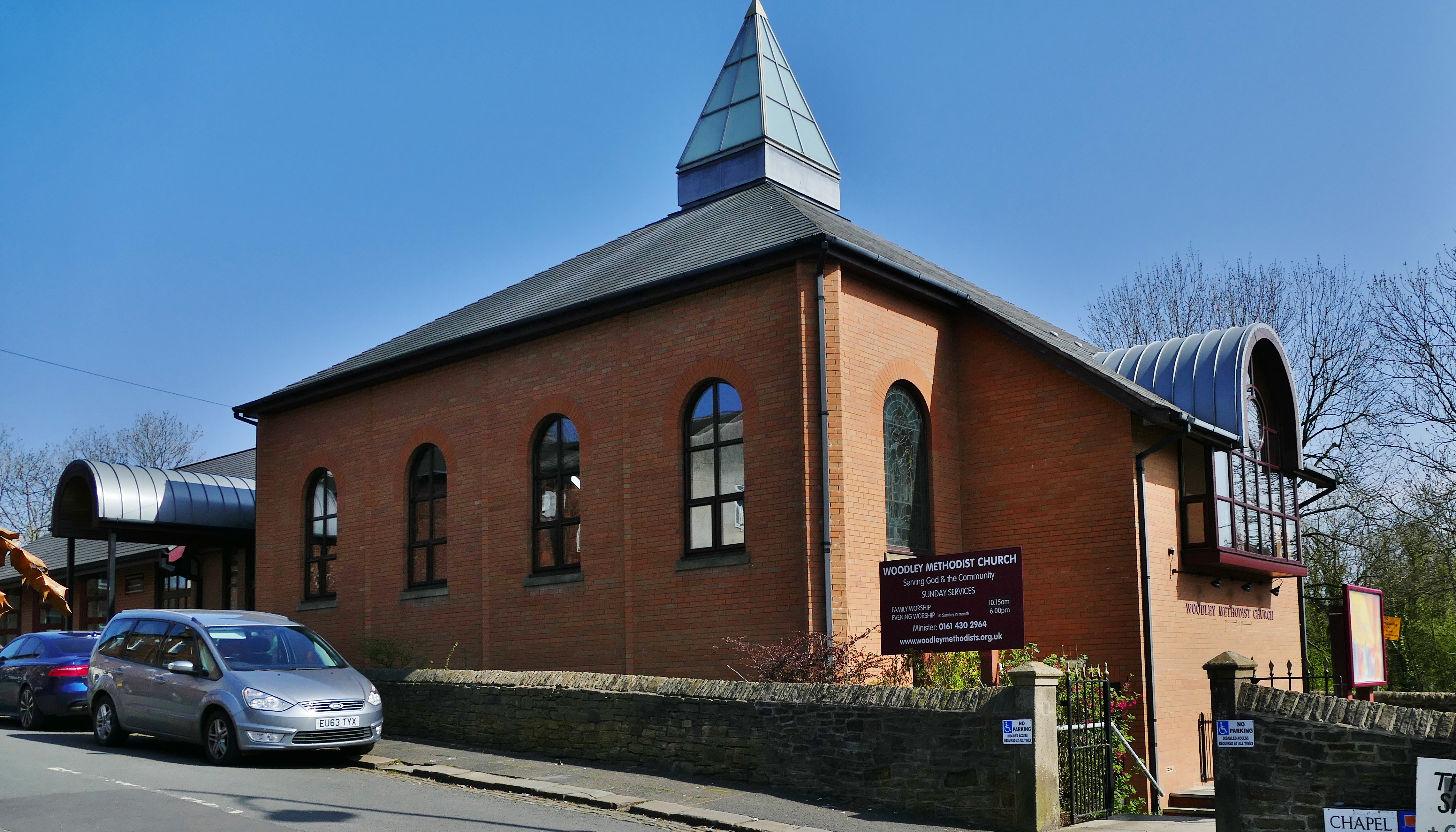
Woodley is a suburb in the Metropolitan Borough of Stockport, Greater Manchester, England. It is situated on the east side of the Peak Forest Canal, next to Bredbury, Romiley and the boundary with Tameside, at Gee Cross. Historic counties of England, Historically part of Cheshire, the name means "a clearing in the wood" because the area contains a lot of woodland. Religion Transport Railway Woodley railway station is on the Hope Valley line; on a loop which stretches from Ashburys railway station, Ashburys to Romiley, via Guide Bridge railway station, Guide Bridge but by-passing Bredbury. Services run half-hourly between Manchester Piccadilly railway station, Manchester Piccadilly and Rose_Hill_Marple_railway station, Rose Hill Marple on Mondays to Saturdays; there is no service on Sundays. Buses Route 330 runs regularly between Stockport and Ashton-under-Lyne via Bredbury, Hyde and Dukinfield. Route 382 runs between Stockport and Woodley, via Bredbury and Romiley. Roads ... [...More Info...] [...Related Items...] OR: [Wikipedia] [Google] [Baidu] |
London
London is the capital and largest city of England and the United Kingdom, with a population of just under 9 million. It stands on the River Thames in south-east England at the head of a estuary down to the North Sea, and has been a major settlement for two millennia. The City of London, its ancient core and financial centre, was founded by the Romans as '' Londinium'' and retains its medieval boundaries.See also: Independent city § National capitals The City of Westminster, to the west of the City of London, has for centuries hosted the national government and parliament. Since the 19th century, the name "London" has also referred to the metropolis around this core, historically split between the counties of Middlesex, Essex, Surrey, Kent, and Hertfordshire, which largely comprises Greater London, governed by the Greater London Authority.The Greater London Authority consists of the Mayor of London and the London Assembly. The London Mayor is distinguished fr ... [...More Info...] [...Related Items...] OR: [Wikipedia] [Google] [Baidu] |


.jpg)

.jpg)

