|
Gyeonghogang
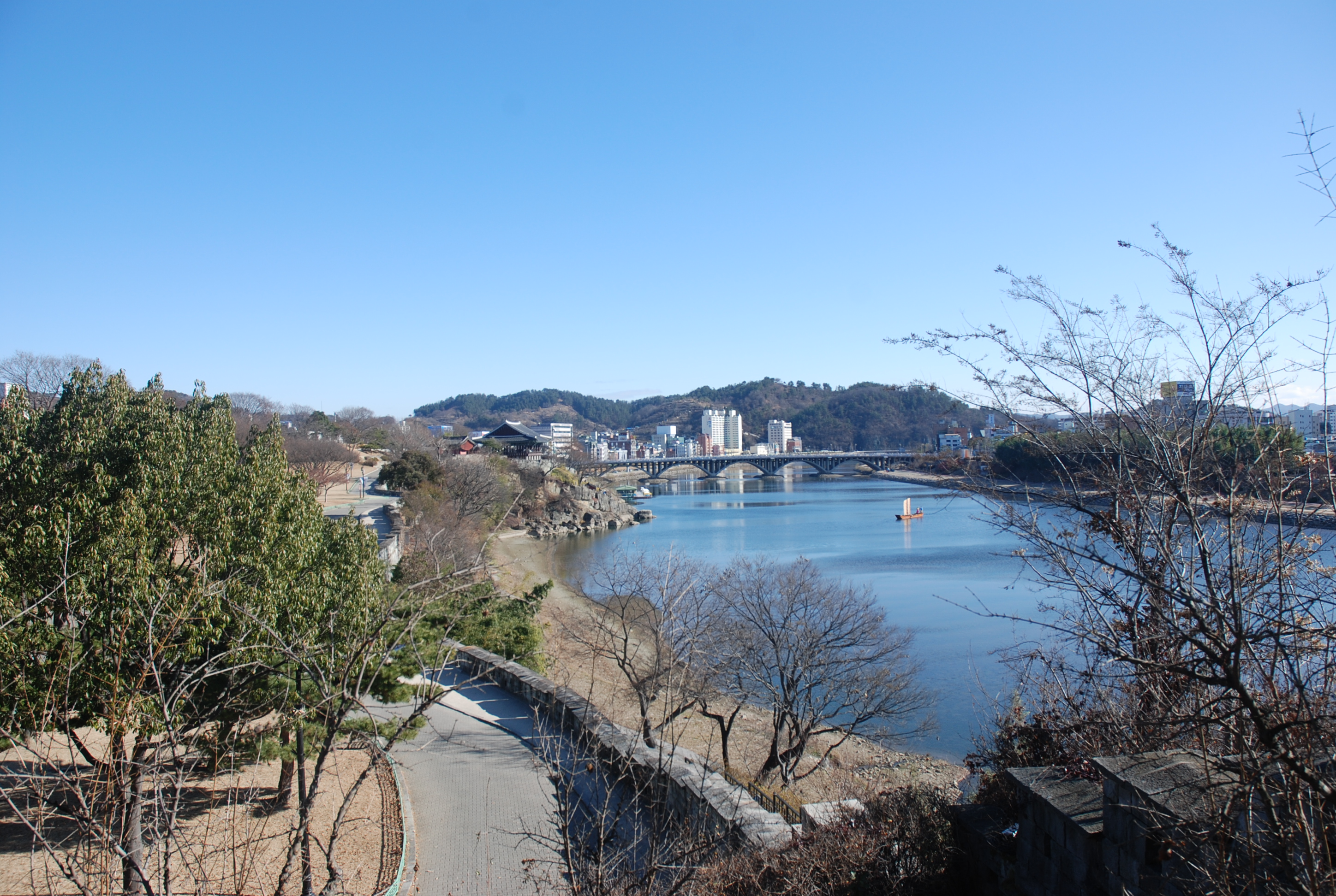
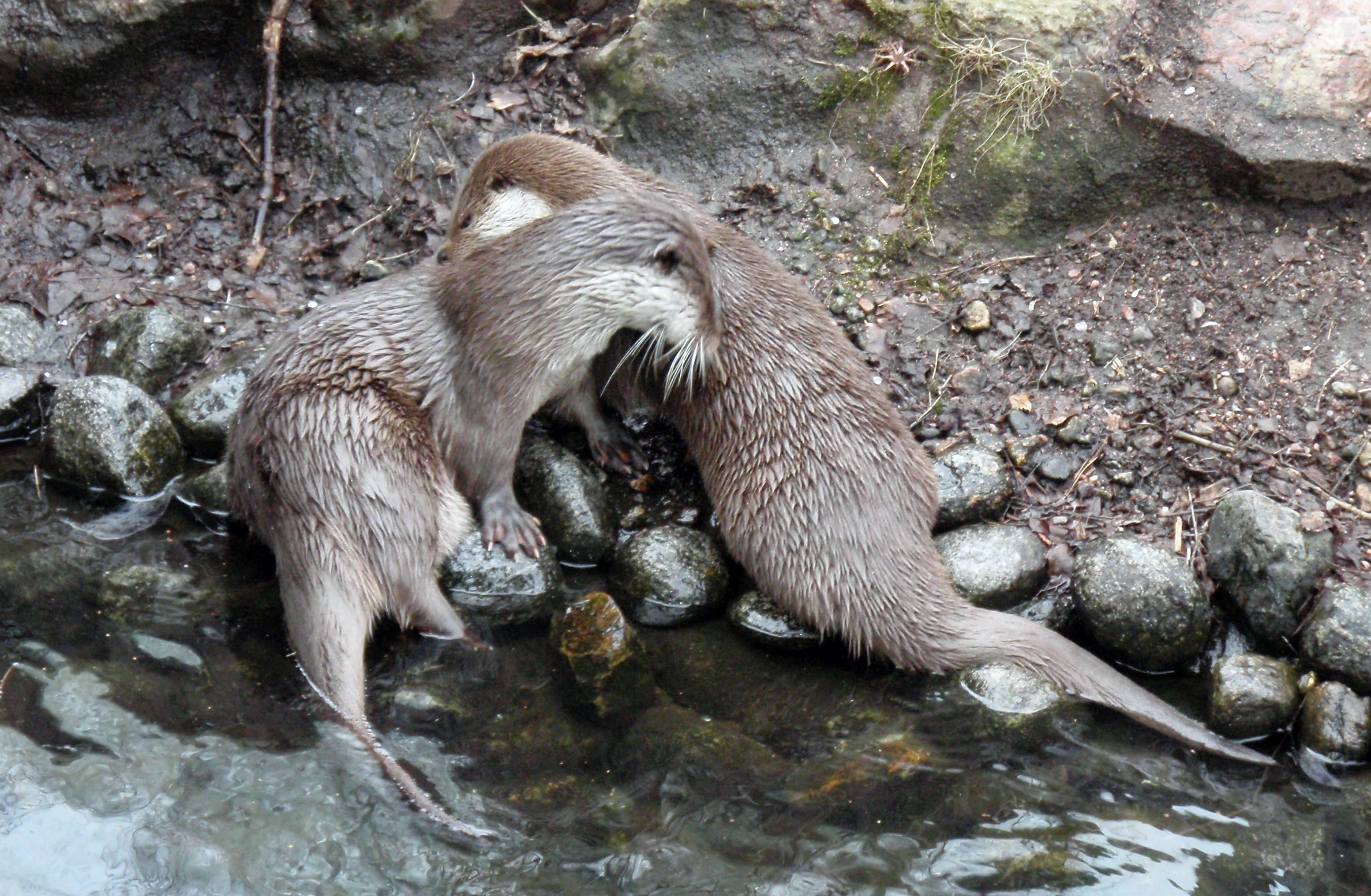
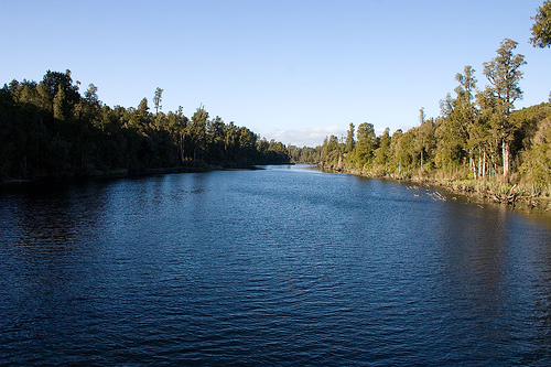
The Gyeongho River is a river in western Gyeongsangnam-do in southern South Korea. It rises on the eastern slopes of Jirisan and flows around the edge of Jirisan National Park, joining the Deokcheon River at Jinyang Lake. Thereafter it drains into the Nam River, and then into the Nakdong River, which carries its waters into the Sea of Japan (East Sea). The Gyeongho River is thus named because it is said its 'water is as clear as a mirror'. The river's clarity and spectacular scenery of the areas through which it passes prompted poets, writers and artists to record the river's beauty in verse and on canvas. The Gyeongho River also draws adventure-seekers. It is wide, with few boulders, making it a wonderful river for rafting. It has even been touted as the only river with rafting opportunity south of the Han River. Numerous rare species can be found in and near the Gyeongho River, including the endangered European otter. See also *List of rivers This is a comprehensive li ... [...More Info...] [...Related Items...] OR: [Wikipedia] [Google] [Baidu] |
Gyeongsangnam-do
South Gyeongsang Province ( ko, 경상남도, translit=Gyeongsangnam-do, ) is a province in the southeast of South Korea. The provincial capital is at Changwon. It is adjacent to the major metropolitan center and port of Busan. The UNESCO World Heritage Site Haeinsa, a Buddhist temple that houses the ''Tripitaka Koreana'' and tourist attraction, is located in this province. Automobile and petrochemical factories are largely concentrated along the southern part of the province, extending from Ulsan through Busan, Changwon, and Jinju. Etymology The name derives ; . The name derives from the names of the principal cities of Gyeongju () and Sangju (). History Before 1895, the area corresponding to modern-day South Gyeongsang Province was part of Gyeongsang Province, one of the Eight Provinces of Korea during the Joseon dynastic kingdom. In 1895, southern Gyeongsang was replaced by the districts of Jinju in the west and Dongnae (modern-day Busan) in the east. In 1896, they were me ... [...More Info...] [...Related Items...] OR: [Wikipedia] [Google] [Baidu] |
South Korea
South Korea, officially the Republic of Korea (ROK), is a country in East Asia, constituting the southern part of the Korea, Korean Peninsula and sharing a Korean Demilitarized Zone, land border with North Korea. Its western border is formed by the Yellow Sea, while its eastern border is defined by the Sea of Japan. South Korea claims to be the sole legitimate government of the entire peninsula and List of islands of South Korea, adjacent islands. It has a Demographics of South Korea, population of 51.75 million, of which roughly half live in the Seoul Capital Area, the List of metropolitan areas by population, fourth most populous metropolitan area in the world. Other major cities include Incheon, Busan, and Daegu. The Korean Peninsula was inhabited as early as the Lower Paleolithic period. Its Gojoseon, first kingdom was noted in Chinese records in the early 7th century BCE. Following the unification of the Three Kingdoms of Korea into Unified Silla, Silla and Balhae in the ... [...More Info...] [...Related Items...] OR: [Wikipedia] [Google] [Baidu] |
Jirisan
Jirisan is a mountain located in the southern region of South Korea. It is the second-tallest mountain in South Korea after Jeju Island's Hallasan, and the tallest mountain in mainland South Korea. The 1915m-high mountain is located in Jirisan National Park. The park spans three provinces (North, South Jeolla and South Gyeongsang) and is the largest in South Korea. The largest proportion of the national park is in the province of South Gyeongsang. The highest peak of the mountain, Cheonwangbong is also located in this province. Another well-known peak is Samshin-bong (Three Spirits Peak). Jirisan is at the southern end of the Sobaek and Baekdudaegan mountain ranges, the "spine" of the Korean Peninsula incorporating the Sobaek mountain range and most of the Taebaek mountain range. There are seven major Buddhist temples on Jirisan. Hwaeomsa is the largest and best-known temple among these. It contains several national treasures, mostly stone artworks from about 600–900 ... [...More Info...] [...Related Items...] OR: [Wikipedia] [Google] [Baidu] |
Jirisan National Park
Jirisan National Park ( ko, 지리산국립공원, 智異山國立公園) is a national park in South Korea, located on the boundaries of Jeollanam-do, Jeollabuk-do, and Gyeongsangnam-do. It is also located bordering the towns of Namwon, Gurye, and Hamyang. Jirisan was the first park to be designated as a national park in South Korea, in 1967. It is also the largest terrestrial national park in the country with an emphasis on biodiversity conservation, a well-known conservation programme on the Asiatic black bear The Asian black bear (''Ursus thibetanus''), also known as the Asiatic black bear, moon bear and white-chested bear, is a medium-sized bear species native to Asia that is largely adapted to an arboreal lifestyle. It lives in the Himalayas, sou ... and a pioneering restoration programme on damaged areas by overuse. File:Biking through Namwon - September 2010 (53).jpg, Namwon Countryside - Jirisan National Park (2010) File:Biking through Namwon - September 2010 (55) ... [...More Info...] [...Related Items...] OR: [Wikipedia] [Google] [Baidu] |
Deokcheon River
Tŏkch'ŏn () is a ''si'', or city, in northern South P'yŏngan province, North Korea. It is bordered by Nyŏngwŏn and Maengsan to the east, Kujang county in North P'yŏngan province to the north, Kaech'ŏn to the west and Pukch'ang to the south. It was known as Tokugawa during Japanese rule. History On April 28, 2017, a Hwasong-12 intermediate-range ballistic missile launched from near Pukchang Airport reportedly crashed into Ch'ŏngsin-dong, Tokchon, damaging several structures in the city. Administrative divisions Tŏkch'ŏn-si is divided into 22 ''tong'' (neighbourhoods) and 10 ''ri'' (villages): Economy The Sŭngri Motor Plant (with associated workshops) has been one of the few domestic sources of both low-cost replicas of foreign passenger cars and military-service trucks in North Korea since it was established in 1950, and developed through the massive militarization campaigns of Kim Il-sung in the 1970s and 80s. However, the total depletion of foreign credit by ... [...More Info...] [...Related Items...] OR: [Wikipedia] [Google] [Baidu] |
Jinyang Lake
Jinyang Lake is a reservoir covering portions of Jinju and Sacheon in Gyeongsangnam-do, South Korea. The water surface covers approximately 29 km². It was formed in 1970, by the construction of a dam where the Gyeongho and Deokcheon rivers join to form the Nam River. Most of the Jinju side of the lake is a city park, which was established in 1998. The area has become a popular local attraction, with hotels, restaurants, a small zoo, and the Jinju Land amusement park. Jinyang Lake, like several other regions in the Nakdong River The Nakdonggang River or Nakdonggang () is the longest river in South Korea, and passes through major cities such as Daegu and Busan. It takes its name from its role as the eastern border of the Gaya confederacy during Korea's Three Kingdoms Er ... basin, is home to a population of endangered Eurasian otters. External linksOfficial park office website, in Korean Lakes of South Korea Parks in South Gyeongsang Province Landforms of Sou ... [...More Info...] [...Related Items...] OR: [Wikipedia] [Google] [Baidu] |
Nam River (Korea)
The Nam River is a River in Gyeongsangnam-do, South Korea. It is one of the many southern tributaries of the Nakdong River. In 1950, during the Korean War, it was the site of fierce battles between United Nations and North Korean forces, the Battle of the Nam River. See also *List of rivers of Asia, Rivers of Asia *Rivers of Korea *Geography of South Korea References Rivers of South Korea Rivers of South Gyeongsang Province {{SouthKorea-river-stub ... [...More Info...] [...Related Items...] OR: [Wikipedia] [Google] [Baidu] |
Nakdong River
The Nakdonggang River or Nakdonggang () is the longest river in South Korea, and passes through major cities such as Daegu and Busan. It takes its name from its role as the eastern border of the Gaya confederacy during Korea's Three Kingdoms Era. Geography The Nakdonggang flows from the Taebaek Mountains to the South Sea or Korean Strait, which separates Korea from Japan. The river originates from the junction of the Cheolamcheon and Hwangjicheon streams in Dongjeom-dong, Taebaek city, Gangwon province. From there to its mouth it winds for about . The width of the river ranges from only a few metres in its upper reaches, to several hundred metres towards its estuary. Major tributaries include the Yeong, Geumho, and Nam rivers. Together with its tributaries, the Nakdonggang drains most of North Gyeongsang and South Gyeongsang provinces, along with small portions of North Jeolla, South Jeolla, and Gangwon. The total watershed is . History The Nakdonggang River has played an ... [...More Info...] [...Related Items...] OR: [Wikipedia] [Google] [Baidu] |
Sea Of Japan
The Sea of Japan is the marginal sea between the Japanese archipelago, Sakhalin, the Korean Peninsula, and the mainland of the Russian Far East. The Japanese archipelago separates the sea from the Pacific Ocean. Like the Mediterranean Sea, it has almost no tides due to its nearly complete enclosure from the Pacific Ocean. This isolation also affects faunal diversity and salinity, both of which are lower than in the open ocean. The sea has no large islands, bays or capes. Its water balance is mostly determined by the inflow and outflow through the straits connecting it to the neighboring seas and the Pacific Ocean. Few rivers discharge into the sea and their total contribution to the water exchange is within 1%. The seawater has an elevated concentration of dissolved oxygen that results in high biological productivity. Therefore, fishing is the dominant economic activity in the region. The intensity of shipments across the sea has been moderate owing to political issues, but it ... [...More Info...] [...Related Items...] OR: [Wikipedia] [Google] [Baidu] |
Han River (Korea)
The Han River or Hangang () is a major river in South Korea and the fourth longest river on the Korean peninsula after the Yalu River, Amnok (Yalu), Tumen River, Tuman (Tumen), and Nakdong rivers. The river begins as two smaller rivers in the eastern mountains of the Korean peninsula, which then converge near Seoul, the capital of the country. The Hangang River and its surrounding area have played an important role in Korean history. The Three Kingdoms of Korea strove to take control of this land, where the river was used as a trade route to China (via the Yellow Sea). The river is no longer actively used for navigation, because its estuary is located at the Korean Demilitarized Zone, borders of the two Koreas, barred for entrance by any civilian. The river serves as a water source for over 12 million South Koreans. In July 2000, the United States military admitted to having dumped formaldehyde in the sewer system connected to the river, causing protests. The lower stretches ... [...More Info...] [...Related Items...] OR: [Wikipedia] [Google] [Baidu] |
European Otter
The Eurasian otter (''Lutra lutra''), also known as the European otter, Eurasian river otter, common otter, and Old World otter, is a semiaquatic mammal native to Eurasia. The most widely distributed member of the otter subfamily (Lutrinae) of the weasel family (Mustelidae), it is found in the waterways and coasts of Europe, many parts of Asia, and parts of northern Africa. The Eurasian otter has a diet mainly of fish, and is strongly territorial. It is endangered in some parts of its range, but is recovering in others. Description The Eurasian otter is a typical species of the otter subfamily. Brown above and cream below, these long, slender creatures are well-equipped for their aquatic habits. Their bones show osteosclerosis, increasing their density to reduce buoyancy. This otter differs from the North American river otter by its shorter neck, broader visage, the greater space between the ears and its longer tail. However, the Eurasian otter is the only otter in much of its r ... [...More Info...] [...Related Items...] OR: [Wikipedia] [Google] [Baidu] |
List Of Rivers
This is a comprehensive list of lists of rivers, organized primarily by continent and country. General lists * List of drainage basins by area (including rivers, lakes, and endorheic basins) * List of largest unfragmented rivers * List of longest undammed rivers * List of river name etymologies * List of rivers by age * List of rivers by discharge * List of rivers by length * List of rivers of Central America and the Caribbean * List of rivers of the Americas * List of rivers of the Americas by coastline Rivers of Africa Rivers of Eastern Africa * List of rivers of Eritrea * List of rivers of Ethiopia * List of rivers of Kenya * List of rivers of Madagascar * List of rivers of Mauritius * List of rivers of Réunion * List of rivers of Somalia * List of rivers of South Sudan * List of rivers of Uganda * List of rivers of Zambia * List of rivers of Zimbabwe Rivers of Middle Africa * List of rivers of Chad Rivers of Northern Africa * List of rivers of Egypt * Li ... [...More Info...] [...Related Items...] OR: [Wikipedia] [Google] [Baidu] |


