|
Gurio Lamanna
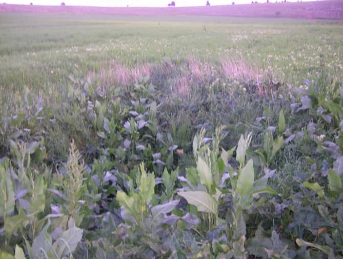
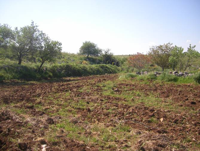
Gurio Lamanna (also incorrectly called Gurlamanna) is a doline shaped like a coat of arms located in the Murge plateau and falling into Gravina in Puglia's territory, on the border with Altamura, Apulia, southern Italy. It is "one of the largest karst landforms of the Murge plateau" C. Colamonico (1917), p. 21 and it is located very close to other two dolines, namely Pulicchio di Gravina and Tre Paduli. Depending on the type of geomorphologic classification employed and the author who suggested it, the karst landform can be defined either a doline or a "karst basin" ( it, bacino carsico). It is traditionally called "karst basin", following the suggestion of Carmelo Colamonico, who first studied the doline and saw in its large size and shallow depth a good reason to distinguish it from a normal doline. C. Colamonico (1917), p. 22 The definition of "karst basin", used by Carmelo Colamonico, has been introduced by Renato Biasutti. Carmelo Colamonico stated that Gurio Lamanna i ... [...More Info...] [...Related Items...] OR: [Wikipedia] [Google] [Baidu] |
Gravina In Puglia
Gravina in Puglia (; nap, label= Barese, Gravéine ; la, Silvium; grc, Σιλούϊον, Siloúïon) is a town and ''comune'' of the Metropolitan City of Bari, Apulia, southern Italy. The word ''gravina'' comes from the Latin ''grava'' or from the messapic ''graba'', with the meaning of ''rock'', ''shaft'' and ''erosion of bank river''. Other words that share the same root are ''grava'', ''gravaglione'' and ''gravinelle''. Alternatively, when the emperor Frederick II went to Gravina, because of the large extension of the lands and for the presence of wheat, he decided to give to it the motto ''Grana dat et vina.'', that is to say ''It offers wheat and wine.''. Gravina is the home of the Alta Murgia National Park. History Thanks to its strategic position, Gravina has a very ancient history. Its territory has been inhabited since the Paleolithic, due to the high presence of water and woods. The largest remains date back to the Neolithic. The oldest settlements have been identifi ... [...More Info...] [...Related Items...] OR: [Wikipedia] [Google] [Baidu] |
Drainage Basin
A drainage basin is an area of land where all flowing surface water converges to a single point, such as a river mouth, or flows into another body of water, such as a lake or ocean. A basin is separated from adjacent basins by a perimeter, the '' drainage divide'', made up of a succession of elevated features, such as ridges and hills. A basin may consist of smaller basins that merge at river confluences, forming a hierarchical pattern. Other terms for a drainage basin are catchment area, catchment basin, drainage area, river basin, water basin, and impluvium. In North America, they are commonly called a watershed, though in other English-speaking places, "watershed" is used only in its original sense, that of a drainage divide. In a closed drainage basin, or endorheic basin, the water converges to a single point inside the basin, known as a sink, which may be a permanent lake, a dry lake, or a point where surface water is lost underground. Drainage basins are similar ... [...More Info...] [...Related Items...] OR: [Wikipedia] [Google] [Baidu] |
Pulo Di Altamura
Pulo di Altamura is a doline located on the Murge plateau ( Apulia, Italy). It is the largest doline in that region and it is located about north-west of the city of Altamura. It shares the local toponym ''pulo'' with other large dolines of the region, i.e. ''Pulicchio di Gravina'', ''Pulo di Molfetta'' and ''Pulicchio di Toritto''. Dimensions The perimeter, measured on the edge of the doline, is around . The larger diameter is abit bigger than and it is never lower than . The depth is around . Etymology The etymology of toponym ''pulo'' is currently unknown. It is used only in the Murge plateau to denote a doline, while it is unused in other regions of Apulia. The term is also used for the nearby dolines Pulo di Molfetta, Pulicchio di Gravina and Pulicchio di Toritto (''pulicchio'' means small ''pulo''), and it is attested as early as in the 17th century, since Domenico Santoro in 1688 wrote "luogo detto dalli Cittadini lo Pulo" (place called by Altamura people 'Pulo') ... [...More Info...] [...Related Items...] OR: [Wikipedia] [Google] [Baidu] |
Lama (geology)
Lama is a local toponym that denotes a wide furrow in the ground typical of the Murge landscape. Lamas convey rainwater from the Murge plateau to the endpoint of the drainage basin they belong to. Lamas are generally confused with rivers or streams. There is a big difference between lamas and streams, since lamas collect only rainwater of their drainage basin, while they are completely dry when there is no rain. Moreover, in lamas water mostly flows underground and just a small amount of the rainwater flows on its surface. As for lamas, surface runoff is greatest in the extreme and uncommon situations of heavy rain. Lamas usually contain fertile soil, that deposited over the millennia due to the erosion and they are usually cultivated. Since they contain fertile soil, they are distinguishable from the nearby typical area of the Murge plateau, that is almost everywhere stony, arid and hard to grow. Lamas also occur in proximity of such notable dolines as Pulo di Altamura, Gurio L ... [...More Info...] [...Related Items...] OR: [Wikipedia] [Google] [Baidu] |
Tectonic
Tectonics (; ) are the processes that control the structure and properties of the Earth's crust and its evolution through time. These include the processes of mountain building, the growth and behavior of the strong, old cores of continents known as cratons, and the ways in which the relatively rigid plates that constitute the Earth's outer shell interact with each other. Tectonics also provide a framework for understanding the earthquake and volcanic belts that directly affect much of the global population. Tectonic studies are important as guides for economic geologists searching for fossil fuels and ore deposits of metallic and nonmetallic resources. An understanding of tectonic principles is essential to geomorphologists to explain erosion patterns and other Earth surface features. Main types of tectonic regime Extensional tectonics Extensional tectonics is associated with the stretching and thinning of the crust or the lithosphere. This type of tectonics is found ... [...More Info...] [...Related Items...] OR: [Wikipedia] [Google] [Baidu] |
Ditch
A ditch is a small to moderate divot created to channel water. A ditch can be used for drainage, to drain water from low-lying areas, alongside roadways or fields, or to channel water from a more distant source for plant irrigation. Ditches are commonly seen around farmland, especially in areas that have required drainage, such as The Fens in eastern England and much of the Netherlands. Roadside ditches may provide a hazard to motorists and cyclists, whose vehicles may crash into them and get damaged, flipped over, or stuck and cause major injury, especially in poor weather conditions and rural areas. Etymology In Anglo-Saxon, the word ''dïc'' already existed and was pronounced "deek" in northern England and "deetch" in the south. The origins of the word lie in digging a trench and forming the upcast soil into a bank alongside it. This practice has meant that the name ''dïc'' was given to either the excavation or the bank, and evolved to both the words "dike"/"dyke" and ... [...More Info...] [...Related Items...] OR: [Wikipedia] [Google] [Baidu] |
Karst
Karst is a topography formed from the dissolution of soluble carbonate rocks such as limestone, dolomite, and gypsum. It is characterized by features like poljes above and drainage systems with sinkholes and caves underground. It has also been documented for more weathering-resistant rocks, such as quartzite, given the right conditions. Subterranean drainage may limit surface water, with few to no rivers or lakes. However, in regions where the dissolved bedrock is covered (perhaps by debris) or confined by one or more superimposed non-soluble rock strata, distinctive karst features may occur only at subsurface levels and can be totally missing above ground. The study of ''paleokarst'' (buried karst in the stratigraphic column) is important in petroleum geology because as much as 50% of the world's hydrocarbon reserves are hosted in carbonate rock, and much of this is found in porous karst systems. Etymology The English word ''karst'' was borrowed from German in the late 19th c ... [...More Info...] [...Related Items...] OR: [Wikipedia] [Google] [Baidu] |
Istituto Geografico Militare
The ''Istituto Geografico Militare'' (IGM), or Military Geographic Institute, is an Italian public organization, dependent on the Italian Army general staff (''Stato Maggiore dell'Esercito''). It is the national mapping agency for Italy. Overview Its headquarters are in via Cesare Battisti, Florence, and they occupy most part of Santissima Annunziata cloister. It was established by king Vittorio Emanuele II Victor Emmanuel II ( it, Vittorio Emanuele II; full name: ''Vittorio Emanuele Maria Alberto Eugenio Ferdinando Tommaso di Savoia''; 14 March 1820 – 9 January 1878) was King of Sardinia from 1849 until 17 March 1861, when he assumed the title o ... in 1861 and it is ruled by the law n. 68 February 2, 1960. References External links * Geography of Italy Government of Italy National mapping agencies Italian Army 1861 establishments in Italy {{Italy-org-stub ... [...More Info...] [...Related Items...] OR: [Wikipedia] [Google] [Baidu] |


.jpg)