|
Gulfton
Gulfton is a community in Southwest Houston, Texas, United States that includes a group of apartment complexes that primarily house refugee and immigrant populations. It is located between the 610 Loop and Beltway 8, west of the City of Bellaire, southeast of Interstate 69/U.S. Highway 59, and north of Bellaire Boulevard. In the 1960s and 1970s Gulfton experienced rapid development, with new apartment complexes built for young individuals from the Northeast and Midwest United States. They came to work in the oil industry during the 1970s oil boom. In the 1980s, as the economy declined, existing tenants left, resulting in a significant drop in occupancy rates in the apartment complexes and forcing many complexes into bankruptcy and foreclosure. Owners marketed the empty units to newly arrived immigrants and Gulfton became a predominantly immigrant community. Beginning in the 1980s Gulfton's crime rate increased and schools were increasingly overwhelmed with excess students. "H ... [...More Info...] [...Related Items...] OR: [Wikipedia] [Google] [Baidu] |
Shenandoah, Houston, Texas
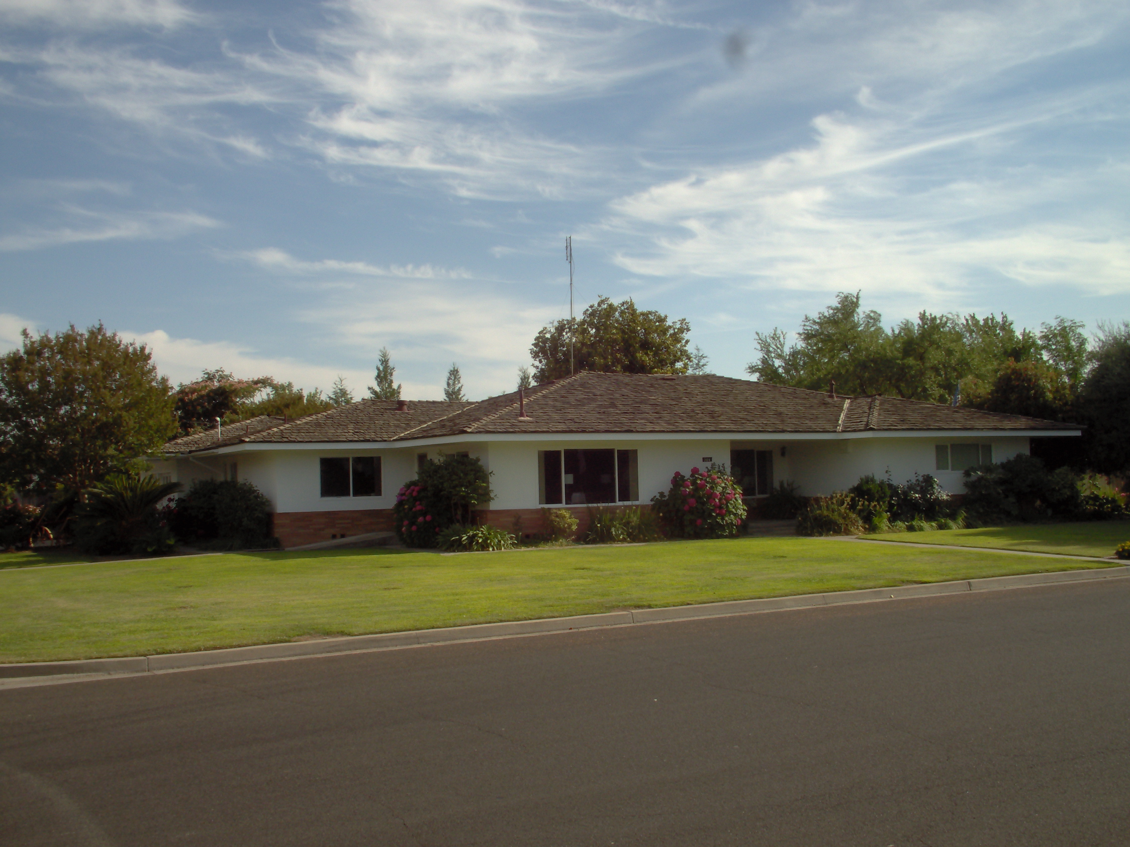
Shenandoah is a subdivision in Houston, Texas, United States. Shenandoah, located outside the 610 Loop, inside Beltway 8, and south and east of U.S. Highway 59 (Southwest Freeway), is surrounded by a community of apartment complexes called Gulfton. Shenandoah's sections include Shenandoah Section 1, Shenandoah Section 2, Shenandoah Section 3. The Shenandoah Civic Association has control over all of these sections and also controls a portion of the neighboring Sigrid subdivision. History Shenandoah, the first subdivision in the area, opened in the mid-1950s on former greenfield. Shenandoah had 16 blocks of ranch-style homes.Rogers, Susan.Superneighborhood 27: A Brief History of Change" ''California Digital Library''. The Shenandoah Civic Association opened in 1956; since the City of Houston has no zoning, the Shenandoah Civic Association's main goal is to enforce deed restrictions which regulate construction of housing and prevent businesses being operated from homes.Fisher, Rober ... [...More Info...] [...Related Items...] OR: [Wikipedia] [Google] [Baidu] |
Bellaire, Texas
Bellaire is a city in southwest Harris County, Texas, United States, within the metropolitan area.. Retrieved on January 24, 2010. As of the 2020 U.S. census, the city population was 17,202. It is surrounded by the cities of Houston and West University Place, Texas, West University Place. Bellaire is known as the "City of Homes", owing to its mostly residential character; but it has offices along the Interstate 610 (Texas), I-610 Loop within the city limits. History Bellaire was founded in 1908 by William Wright Baldwin, who was the president of the South End Land Company. Baldwin, a native of Iowa, was well known as the vice president of the Burlington Railroad. Bellaire was founded on what was part of William Marsh Rice's ranch. Baldwin surveyed the eastern of the ranch into small truck farms. He named them "Westmoreland Farms". Baldwin started Bellaire in the middle of "Westmoreland Farms" to serve as a residential neighborhood and an agricultural trading center. South E ... [...More Info...] [...Related Items...] OR: [Wikipedia] [Google] [Baidu] |
List Of Houston Neighborhoods
The city of Houston, Texas, contains many neighborhoods, ranging from planned communities to historic wards. There is no uniform standard for what constitutes an individual neighborhood within the city; however, the city of Houston does recognize a list of 88 ''super neighborhoods'' which encompass broadly recognized regions. According to the city, a super neighborhood is a "geographically designated area where residents, civic organizations, institutions and businesses work together to identify, plan, and set priorities to address the needs and concerns of their community."A list of the super neighborhoods, in the numerical order as assigned by the city, is shown below: In addition to the recognized super neighborhoods, Houston is further divided into a number of other formal and informal regions, including special districts and individual subdivisions. An ''incomplete'' list of these communities and jurisdictions is provided below. Management districts In Texas, ''municipal m ... [...More Info...] [...Related Items...] OR: [Wikipedia] [Google] [Baidu] |
Southwest Houston
Southwest Houston is a region in Houston, Texas, United States. The area is considered to be from Texas State Highway 6, south of Westpark Tollway to north of U.S. Route 90. Many Section 8 (housing) complexes are located in Southwest Houston. Hurricane Katrina refugees came to the area in 2005. The Houston Metropolitan Chamber, formerly the Greater Southwest Houston Chamber of Commerce, serves several neighborhoods often identified as "Southwest Houston." History From the 1980 U.S. Census to the 1990 Census, many African-Americans left traditional African-American neighborhoods and entered parts of Southwest Houston; areas of Southwest Houston received from more than 1,000 African-Americans per square mile to more than 3,500 African-Americans per square mile. Many African Americans in the U.S are also moving to Southwest Houston in the New Great Migration. Many Asian-Americans moved into Southwest Houston during the same period. They were mostly Chinese American, Indian America ... [...More Info...] [...Related Items...] OR: [Wikipedia] [Google] [Baidu] |
Bellaire Boulevard
Bellaire Boulevard (also known as Holcombe, and as 百利大道 ''Bǎilì Dàdào'' in Chinese and ''Đại Lộ Sàigòn'' in Vietnamese) is an arterial road in western Houston, Texas, United States. The street also goes through unincorporated areas in Harris County and the cities of Bellaire, Southside Place, and West University Place. Bellaire Boulevard goes through or next to the Houston communities of Alief, Chinatown, Gulfton, and Sharpstown.Lomax, John NovaI am a Pedestrian Report: Bellaire ''Houston Press''. May 25, 2007. Retrieved on August 4, 2009. In addition the boulevard goes through the Greater Sharpstown management district. John Nova Lomax of the ''Houston Press'' described Bellaire Boulevard as "a world market of a street, a bazaar where Mexicans, Anglos, Salvadorans, African Americans, Hondurans, stoners, Vietnamese, Chinese, Filipinos, Japanese, Koreans and Thais go to shop and eat." The street ends at Holcombe Boulevard, which extends to the Texas Medical C ... [...More Info...] [...Related Items...] OR: [Wikipedia] [Google] [Baidu] |
Colombia
Colombia (, ; ), officially the Republic of Colombia, is a country in South America with insular regions in North America—near Nicaragua's Caribbean coast—as well as in the Pacific Ocean. The Colombian mainland is bordered by the Caribbean Sea to the north, Venezuela to the east and northeast, Brazil to the southeast, Ecuador and Peru to the south and southwest, the Pacific Ocean to the west, and Panama to the northwest. Colombia is divided into 32 departments and the Capital District of Bogotá, the country's largest city. It covers an area of 1,141,748 square kilometers (440,831 sq mi), and has a population of 52 million. Colombia's cultural heritage—including language, religion, cuisine, and art—reflects its history as a Spanish colony, fusing cultural elements brought by immigration from Europe and the Middle East, with those brought by enslaved Africans, as well as with those of the various Amerindian civilizations that predate colonization. Spanish is th ... [...More Info...] [...Related Items...] OR: [Wikipedia] [Google] [Baidu] |
Greenfield Land
Greenfield land is a British English term referring to undeveloped land in an urban or rural area either used for agriculture or landscape design, or left to evolve naturally. These areas of land are usually agricultural or amenity properties being considered for urban development. Greenfield land can be unfenced open fields, urban lots or restricted closed properties. They are kept off limits to the general public by a private or government entity. Greenfield sites offer a high degree of freedom for a developer, compared to sites with existing developments. For example, a greenfield site is a welcome opportunity for a cable operator to choose equipment based on cost and aesthetic parameters, without considering migration issues related to legacy equipment on the site. Rather than building upon greenfield land, a developer may choose to redevelop brownfield or greyfield lands, which have been developed but left abandoned or underused. Other uses The term has broadened in sco ... [...More Info...] [...Related Items...] OR: [Wikipedia] [Google] [Baidu] |
Ranch-style House
Ranch (also known as American ranch, California ranch, rambler, or rancher) is a domestic architectural style that originated in the United States. The ranch-style house is noted for its long, close-to-the-ground profile, and wide open layout. The style fused modernist ideas and styles with notions of the American Western period of wide open spaces to create a very informal and casual living style. While the original ranch style was informal and basic in design, ranch-style houses built in the United States (particularly in the Sun Belt region) from around the early 1960s increasingly had more dramatic features such as varying roof lines, cathedral ceilings, sunken living rooms, and extensive landscaping and grounds. First appearing as a residential style in the 1920s, the ranch was extremely popular with the booming post-war middle class of the 1940s to the 1970s. The style is often associated with tract housing built at this time, particularly in the southwest United States, ... [...More Info...] [...Related Items...] OR: [Wikipedia] [Google] [Baidu] |
White People
White is a racialized classification of people and a skin color specifier, generally used for people of European origin, although the definition can vary depending on context, nationality, and point of view. Description of populations as "White" in reference to their skin color predates this notion and is occasionally found in Greco-Roman ethnography and other ancient or medieval sources, but these societies did not have any notion of a White or pan-European race. The term "White race" or "White people", defined by their light skin among other physical characteristics, entered the major European languages in the later seventeenth century, when the concept of a "unified White" achieve universal acceptance in Europe, in the context of racialized slavery and unequal social status in the European colonies. Scholarship on race distinguishes the modern concept from pre-modern descriptions, which focused on physical complexion rather than race. Prior to the modern era, no Europe ... [...More Info...] [...Related Items...] OR: [Wikipedia] [Google] [Baidu] |
Cuba
Cuba ( , ), officially the Republic of Cuba ( es, República de Cuba, links=no ), is an island country comprising the island of Cuba, as well as Isla de la Juventud and several minor archipelagos. Cuba is located where the northern Caribbean Sea, Gulf of Mexico, and Atlantic Ocean meet. Cuba is located east of the Yucatán Peninsula (Mexico), south of both the American state of Florida and the Bahamas, west of Hispaniola ( Haiti/Dominican Republic), and north of both Jamaica and the Cayman Islands. Havana is the largest city and capital; other major cities include Santiago de Cuba and Camagüey. The official area of the Republic of Cuba is (without the territorial waters) but a total of 350,730 km² (135,418 sq mi) including the exclusive economic zone. Cuba is the second-most populous country in the Caribbean after Haiti, with over 11 million inhabitants. The territory that is now Cuba was inhabited by the Ciboney people from the 4th millennium BC with the Gua ... [...More Info...] [...Related Items...] OR: [Wikipedia] [Google] [Baidu] |
Rust Belt
The Rust Belt is a region of the United States that experienced industrial decline starting in the 1950s. The U.S. manufacturing sector as a percentage of the U.S. GDP peaked in 1953 and has been in decline since, impacting certain regions and cities primarily in the Northeast and Midwest regions of the U.S., including Allentown, Buffalo, Cincinnati, Cleveland, Columbus, Jersey City, Newark, Pittsburgh, Rochester, Toledo, Trenton, Youngstown, and other areas of New Jersey, Ohio, Pennsylvania, and Upstate New York. These regions experienced and, in some cases, are continuing to experience the elimination or outsourcing of manufacturing jobs beginning in the late 20th century. The term "Rust" refers to the impact of deindustrialization, economic decline, population loss, and urban decay on these regions attributable to the shrinking of the once-powerful industrial sector especially including steelmaking, automobile manufacturing, and coal mining. The term gained popularity ... [...More Info...] [...Related Items...] OR: [Wikipedia] [Google] [Baidu] |


