|
Guldental
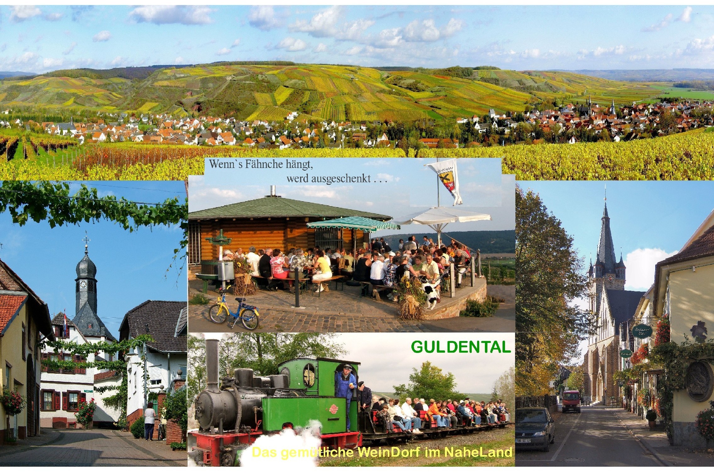
Guldental is an ''Ortsgemeinde'' – a municipality belonging to a ''Verbandsgemeinde'', a kind of collective municipality – in the Bad Kreuznach district in Rhineland-Palatinate, Germany. It belongs to the ''Verbandsgemeinde'' Langenlonsheim-Stromberg, whose seat is in Langenlonsheim. With a population of some 2,900 inhabitants, Guldental is the biggest rural winegrowing community on the Nahe. Geography Location Guldental lies in the Naheland – the land lining each side of the Nahe – among the southern foothills of the Hunsrück, on the Guldenbach. Neighbouring municipalities Clockwise from the north, Guldental's neighbours are the municipality of Langenlonsheim, the municipality of Bretzenheim, the town of Bad Kreuznach, the municipality of Hargesheim, the municipality of Gutenberg and the municipality of Windesheim. Constituent communities Guldental's ''Ortsteile'' are Heddesheim and Waldhilbersheim. Also belonging to Guldental are the outlying homesteads ... [...More Info...] [...Related Items...] OR: [Wikipedia] [Google] [Baidu] |
Langenlonsheim
Langenlonsheim is an ''Ortsgemeinde'' – a municipality belonging to a ''Verbandsgemeinde'', a kind of collective municipality – in the Bad Kreuznach district in Rhineland-Palatinate, Germany. It belongs to the ''Verbandsgemeinde'' Langenlonsheim-Stromberg, and is also its seat. Langenlonsheim is a state-recognized tourism community and a winegrowing village. Geography Location Langenlonsheim lies between the southern edge of the Hunsrück and the Nahe. Lying 7 km away is the district seat, Bad Kreuznach, while Bingen am Rhein lies just under 10 km away. On the municipality's western outskirts, the Guldenbach flows by, while the Nahe flows by to the south. Langenlonsheim is well known for its good vineyards and wineries and its ''Qualitätsweine''. Fertile loess soils and the region's warm climate have been defining factors for the village. Neighbouring municipalities Clockwise from the north, Langenlonsheim's neighbours are the municipalities of Laubenheim, G ... [...More Info...] [...Related Items...] OR: [Wikipedia] [Google] [Baidu] |
Gutenberg, Germany
Gutenberg is an ''Ortsgemeinde'' – a municipality belonging to a ''Verbandsgemeinde'', a kind of collective municipality – in the Bad Kreuznach district in Rhineland-Palatinate, Germany. It belongs to the ''Verbandsgemeinde'' of Rüdesheim, whose seat is in the municipality of Rüdesheim an der Nahe. Gutenberg is a winegrowing village. Geography Location Flowing through Gutenberg is the Gräfenbach. Gutenberg belongs to the Nahe wine region and lies at the foot of the Soonwald in the Hunsrück. Its elevation is roughly 145 m above sea level and it lies some 7 km from the district seat, Bad Kreuznach. Bad Sobernheim, Idar-Oberstein, Bad Münster am Stein-Ebernburg and Bingen am Rhein also lie relatively nearby. Gutenberg is distinguished by the consistency of its weather, low rainfall averaging only 480 mm yearly and a great many sunny days. This has led the municipality to adopt the slogan "''Gutenberg – auf der Sonnenseite der Welt''" ("Gutenberg ... [...More Info...] [...Related Items...] OR: [Wikipedia] [Google] [Baidu] |
Bad Kreuznach
Bad Kreuznach () is a town in the Bad Kreuznach district in Rhineland-Palatinate, Germany. It is a spa town, most well known for its medieval bridge dating from around 1300, the Alte Nahebrücke, which is one of the few remaining bridges in the world with buildings on it.Brückenhäuser, Alte Nahebrücke, Neustadt , Bad Kreuznach o www.romantic-germany.info (in English). Retrieved 14 June 2018 The town is located in the Nahe River wine region, renowned both nationally and internatio ... [...More Info...] [...Related Items...] OR: [Wikipedia] [Google] [Baidu] |
Bretzenheim
Bretzenheim is an ''Ortsgemeinde'' – a municipality belonging to a ''Verbandsgemeinde'', a kind of collective municipality – in the Bad Kreuznach district in Rhineland-Palatinate, Germany. It belongs to the ''Verbandsgemeinde'' Langenlonsheim-Stromberg, whose seat is in Langenlonsheim. Bretzenheim is a state-recognized tourism community and a winegrowing centre. It is also one of the district's ten biggest municipalities. Geography Location Bretzenheim lies on the Nahe, 10 km up from its mouth where it empties into the Rhine at Bingen am Rhein to the north. The municipality lies just north of Bad Kreuznach. Neighbouring municipalities Clockwise from the north, Bretzenheim's neighbours are the municipality of Langenlonsheim, the town of Bad Kreuznach and the municipality of Guldental. History It was people of the Linear Pottery culture of the New Stone Age who, about 5000 BC, founded the first settlement of any great size at what is now Bretzenheim. A wea ... [...More Info...] [...Related Items...] OR: [Wikipedia] [Google] [Baidu] |
Hunsrück
The Hunsrück () is a long, triangular, pronounced upland in Rhineland-Palatinate, Germany. It is bounded by the valleys of the Moselle-Saar (north-to-west), the Nahe (south), and the Rhine (east). It is continued by the Taunus mountains, past the Rhine and by the Eifel past the Moselle. To the south of the Nahe is a lower, hilly country forming the near bulk of the Palatinate region and all of the, smaller, Saarland. Below its north-east corner is Koblenz. As the Hunsrück proceeds east it acquires north-south width and three notable gaps in its southern ridges. In this zone are multi-branch headwaters including the Simmerbach ending at Simmertal on the southern edge. This interior is therefore rarely higher than above sea level. Peaks and escarpments are principally: the (Black Forest) Hochwald, the Idar Forest, the Soonwald, and the Bingen Forest. The highest mountain is the Erbeskopf (816 m; 2,677 ft), towards the region's south-west. Notable towns are Simmern ... [...More Info...] [...Related Items...] OR: [Wikipedia] [Google] [Baidu] |
Hargesheim
Hargesheim is an ''Ortsgemeinde'' – a Municipalities of Germany, municipality belonging to a ''Verbandsgemeinde'', a kind of collective municipality – in the Bad Kreuznach district in Rhineland-Palatinate, Germany. It belongs to the Rüdesheim (Verbandsgemeinde), ''Verbandsgemeinde'' of Rüdesheim, whose seat is in the municipality of Rüdesheim an der Nahe. Hargesheim is a state-recognized tourism community. Geography Location Hargesheim lies on the Gräfenbach in a side valley of the Nahe (Rhine), Nahe. Lying 5 km away is the district seat of Bad Kreuznach. Hargesheim thus lies on the boundary between Rhenish Hesse and the Hunsrück. A great part of the municipality's area is built up (48 ha), whereas only a small part is used for forestry. The rest is used for either agriculture or winegrowing. Neighbouring municipalities Clockwise from the north, Hargesheim's neighbours are Guldental, Bad Kreuznach, Roxheim and Gutenberg, Germany, Gutenberg, all of which likewise ... [...More Info...] [...Related Items...] OR: [Wikipedia] [Google] [Baidu] |
Langenlonsheim-Stromberg
Langenlonsheim-Stromberg is a ''Verbandsgemeinde'' ("collective municipality") in the district of Bad Kreuznach, Rhineland-Palatinate, Germany. The seat of the ''Verbandsgemeinde'' is in Langenlonsheim. It was formed on 1 January 2020 by the merger of the former ''Verbandsgemeinden'' Langenlonsheim and Stromberg. The ''Verbandsgemeinde'' Langenlonsheim-Stromberg consists of the following ''Ortsgemeinden'' ("local municipalities"): # Bretzenheim # Daxweiler # Dörrebach # Dorsheim # Eckenroth # Guldental # Langenlonsheim # Laubenheim # Roth # Rümmelsheim # Schöneberg # Schweppenhausen # Seibersbach # Stromberg # Waldlaubersheim # Warmsroth Warmsroth is a municipality in the district of Bad Kreuznach in Rhineland-Palatinate, in western Germany Germany,, officially the Federal Republic of Germany, is a country in Central Europe. It is the second most populous country i ... # Windesheim External linksOfficial website Verbandsgemeinde in Rhineland-Palati ... [...More Info...] [...Related Items...] OR: [Wikipedia] [Google] [Baidu] |
Laubenheim
Laubenheim is an ''Ortsgemeinde'' – a municipality belonging to a ''Verbandsgemeinde'', a kind of collective municipality – in the Bad Kreuznach district in Rhineland-Palatinate, Germany. It belongs to the ''Verbandsgemeinde'' Langenlonsheim-Stromberg, whose seat is in Langenlonsheim. Laubenheim is a winegrowing village. Geography Location Laubenheim, a village of some 900 inhabitants, lies between Bingen am Rhein to the north and Bad Kreuznach to the south, right on the Nahe just up from the place where it empties into the Rhine. Laubenheim lies alee of the Hunsrück and has a mild climate, which is favourable to the vineyards that are kept above the village. Neighbouring municipalities Clockwise from the north, Laubenheim's neighbours are the municipality of Münster-Sarmsheim, the town of Bingen am Rhein and the municipalities of Grolsheim (all three of which lie in the neighbouring Mainz-Bingen district), Langenlonsheim and Dorsheim (both of which likewise lie in the B ... [...More Info...] [...Related Items...] OR: [Wikipedia] [Google] [Baidu] |
Bad Kreuznach (district)
Bad Kreuznach is a district in Rhineland-Palatinate, Germany. It is bounded by (from the north and clockwise) the districts of Rhein-Hunsrück, Mainz-Bingen, Alzey-Worms, Donnersbergkreis, Kusel and Birkenfeld. History The region is full of medieval castles, especially along the Nahe River. Best known is the Kyrburg of Kirn, built in the 12th century and sitting in state above the river. In 1815, the district of Kreuznach was established by the Prussian government. In 1932, it was merged with the district of Meisenheim. The name of the district officially changed from Kreuznach to Bad Kreuznach in 1969. Geography The district is located in the hilly country between the mountain chains of the Hunsrück in the north and the North Palatine Uplands in the south. The main axis of the district is the Nahe River, which enters the territory in the west, runs through Kirn, Bad Sobernheim and Bad Kreuznach, and leaves to the northeast. The region formed by this district and ... [...More Info...] [...Related Items...] OR: [Wikipedia] [Google] [Baidu] |


