|
Guayas River
The Guayas River also called Rio Guayas is a major river in western Ecuador. It gives name to Guayas Province and is the most important river in South America that does not flow into the Atlantic Ocean or any of its marginal seas. Its total length, including the Daule River, is 389 km (241 mi). The Guayas River's drainage basin is 34,500 sq.km (13,320 sq.mi) and it has an average discharge of 70,000 cu ft/s (1,982 m3/s). It is the national river of Ecuador and is present on the Coat of Arms. Geography Course The Guayas River has one of its sources in the Andes and the Chimborazo (volcano), Ecuador's highest volcano. The coat of arms of Ecuador shows an image of the river descending from the mountain. ''Guayas'' is the name of the lower part of the river, which starts at the confluence of the Daule River from the west and the Babahoyo River from the east, between the cities of Guayaquil and Durán, in Guayas province. The Guayas River then flows around Santay Islan ... [...More Info...] [...Related Items...] OR: [Wikipedia] [Google] [Baidu] |
Guayaquil
, motto = Por Guayaquil Independiente en, For Independent Guayaquil , image_map = , map_caption = , pushpin_map = Ecuador#South America , pushpin_relief = 1 , pushpin_map_caption = , pushpin_mapsize = , coordinates = , subdivision_type = Country , subdivision_name = Ecuador , subdivision_type1 = Province , subdivision_name1 = Guayas , subdivision_type2 = Canton , subdivision_name2 = Guayaquil , established_title = Spanish foundation , established_date = , founder = Francisco de Orellana , named_for = Guayas and Quil , established_title2 = Independence , established_date2 = , parts_type = Urban ... [...More Info...] [...Related Items...] OR: [Wikipedia] [Google] [Baidu] |
Confluence (geography)
In geography, a confluence (also: ''conflux'') occurs where two or more flowing bodies of water join to form a single channel. A confluence can occur in several configurations: at the point where a tributary joins a larger river (main stem); or where two streams meet to become the source of a river of a new name (such as the confluence of the Monongahela and Allegheny rivers at Pittsburgh, forming the Ohio); or where two separated channels of a river (forming a river island) rejoin at the downstream end. Scientific study of confluences Confluences are studied in a variety of sciences. Hydrology studies the characteristic flow patterns of confluences and how they give rise to patterns of erosion, bars, and scour pools. The water flows and their consequences are often studied with mathematical models. Confluences are relevant to the distribution of living organisms (i.e., ecology) as well; "the general pattern ownstream of confluencesof increasing stream flow and decreasing sl ... [...More Info...] [...Related Items...] OR: [Wikipedia] [Google] [Baidu] |
Slum
A slum is a highly populated urban residential area consisting of densely packed housing units of weak build quality and often associated with poverty. The infrastructure in slums is often deteriorated or incomplete, and they are primarily inhabited by impoverished people.What are slums and why do they exist? UN-Habitat, Kenya (April 2007) Although slums are usually located in s, in some countries they can be located in suburban areas where housing quality is low and living conditions are poor. While slums differ in size and other characteristics, most lack r ... [...More Info...] [...Related Items...] OR: [Wikipedia] [Google] [Baidu] |
Maze
A maze is a path or collection of paths, typically from an entrance to a goal. The word is used to refer both to branching tour puzzles through which the solver must find a route, and to simpler non-branching ("unicursal") patterns that lead unambiguously through a convoluted layout to a goal. The term "labyrinth" is generally synonymous with "maze", but can also connote specifically a unicursal pattern. The pathways and walls in a maze are typically fixed, but puzzles in which the walls and paths can change during the game are also categorised as mazes or tour puzzles. Construction Mazes have been built with walls and rooms, with hedges, turf, corn stalks, straw bales, books, paving stones of contrasting colors or designs, and brick, or in fields of crops such as corn or, indeed, maize. Maize mazes can be very large; they are usually only kept for one growing season, so they can be different every year, and are promoted as seasonal tourist attractions. Indoors, mirror ma ... [...More Info...] [...Related Items...] OR: [Wikipedia] [Google] [Baidu] |
Tides
Tides are the rise and fall of sea levels caused by the combined effects of the gravitational forces exerted by the Moon (and to a much lesser extent, the Sun) and are also caused by the Earth and Moon orbiting one another. Tide tables can be used for any given locale to find the predicted times and amplitude (or "tidal range"). The predictions are influenced by many factors including the alignment of the Sun and Moon, the phase and amplitude of the tide (pattern of tides in the deep ocean), the amphidromic systems of the oceans, and the shape of the coastline and near-shore bathymetry (see '' Timing''). They are however only predictions, the actual time and height of the tide is affected by wind and atmospheric pressure. Many shorelines experience semi-diurnal tides—two nearly equal high and low tides each day. Other locations have a diurnal tide—one high and low tide each day. A "mixed tide"—two uneven magnitude tides a day—is a third regular category. Tides va ... [...More Info...] [...Related Items...] OR: [Wikipedia] [Google] [Baidu] |
Swamps
A swamp is a forested wetland.Keddy, P.A. 2010. Wetland Ecology: Principles and Conservation (2nd edition). Cambridge University Press, Cambridge, UK. 497 p. Swamps are considered to be transition zones because both land and water play a role in creating this environment. Swamps vary in size and are located all around the world. The water of a swamp may be fresh water, brackish water, or seawater. Freshwater swamps form along large rivers or lakes where they are critically dependent upon rainwater and seasonal flooding to maintain natural water level fluctuations.Hughes, F.M.R. (ed.). 2003. The Flooded Forest: Guidance for policy makers and river managers in Europe on the restoration of floodplain forests. FLOBAR2, Department of Geography, University of Cambridge, Cambridge, UK. 96 p. Saltwater swamps are found along tropical and subtropical coastlines. Some swamps have hammock (ecology), hammocks, or dry-land protrusions, covered by aquatic vegetation, or vegetation that tolerates ... [...More Info...] [...Related Items...] OR: [Wikipedia] [Google] [Baidu] |
Estero Salado
Estero is a village in Lee County, Florida, United States. As of the 2020 census, the population was 36,939. During the 2010 census, Estero was an unincorporated community, or census-designated place, the population at that time was 22,612. Estero incorporated as a village in 2014. In 2019, the village's estimated population was 33,871. Estero is part of the Cape Coral-Fort Myers, Florida Metropolitan Statistical Area. Estero is the home of Hertz Arena, which hosts the home games for the Florida Everblades ECHL ice hockey team. Florida Gulf Coast University is located just north of the Estero village limits. History Mound Key, located in Estero Bay, is believed to have been the ceremonial center of the Calusa Indians when they were encountered by the Spanish in the early 1500s. German homesteader Gustave Damkohler began planting mulberry trees in 1882 along the Estero River, followed by others who established fish camps and the region's first citrus groves. In 1894, Damkohler d ... [...More Info...] [...Related Items...] OR: [Wikipedia] [Google] [Baidu] |
River Delta
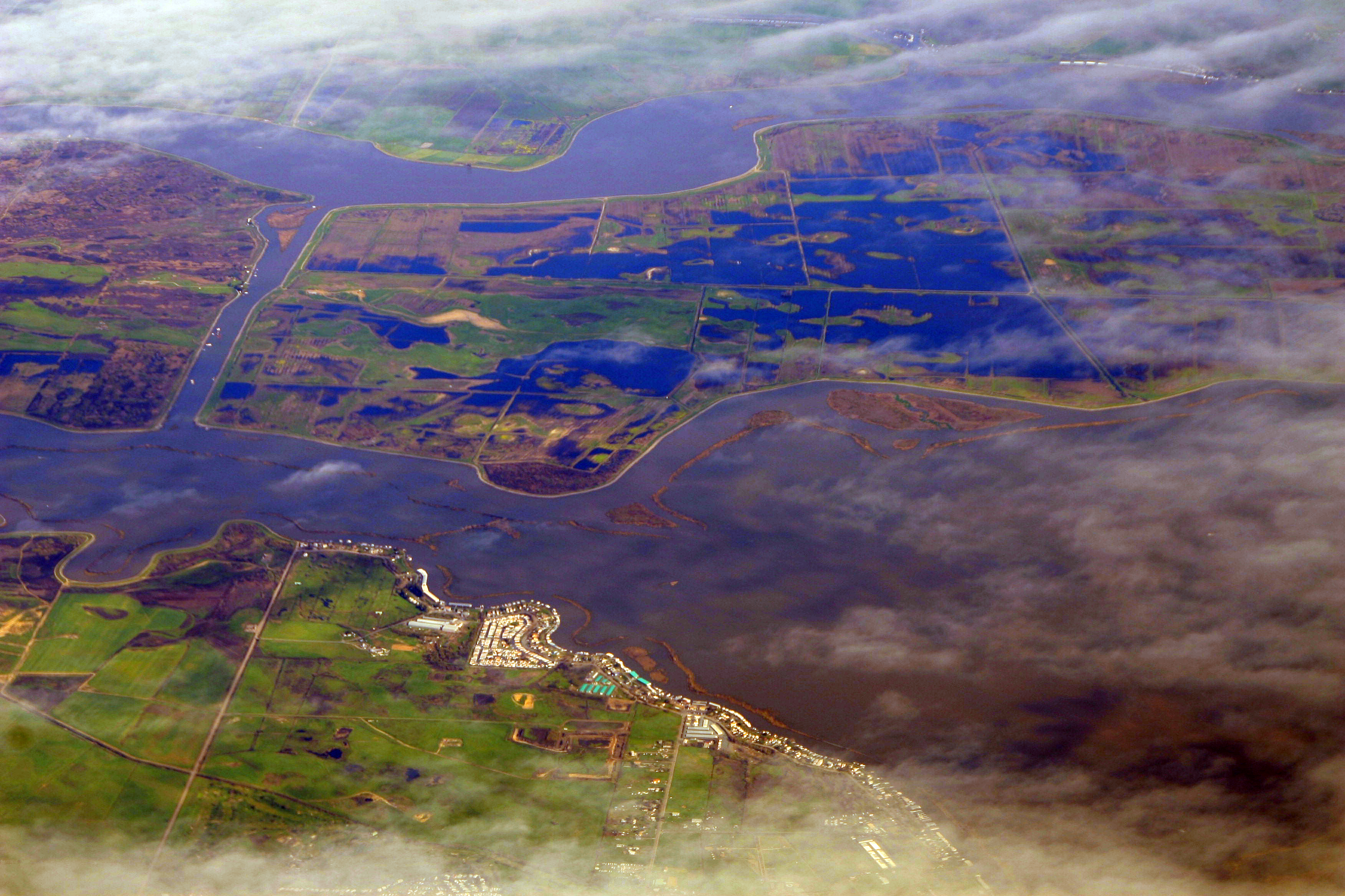
A river delta is a landform shaped like a triangle, created by deposition (geology), deposition of sediment that is carried by a river and enters slower-moving or stagnant water. This occurs where a river enters an ocean, sea, estuary, lake, reservoir, or (more rarely) another river that cannot carry away the supplied sediment. It is so named because its triangle shape resembles the Greek letter Delta. The size and shape of a delta is controlled by the balance between watershed processes that supply sediment, and receiving basin processes that redistribute, sequester, and export that sediment. The size, geometry, and location of the receiving basin also plays an important role in delta evolution. River deltas are important in human civilization, as they are major agricultural production centers and population centers. They can provide Coast, coastline defense and can impact drinking water supply. They are also Ecology, ecologically important, with different species' assemblages ... [...More Info...] [...Related Items...] OR: [Wikipedia] [Google] [Baidu] |
Naranjal Canton
Naranjal is a canton (subnational entity), canton in the province of Guayas Province, Guayas in western continental Ecuador. The canton was named after its seat, Naranjal (canton seat), Naranjal. Demographics Ethnic groups as of the Ecuadorian census of 2010: *Mestizo 74.1% *Montubio 10.9% *Afro-Ecuadorian 8.7% *White Latin American, White 5.5% *Indigenous peoples in Ecuador, Indigenous 0.7% *Other 0.2% References Cantons of Guayas Province {{Ecuador-geo-stub ... [...More Info...] [...Related Items...] OR: [Wikipedia] [Google] [Baidu] |
Durán (canton)
Duran or Durán may refer to: Places * Duran, Gers, a commune in France * Durán, Ecuador * Duran, Iran, a village in Zanjan Province, Iran * Duran, New Mexico * Duran, a barangay in Dumalag, Capiz, Philippines Entertainment * Duran (comics), a supervillain in the pages of DC Comics * Lieutenant Samir Duran, a character in the Starcraft universe * Duran (Japanese musician), Japanese guitarist and musician Other uses * Duran (surname) * Duran (glass), or DURAN, a brand name of borosilicate glass See also * Duran Duran Duran Duran () are an English Rock music, rock band formed in Birmingham in 1978 by singer and bassist Stephen Duffy, keyboardist Nick Rhodes and guitarist/bassist John Taylor (bass guitarist), John Taylor. With the addition of drummer Roger ..., an English New Wave band * Durand Durand, the villain in the 1968 film ''Barbarella'' * Duran Consent Decree, stipulated agreement to ''Duran v. King'' court case {{DEFAULTSORT:Duran ... [...More Info...] [...Related Items...] OR: [Wikipedia] [Google] [Baidu] |
Guayaquil (canton)
The Guayaquil Canton, officially the Municipality of Guayaquil, is a canton in the center of the Guayas Province in western Ecuador. The canton was named after its seat, the city of Guayaquil, the most populous city in Ecuador. Political divisions The canton is divided into 16 urban parishes and 5 rural parishes. The urban parishes make up the city of Guayaquil. Urban parishes *Ayacucho *Bolivar (Sagario) *Carbo (Concepcion) *Chongón *Febres Cordero *Garcia Moreno *Letamendi *Nueva de Octubre *Olmedo (San Alejo) *Pascuales *Roca *Rocafuerte *Sucre *Tarqui *Urdaneta *Ximena Rural parishes *Juan Gomez Rendon (Progreso) *Morro *Posorja * Puná *Tenguel Demographics Ethnic groups as of the Ecuadorian census of 2010: *Mestizo 70.8% *White 11.4% *Afro-Ecuadorian 10.9% *Montubio 5.0% *Indigenous Indigenous may refer to: *Indigenous peoples *Indigenous (ecology), presence in a region as the result of only natural processes, with no human intervention *Indigenous (band), an Ameri ... [...More Info...] [...Related Items...] OR: [Wikipedia] [Google] [Baidu] |
River Delta
A river delta is a landform shaped like a triangle, created by deposition (geology), deposition of sediment that is carried by a river and enters slower-moving or stagnant water. This occurs where a river enters an ocean, sea, estuary, lake, reservoir, or (more rarely) another river that cannot carry away the supplied sediment. It is so named because its triangle shape resembles the Greek letter Delta. The size and shape of a delta is controlled by the balance between watershed processes that supply sediment, and receiving basin processes that redistribute, sequester, and export that sediment. The size, geometry, and location of the receiving basin also plays an important role in delta evolution. River deltas are important in human civilization, as they are major agricultural production centers and population centers. They can provide Coast, coastline defense and can impact drinking water supply. They are also Ecology, ecologically important, with different species' assemblages ... [...More Info...] [...Related Items...] OR: [Wikipedia] [Google] [Baidu] |


