|
Guasca
Guasca is a Colombian town and municipality in the Guavio Province, part of the Cundinamarca Department located approximately 55 km from Bogotá passing through the town of La Calera, Cundinamarca or 65 km passing through Sopó. Guasca borders the municipalities Tocancipá and Guatavita in the north, Junín in the east, in the south La Calera and in the west Sopó.Official website Guasca - accessed 05-05-2016 History Before the of the central highlands of the Colombian , the |
Siecha Lakes
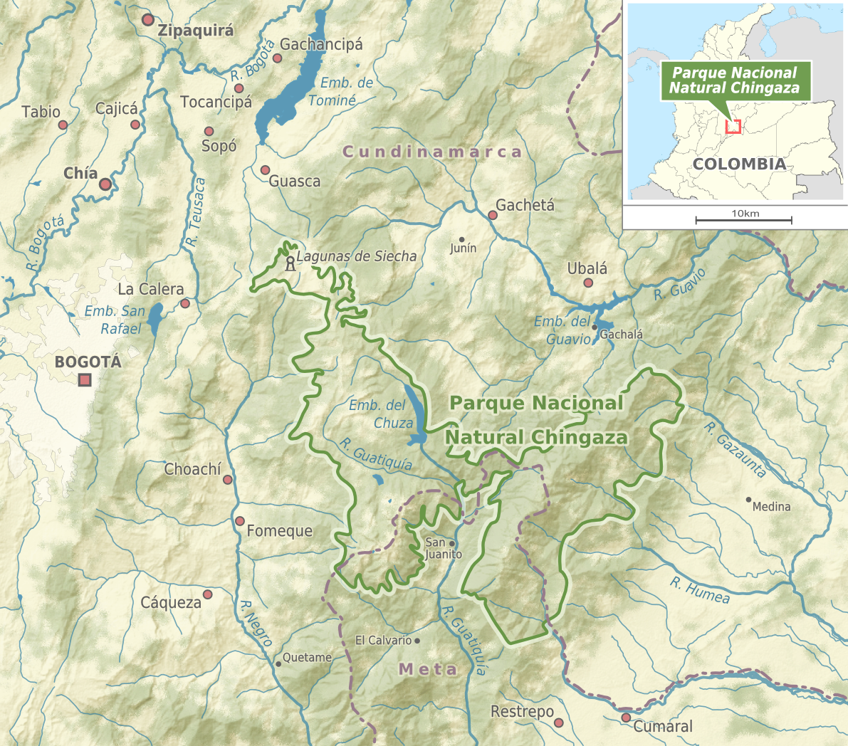
The Siecha Lakes are three glacial lakes located in the Chingaza Natural National Park in Cundinamarca, Colombia. The Andean lakes are considered sacred in the religion of the Muisca who inhabited the area before the Spanish conquest of the Muisca in the 1530s. Etymology In the Chibcha language of the Muisca ''Siecha'' means "House of the Lord". Description The Siecha Lakes consist of three small glacial lakes, from large to small and east to west; Siecha (63,893 m²), Guasca (56,846 m²) and De los Patos (20,662 m²). Alternative names for the smaller two are Fausto and America. The lakes belong to the municipality of Guasca. Fauna around the lakes are the birds American purple gallinule, helmeted curassow, torrent duck, Andean cock-of-the-rock, eagles and orange-fronted parakeet. In the lakes the birds '' Oxyura jamaicensis andina'', Andean teal and the American coot can be found. Mammals around the lakes include the spectacled bear, white-tailed deer, red deer and th ... [...More Info...] [...Related Items...] OR: [Wikipedia] [Google] [Baidu] |
Chingaza Natural National Park
Chingaza National Natural Park ( es, Parque Nacional Natural (PNN) Chingaza) is located in the Eastern Ranges of the Colombian Andes, northeast of Bogotá, Colombia in the departments of Cundinamarca and Meta. The elevation in the park, to the east of the Altiplano Cundiboyacense, ranges from to , and the temperature ranges from .Website Chingaza Natural National Park - accessed 06-05-2016 The park extends over the Cundinamarca municipalities La Calera, , and [...More Info...] [...Related Items...] OR: [Wikipedia] [Google] [Baidu] |
Mariano Ospina Rodríguez
Mariano Ospina Rodríguez was a Colombian politician, journalist and lawyer, founder of the Colombian Conservative Party and later President of Colombia between 1857 and 1861Arismendi Posada, Ignacio; ''Gobernantes Colombianos''; trans. Colombian Presidents; Interprint Editors Ltd., Italgraf, Segunda Edición; Page 73; Bogotá, Colombia; 1983 during the Granadine Confederation. Biographic data Ospina was born in Guasca, Viceroyalty of New Granada, on October 18, 1805. He died in Medellín, Antioquia, on January 11, 1885. His parents were Santiago Ospina and Urbina Rodríguez. His body was interred at the San Pedro Cemetery Museum. His son Tulio Ospina died on February 17, 1921, and was buried next to his father. Early life He was home schooled by both of his parents, Santiago and Urbina, and later received private tutoring from Professor José Félix Restrepo. He attended the School of San Bartolomé in Bogotá, where he graduated in jurisprudence and obtained a l ... [...More Info...] [...Related Items...] OR: [Wikipedia] [Google] [Baidu] |
Guavio Province
The Guavio Province ( es, Provincia del Guavio) is one of the 15 provinces in the Cundinamarca department, Colombia. Guavio borders the Capital District of Bogotá and the Central Savanna Province to the west, to the north the Almeidas Province, to the east the Boyacá Department and Medina Province and to the south the Meta Department and the Eastern Province. The Alberto Lleras Dam is also located in this area. The eastern municipalities Gachalá and Ubalá are rich in emeralds. Subdivision Guavio Province is subdivided into 8 municipalities A municipality is usually a single administrative division having corporate status and powers of self-government or jurisdiction as granted by national and regional laws to which it is subordinate. The term ''municipality'' may also mean the ...: [...More Info...] [...Related Items...] OR: [Wikipedia] [Google] [Baidu] |
La Calera, Cundinamarca
La Calera is a municipality and town of Colombia in the Guavio Province, part of the department of Cundinamarca. La Calera is a common weekend destination, mainly for the many restaurants, as it is approximately over land from Bogotá, the capital city of Colombia. La Calera is located in the Eastern Ranges of the Colombian Andes, east of the capital and overlooking part of it. La Calera borders Guasca, Sopó and Chía in the north, Guasca and Junín in the east, Bogotá in the west and Choachí and Fómeque in the south.Official website La Calera Etymology The name of the town is derived from the limestone |
Tocancipá
Tocancipá () is a municipality and town of Colombia in the Central Savanna Province, part of the department of Cundinamarca. Tocancipá is situated in the northern part of the Bogotá savanna, part of the Altiplano Cundiboyacense in the Eastern Ranges of the Colombian Andes with the urban centre at an altitude of . The capital Bogotá, which metropolitan area includes Tocancipá, is to the south. Tocancipá borders Gachancipá and Nemocón in the north, Zipaquirá in the west, Guasca and Guatavita in the east and Guasca and Sopó in the south. Etymology The name Tocancipá comes from Muysccubun and means "Valley of the joys of the ''zipa''". History The area of Tocancipá was inhabited early in the history of inhabitation of the Altiplano. The archaeological site Tibitó is located within the boundaries of Tocancipá and evidence of inhabitation has been dated to 11,740 ± 110 years BP.Aceituno & Rojas, 2012, p.127 At the time of arrival of the Spanish conqui ... [...More Info...] [...Related Items...] OR: [Wikipedia] [Google] [Baidu] |
Municipalities Of Colombia
The Municipalities of Colombia are decentralized subdivisions of the Republic of Colombia. Municipalities make up most of the departments of Colombia with 1,122 municipalities ('' municipios''). Each one of them is led by a mayor (''alcalde'') elected by popular vote and represents the maximum executive government official at a municipality level under the mandate of the governor of their department which is a representative of all municipalities in the department; municipalities are grouped to form departments. The municipalities of Colombia are also grouped in an association called the ''Federación Colombiana de Municipios'' (Colombian Federation of Municipalities), which functions as a union under the private law and under the constitutional right to free association to defend their common interests. Categories Conforming to the law 1551/12 that modified the sixth article of the law 136/94 Article 7 http://www.alcaldiabogota.gov.co/sisjur/normas/Norma1.jsp?i=48267 the mu ... [...More Info...] [...Related Items...] OR: [Wikipedia] [Google] [Baidu] |
Muisca People
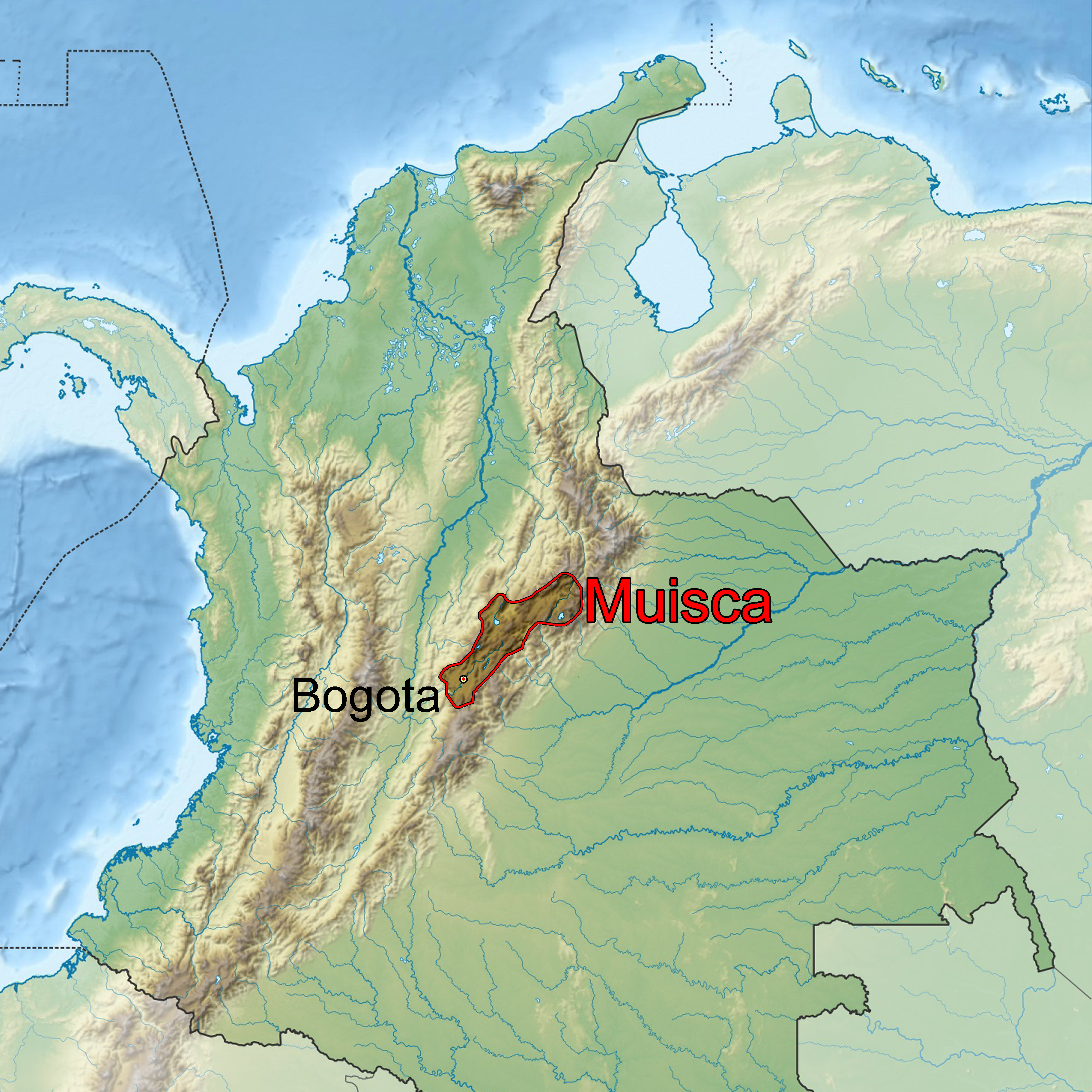
The Muisca (also called Chibcha) are an indigenous peoples of Colombia, indigenous people and Pre-Columbian cultures of Colombia, culture of the Altiplano Cundiboyacense, Colombia, that formed the Muisca Confederation before the Spanish conquest of the Muisca, Spanish conquest. The people spoke Muysccubun, a language of the Chibchan languages, Chibchan language family, also called ''Muysca'' and ''Mosca''. They were encountered by list of conquistadors in Colombia, conquistadors dispatched by the Spanish Empire in 1537 at the time of the Spanish conquest of the Muisca, conquest. Subgroupings of the Muisca were mostly identified by their allegiances to three great rulers: the ''zaque, hoa'', centered in Tunja, Hunza, ruling a territory roughly covering modern southern and northeastern Boyacá Department, Boyacá and southern Santander Department, Santander; the ''zipa, psihipqua'', centered in Bacatá, Muyquytá and encompassing most of modern Cundinamarca Department, Cundinama ... [...More Info...] [...Related Items...] OR: [Wikipedia] [Google] [Baidu] |
Junín, Cundinamarca
Junín is a municipality and town of Colombia in the Guavio Province, part of the department of Cundinamarca. The urban centre is situated at an altitude of in the east of the Altiplano Cundiboyacense. Junín borders Gachetá and Guatavita in the north, Gama and Gachalá in the east, Fómeque in the south, and La Calera and Guasca in the west. Etymology The former name Chipazaque of Junín refers to the shared terrain by the ''zipa'' and '' zaque'', the most important ''caciques'' of the Muisca Confederation. In Muysccubun it means "our father the ''zaque''" or "union between ''zipa'' and ''zaque''". The name Junín was given by Tomas Cipriano de Mosquera in 1861, because the green valleys reminded him of the Pampa de Junín, location of the Battle of Junín in Peru. History Before the Spanish conquest of the Muisca, the green hills of Junín, then called Chipazaque, were a shared terrain between the ''zipa'' of Bacatá and the ''zaque'' of Hunza Hunza may refer to: ... [...More Info...] [...Related Items...] OR: [Wikipedia] [Google] [Baidu] |
Guatavita
Guatavita is a municipality and town of Colombia in the Guavio Province of the department of Cundinamarca. Guatavita is located 75 km northeast of the capital Bogotá. It borders Sesquilé and Machetá in the north, Gachetá and Junín in the east, Guasca in the south and in the west are Tocancipá and Gachancipá.Official website Guatavita - accessed 05-05-2016 History Before the on the , the central plateau in the Colombia ...[...More Info...] [...Related Items...] OR: [Wikipedia] [Google] [Baidu] |
Sopó
Sopó is a municipality and town of Colombia in the department of Cundinamarca. The town is located 39 km north of the Colombian capital Bogotá. History The area of Sopó was inhabited first by indigenous groups during the Herrera Period and later the Muisca before the arrival of the Spanish in 1537. It was part of the ''zipazgo'' ruled from Bacatá. In the coat of arms of the town in the lower left quadrant a Muisca pattern can be seen. Borders *North: Zipaquirá and Tocancipá *South: La Calera *East: Guasca *West: Cajicá and Chía. Economy The major economical activity in Sopó is agriculture and especially dairy. The third largest Colombian dairy company Alpina Alpina Burkard Bovensiepen GmbH & Co. KG is an automobile manufacturing company based in Buchloe, in the Ostallgäu district of Bavaria, Germany that develops and sells high-performance versions of BMW cars. Alpina works closely with BMW and ... was founded in Sopó in 1945. [...More Info...] [...Related Items...] OR: [Wikipedia] [Google] [Baidu] |
Cordillera Oriental (Colombia)
The Cordillera Oriental ( en, Eastern Ranges) is the widest of the three branches of the Colombian Andes. The range extends from south to north dividing from the Colombian Massif in Huila Department to Norte de Santander Department where it splits into the Serranía del Perijá and the Cordillera de Mérida in Venezuelan Andes. The highest peak is Ritacuba Blanco at in the Sierra Nevada del Cocuy. Geography The western part of the Cordillera Oriental belongs to the Magdalena River basin, while the eastern part includes the river basins of the Amazon River, Orinoco River, and Catatumbo River. Within it, the Altiplano Cundiboyacense and the Sierra Nevada del Cocuy (with the only snowy peaks in this mountain range) stand out. The mountain range contains the most páramos in the world. Protected areas * Cueva de los Guácharos * Chingaza National Natural Park * Yariguíes National Park * Sierra Nevada del Cocuy * Sumapaz Páramo * Tamá National Natural Park * Lo ... [...More Info...] [...Related Items...] OR: [Wikipedia] [Google] [Baidu] |
.jpg)


