|
Grevillea Pyramidalis
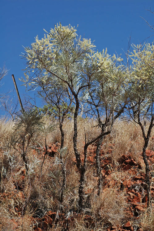
''Grevillea pyramidalis'', commonly known as the caustic bush, is a species of flowering plant in the family Proteaceae and is endemic to north-western Australia. It is an erect, spindly shrub or small tree with Leaf#Divisions of the blade , simple linear or Glossary of leaf morphology#pinnatisect, pinnatisect leaves with linear to narrowly egg-shaped lobes, and white to yellow or cream-coloured flowers. Description ''Grevillea pyramidalis'' is an erect, spindly shrub or tree that typically grows to a height of and has brownish branchlets. Its leaves are long simple, linear to narrowly egg-shaped with the narrower end towards the base, or pinnatisect. Pinnatisect leves have 2 to 20 erect lobes shaped like the simple leaves, the end lobes are long and wide and flattened laterally. The flowers are usually arranged on the ends of branches in clusters with 3 to 11 branches, each branch long, the flowers white to yellow or cream-coloured, the Gynoecium#Pistils, pistil long. Flow ... [...More Info...] [...Related Items...] OR: [Wikipedia] [Google] [Baidu] |
Karijini National Park
Karijini National Park is an List of national parks of Australia, Australian national park centred in the Hamersley Ranges of the Pilbara region in the northwestern section of Western Australia. The park is located north of the Tropic of Capricorn, from the state's capital city, Perth. Formerly known as Hamersley Range National Park, the park was officially renamed in 1991. At , Karijini is the second largest national park in Western Australia (behind Karlamilyi National Park). The park is physically split into a northern and a southern half by a corridor containing the Hamersley & Robe River railway and the Marandoo mine, Marandoo iron ore mine. The park is served by the Solomon Airport (Western Australia), Solomon Airport, located to the west. History The park is the traditional home of the Panyjima people, Banyjima, Kurrama and Innawonga Aboriginal people. The Banyjima name for the Hamersley Range is Karijini ("Hilly Place" in English). Evidence of their early occupati ... [...More Info...] [...Related Items...] OR: [Wikipedia] [Google] [Baidu] |
Carnarvon Bioregion
The Carnarvon xeric shrublands is a deserts and xeric shrublands ecoregion of Western Australia. The ecoregion is coterminous with the Carnarvon Interim Biogeographic Regionalisation for Australia (IBRA) bioregion.IBRA Version 6.1 data Location and description The ecoregion covers an area of 90,500 square kilometers (34,900 square miles) from the bounded by the to the west from the in Shark Bay up to the |
Grevillea
''Grevillea'', commonly known as spider flowers, is a genus of about 360 species of evergreen flowering plants in the family Proteaceae. Plants in the genus ''Grevillea'' are shrubs, rarely trees, with the leaves arranged alternately along the branches, the flowers zygomorphic, arranged in racemes at the ends of branchlets, and the fruit a follicle that splits down one side only, releasing one or two seeds. Description Plants in the genus ''Grevillea'' are shrubs, rarely small trees with simple or compound leaves arranged alternately along the branchlets. The flowers are zygomorphic and typically arranged in pairs along a sometimes branched raceme at the ends of branchlets. The flowers are bisexual, usually with four tepals in a single whorl. There are four stamens and the gynoecium has a single carpel. The fruit is a thin-walled follicle that splits down only one side, releasing one or two seeds before the next growing season. Taxonomy The genus ''Grevillea'' was first forma ... [...More Info...] [...Related Items...] OR: [Wikipedia] [Google] [Baidu] |
List Of Grevillea Species
This is a list of ''Grevillea'' species accepted by Plants of the World Online as of December 2021: A *'' Grevillea acacioides'' C.A.Gardner ex McGill. (W.A.) *'' Grevillea acanthifolia'' A.Cunn. – Acanthus-leaved grevillea (N.S.W.) *:''Grevillea acanthifolia'' A.Cunn. subsp. ''acanthifolia'' *:''Grevillea acanthifolia'' subsp. ''paludosa'' Makinson & Albr. — bog grevillea *:''Grevillea acanthifolia'' subsp. ''stenomera'' (F.Muell. ex Benth.) McGill. *'' Grevillea acerata'' McGill. (N.S.W.) *'' Grevillea acrobotrya'' Meisn. (W.A.) *'' Grevillea acropogon'' Makinson (W.A.) *'' Grevillea acuaria'' F.Muell. ex Benth. (W.A.) *'' Grevillea adenotricha'' McGill. (W.A.) *'' Grevillea agrifolia'' A.Cunn. ex R.Br. — blue grevillea (W.A., N.T.) *:''Grevillea agrifolia'' A.Cunn. ex R.Br. subsp. ''agrifolia'' *:''Grevillea agrifolia'' subsp. ''microcarpa'' (Olde & Marriott) Makinson *'' Grevillea albiflora'' C.T.White – white spider flower (N.S.W., Qld., S.A., N.T.) *'' Grevillea ... [...More Info...] [...Related Items...] OR: [Wikipedia] [Google] [Baidu] |
Prince Regent River
The Prince Regent River is a river in the Kimberley region of Western Australia. The headwaters of the river rise in the Caroline Range near Mount Agnes then flow in a north westerly direction. The river enters and flows through the Prince Regent National Park and past King Cascade and finally discharging into Saint George Basin and Hanover Bay to the Indian Ocean. The river runs a uniquely straight course following a fault line for the majority of its length. The river has six tributaries, including Quail Creek, Youwanjela Creek, Womarama Creek and Pitta Creek. The river was named in 1820 by the first European to find the river, Philip Parker King and the crew of ''Mermaid''. The river is named after the Hanoverian prince, King George IV, who was shortly to succeed his father to the throne. The first European to settle in the area was Joseph Bradshaw, who established Marigui homestead along the river with his cousin Aeneas Gunn in 1890. In 1891 he located the Gwion Gwion ... [...More Info...] [...Related Items...] OR: [Wikipedia] [Google] [Baidu] |
Broome, Western Australia
Broome, also known as Rubibi by the Yawuru people, is a coastal pearling and tourist town in the Kimberley region of Western Australia, north of Perth. In the the population was recorded as 14,660. It is the largest town in the Kimberley region. Geography Broome is located on Western Australia's tropical Kimberley coast on the eastern edge of the Indian Ocean. Roebuck Bay Being situated on a north–south peninsula, Broome has water on both sides of the town. On the eastern shore are the waters of Roebuck Bay extending from the main jetty at Port Drive to Sandy Point, west of Thangoo station. Town Beach is part of the shoreline and is popular with visitors on the eastern end of the town. It is the site of the 'Staircase to the Moon', where a receding tide and a rising moon combine to create a stunning natural phenomenon. On "Staircase to the Moon" nights, a food and craft market operates on Town Beach. Roebuck Bay is of international importance for the millions of migratin ... [...More Info...] [...Related Items...] OR: [Wikipedia] [Google] [Baidu] |
Katherine, Northern Territory
Katherine is a town in the Northern Territory of Australia. It is situated on the Katherine River, after which it is named, southeast of Darwin. It is the fourth largest settlement in the Territory and is known as the place where "The outback meets the tropics". Katherine had an urban population of approximately 6,300 at the 2016 Census. Katherine is also the closest major town to RAAF Base Tindal, located southeast, and provides education, health, local government services and employment opportunities for the families of Defence personnel stationed there. In the , the base had a residential population of 857, with only around 20% of the workforce engaged in employment outside of defence, the majority commuting to work in Katherine. Katherine is also the central hub of the great "Savannah Way" which stretches from Cairns in north Queensland to Broome in the Kimberley region of Western Australia. Beginning as an outpost established with the Australian Overland Telegraph ... [...More Info...] [...Related Items...] OR: [Wikipedia] [Google] [Baidu] |
Victoria Bonaparte
The Victoria Bonaparte, an interim Australian bioregion, is located in the Northern Territory and Western Australia,IBRA Version 6.1 data comprising . The bioregion draws its name from the Victoria River and the . See also *Geography of Australia
The geography of Australia encompasses a wide variety of biogeographi ...
[...More Info...] [...Related Items...] OR: [Wikipedia] [Google] [Baidu] |
Tanami Bioregion
Tanami is an interim Australian bioregion, comprising in the Northern Territory and Western Australia. It is part of the Great Sandy-Tanami desert ecoregion. The bioregion has the code TAN. There are three subregions. See also *Geography of Australia The geography of Australia encompasses a wide variety of biogeographic regions being the world's smallest continent, while comprising the territory of the sixth-largest country in the world. The population of Australia is concentrated along ... References Further reading * Thackway, R and I D Cresswell (1995) ''An interim biogeographic regionalisation for Australia : a framework for setting priorities in the National Reserves System Cooperative Program'' Version 4.0 Canberra : Australian Nature Conservation Agency, Reserve Systems Unit, 1995. {{Northern Territory IBRA regions Biogeography of Western Australia Biogeography of the Northern Territory ... [...More Info...] [...Related Items...] OR: [Wikipedia] [Google] [Baidu] |
Pilbara Shrublands
The Pilbara shrublands is a deserts and xeric shrublands ecoregion in Western Australia. It is coterminous with the Pilbara IBRA region. For other definitions and uses of "Pilbara region" see Pilbara. Geography The Pilbara shrublands is bounded on the north by the Indian Ocean, and on the west, south, and east by other deserts and xeric shrubland ecoregions - the Carnarvon xeric shrublands to the west, the Western Australian mulga shrublands to the south, and the Great Sandy-Tanami desert to the east and northeast. The Pilbara geographic region covers most of the ecoregion, and extends east into the Great Sandy desert. The Hamersley Range, a region of mountain ranges and plateaus dissected by gorges, lies in the southern portion of the ecoregion. The Fortescue Plains extend east and west to the north of the Hamersley Range, forming the upper basin of the Fortescue River. The Chichester Plateau lies north of the Fortescue Plains. The Roebourne subregion encompasses the coas ... [...More Info...] [...Related Items...] OR: [Wikipedia] [Google] [Baidu] |
Ord Victoria Plain
The Ord Victoria Plain, an interim Australian bioregion, is located in the Northern Territory and Western Australia, comprising .IBRA Version 6.1 data The bioregion draws its name from the and the Victoria River. Location and description This is an area of large plains of dry grassland lying between the to the south and the wetter, greener grassland to the north towards the coast. Sandstone outcrops rise ...[...More Info...] [...Related Items...] OR: [Wikipedia] [Google] [Baidu] |
Northern Kimberley
The Northern Kimberley, an interim Australian bioregion, is located in the northern Kimberley region of Western Australia,IBRA Version 6.1 data comprising . It is composed of two recognised sub-regions: Mitchell and Berkeley subregions. See also *Geography of Australia
The geography of Australia encompasses a wide variety of biogeographic regions being the world's smallest continent, while comprising the territory of the sixth-largest country in the world. The population of Australia is concentrated along ...
References Further reading * Thack ...[...More Info...] [...Related Items...] OR: [Wikipedia] [Google] [Baidu] |


