|
Greenrow
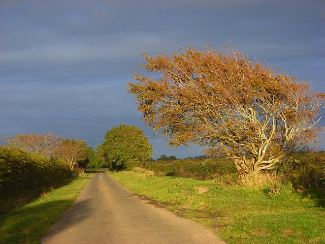
Greenrow is a village in the civil parish of Holme Low in Cumbria, United Kingdom. It is located about 10 miles west of Wigton, near the town of Silloth. Villages in Cumbria Silloth {{Cumbria-geo-stub ... [...More Info...] [...Related Items...] OR: [Wikipedia] [Google] [Baidu] |
Holme Low
Holme Low is a civil parish in the Allerdale borough of Cumbria, United Kingdom. It borders the parishes of Holme St. Cuthbert and Holme Abbey to the south, the town of Silloth-on-Solway to the north-west, and has a short stretch of coastline on the Solway Firth to the west. To the north, it is bordered by lands common to Holme St. Cuthbert, Holme Low, and Holme Abbey, which is an unpopulated area. Holme Low had a population of 373 in 137 households at the 2001 census, reducing slightly in the 2011 Census to a population of 362 in 162 households. The parish is entirely rural, and the population is scattered in small hamlets. Holme Low includes the hamlets of Barracks Bridge, Blackdyke, Blitterlees, Calvo, Causewayhead, Greenrow, Seaville and Wolsty. There are bus services available in the parish, with several Silloth-bound routes passing through or close by. The number 60 from Silloth runs every two hours to Maryport along the B5300 coast road, and stops at Blitterlees, Beck ... [...More Info...] [...Related Items...] OR: [Wikipedia] [Google] [Baidu] |
Silloth-on-Solway
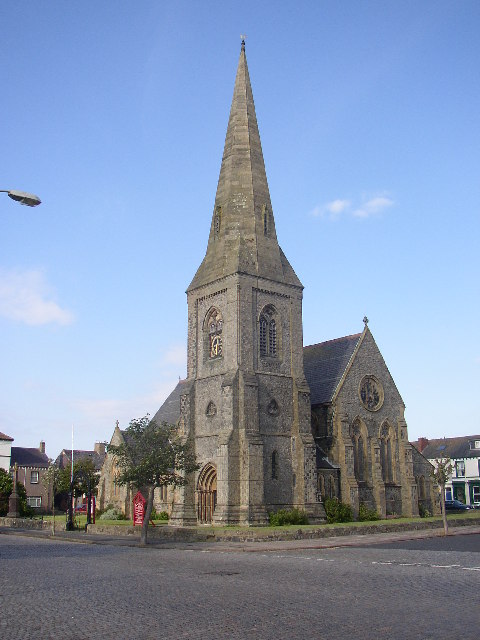
Silloth (sometimes known as Silloth-on-Solway) is a port town and civil parish in the Allerdale borough of Cumbria, England. Historic counties of England, Historically in the county of Cumberland, the town is an example of a Victorian era, Victorian seaside resort in the Northern England, North of England. Silloth had a population of 2,932 at the 2001 Census, falling slightly to 2,906 at the 2011 Census. Location It sits on the shoreline of the Solway Firth, north of Workington and west of Carlisle, Cumbria, Carlisle. The town of Maryport lies south, down the B5300 road, B5300 coast road which also passes through the villages of Blitterlees, Beckfoot, Mawbray, and Allonby. Wigton is east, along the B5302 road, which also passes through the village of Abbeytown, southeast. History Silloth developed in the 1860s onwards around the terminus of the railway from Carlisle and associated docks which had begun construction in 1855 to replace Port Carlisle as the deep-water por ... [...More Info...] [...Related Items...] OR: [Wikipedia] [Google] [Baidu] |
Cumberland (unitary Authority)
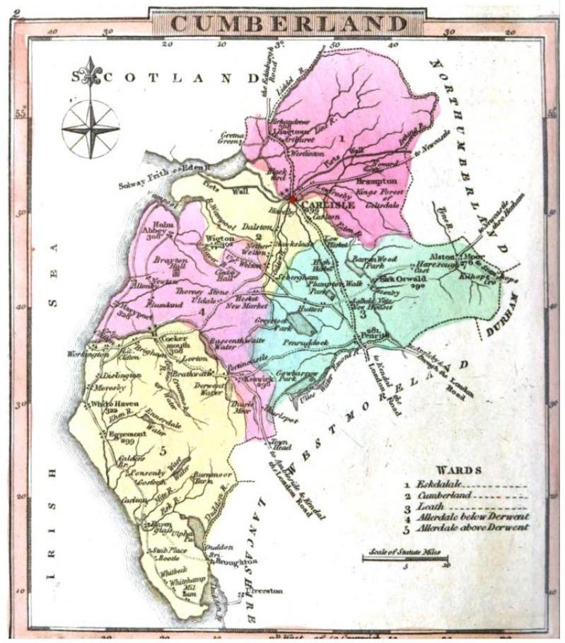
Cumberland is a future unitary local government area in north-west England. Together with Westmorland and Furness, it will be formally established on 1 April 2023 when Cumbria County Council is abolished. The district will consist of the areas covered by the current districts of Allerdale, Carlisle and Copeland, which will also cease to function. It will cover 77% of the area of, and 90% of the population of, the historic county of Cumberland. The authority will sit within the ceremonial county of Cumbria, which will no longer have any administrative function. The authority is named after the historic county of Cumberland, which was abolished for administrative purposes in 1974. Penrith and the surrounding area is the part of the historic county which is excluded from the new council area. Penrith will instead fall within Westmorland and Furness. Governance The first elections to Cumberland Council took place in May 2022, with the council acting as a 'shadow authority' until ... [...More Info...] [...Related Items...] OR: [Wikipedia] [Google] [Baidu] |
Workington (UK Parliament Constituency)
Workington is a Constituencies of the Parliament of the United Kingdom, constituency in Cumbria represented in the House of Commons of the United Kingdom, House of Commons of the Parliament of the United Kingdom, UK Parliament since 2019 United Kingdom general election, 2019 by Mark Jenkinson, a Conservative Party (UK), Conservative. Boundaries The constituency covers much of the north-west of Cumbria, corresponding largely to the Allerdale borough, except for the areas around Wigton and Keswick, Cumbria, Keswick. As well as Workington itself, the constituency contains the towns of Cockermouth, Maryport, Aspatria and Silloth. Boundary review 1918–1950: The Municipal Borough of Workington, the Urban Districts of Arlecdon and Frizington, Aspatria, Harrington, and Maryport, and parts of the Rural Districts of Cockermouth, Whitehaven, and Wigton. 1950–1983: The Municipal Borough of Workington, the Urban Districts of Cockermouth, Keswick, and Maryport, and the Rural District of ... [...More Info...] [...Related Items...] OR: [Wikipedia] [Google] [Baidu] |
Allerdale
Allerdale is a non-metropolitan district of Cumbria, England, with borough status. Its council is based in Workington and the borough has a population of 93,492 according to the 2001 census, increasing to 96,422 at the 2011 Census. The Borough of Allerdale was formed under the Local Government Act 1972, on 1 April 1974 by the merger of the municipal borough of Workington, the urban districts of Maryport, Cockermouth and Keswick; and the rural districts of Cockermouth and Wigton, all of which were within the administrative county of Cumberland. In 1995 Allerdale was granted borough status. The name derives from the ancient region of Allerdale, represented latterly by the two wards of Cumberland, called Allerdale-above-Derwent and Allerdale-below-Derwent, the present borough corresponding largely to the latter with parts of the former. Much of the area during the medieval period was a royal forest subject to forest law. In July 2021 the Ministry of Housing, Communities an ... [...More Info...] [...Related Items...] OR: [Wikipedia] [Google] [Baidu] |
Cumbria
Cumbria ( ) is a ceremonial and non-metropolitan county in North West England, bordering Scotland. The county and Cumbria County Council, its local government, came into existence in 1974 after the passage of the Local Government Act 1972. Cumbria's county town is Carlisle, in the north of the county. Other major settlements include Barrow-in-Furness, Kendal, Whitehaven and Workington. The administrative county of Cumbria consists of six districts ( Allerdale, Barrow-in-Furness, Carlisle, Copeland, Eden and South Lakeland) and, in 2019, had a population of 500,012. Cumbria is one of the most sparsely populated counties in England, with 73.4 people per km2 (190/sq mi). On 1 April 2023, the administrative county of Cumbria will be abolished and replaced with two new unitary authorities: Westmorland and Furness (Barrow-in-Furness, Eden, South Lakeland) and Cumberland ( Allerdale, Carlisle, Copeland). Cumbria is the third largest ceremonial county in England by area. It i ... [...More Info...] [...Related Items...] OR: [Wikipedia] [Google] [Baidu] |
Wigton
Wigton is a market town in the Allerdale borough of Cumbria, England. Historically in Cumberland, it lies just outside the Lake District in the borough of Allerdale. Wigton is at the centre of the Solway Plain, between the Caldbeck Fells and the Solway coast. It is served by Wigton railway station on the Cumbrian Coast Line, and the A596 road to Workington. The town of Silloth-on-Solway lies to the west, beyond Abbeytown. Etymology Wigton is "Wicga's tūn". "Wicga" is an Old English pre-7th-century personal name meaning "a beetle" (as in "earwig"), while "tūn" is Old English for a demarcated plot, a "homestead" or "village", so Wigton is "the hamlet belonging to Wicga". History On the River Wampool and Wiza Beck ( beck being a dialect word meaning "brook" or "stream" – from the Old Norse ''bekkr''), the market town of Wigton is an ancient settlement and evolved from a pre-medieval street plan, which can still be traced today. The Romans had a cavalry station, Maglo ... [...More Info...] [...Related Items...] OR: [Wikipedia] [Google] [Baidu] |
Silloth
Silloth (sometimes known as Silloth-on-Solway) is a port town and civil parish in the Allerdale borough of Cumbria, England. Historically in the county of Cumberland, the town is an example of a Victorian seaside resort in the North of England. Silloth had a population of 2,932 at the 2001 Census, falling slightly to 2,906 at the 2011 Census. Location It sits on the shoreline of the Solway Firth, north of Workington and west of Carlisle. The town of Maryport lies south, down the B5300 coast road which also passes through the villages of Blitterlees, Beckfoot, Mawbray, and Allonby. Wigton is east, along the B5302 road, which also passes through the village of Abbeytown, southeast. History Silloth developed in the 1860s onwards around the terminus of the railway from Carlisle and associated docks which had begun construction in 1855 to replace Port Carlisle as the deep-water port for Carlisle. Workers from the factories of Carlisle were presented with access to t ... [...More Info...] [...Related Items...] OR: [Wikipedia] [Google] [Baidu] |
Villages In Cumbria
A village is a clustered human settlement or community, larger than a hamlet but smaller than a town (although the word is often used to describe both hamlets and smaller towns), with a population typically ranging from a few hundred to a few thousand. Though villages are often located in rural areas, the term urban village is also applied to certain urban neighborhoods. Villages are normally permanent, with fixed dwellings; however, transient villages can occur. Further, the dwellings of a village are fairly close to one another, not scattered broadly over the landscape, as a dispersed settlement. In the past, villages were a usual form of community for societies that practice subsistence agriculture, and also for some non-agricultural societies. In Great Britain, a hamlet earned the right to be called a village when it built a church. [...More Info...] [...Related Items...] OR: [Wikipedia] [Google] [Baidu] |


