|
Greenock West Railway Station
, symbol_location = gb , symbol = rail , image = File:Greenock West station 210708d platform 1.jpg , caption = View west from under Inverkip Street to footbridge, aqueduct and Newton Street tunnel , borough = Greenock, Inverclyde , country = Scotland , coordinates = , grid_name = Grid reference , grid_position = , manager = ScotRail , platforms = 2 , code = GKW , years = 1 June 1889 , events = Opened , mpassengers = , footnotes = Passenger statistics from the Office of Rail and Road Greenock West railway station is a station in Greenock, Scotland, located on the Inverclyde Line which runs from Gourock to Glasgow Central. The route is currently operated by ScotRail under the auspices of Strathclyde Partnership for Transport. Each service to and from Glasgow on the Inverclyde Line stops at th ... [...More Info...] [...Related Items...] OR: [Wikipedia] [Google] [Baidu] |
Greenock
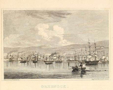
Greenock (; sco, Greenock; gd, Grianaig, ) is a town and administrative centre in the Inverclyde council areas of Scotland, council area in Scotland, United Kingdom and a former burgh of barony, burgh within the Counties of Scotland, historic county of Renfrewshire (historic), Renfrewshire, located in the west central Lowlands of Scotland. It forms part of a contiguous urban area with Gourock to the west and Port Glasgow to the east. The United Kingdom Census 2011, 2011 UK Census showed that Greenock had a population of 44,248, a decrease from the 46,861 recorded in the United Kingdom Census 2001, 2001 UK Census. It lies on the south bank of the Clyde at the "Tail of the Bank" where the River Clyde deepens into the Firth of Clyde. History Name Place-name scholar William J. Watson wrote that "Greenock is well known in Gaelic as Grianáig, dative of grianág, a sunny knoll". The Scottish Gaelic place-name ''Grianaig'' is relatively common, with another (Greenock) near Calla ... [...More Info...] [...Related Items...] OR: [Wikipedia] [Google] [Baidu] |
Glasgow And South Western Railway
The Glasgow and South Western Railway (G&SWR) was a railway company in Scotland. It served a triangular area of south-west Scotland between Glasgow, Stranraer and Carlisle. It was formed on 28 October 1850 by the merger of two earlier railways, the Glasgow, Paisley, Kilmarnock and Ayr Railway and the Glasgow, Dumfries and Carlisle Railway. Already established in Ayrshire, it consolidated its position there and extended southwards, eventually reaching Stranraer. Its main business was mineral traffic, especially coal, and passengers, but its more southerly territory was very thinly populated and local traffic, passenger and goods, was limited, while operationally parts of its network were difficult. It later formed an alliance with the English Midland Railway and ran express passenger trains from Glasgow to London with that company, in competition with the Caledonian Railway and its English partner, the London and North Western Railway, who had an easier route. In 1923 the G&S ... [...More Info...] [...Related Items...] OR: [Wikipedia] [Google] [Baidu] |
Siding (rail)
A siding, in rail terminology, is a low-speed track section distinct from a running line or through route such as a main line, branch line, or spur. It may connect to through track or to other sidings at either end. Sidings often have lighter rails, meant for lower speed or less heavy traffic, and few, if any, signals. Sidings connected at both ends to a running line are commonly known as loops; those not so connected may be referred to as single-ended or dead-end sidings, or (if short) stubs. Functions Sidings may be used for marshalling (classifying), stabling, storing, loading, and unloading vehicles. Common sidings store stationary rolling stock, especially for loading and unloading. Industrial sidings (also known as spurs) go to factories, mines, quarries, wharves, warehouses, some of them are essentially links to industrial railways. Such sidings can sometimes be found at stations for public use; in American usage these are referred to as team tracks (after the use ... [...More Info...] [...Related Items...] OR: [Wikipedia] [Google] [Baidu] |
Aqueduct (bridge)
Aqueducts (or water bridges) are bridges constructed to convey watercourses across gaps such as valleys or ravines. The term ''aqueduct'' may also be used to refer to the Aqueduct (water supply), entire watercourse, as well as the bridge. Large navigable aqueducts are used as transport links for boats or ships. Aqueducts must span a crossing at the same level as the watercourses on each end. The word is derived from the Latin language, Latin ' ("water") and ' ("to lead"), therefore meaning "to lead water". A modern version of an aqueduct is a pipeline bridge. They may take the form of tunnels, networks of surface channels and canals, covered clay pipes or monumental bridges. Ancient bridges for water Although particularly associated with the Roman aqueduct, Romans, aqueducts were likely first used by the Minoans around 2000 BCE. The Minoans had developed what was then an extremely advanced irrigation system, including several aqueducts. In the seventh century BCE, the Neo-Ass ... [...More Info...] [...Related Items...] OR: [Wikipedia] [Google] [Baidu] |
Culvert
A culvert is a structure that channels water past an obstacle or to a subterranean waterway. Typically embedded so as to be surrounded by soil, a culvert may be made from a pipe, reinforced concrete or other material. In the United Kingdom, the word can also be used for a longer artificially buried watercourse. Culverts are commonly used both as cross-drains to relieve drainage of ditches at the roadside, and to pass water under a road at natural drainage and stream crossings. When they are found beneath roads, they are frequently empty. A culvert may also be a bridge-like structure designed to allow vehicle or pedestrian traffic to cross over the waterway while allowing adequate passage for the water. Culverts come in many sizes and shapes including round, elliptical, flat-bottomed, open-bottomed, pear-shaped, and box-like constructions. The culvert type and shape selection is based on a number of factors including requirements for hydraulic performance, limitations on up ... [...More Info...] [...Related Items...] OR: [Wikipedia] [Google] [Baidu] |
Sugar Refinery
A sugar refinery is a refinery which processes raw sugar from cane or beets into white refined sugar. Many cane sugar mills produce raw sugar, which is sugar that still contains molasses, giving it more colour (and impurities) than the white sugar which is normally consumed in households and used as an ingredient in soft drinks and foods. While cane sugar does not need refining to be palatable, sugar from sugar beet is almost always refined to remove the strong, usually unwanted, taste of beets from it. The refined sugar produced is more than 99 percent pure sucrose. Many sugar mills only operate during the harvest season, whereas refineries may work the year round. Sugar beet refineries tend to have shorter periods when they process beet than cane refineries, but may store intermediate product and process it in the off-season. Raw sugar is either processed and sold locally, or is exported and refined elsewhere. History Sugar refineries date back to Arab Egypt in the 12th ... [...More Info...] [...Related Items...] OR: [Wikipedia] [Google] [Baidu] |
Greenock West Station 210708b From Newton St
Greenock (; sco, Greenock; gd, Grianaig, ) is a town and administrative centre in the Inverclyde council area in Scotland, United Kingdom and a former burgh within the historic county of Renfrewshire, located in the west central Lowlands of Scotland. It forms part of a contiguous urban area with Gourock to the west and Port Glasgow to the east. The 2011 UK Census showed that Greenock had a population of 44,248, a decrease from the 46,861 recorded in the 2001 UK Census. It lies on the south bank of the Clyde at the "Tail of the Bank" where the River Clyde deepens into the Firth of Clyde. History Name Place-name scholar William J. Watson wrote that "Greenock is well known in Gaelic as Grianáig, dative of grianág, a sunny knoll". The Scottish Gaelic place-name ''Grianaig'' is relatively common, with another (Greenock) near Callander in Menteith (formerly in Perthshire) and yet another at Muirkirk in Kyle, now in East Ayrshire. R. M. Smith in (1921) described the a ... [...More Info...] [...Related Items...] OR: [Wikipedia] [Google] [Baidu] |
Caledonian Railway 80 Class
Caledonian is a geographical term used to refer to places, species, or items in or from Scotland, or particularly the Scottish Highlands. It derives from Caledonia, the Roman name for the area of modern Scotland. Caledonian is also used to refer to places or people in or from New Caledonia. Caledonian may also refer to: Transport * ''Caledonian'' (ship), several ships with the name * Caledonian (locomotive), an early locomotive of the Liverpool and Manchester Railway * The Caledonian, discontinued British passenger train * Caledonian Airways, former Scottish airline * Caledonian Canal, between Inverness and Fort William, Scotland * Caledonian Railway, former Scottish railway company * Caledonian Railway (Brechin), preserved steam railway * Caledonian Road (other), the name of several places in London, England * Caledonian Sleeper, a sleeper train service in Scotland Sports * Caledonian F.C., former football club from Inverness * Inverness Caledonian Thistle F ... [...More Info...] [...Related Items...] OR: [Wikipedia] [Google] [Baidu] |
Dugald Drummond
Dugald Drummond (1 January 1840 – 8 November 1912) was a Scottish steam locomotive engineer. He had a career with the North British Railway, LB&SCR, Caledonian Railway and London and South Western Railway. He was the older brother of the engineer Peter Drummond, who often followed Dugald's ideas in his own work. He was a major locomotive designer and builder and many of his London and South Western Railway engines continued in main line service with the Southern Railway to enter British Railways service in 1947. Career Drummond was born in Ardrossan, Ayrshire on 1 January 1840. His father was permanent way inspector for the Bowling Railway. Drummond was apprenticed to Forest & Barr of Glasgow gaining further experience on the Dumbartonshire and Caledonian Railways. He was in charge of the boiler shop at the Canada Works, Birkenhead of Thomas Brassey before moving to the Edinburgh and Glasgow Railway's Cowlairs railway works in 1864 under Samuel Waite Johnson. He beca ... [...More Info...] [...Related Items...] OR: [Wikipedia] [Google] [Baidu] |
Fort Matilda Railway Station
, symbol_location = gb , symbol = rail , image = Fort Matilda station.jpg , caption = Looking west as a train leaves for Gourock , borough = Fort Matilda, Inverclyde , country = Scotland , coordinates = , grid_name = Grid reference , grid_position = , manager = ScotRail , platforms = 2 , code = FTM , original = Caledonian Railway , pregroup = Caledonian Railway , postgroup = London, Midland and Scottish Railway , years = 1 June 1889 , events = Opened , years1 = 5 February 1973 , events1 = Temporarily closed , years2 = 20 April 1973 , events2 = Reopened , years3 = October 1993 , events3 = Closed , years4 = ? , events4 = Reopened , mpassengers = , footnotes ... [...More Info...] [...Related Items...] OR: [Wikipedia] [Google] [Baidu] |
Lyle Hill
Lyle Hill stands at the West End of Greenock in Inverclyde, Scotland. It has scenic viewpoints accessible from Lyle Road, which was constructed in 1879–1880 and named after Provost Abram Lyle, well known as a sugar refiner. The hill's highest point is Craigs Top at 426 feet (130 m) above sea level, and before the road was constructed the hill was known as the Craigs, or as the Bingens (with various spellings). Adjacent to the highest point of the road, a scenic viewpoint looks out over Gourock and the Firth of Clyde to Cowal in the west, and north over the Fort Matilda area of Greenock to Argyll across the Clyde. There are benches, information points, and a beacon which is lit on significant occasions. Car parking spaces give views to the west, and a short distance further down the road the Free French Memorial is in the shape of the Cross of Lorraine combined with an anchor. Across the road, steps and a rough path lead up to a viewpoint at Craigs Top with views up t ... [...More Info...] [...Related Items...] OR: [Wikipedia] [Google] [Baidu] |
Grid Plan
In urban planning, the grid plan, grid street plan, or gridiron plan is a type of city plan in which streets run at right angles to each other, forming a grid. Two inherent characteristics of the grid plan, frequent intersections and orthogonal geometry, facilitate movement. The geometry helps with orientation and wayfinding and its frequent intersections with the choice and directness of route to desired destinations. In ancient Rome, the grid plan method of land measurement was called centuriation. The grid plan dates from antiquity and originated in multiple cultures; some of the earliest planned cities were built using grid plans in Indian subcontinent. History Ancient grid plans By 2600 BC, Mohenjo-daro and Harappa, major cities of the Indus Valley civilization, were built with blocks divided by a grid of straight streets, running north–south and east–west. Each block was subdivided by small lanes. The cities and monasteries of Sirkap, Taxila and Thimi (in the Ind ... [...More Info...] [...Related Items...] OR: [Wikipedia] [Google] [Baidu] |


.jpg)


