|
Gravel Place, Pennsylvania
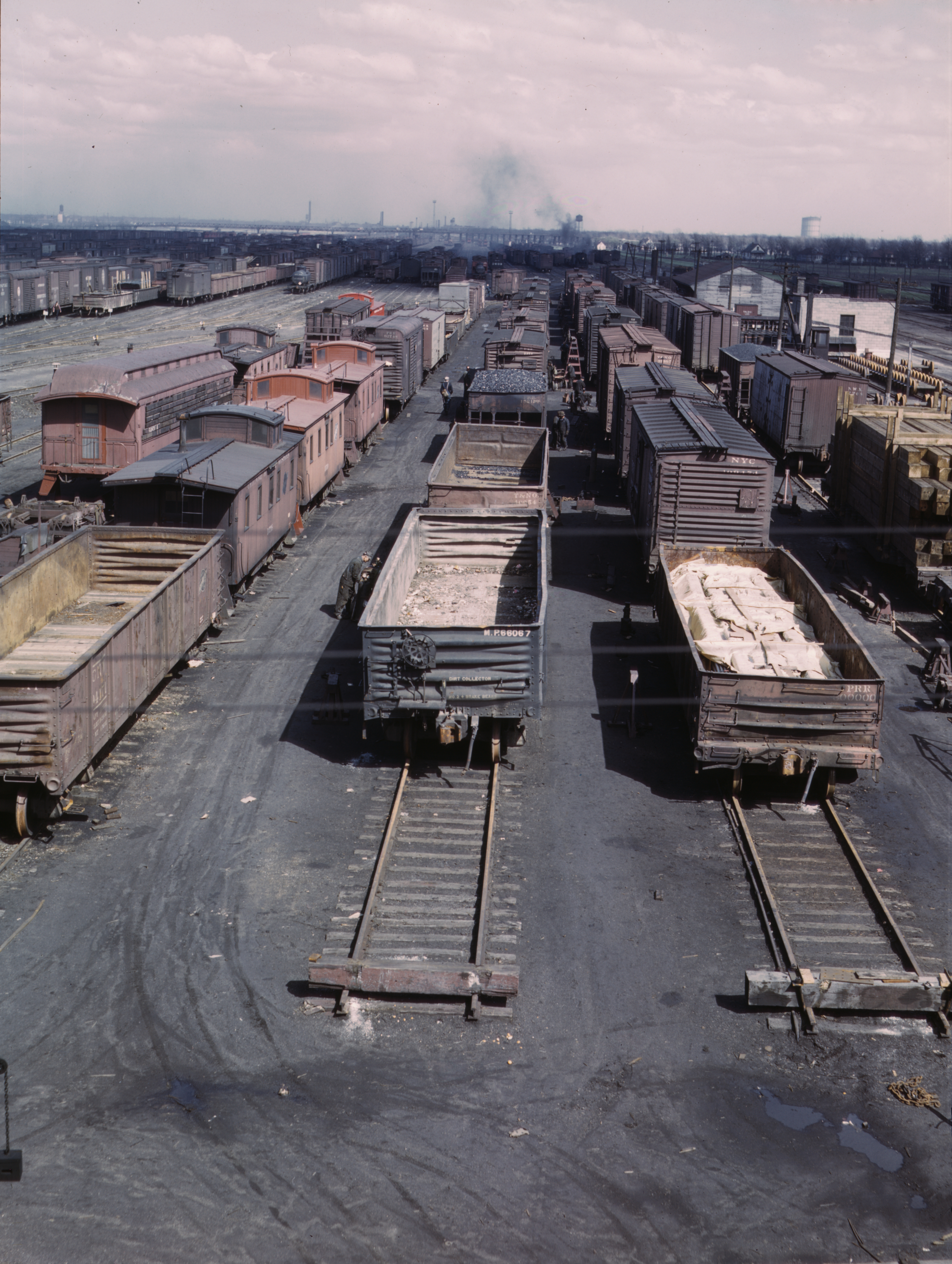
Gravel Place is a location within Arlington Heights, Pennsylvania, about northeast of East Stroudsburg. It is neither incorporated nor a census-designated place, but has a name recognized by the USGS. From the 1880s to about 1950, it was a railroad yard of the Delaware, Lackawanna and Western Railroad (DL&W) on its mainline from Hoboken Terminal in New Jersey, which served New York City by ferry, to Scranton, Pennsylvania, continuing northwest into New York State with its western terminus in Buffalo, New York. It is just north of present Mill Creek Road. NYS&W interchange The New York, Susquehanna and Western Railway (NYS&W) was formed in June, 1881 through the merger of several small railroads. It had an agreement with the DL&W which called for the DL&W to haul coal from mines in northeastern Pennsylvania, primarily from Pennsylvania Anthracite Coal Company and Lackawanna Coal Company mines near Scranton, to an interchange with the NYS&W at Gravel Place. The NYS&W would take it ... [...More Info...] [...Related Items...] OR: [Wikipedia] [Google] [Baidu] |
Arlington Heights, Pennsylvania
Arlington Heights is a census-designated place (CDP) in Monroe County, Pennsylvania, United States. The population was 6,331 at the 2020 census. One notable location in Arlington Heights is the Stroud Mall. Arlington Heights is northeast of Allentown, Pennsylvania, Allentown and northwest of New York City. Geography Arlington Heights is located at (41.002024, -75.207766). According to the United States Census Bureau, the CDP has a total area of , of which is land and (0.38%) is water. Arlington Heights is served by exit 303 on Interstate 80 in Pennsylvania, Interstate 80. Pennsylvania Route 611, PA 611 serves as the main thoroughfare in the community. Demographics As of the census of 2000, there were 5,132 people, 2,055 households, and 1,432 families residing in the CDP. The population density was . There were 2,131 housing units at an average density of . The racial makeup of the CDP was 90.57% White (U.S. Census), White, 4.38% African American (U.S. Census), African A ... [...More Info...] [...Related Items...] OR: [Wikipedia] [Google] [Baidu] |
NYS&W
The New York, Susquehanna and Western Railway (or New York, Susquehanna and Western Railroad and also known as the Susie-Q or the Susquehanna) is a Class II American freight railway operating over 400 miles (645 km) of track in the northeastern U.S. states of New York, Pennsylvania, and New Jersey. The railroad was formed in 1881 from the merger of several smaller railroads. Passenger service in northern New Jersey was offered until 1966. The railroad was purchased by the Delaware Otsego Corporation in 1980, and saw success during the 1980s and 1990s in the intermodal freight transport business. The railroad uses three main routes: a Southern Division running from Jersey City, New Jersey to Binghamton, New York and a Northern Division formed by two branches north of Binghamton serving Utica and Syracuse. The Utica Branch is notable for street running down the center of Schuyler Street. History Before the New York, Susquehanna and Western Railway The New York ... [...More Info...] [...Related Items...] OR: [Wikipedia] [Google] [Baidu] |
Pocono Mountains
The Pocono Mountains, commonly referred to as the Poconos , are a geographical, geological, and cultural region in Northeastern Pennsylvania. They overlook the Delaware River and Delaware Water Gap to the east, Lake Wallenpaupack to the north, Wyoming Valley and the Coal Region to the west, and the Lehigh Valley to the south. The name Pocono is derived from the Munsee word Pokawachne, which means "Creek Between Two Hills". Much of the Poconos region lies within the Greater New York–Newark, NY–NJ–CT–PA Combined Statistical Area. The wooded hills and valleys have long been a popular recreation area, accessible within a two-hour drive to millions of metropolitan area residents, with many Pocono communities having resort hotels with fishing, hunting, skiing, and other sports facilities. The Poconos are an upland of the larger Allegheny Plateau, forming a escarpment. Population The Pocono Mountains are a popular recreational destination for local and regional visitors. ... [...More Info...] [...Related Items...] OR: [Wikipedia] [Google] [Baidu] |
Pocono Summit
Pocono Summit is a unincorporated community and census-designated place located in Monroe County, Pennsylvania. Parts of Pocono Summit are located in the municipalities of Coolbaugh and Tobyhanna townships. Geography Pocono Summit is located at (41.111, -75.386). According to the U.S. Census Bureau, Pocono Summit has a total area of 16.1 square miles (41.7 km), 95% of it land. Pocono Summit is home to Stillwater Lake and Pocono Summit Lake. Demographics As of the census of 2010, there were 2,964 people living in the area. Education The Pocono Mountain School District's Sullivan Trail campus is located in Pocono Summit; the campus includes Pocono Mountain West High School and Pocono Mountain West Junior High School. Recreation Pocono Summit is home to Camp Minsi, a Boy Scout camp located on the western shores of Stillwater Lake. The camp was first opened in 1949 and encompasses more than . The area also includes portions of Pennsylvania State Game Lands 127. Transpor ... [...More Info...] [...Related Items...] OR: [Wikipedia] [Google] [Baidu] |
Pusher Locomotive
A bank engine (United Kingdom/Australia) (colloquially a banker), banking engine, helper engine or pusher engine (North America) is a railway locomotive that temporarily assists a train that requires additional power or traction to climb a gradient (or ''bank''). Helpers/bankers are most commonly found in mountain divisions (called "helper districts" in the United States), where the ruling grade may demand the use of substantially greater motive power than that required for other grades within the division. Historic practice Helpers/bankers were most widely used during the age of steam, especially in the American West, where significant grades are common and trains are long. The development of advanced braking systems and diesel-electric or electric locomotives has eliminated the everyday need for bankers/helpers in all but a few locations. With the advent of dynamic brakes on electric or diesel-electric locomotives, helpers/bankers can also be used to provide more braking f ... [...More Info...] [...Related Items...] OR: [Wikipedia] [Google] [Baidu] |
Cripple Track
A RIP track, short for ''repair in place'' track, (also known as a "cripple track" in slang terms) is a designated track, or tracks, in a rail yard or a siding along a section of a main rail line where locomotives and/or railroad cars can be placed for minor repairs. A RIP tracks allows for minor repairs to be done without removing the units from service and sometimes allows for these repairs to be done without removing a freight load from the car. In some yards, a RIP track may be used for staging locomotives or damaged cars for major repairs and some rail yards may have more than one RIP track to serve both functions. Usage When it is discovered that an unloaded freight car requires repairs, they are normally sent to the repair shops. However, mechanical defects often do not show up, or are not discovered, until after a freight car has been loaded and is in transit. Obviously, it would be expensive and entail considerable delay to have to unload a defective car and transfe ... [...More Info...] [...Related Items...] OR: [Wikipedia] [Google] [Baidu] |
Railway Roundhouse
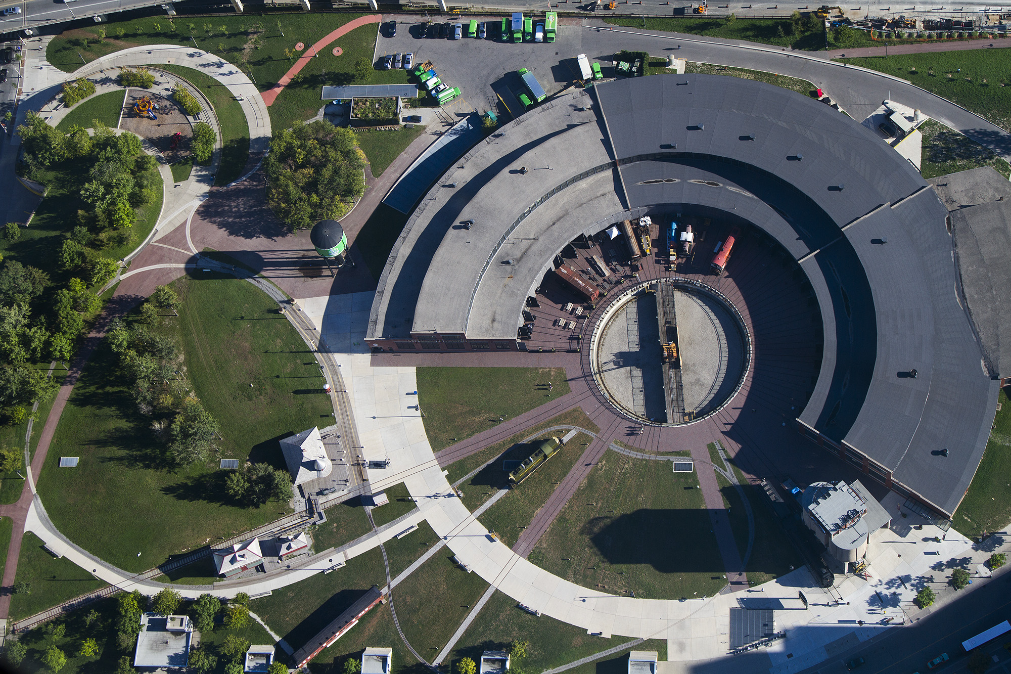
A railway roundhouse is a building with a circular or semicircular shape used by railways for servicing and storing locomotives. Traditionally, though not always the case today, these buildings surrounded or were adjacent to a turntable A phonograph, in its later forms also called a gramophone (as a trademark since 1887, as a generic name in the UK since 1910) or since the 1940s called a record player, or more recently a turntable, is a device for the mechanical and analogu .... Overview Early steam locomotives normally traveled forwards only. Although reverse operations capabilities were soon built into locomotive mechanisms, the controls were normally optimized for forward travel, and the locomotives often could not operate as well in reverse. Some Passenger car (rail), passenger cars, such as observation cars, were also designed as late as the 1960s for operations in a particular direction. Turntables allowed locomotives or other rolling stock to be turned aroun ... [...More Info...] [...Related Items...] OR: [Wikipedia] [Google] [Baidu] |
Wilkes-Barre
Wilkes-Barre ( or ) is a city in the U.S. state of Pennsylvania and the county seat of Luzerne County. Located at the center of the Wyoming Valley in Northeastern Pennsylvania, it had a population of 44,328 in the 2020 census. It is the second-largest city, after Scranton, in the Scranton–Wilkes-Barre–Hazleton, PA Metropolitan Statistical Area, which had a population of 563,631 as of the 2010 census and is the fourth-largest metropolitan area in Pennsylvania after the Delaware Valley, Greater Pittsburgh, and the Lehigh Valley with an urban population of 401,884. Scranton/Wilkes-Barre is the cultural and economic center of a region called Northeastern Pennsylvania, which is home to over 1.3 million residents. Wilkes-Barre and the surrounding Wyoming Valley are framed by the Pocono Mountains to the east, the Endless Mountains to the north and west, and the Lehigh Valley to the south. The Susquehanna River flows through the center of the valley and defines the northwe ... [...More Info...] [...Related Items...] OR: [Wikipedia] [Google] [Baidu] |
Stroudsburg
Stroudsburg is a borough in Monroe County, Pennsylvania. It lies within the Poconos region, approximately five miles (8 km) from the Delaware Water Gap at the confluence of the Brodhead, McMichaels and Pocono Creeks in Northeastern Pennsylvania. It is also the county seat of Monroe County. Stroudsburg is part of the East Stroudsburg, PA Metropolitan Statistical Area, which in turn is part of the New York combined statistical area. The population was 5,927 at the 2020 census. Stroudsburg is northeast of Allentown and northwest of New York City. History Stroudsburg was laid out by Colonel Jacob Stroud (1735–1806) in 1799. Jacob Stroud's family had founded Stroudsburg in the mid-1700s. The Academy Hill Historic District, Kitson Woolen Mill, Monroe County Courthouse, and Stroud Mansion are listed on the National Register of Historic Places. Geography Stroudsburg is located at (40.985764, -75.195352). According to the United States Census Bureau, the borough has a ... [...More Info...] [...Related Items...] OR: [Wikipedia] [Google] [Baidu] |
Wilkes-Barre And Eastern Railroad
The Wilkes-Barre and Eastern Railroad (WB&E) was a railroad that operated in Pennsylvania from 1892 to 1939. History The WB&E was a wholly owned subsidiary of the New York, Susquehanna and Western Railroad (NYS&W). It was chartered in 1892 to provide the NYS&W with a route to bring coal from the mines in northeastern Pennsylvania for delivery to the port of Edgewater, New Jersey. Previously, the NYS&W was contracting the coal haulage in Pennsylvania to the Delaware, Lackawanna and Western Railroad (DL&W). The DL&W originally hauled coal to their interchange with the NYS&W at Gravel Place, Pennsylvania. From there, the NYS&W would haul the coal to an interchange with the Pennsylvania Railroad in New Jersey. With the WB&E and exclusive control of distribution facilities at the port in Edgewater, the NYS&W had a direct way to move the coal from the mine to various markets without having to rely on (and pay) two additional railroads for haulage. Wilkes-Barre and Eastern Map, wi ... [...More Info...] [...Related Items...] OR: [Wikipedia] [Google] [Baidu] |
Delaware Water Gap
Delaware Water Gap is a water gap on the border of the U.S. states of New Jersey and Pennsylvania where the Delaware River cuts through a large ridge of the Appalachian Mountains. The gap makes up the southern portion of the Delaware Water Gap National Recreation Area, which is used primarily for recreational purposes, such as canoeing, fishing, hiking, and rock climbing. Though the US National Park Service manages the National Recreation Area, portions of the water gap are also patrolled by New Jersey Division of Parks and Forestry. The Park does not charge an entrance fee but does have expanded amenity fees, including vehicle season and daily passes, bicycles amenity fees, and charges for beach use. Most of the park is open 24-hours a day, with most day-use areas within the park open sunrise to sunset (such as trailhead parking lots, Millbrook Village, and all picnic areas). Geology A water gap is a geological feature where a river cuts through a mountain ridge. The Dela ... [...More Info...] [...Related Items...] OR: [Wikipedia] [Google] [Baidu] |
Delaware River
The Delaware River is a major river in the Mid-Atlantic (United States), Mid-Atlantic region of the United States. From the meeting of its branches in Hancock (village), New York, Hancock, New York, the river flows for along the borders of New York (state), New York, Pennsylvania, New Jersey, and Delaware, before emptying into Delaware Bay. It is the longest free-flowing river in the Eastern United States. The river has been recognized by the National Wildlife Federation as one of the country's Great Waters. The river's drainage basin, watershed drains an area of and provides drinking water for 17 million people. The river has two branches that rise in the Catskill Mountains of New York: the West Branch Delaware River, West Branch at Mount Jefferson (New York), Mount Jefferson in Jefferson, New York, Jefferson, Schoharie County, New York, Schoharie County, and the East Branch Delaware River, East Branch at Grand Gorge, New York, Grand Gorge, Delaware County, New York, ... [...More Info...] [...Related Items...] OR: [Wikipedia] [Google] [Baidu] |


_(14759200922).jpg)


